

Sgurr Dearg - Cairn
Good walks are even better shared.
NG4421 : Inaccessible Pinnacle
Ian Taylor Photo source
Overview
Sgurr Dearg - Cairn
Nestled in the majestic Scottish Highlands, Sgurr Dearg stands proudly at an elevation of 1021 meters, making it a true Munro. Its name, meaning 'Red Peak,' hints at the warm hues that adorn its rocky face, particularly as the sun begins to set.
Geology
The mountain boasts a fascinating geological make-up primarily consisting of granite. You’ll also find patches of schist and quartzite, all of which contribute to the stunning views and captivating landscapes that draw hikers and climbers alike. Just try not to pick up any rocks too heavy for your backpack!
Routes
Two popular routes provide access to the summit: The Red Cuillin Ridge, a challenging trek that thrills with its breathtaking scenery and invigorating climbs, and the more moderate path through Coire Na Banachdaich, which allows you to admire the surroundings without wrestling too much with gravity. Bring your best trail snacks; you’ll need the energy!
Summit Features
At the summit, a well-built cairn stands sentinel—a perfect backdrop for that coveted summit selfie or a peaceful moment to reflect on your achievement. Don’t forget to wave at the other hikers!
Terrain Type
Be prepared for rocky, rugged terrain, complete with sections that will have you breaking into a sweat (and perhaps reconsidering that soggy sandwich). Proper footwear is a must unless you fancy some unintentional foot exfoliation.
Views
The vistas from the summit are nothing short of spectacular. With panoramic views of the Black Cuillin, Loch Coruisk, and the distant islands of Rum and Canna, it's the kind of beauty that even makes the uphill slog worth it. Early risers are rewarded with a stunning sunrise and the chance to see the hilltops kiss the morning light.
Hazards
Caution is advised in this wild terrain due to loose rocks and sudden shifts in weather. Don’t forget, the Highlands are renowned for their unpredictable conditions, so pack accordingly.
Access and Facilities
The nearest parking area lies just outside Portree at Glamaig Path, with public transport options aplenty. Portree is just a stone's throw away, offering all conveniences from cozy cafes to essential amenities. Plan your visit to refuel after a day on the trails!
History
Rich in history and local folklore, Sgurr Dearg's presence is woven into the cultural fabric of the region. The tales of ancient clans and mythical creatures add an enchanting edge to your hiking experience.
Whether you’re an experienced climber seeking a challenge or a casual hiker wanting to soak in breathtaking views, Sgurr Dearg is a must-visit! Bring your sense of adventure (and maybe a chocolate bar or two)!
Happy hiking!
Explore routes near Sgurr Dearg - Cairn
Walks starting near this hill. Open a route to check its map, distance and full itinerary.
Beinn Eighe Lancaster Wreckage at Coire Mhic Fhearchair
View route
Fairy Lochs Liberator Wreckage Circuit
View route
Dun Mhulan Broch Quick Walk
View route
Loch Affric full circuit from River Affric
View route
Route planning notes
These notes describe possible approaches. Check a route's map and access information when planning your walk.
The Coire Lagan Approach
This classic route starts from the Glen Brittle Memorial Hut and ascends through Coire Lagan, a stunning corrie surrounded by towering cliffs. The path is well-trodden and climbs steeply, passing the small lochan at the corrie's head before tackling the scree slopes up to the ridge. From there, it's a short scramble to reach the summit cairn of Sgurr Dearg.
The Inaccessible Pinnacle Traverse
Starting at the Glen Brittle campsite, this route follows the Coire na Banachdich path to gain the ridge. From there, it involves a technical scramble across the Inaccessible Pinnacle (In Pinn), which is widely regarded as one of the most iconic challenges in the UK for climbers. A rope and experience in mountain climbing are essential for this route.
The Coire Banachdich Ascent
This is often considered one of the easiest approaches to Sgurr Dearg. Starting from the Glen Brittle Youth Hostel, the path heads into Coire Banachdich, following a well-defined trail. The ascent is less steep and less technical than other routes, but still involves some scrambling near the ridge. This is a good option for those wishing to avoid the In Pinn.
The Sligachan Ridge Route
For experienced mountaineers looking for a longer adventure, this route begins at Sligachan and follows the Cuillin Ridge towards Sgurr Dearg. This is a strenuous day out, requiring excellent navigation skills and confidence on exposed terrain. The route is highly rewarding, offering breathtaking views of the entire Cuillin range.
The An Dorus Gateway Approach
This route starts from the Glen Brittle campsite and heads towards An Dorus, a narrow notch in the ridge. From An Dorus, a steep scramble leads to the summit of Sgurr Dearg. This approach avoids the most technical sections of the ridge and is a popular choice for walkers with some scrambling experience.
Make a day of it, together
Find someone to share the walk with, or organise a day out along a route you like.
Photo Gallery
View all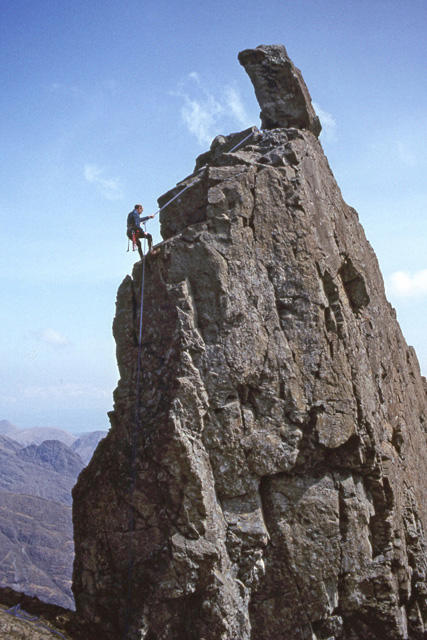 Photo could not load
NG4421 : Inaccessible Pinnacle
Ian Taylor
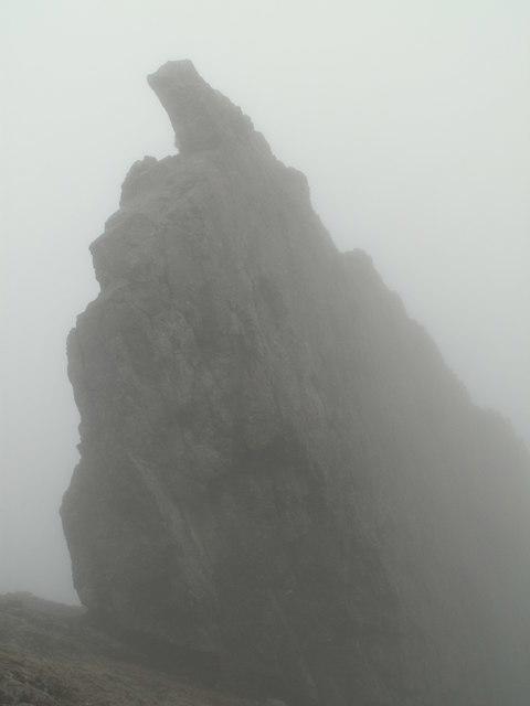 Photo could not load
NG4421 : The Inn Pin
John Fielding
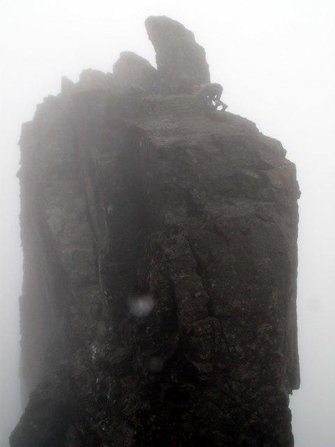 Photo could not load
NG4421 : A climber reaching the top of the In Pin
John Fielding
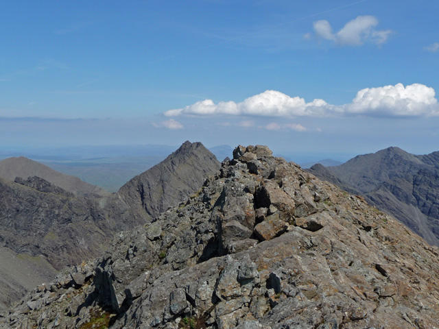 Photo could not load
NG4421 : The summit of Sgurr Dearg
John Allan
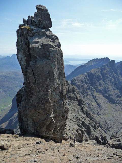 Photo could not load
NG4421 : The Inaccessible Pinnacle
John Allan
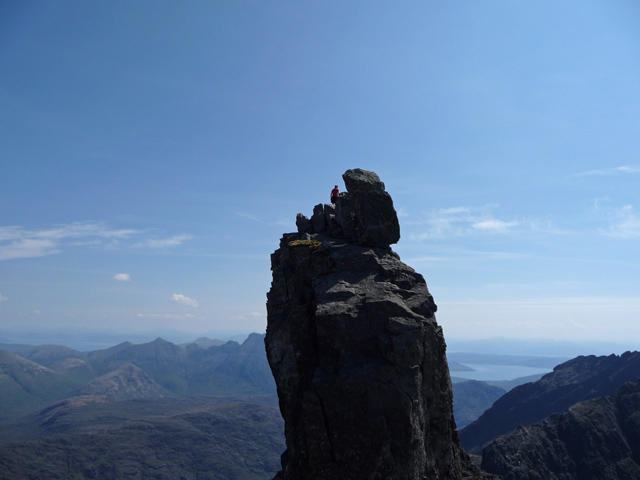 Photo could not load
NG4421 : Climber atop the Inaccessible Pinnacle
John Allan
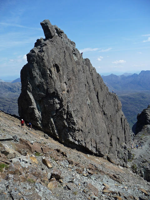 Photo could not load
NG4421 : The Inaccessible Pinnacle of Sgurr Dearg
John Allan
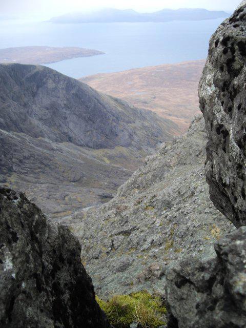 Photo could not load
NG4421 : View from the In Pinn
Callum Black
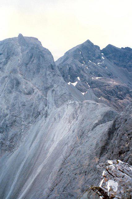 Photo could not load
NG4421 : Sgurr Dearg and the "In Pin" and Sgurr na Banachdich
Ken Ross
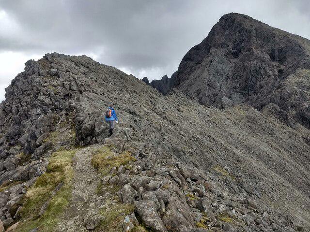
NG4421 : Heading towards Sgùrr Dearg
David Medcalf
Hill facts and local notes
Classifications
Elevation
978m
3,209 ft
Prominence
12m
Coordinates
57.2135, -6.2352
NG443215
OS Map
32
Explorer: 411
At the Summit
The summit is marked by a prominent cairn, offering a perfect spot for a celebratory snack (or an impromptu nap) after the climb.
Terrain & Geology
Sgurr Dearg is primarily composed of granite, typical of the Skye region, with some schist and quartzite features. The varied geology contributes to the striking views and unique landscapes.
Views & Scenery
From the summit, gaze upon the majestic peaks of the Black Cuillin, the tranquil waters of Loch Coruisk, and the far-off islands of Rum and Canna.
History & Heritage
Name Origin
Sgurr Dearg translates to 'Red Peak,' likely referring to the reddish hue of its rock under the sun.
Historical Significance
This mountain is not only a haven for hikers but also rich in local folklore and history, with tales of ancient clans and legendary creatures.
Getting There & Facilities
Parking
There is a small car park at the entrance to the Glamaig Path, approximately 3 km from Portree.
Public Transport
Buses run from Portree to the nearby car parks, typically once every hour. Check local schedules.
Nearby Facilities
Portree offers various facilities, including cafes, shops, and public toilets. Ideal for stocking up before your adventure!
Safety Information
Known Hazards
- Loose rocks and slippery surfaces can be found; proper footwear is advised. Watch out for sudden weather changes characteristic of the Highlands.
General Safety Tips
- Check weather conditions before setting out
- Carry appropriate clothing and equipment
- Let someone know your planned route
- Take a map, compass, and GPS device
- Carry emergency supplies: food, water, first aid kit, torch
Hills
Some common questions about the hills answered
Are there group walks up Sgurr Dearg - Cairn?
Many walkers use Walkmates to join or organise walks with others. You can check for group walks around Sgurr Dearg - Cairn through the maps
Are there other walkers around Sgurr Dearg - Cairn?
Activity varies by location and time, but Walkmates lets you see whether others have shared walks or shown interest in this area. Find other people through the walking friends search walking friends for Sgurr Dearg - Cairn search or of course create your own walk for Sgurr Dearg - Cairn
Can I organise a walk to Sgurr Dearg - Cairn?
Yes. If there aren’t any walks listed already, you can create a walk and make it available for others to join.
If you're signed up to Walkmates, you can create a walk to Sgurr Dearg - Cairn.
How do I find a walk up this hill?
There are often multiple ways to walk this hill, depending on experience and route preference. Walkmates helps you explore walks and routes that others have shared.
Can I suggest a new route up Sgurr Dearg - Cairn?
Yes. You can suggest or create routes to share with others. Walkmates focuses on the social side of walking, so routes are used to help people organise walks and explore areas together, rather than as detailed navigation tools or route libraries.
Other uses really appreciate knowledgeable walkers sharing their routes. Share your favourite route to Sgurr Dearg - Cairn here
The is an error or something incorrect about this hill. How do I let you know?
We always strive to keep the information on Walkmates as accurate as possible. If you find an error, please let us know through the contact form and we'll aim to correct it as quickly as possible
Community Discussion
Comments
Location
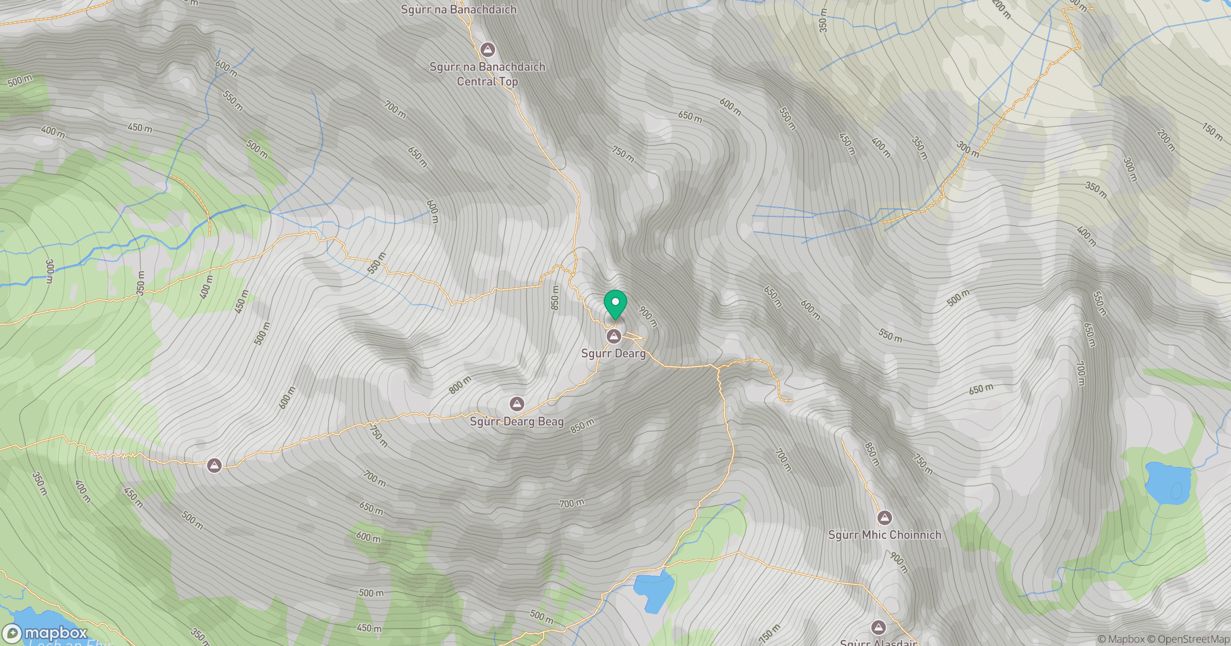
Grid reference: NG443215
View on OpenStreetMapOpens a map in a new tab, centred on the hill.
No comments yet. Be the first.