

Sedgley Beacon
Good walks are even better shared.
SO9294 : Tower and masts on Beacon Hill near Sedgley, Dudley
Roger D Kidd Photo source
Overview
Sedgley Beacon: A Beacon of Beauty in the West Midlands
Sedgley Beacon, soaring to an elevation of 191 meters above sea level, is a delightful retreat for both seasoned hikers and casual wanderers. Nestled in the West Midlands, its prominent trig point marks the summit, inviting all who dare to take the stride to its peak.
Geology
The Beacon's intrigue begins beneath our feet. Primarily made up of Triassic sandstone, it offers a geological window into the past with layered sediments telling stories of ancient times. Keep an eye out for clay patches as you traverse the area—these add variety to the terrain.
Routes
One of the most beloved trails is the Sedgley Hill Circular, a user-friendly trek that spans approximately 4.5 km. This route takes about 1.5 hours to complete and is accessible for hikers of all abilities. Expect to meander through a mix of charming woodlands and open fields before reaching the summit, where a well-deserved view awaits.
Summit Features
Upon reaching the summit, take a moment to admire the iconic trig point. A quaint stone shelter provides a great spot for a quick snack or to escape the fickle British weather.
Terrain
The route features a delightful mix of grassy hills and woodlands, and while the ascent is pleasantly gentle, be cautious of rocky patches as you approach the summit. Keep those hiking boots tied tight!
Views
The panorama from Sedgley Beacon is nothing short of spectacular. On a clear day, the sweeping vistas include the majestic Wrekin in the distance and the bustling skyline of Birmingham—a beautiful blend of nature and urban life. To catch the best views, aim for spring or early autumn when the weather is just right and the foliage is at its most vibrant.
Hazards
While the trails are generally safe, keep your wits about you! Muddy patches can crop up after rain, transforming the path into a slip-and-slide adventure. For those feeling adventurous in winter, remember that it can get quite slippery at the top after frosty nights.
Nearby Summits
If you're keen on exploration, nearby Dudley Castle (elevation 119 meters) offers additional hiking opportunities.
Access
Sedgley is easily accessible with a small car park available on Sedgley Road, only a short walk to the trailhead. Buses frequently connect from Wolverhampton and Dudley, meaning your adventure is only a ride away.
Facilities
Before heading out, grab a bite or a cup of tea at one of the lovely cafes in Sedgley, and make sure to check out the public toilets available in the town for added convenience.
History
The name 'Sedgley' gives a nod to the area’s verdant past, originating from Old English meaning 'sedge wood.' Furthermore, the Beacon has historical significance as a signalling point during the Napoleonic Wars, calling forth those brave enough to rise to the occasion.
All in all, Sedgley Beacon is a gem that promises not just a workout for your legs but a feast for your eyes and soul. So lace up those hiking boots, grab a mate, and set forth on a journey to one of the West Midlands’ hidden treasures!
Explore routes near Sedgley Beacon
Walks starting near this hill. Open a route to check its map, distance and full itinerary.
Baggeridge Country Park: Bag Pool, Wishing Pools and woodland circuit
View route
Wombourne to Castlecroft: South Staffordshire Railway Walk
View route
Wednesfield Walk with Men Walking & Talking
View route
Bloxwich Walk with Men Walking & Talking
View route
Route planning notes
These notes describe possible approaches. Check a route's map and access information when planning your walk.
Sedgley Hill Circular
A popular route starting from Sedgley, this circular walk offers a combination of woodland trails and open fields leading to stunning views from the Beacon.
Make a day of it, together
Find someone to share the walk with, or organise a day out along a route you like.
Photo Gallery
View all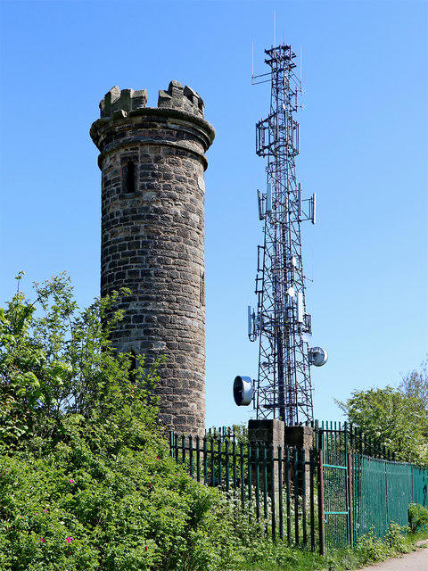 Photo could not load
SO9294 : Tower and masts on Beacon Hill near Sedgley, Dudley
Roger D Kidd
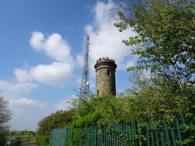 Photo could not load
SO9294 : Tower Scene
Gordon Griffiths
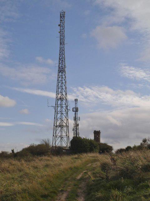 Photo could not load
SO9294 : Mast Scene
Gordon Griffiths
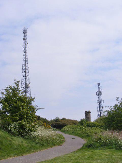 Photo could not load
SO9294 : Masts Scene
Gordon Griffiths
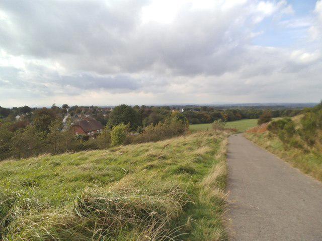 Photo could not load
SO9294 : Beacon Path View
Gordon Griffiths
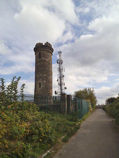 Photo could not load
SO9294 : Beacon Tower
Gordon Griffiths
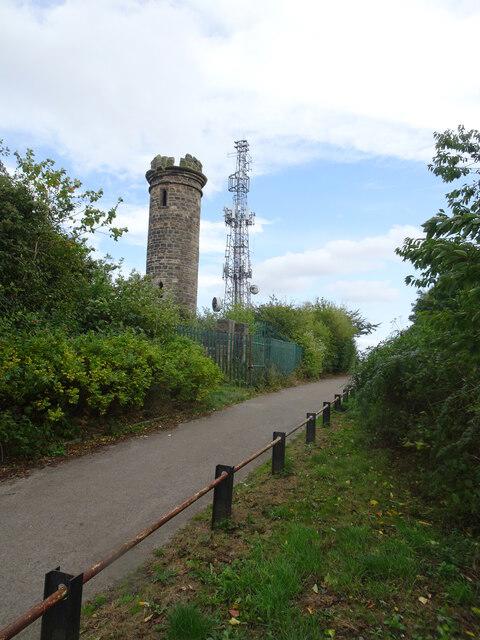 Photo could not load
SO9294 : Tower and Mast
Gordon Griffiths
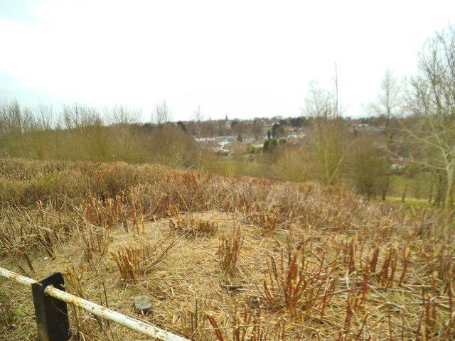 Photo could not load
SO9294 : Looking down on Sedgley
Gordon Griffiths
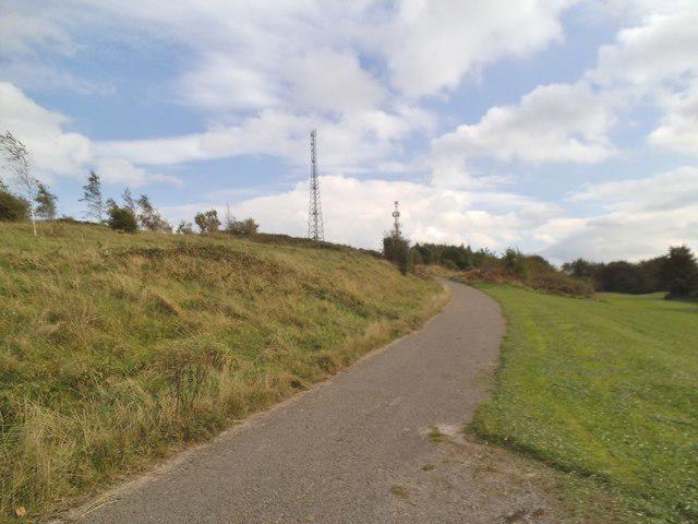 Photo could not load
SO9294 : Path to the Masts
Gordon Griffiths
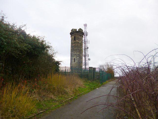
SO9294 : Sedgley, tower
Mike Faherty
Hill facts and local notes
Classifications
Elevation
238m
779 ft
Prominence
29m
Coordinates
52.5475, -2.1153
SO922944
OS Map
139
Explorer: 219N
At the Summit
At the summit, you'll find a prominent trig point and a small stone shelter that can provide a respite when the weather takes a turn for the worse.
Terrain & Geology
Sedgley Beacon is primarily composed of sandstone, which offers a unique geological feature as it showcases layers of sediment that date back to the Triassic period. The area also includes patches of clay, providing a contrast to the surrounding terrain.
Views & Scenery
From the summit, you can gaze over the Black Country, spotting landmarks such as the Wrekin and even the central Birmingham skyline on a clear day.
History & Heritage
Name Origin
The name 'Sedgley' is thought to derive from the Old English 'saege' meaning 'sedge' and 'leah' meaning 'wood' or 'clearing'. So, a bit of a leafy connection!
Historical Significance
Historically, Sedgley Beacon served as a signal point during the Napoleonic Wars. It played a crucial role in communicating alerts to nearby fortifications.
Getting There & Facilities
Parking
There is a small car park on Sedgley Road, just a short walk from the trailhead to Sedgley Beacon.
Public Transport
Buses frequently run from Wolverhampton and Dudley to Sedgley, providing easy access to the starting point.
Nearby Facilities
There are a few cafes and public toilets available in Sedgley, making it convenient for hikers to refuel before or after their trek.
Safety Information
Known Hazards
- Beware of muddy patches after rainfall, and in winter, the summit can become slippery. Always check the weather before heading out!
General Safety Tips
- Check weather conditions before setting out
- Carry appropriate clothing and equipment
- Let someone know your planned route
- Take a map, compass, and GPS device
- Carry emergency supplies: food, water, first aid kit, torch
Hills
Some common questions about the hills answered
Are there group walks up Sedgley Beacon?
Many walkers use Walkmates to join or organise walks with others. You can check for group walks around Sedgley Beacon through the maps
Are there other walkers around Sedgley Beacon?
Activity varies by location and time, but Walkmates lets you see whether others have shared walks or shown interest in this area. Find other people through the walking friends search walking friends for Sedgley Beacon search or of course create your own walk for Sedgley Beacon
Can I organise a walk to Sedgley Beacon?
Yes. If there aren’t any walks listed already, you can create a walk and make it available for others to join.
If you're signed up to Walkmates, you can create a walk to Sedgley Beacon.
How do I find a walk up this hill?
There are often multiple ways to walk this hill, depending on experience and route preference. Walkmates helps you explore walks and routes that others have shared.
Can I suggest a new route up Sedgley Beacon?
Yes. You can suggest or create routes to share with others. Walkmates focuses on the social side of walking, so routes are used to help people organise walks and explore areas together, rather than as detailed navigation tools or route libraries.
Other uses really appreciate knowledgeable walkers sharing their routes. Share your favourite route to Sedgley Beacon here
The is an error or something incorrect about this hill. How do I let you know?
We always strive to keep the information on Walkmates as accurate as possible. If you find an error, please let us know through the contact form and we'll aim to correct it as quickly as possible
Community Discussion
Comments
Location
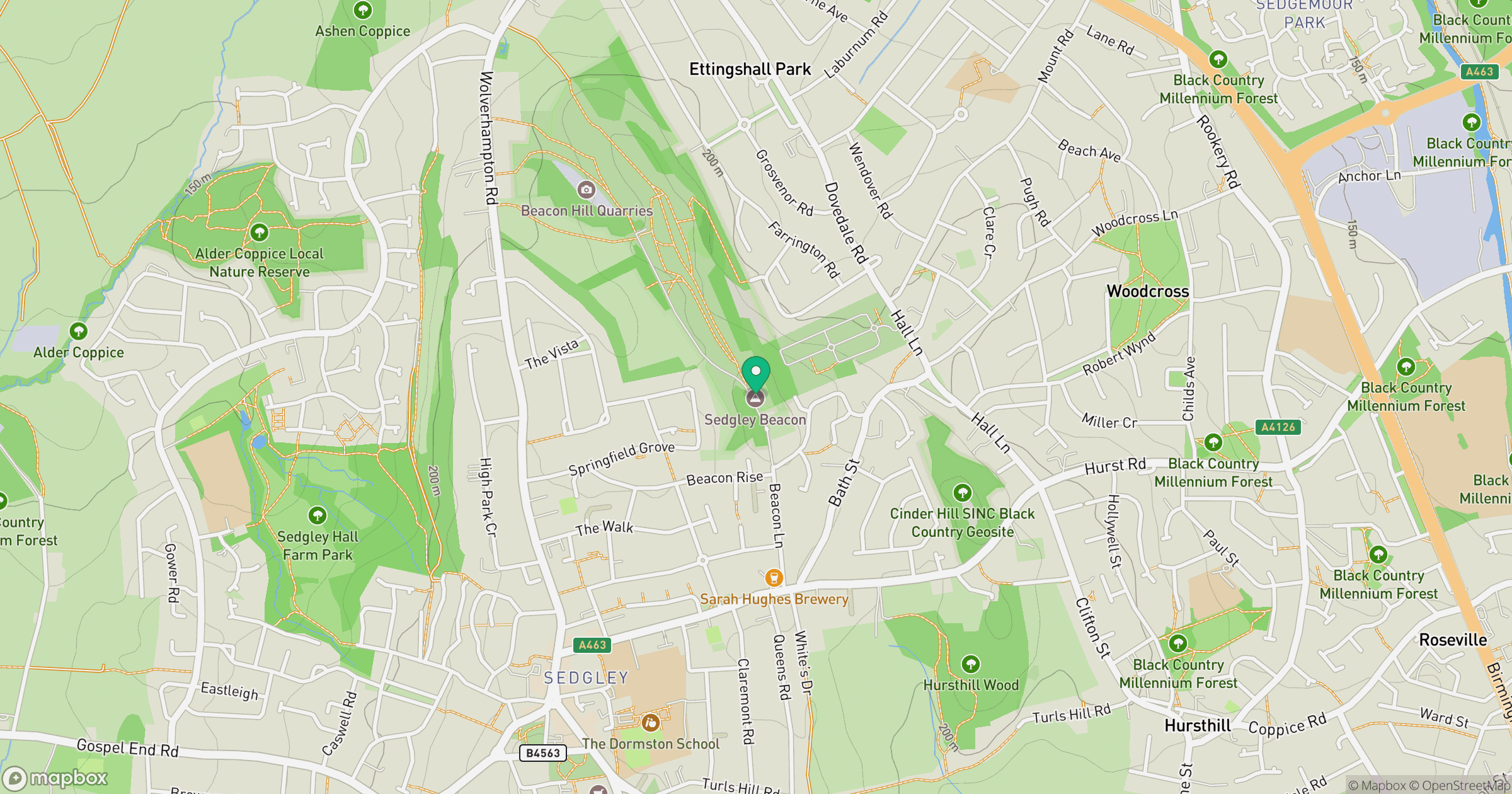
Grid reference: SO922944
View on OpenStreetMapOpens a map in a new tab, centred on the hill.
Nearby Hills

The Wrekin
407m
Worcestershire Beacon
425m
Titterstone Clee Hill
533m
The Roaches
505m
Long Mynd - Pole Bank
517m
No comments yet. Be the first.