

Prestonbury Castle
Good walks are even better shared.
SX7489 : Prestonbury Common
Derek Harper Photo source
Overview
Prestonbury Castle: A Hidden Gem of Dartmoor National Park
Nestled within the stunning Dartmoor National Park, Prestonbury Castle may not be the highest peak on the moors, but it certainly packs a punch in terms of historical and scenic offerings. Rising to an elevation of 350 meters, this hillfort boasts captivating views that stretch across the Dartmoor landscape.
Geology
Made primarily of local granite, Prestonbury Castle showcases the rugged terrain and ancient geological features of Dartmoor. The surrounding landscape is peppered with interesting volcanic formations, providing ample opportunities for those interested in geology to explore.
The Route
Prestonbury Castle Circuit
Starting from Drewsteignton, this moderate circular route covers approximately 5 km and will take about 2 hours to complete. While navigating through lush pastures and rocky outcrops, you'll also get the chance to explore the impressive remnants of the hillfort itself.
Summit Features
At the top, you’ll be greeted by the remarkable earthworks of the Iron Age fortifications. Not only do these ancient structures offer a taste of history, but they also provide excellent vantage points for taking in Dartmoor’s breathtaking views. Just remember to bring your camera (and maybe a snack or two).
Terrain
The terrain leading to Prestonbury Castle is predominantly grassy with rocky outcrops and transitions into delightful heather during summer months. It’s an Instagram-worthy spot that may get your creative juices flowing. Just be sure to watch your footing, especially after rain!
Views and Seasons
Climbing to the summit rewards you with sweeping views of the Teign Valley and sunlight glinting off the moors. Timing is everything; the best views are during late spring and autumn when the colours are truly scintillating. On a misty morning, the landscape can be transformed into a ghostly realm—perfect for those into atmospheric photography.
Hazards
Do keep in mind that Dartmoor's weather can turn on a dime. Sudden showers are a frequent challenge, and the rocks can be slippery, especially on overcast days. Always pack extra layers and a waterproof jacket to stay on the safe side!
Nearby Summits
In your explorations, don’t miss nearby peaks such as Cranmere Pool and Sharpitor, both of which offer their own unique landscapes and views.
Access and Facilities
Parking
The closest car park is situated in Drewsteignton, a mere 1.5 km from the trailhead. It’s small but convenient for those looking to set out for a day of adventure.
Public Transport
Drewsteignton is accessible via local bus routes from Exeter. Just double-check the schedules as they can be as fickle as the moorland weather!
Nearest Town
The charming village of Drewsteignton offers basic facilities, including a village shop and a couple of lovely cafes—perfect for a pre-hike brew or post-hike treat.
History
Historically, Prestonbury Castle carries a name with intriguing ties to early ecclesiastical structures. The earthworks represent not just a military stronghold but a slice of Dartmoor's rich cultural heritage.
Conclusion
Prestonbury Castle is a delightful destination for hikers and history buffs alike. Whether you’re looking for a scenic view, a historical outing, or simply a chance to stretch your legs amidst nature’s splendour, this spot is certainly worth a visit! Just be sure to pack your sense of adventure and a little enthusiasm for exploring history. Happy hiking!
Explore routes near Prestonbury Castle
Walks starting near this hill. Open a route to check its map, distance and full itinerary.
Castle Drogo and Fingle Bridge: Teign Gorge woodland circuit
View route
Moretonhampstead to Lustleigh: Wray Valley woodland railway trail
View route
Exeter Canal, Double Locks and Countess Wear river circuit
View route
Killerton to Clyston Mill: Broadclyst farmland and heritage walk
View route
Route planning notes
These notes describe possible approaches. Check a route's map and access information when planning your walk.
Prestonbury Castle Circuit
A circular walk starting from the nearby village of Drewsteignton that takes you up through scenic landscapes and offers a chance to explore the historic earthworks.
Make a day of it, together
Find someone to share the walk with, or organise a day out along a route you like.
Photo Gallery
View all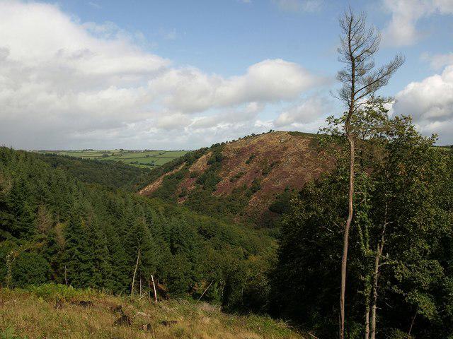 Photo could not load
SX7489 : Prestonbury Common
Derek Harper
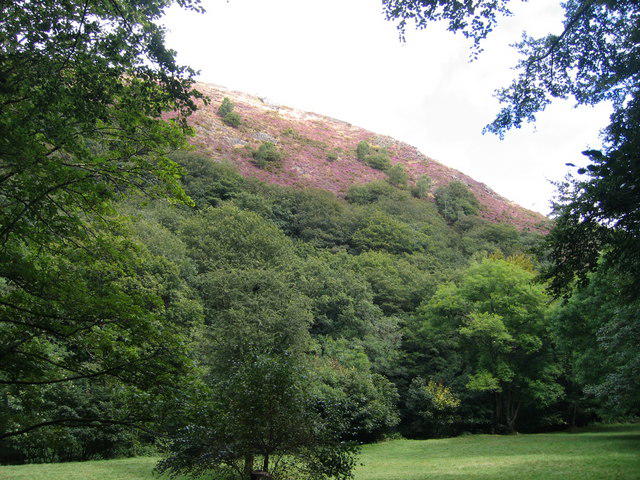 Photo could not load
SX7489 : Teign Valley near Fingle Bridge
Ian Medcalf
Hill facts and local notes
Classifications
Elevation
249m
817 ft
Prominence
87m
Coordinates
50.6958, -3.7765
SX746899
OS Map
191
Explorer: OL28N
At the Summit
At the summit, you'll find the remnants of an Iron Age hillfort including impressive bank and ditch structures, which make for a perfect photo op and an even better excuse to catch your breath.
Terrain & Geology
Prestonbury Castle is primarily composed of local granite, which contributes to its rugged beauty and distinct appearance. The surrounding area features interesting volcanic rock formations, making it a fascinating study for geology enthusiasts.
Views & Scenery
From the summit, you can enjoy panoramic views of the Teign Valley and the surrounding moors. On a clear day, Dartmoor's vastness stretches out before you like a green-and-brown patchwork quilt.
History & Heritage
Name Origin
The name 'Prestonbury' may derive from the Old English 'preost' meaning 'priest' and 'burh' meaning 'fort', suggesting a historical significance tied to early ecclesiastical establishments.
Historical Significance
This site was not just a defensive stronghold but also held importance for local tribes during its time of occupation, providing a great window into early human settlement in Dartmoor.
Getting There & Facilities
Parking
There is a small car park at Drewsteignton, approximately 1.5 km from the start of the walk to Prestonbury Castle, making it a convenient spot to leave your vehicle.
Public Transport
The nearest bus stop is in Drewsteignton with services from Exeter. However, be sure to check local timetables as they can be infrequent.
Nearby Facilities
While there are no facilities on the summit, Drewsteignton has a quaint village shop and a couple of local cafes where you can grab some refreshments before or after your hike.
Safety Information
Known Hazards
- Watch out for sudden changes in weather as Dartmoor can be notoriously unpredictable. Mossy, slippery rocks can be a hazard, especially after rain.
General Safety Tips
- Check weather conditions before setting out
- Carry appropriate clothing and equipment
- Let someone know your planned route
- Take a map, compass, and GPS device
- Carry emergency supplies: food, water, first aid kit, torch
Hills
Some common questions about the hills answered
Are there group walks up Prestonbury Castle?
Many walkers use Walkmates to join or organise walks with others. You can check for group walks around Prestonbury Castle through the maps
Are there other walkers around Prestonbury Castle?
Activity varies by location and time, but Walkmates lets you see whether others have shared walks or shown interest in this area. Find other people through the walking friends search walking friends for Prestonbury Castle search or of course create your own walk for Prestonbury Castle
Can I organise a walk to Prestonbury Castle?
Yes. If there aren’t any walks listed already, you can create a walk and make it available for others to join.
If you're signed up to Walkmates, you can create a walk to Prestonbury Castle.
How do I find a walk up this hill?
There are often multiple ways to walk this hill, depending on experience and route preference. Walkmates helps you explore walks and routes that others have shared.
Can I suggest a new route up Prestonbury Castle?
Yes. You can suggest or create routes to share with others. Walkmates focuses on the social side of walking, so routes are used to help people organise walks and explore areas together, rather than as detailed navigation tools or route libraries.
Other uses really appreciate knowledgeable walkers sharing their routes. Share your favourite route to Prestonbury Castle here
The is an error or something incorrect about this hill. How do I let you know?
We always strive to keep the information on Walkmates as accurate as possible. If you find an error, please let us know through the contact form and we'll aim to correct it as quickly as possible
Community Discussion
Comments
Location
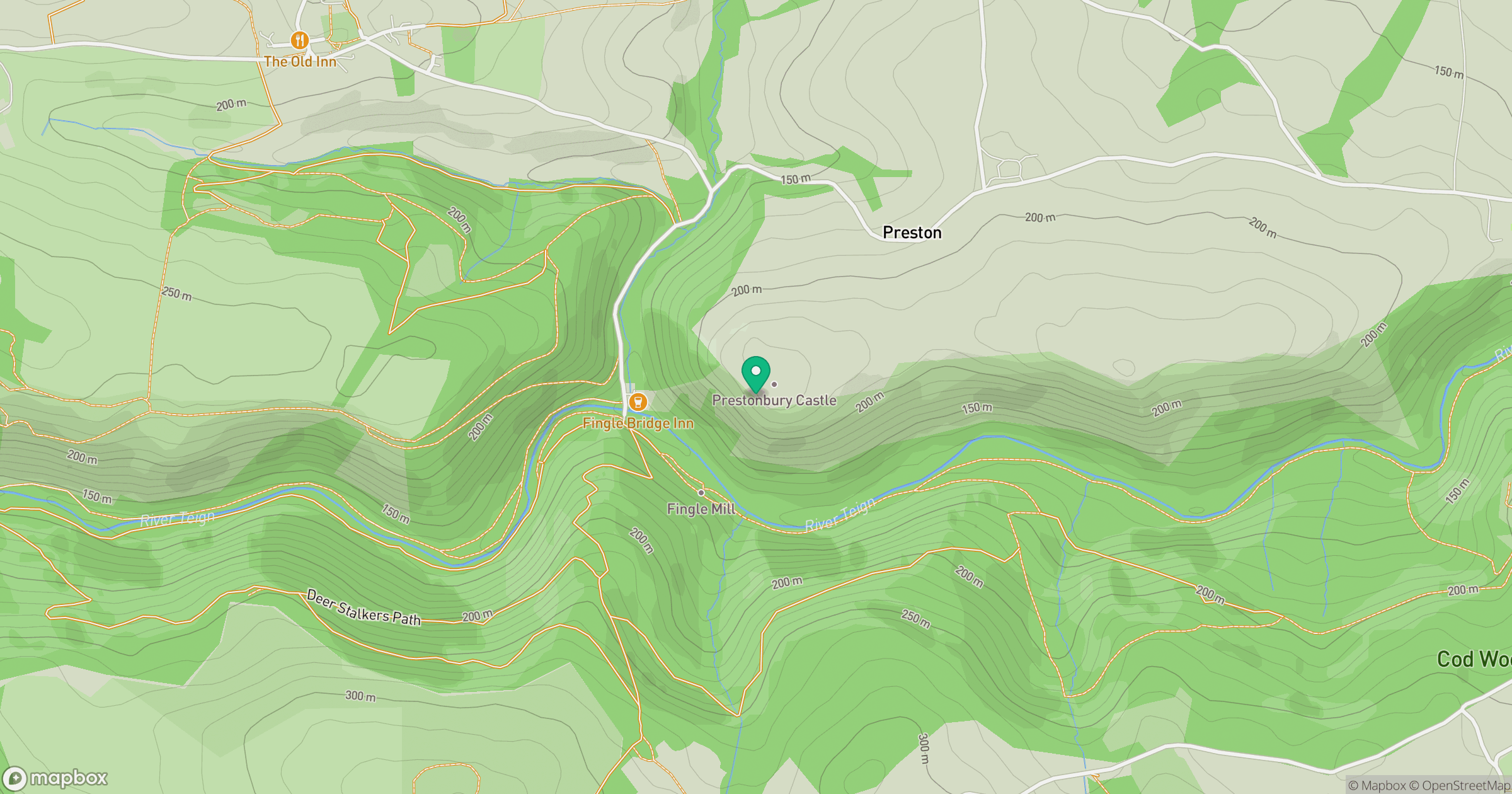
Grid reference: SX746899
View on OpenStreetMapOpens a map in a new tab, centred on the hill.
Nearby Hills

High Willhays
622m

Brent Tor
334m

Dunkery Beacon
520m
Brown Willy
420m
Rhossili Down - The Beacon
193m
No comments yet. Be the first.