

North Goatfell
Good walks are even better shared.
NR9942 : North Goatfell towards Stacach Ridge
Alan Reid Photo source
Overview
North Goatfell
North Goatfell, standing tall at an impressive 850 meters, is the crowning jewel of the Isle of Arran. Nestled in the Scottish Highlands, this Munro offers an adventure that is both rewarding and challenging.
Geology
North Goatfell boasts a predominantly granite structure, creating a dramatic landscape that has withstood the tests of time. Surrounded by schists, the geological formation tells the tale of both fire and ice that has sculpted this rugged mountain.
Routes
The most popular route is the Corrie path, which is a well-engineered trail leading from Brodick. Offering stunning views throughout the ascent, this 6.5 km trek takes around 3.5 hours to complete and is regarded as challenging due to its steep sections. For those seeking a more extensive expedition, the Goatfell Circuit spans 12 km and takes approximately 6 hours, meandering through surrounding peaks and providing a fuller taste of Arran's natural beauty.
Summit Features
At the summit, hikers are greeted by a large stone cairn and a trig point, perfect for that triumphant selfie. The panoramic views showcase the splendor of Arran’s rugged terrain and the distant Scottish mainland, making every step worthwhile.
Terrain Type
Expect rocky paths with grassy patches and scree along the way. Steep sections may require some light scrambling, ensuring a true mountain experience.
Views
The views from North Goatfell are nothing short of breathtaking. On clear days, you’ll witness the stunning outlines of neighbouring peaks and the sparkling waters of the Firth of Clyde. For the best vistas, aim for late spring through early autumn, when visibility is at its peak.
Hazards
While the climb is exhilarating, be wary of loose rocks and sudden weather changes—don’t let mist turn your ascent into a game of hide-and-seek with the summit!
Nearby Summits
You can easily extend your hike to include nearby summits such as Goatfell (874m) and South Goatfell (843m), both providing additional views and challenges.
Access
Brodick Bay is your gateway to this adventure, with plenty of parking available, although it might fill up like a tin of sardines in summer. For public transport enthusiasts, regular buses run from Glasgow to Brodick, and ferries transport you straight to this hiker's paradise.
Facilities
In Brodick, you’ll find several quaint cafés to fuel up before your climb, and public toilets are conveniently located to ensure all comforts before you head out into the wild.
History
The name North Goatfell is thought to derive from the Old Norse, referencing both its stature and its historical connection to goats that once roamed the area. As Arran’s highest peak, it holds a significant place in the hearts of Scottish adventurers.
In conclusion, North Goatfell presents a superb hiking challenge, steeped in geological intrigue, offering spectacular sights and a respectable workout. Don’t forget your camera, your sense of adventure, and perhaps a snack or two for the trek!
Explore routes near North Goatfell
Walks starting near this hill. Open a route to check its map, distance and full itinerary.
Goatfell from Cladach
View route
Bishop’s Glen group walk
View route
West Bay walk and talk
View route
West Bay walk and talk
View route
Route planning notes
These notes describe possible approaches. Check a route's map and access information when planning your walk.
North Goatfell via Brodick Castle and Goatfell Summit
Starting from Brodick Castle, follow the well-marked trail through the forest and across open moorland to the summit of Goatfell. From Goatfell, continue along the ridgeline northwards to reach North Goatfell. Enjoy stunning views of the Isle of Arran and beyond before retracing your steps back to the starting point.
North Goatfell via Glen Rosa Circuit
Begin at the Glen Rosa car park and follow the scenic Glen Rosa track as it ascends gradually. Take the path towards the Saddle, then climb steeply to North Goatfell. For a circular route, descend via Goatfell and return through the forest path to Glen Rosa car park.
North Goatfell Ridge Scramble
This route is for experienced scramblers. Start from Corrie and take the path leading to North Goatfell via Meall Breac. The ridge offers exhilarating scrambling opportunities with dramatic views, culminating in a rewarding ascent to North Goatfell. Descend via the Goatfell path to Brodick or Corrie.
North Goatfell and Coire Lan Loop
From Sannox, ascend through Coire Lan, following the path leading to North Goatfell. The route offers breathtaking views of the surrounding corries and ridges. Descend via the north-eastern spur back to Sannox for a rewarding loop.
North Goatfell via Cioch na h-Oighe Traverse
From Corrie, follow the path to Cioch na h-Oighe, traversing its rocky ridgeline before reaching North Goatfell. This challenging route provides a rugged mountain experience with stunning panoramas. Descend via Goatfell and return to Corrie.
Make a day of it, together
Find someone to share the walk with, or organise a day out along a route you like.
Photo Gallery
View all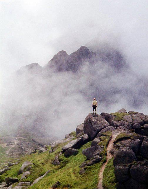 Photo could not load
NR9942 : North Goatfell towards Stacach Ridge
Alan Reid
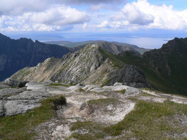 Photo could not load
NR9942 : The Northern Arran Hills from Goatfell
wfb
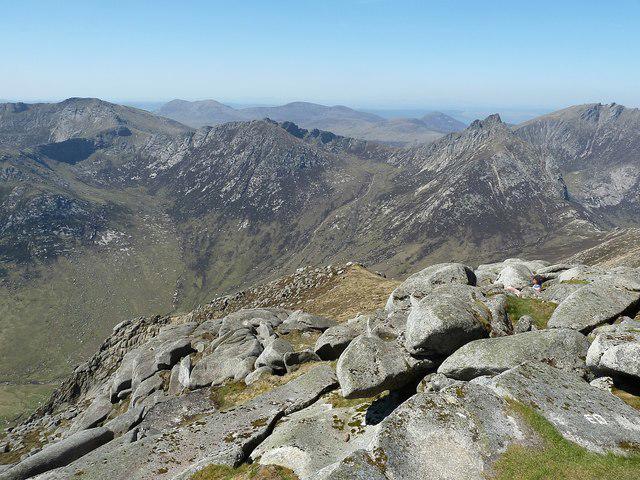 Photo could not load
NR9842 : Peaks and ridges to the north of Goatfell
Rob Farrow
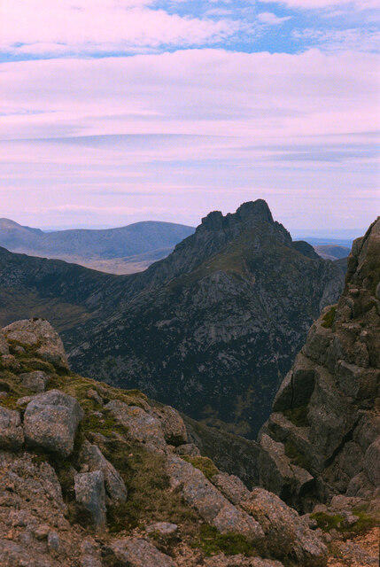 Photo could not load
NR9942 : A view towards Cir Mhor from the Stacach ridge, Arran
habiloid
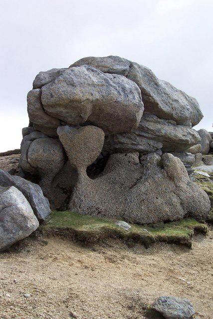 Photo could not load
NR9842 : Strange weathering
Alex Mcnaughton
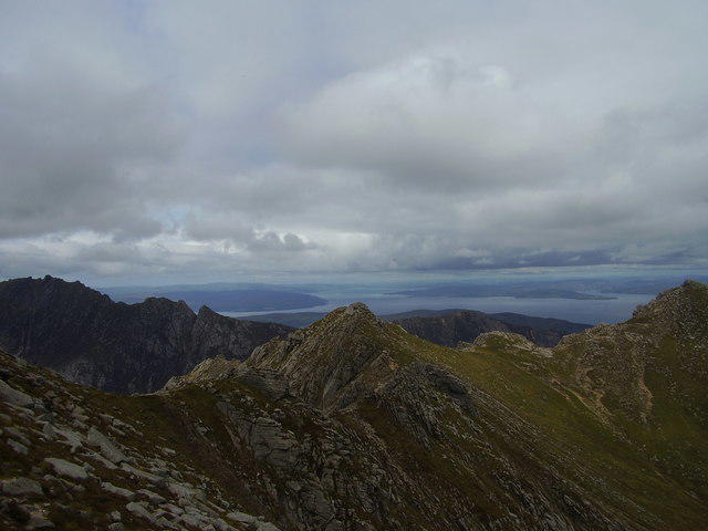 Photo could not load
NR9842 : Looking North from the East slope of Goatfell
Alan Murray Walsh
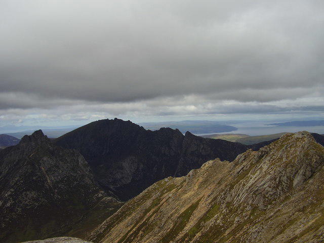 Photo could not load
NR9842 : View North from Goatfell summit
Alan Murray Walsh
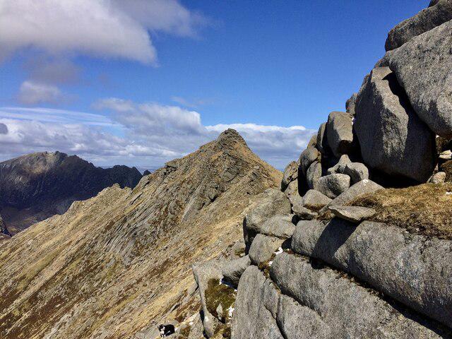 Photo could not load
NR9942 : Heading to North Goatfell
Iain Lees
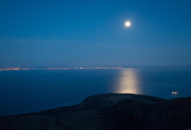 Photo could not load
NR9942 : Moon over the Firth of Clyde
Doug Lee
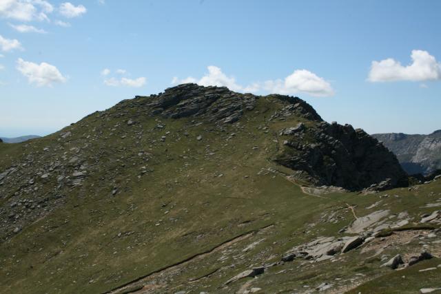
NR9942 : North Goat Fell
Steve Partridge
Hill facts and local notes
Classifications
Elevation
818m
2,684 ft
Prominence
58m
Coordinates
55.6324, -5.1946
NR989422
OS Map
62 69
Explorer: 361N
At the Summit
The summit showcases a large cairn with a great view across to the neighbouring peaks and the Firth of Clyde. There's also a trig point for those who like to tick boxes and take photos.
Terrain & Geology
North Goatfell is primarily composed of granite, which gives it a rugged appearance and provides a stable footing as you make your way up. The surrounding hills are made of schists, and the area's geological history is a testament to the incredible forces of nature over millennia.
Views & Scenery
From the summit, you can see the entirety of the Isle of Arran, including the famous Goatfell ridge, and on a clear day, the coastline of the Scottish mainland stretches out before you.
History & Heritage
Name Origin
The name 'Goatfell' is derived from the Old Norse word 'Geit', meaning goat, and 'fell', meaning mountain or hill; thus it could refer to the mountain's past inhabitants or the elusive goats that once roamed these slopes.
Historical Significance
As the highest peak on Arran, Goatfell holds cultural significance in Scottish folklore and is a beloved challenge among hikers and climbers.
Getting There & Facilities
Parking
Brodick Bay, with ample parking available, though it can fill up during peak tourist season.
Public Transport
Regular buses from Glasgow to Brodick, and the ferry from Ardrossan takes you directly to the island.
Nearby Facilities
Brodick has several cafes and shops, as well as public toilets, ensuring you are well-fed and relieved before embarking on your adventure.
Safety Information
Known Hazards
- Steep inclines, loose rocks, sudden weather changes, and potential for mist to roll in quickly making navigation tricky.
General Safety Tips
- Check weather conditions before setting out
- Carry appropriate clothing and equipment
- Let someone know your planned route
- Take a map, compass, and GPS device
- Carry emergency supplies: food, water, first aid kit, torch
Hills
Some common questions about the hills answered
Are there group walks up North Goatfell?
Many walkers use Walkmates to join or organise walks with others. You can check for group walks around North Goatfell through the maps
Are there other walkers around North Goatfell?
Activity varies by location and time, but Walkmates lets you see whether others have shared walks or shown interest in this area. Find other people through the walking friends search walking friends for North Goatfell search or of course create your own walk for North Goatfell
Can I organise a walk to North Goatfell?
Yes. If there aren’t any walks listed already, you can create a walk and make it available for others to join.
If you're signed up to Walkmates, you can create a walk to North Goatfell.
How do I find a walk up this hill?
There are often multiple ways to walk this hill, depending on experience and route preference. Walkmates helps you explore walks and routes that others have shared.
Can I suggest a new route up North Goatfell?
Yes. You can suggest or create routes to share with others. Walkmates focuses on the social side of walking, so routes are used to help people organise walks and explore areas together, rather than as detailed navigation tools or route libraries.
Other uses really appreciate knowledgeable walkers sharing their routes. Share your favourite route to North Goatfell here
The is an error or something incorrect about this hill. How do I let you know?
We always strive to keep the information on Walkmates as accurate as possible. If you find an error, please let us know through the contact form and we'll aim to correct it as quickly as possible
Community Discussion
Comments
Location
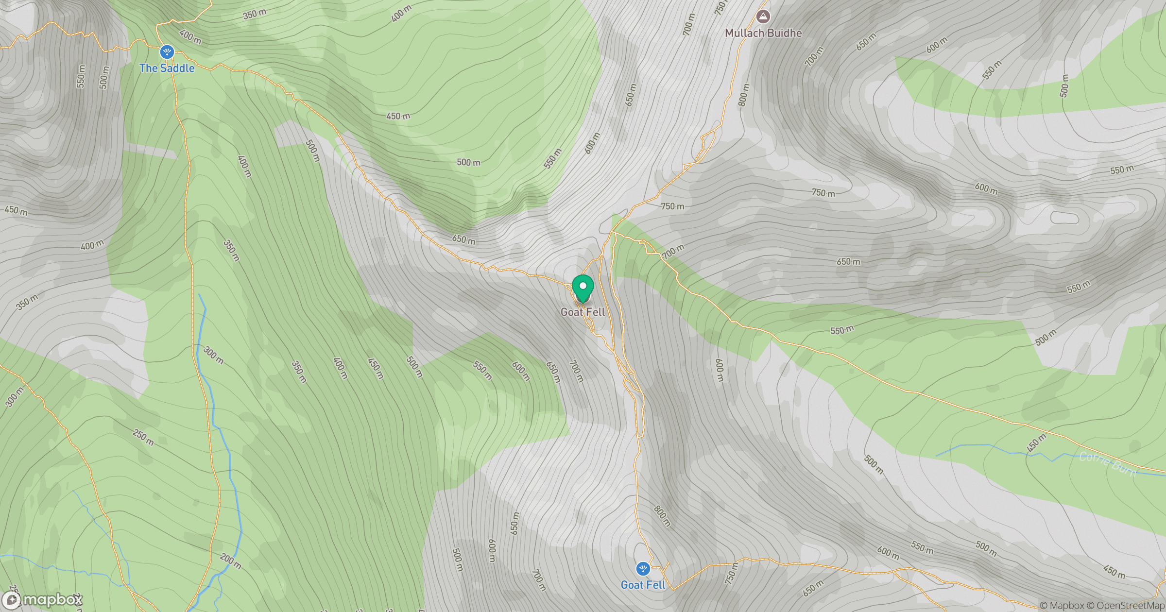
Grid reference: NR989422
View on OpenStreetMapOpens a map in a new tab, centred on the hill.
Nearby Hills
Goatfell [Goat Fell]
875m
Cir Mhor
798m
Ailsa Craig
339m
Beinn Ghlas
420m
![The Cobbler [Ben Arthur]](https://cdn.walkmates.com/gallery-images/a1b697040769474a8338b3fb586ebc7a.jpg)
The Cobbler [Ben Arthur]
887m
No comments yet. Be the first.