

Napes Needle
Good walks are even better shared.
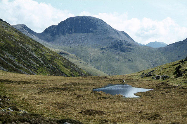
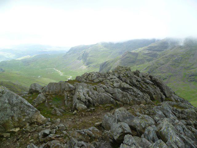
NY2009 : Great Gable and Lingmell, seen from Corridor Route
Richard Law Photo source
Overview
Napes Needle
Overview
Nestled in the breathtaking Lake District, Napes Needle stands as an iconic landmark renowned for both its beauty and its challenging climb. Measuring a considerable height, this striking volcanic formation offers seasoned climbers and hiking enthusiasts alike a taste of adventure amid majestic scenery.
Geology
The geology of Napes Needle showcases the ancient volcanic activity that birthed this stunning landscape. Composed mainly of andesite and basalt from the Borrowdale Volcanic Group, this rock formation is a testament to the power of nature. Many geologists and hikers alike marvel at its unique features, so it’s worth taking a moment to appreciate the natural history etched into the rock face.
Routes
The most celebrated route is the Ridge Walk from Wasdale Head. Spanning approximately 15.5 km, this challenging trek can take around six hours. Prepare for rugged terrain that will have your heart racing, and your spirits soaring! It’s essential to stay well-hydrated, so don’t be shy—bring that water bottle!
Summit Features
The pinnacle of your climb will be marked by a striking, needle-like formation with a small stone cairn at the summit. A perfect photo op, so snap away! Just don’t drop your phone between the rocks… nobody wants to go fishing for technology.
Terrain Type
Expect a rich mix of rocky outcrops and grassy slopes leading you to the summit. And while some portions are indeed a scramble—think balance and good footwear—you can also find wide-open spaces for taking in the views.
Views
The scenery from the summit is nothing short of spectacular! Gaze upon the sprawling expanse of Scafell Pike and the serene waters of Wastwater. Every angle reveals nature’s artistry—so don’t forget your camera! Early mornings often yield the clearest vistas with ethereal mist floating over valley tops.
Hazards
While the climb is an exhilarating experience, it comes with its share of hazards. Rockfall is a concern; caution around loose stones is advised. The weather can also change rapidly—pack a waterproof jacket unless you fancy getting drenched!
Nearby Summits
You’ll find yourself in good company, with Scafell Pike looming nearby (at a staggering 978 meters) and the ever-imposing Great Gable peering down at you from 899 meters. Both are worthy challenges and offer equally stunning views.
Access
Getting to Napes Needle is relatively straightforward. The nearest parking can be found at the Wasdale National Trust car park. Note that spaces are limited—you’d be wise to arrive early or be prepared to drive off into the landscape, keeping the sheep company!
Public transport options are available from Seascale to Wasdale Head, but services might not run daily, so check timetables before relying on them.
The quaint village of Gosforth is the closest town, providing a warm welcome and some basic amenities to prepare you for your adventure.
Facilities
Keep in mind that there are no direct facilities at Napes Needle. Ensure you pack enough supplies, including food and drink, before setting off. For those in need, the nearest cafes and toilets can be found in Seascale.
History
The name “Napes Needle” derives from ‘nape’, signifying neck—a nod to its distinctive profile. Historically, this site has been significant for climbers and mountaineers, with many considering a trek here a rite of passage. Climbing Napes Needle offers not only a physical challenge but also an exhilarating sense of achievement.
In conclusion, Napes Needle is a gem of the Lake District, offering adventure, stunning views, and a connection to our planet's geological past. So lace up those boots, grab a mate, and embark on an unforgettable journey!
Explore routes near Napes Needle
Walks starting near this hill. Open a route to check its map, distance and full itinerary.
Scafell Pike from Seathwaite via the Corridor Route
View route
Scafell Pike via Brown Tongue and Hollow Stones
View route
Bow Fell from Langdale
View route
Great Carrs Halifax Wreckage from Wrynose Pass
View route
Route planning notes
These notes describe possible approaches. Check a route's map and access information when planning your walk.
Classic Napes Needle Ascent via Sty Head Pass
This route begins at Seathwaite (Grid Ref: NY235121), following the path towards Sty Head Pass. From Sty Head Tarn, take the climbers' traverse path that leads towards Great Gable, reaching the base of Napes Needle. This is an iconic scramble and climbing route, known for its stunning views and historical significance as one of the UK's climbing cradles.
Napes Needle via Gavel Neese and Moses' Trod
This route starts at Honister Pass (Grid Ref: NY225135). Follow the old mining path known as Moses' Trod, which contours around to Great Gable's southern slopes. Continue towards Gavel Neese before taking the climbers' traverse up to Napes Needle. This route offers a mix of historical interest and rugged mountain scenery.
Circular Route from Wasdale Head
Starting at Wasdale Head (Grid Ref: NY186085), this circular route ascends via Gavel Neese to gain access to the climbers’ traverse towards Napes Needle. After exploring the Needle, continue upwards to summit Great Gable before descending via Beck Head Pass back to Wasdale Head.
Napes Needle from Ennerdale via Windy Gap
Begin at the car park near Bowness Knott in Ennerdale (Grid Ref: NY109153). Follow the valley path along Ennerdale Water before ascending to Windy Gap. From here, traverse Great Gable’s southern slopes to reach Napes Needle. Descend via the same route.
Great Gable Traverse including Napes Needle
A full traverse of Great Gable starting from Seathwaite (Grid Ref: NY235121). Ascend via Green Gable and Windy Gap, then traverse to Napes Needle for a scrambling detour. Complete the traverse over Great Gable summit, descending via Sty Head Pass to return to Seathwaite.
Make a day of it, together
Find someone to share the walk with, or organise a day out along a route you like.
Photo Gallery
View all Photo could not load
NY2009 : Great Gable and Lingmell, seen from Corridor Route
Richard Law
 Photo could not load
NY2010 : The Sphinx Rock
Walter Baxter
 Photo could not load
NY2010 : The Sphinx Rock
Walter Baxter
 Photo could not load
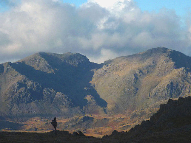
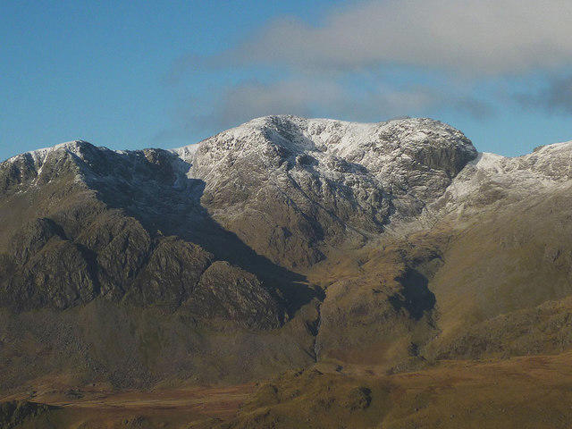
NY2110 : Great Gable from Lingmell
Walter Baxter
 Photo could not load
NY2010 : Cloud on Gable
Karl and Ali
 Photo could not load
NY2109 : Great Hell Gate, Great Gable
N Chadwick
 Photo could not load
NY2009 : Great Gable from Wasdale Head
N Chadwick
 Photo could not load
NY2009 : Napes Needle
Stephen McKay
 Photo could not load
NY2009 : Napes Needle
David Gruar

NY2110 : Great Gable from Lingmell
Walter Baxter
Hill facts and local notes
Classifications
Elevation
692m
2,270 ft
Prominence
13m
Coordinates
54.4791, -3.2216
NY209099
OS Map
89 90
Explorer: OL4S OL6N
At the Summit
The summit features a prominent, needle-like rock formation that greets climbers, often adorned with a small cairn at its apex. It's a popular spot for those looking to take a photo that screams adventure!
Terrain & Geology
Napes Needle is primarily composed of volcanic rock, including andesite and basalt, characteristic of the Borrowdale Volcanic Group. Its striking shapes were formed from ancient eruptions and glacial processes, making it a fascinating study for geologists and climbers alike.
Views & Scenery
From the summit, enjoy jaw-dropping views of Scafell Pike, the highest peak in England, and the picturesque Wastwater, a gem of the Lake District.
History & Heritage
Name Origin
The name Napes Needle is thought to derive from 'nape', which means neck, referring to the needle's striking profile at the top of the mountain.
Historical Significance
Napes Needle is known for its climbing routes, particularly the iconic Napes Needle climb, which attracts climbers from around the globe. It's a rite of passage for many in the climbing community.
Getting There & Facilities
Parking
Wasdale National Trust car park, which has limited spaces; arrive early to secure your spot or risk being left with the sheep.
Public Transport
The nearest bus service links to Wasdale Head from Seascale; inquire for timetables as they may not run daily.
Nearby Facilities
There are no facilities directly at Napes Needle, so ensure to bring enough food and drink. The nearest cafes and toilets can be found in nearby Seascale.
Safety Information
Known Hazards
- Rockfall is a concern in parts; beware of loose stones. Weather can change quickly, so pack a waterproof just in case your sunny hike becomes a drenching!
General Safety Tips
- Check weather conditions before setting out
- Carry appropriate clothing and equipment
- Let someone know your planned route
- Take a map, compass, and GPS device
- Carry emergency supplies: food, water, first aid kit, torch
Hills
Some common questions about the hills answered
Are there group walks up Napes Needle?
Many walkers use Walkmates to join or organise walks with others. You can check for group walks around Napes Needle through the maps
Are there other walkers around Napes Needle?
Activity varies by location and time, but Walkmates lets you see whether others have shared walks or shown interest in this area. Find other people through the walking friends search walking friends for Napes Needle search or of course create your own walk for Napes Needle
Can I organise a walk to Napes Needle?
Yes. If there aren’t any walks listed already, you can create a walk and make it available for others to join.
If you're signed up to Walkmates, you can create a walk to Napes Needle.
How do I find a walk up this hill?
There are often multiple ways to walk this hill, depending on experience and route preference. Walkmates helps you explore walks and routes that others have shared.
Can I suggest a new route up Napes Needle?
Yes. You can suggest or create routes to share with others. Walkmates focuses on the social side of walking, so routes are used to help people organise walks and explore areas together, rather than as detailed navigation tools or route libraries.
Other uses really appreciate knowledgeable walkers sharing their routes. Share your favourite route to Napes Needle here
The is an error or something incorrect about this hill. How do I let you know?
We always strive to keep the information on Walkmates as accurate as possible. If you find an error, please let us know through the contact form and we'll aim to correct it as quickly as possible
Community Discussion
Comments
Location
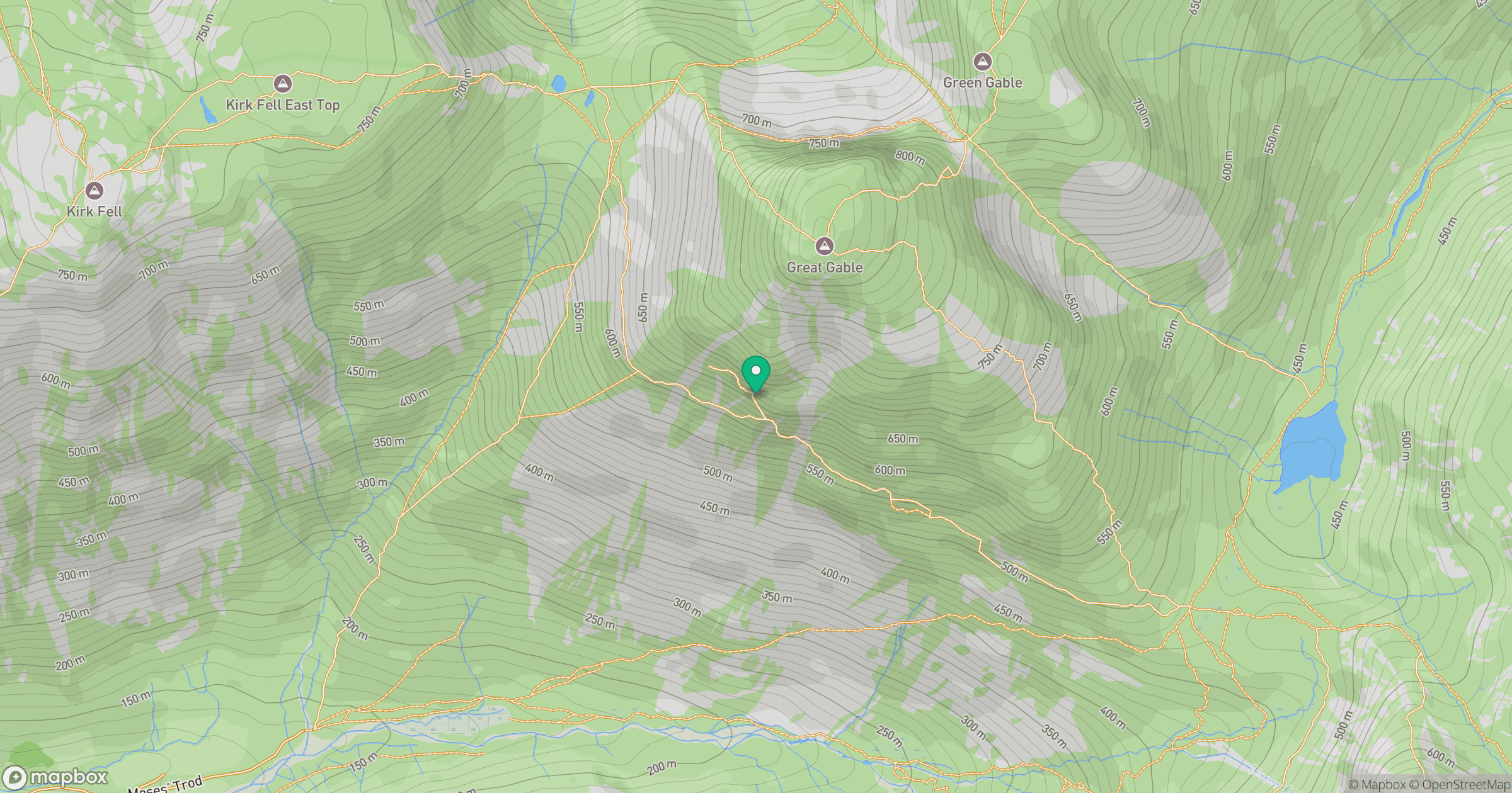
Grid reference: NY209099
View on OpenStreetMapOpens a map in a new tab, centred on the hill.
No comments yet. Be the first.