

Lindisfarne
Good walks are even better shared.
Overview
Lindisfarne: The Holy Island
Lindisfarne, often referred to as Holy Island, is a breathtaking location on the Northumberland coast famed for its spiritual heritage and stunning landscapes. It won't be difficult to see why it has captured the hearts of many hikers and history buffs alike!
Geology
Nestled in the stunning Northumberland coastline, Lindisfarne exhibits unique geological formations that are predominantly composed of sandstone. This ancient rock has weathered through time to create a dramatic landscape perfect for an afternoon jaunt. Watch your step on the rocky patches, and you may stumble upon some fascinating fossils!
Access
Getting to Lindisfarne is an adventure in itself, and it’s accessible via a causeway from the mainland. But beware—the tides can be a bit cheeky! Check the tide tables before heading over to avoid being swept away on a sea of disappointment (or, worse, water).
The nearest parking facility is conveniently located at the Lindisfarne Visitor Centre, where you can safely leave your vehicle. Public transport options might be a tad scarce, so sorting out a ride beforehand can save you some hassle. Bamburgh, just six miles away, is the nearest town, brimming with character and all the essentials you might need.
Routes
1. Coastal Path: This easy route takes you along the picturesque coastline. It's a short 3.5 km route that allows you to soak in the sea breeze and the breathtaking views of the coastline.
2. Lindisfarne Priory Trail: An easy stroll of about 1 km that leads you past crucial historical landmarks, including the ancient priory's ruins. Ideal for anyone interested in the island's storied past.
Summit Features
While Lindisfarne is technically flat as a pancake, its scenery is dotted with the evocative ruins of Lindisfarne Priory and the impressive Lindisfarne Castle standing proudly on its heights. Grab your camera as you'll want to capture these lovely spots!
Terrain Type
Expect a delightful mix of grassy fields and rocky outcrops, along with stretches of sandy beaches. Perfect for a ramble, but keep your eyes peeled for slippery areas, especially if it’s been raining.
Views
The views from the island are simply to die for! On a clear day, you can catch sight of Bamburgh Castle gracing the landscape, not to mention the ever-changing maritime views. The best seasons to appreciate this beauty are during spring and summer, when the sun is shining and the flowers are in bloom.
Hazards
While wandering the lovely paths of Lindisfarne comes with its joys, beware of the ever-looming tides! They can rise with little warning, leaving you less time for exploring. Also, some areas could be slippery underfoot, so it’s wise to tread carefully.
Nearby Summits
Just a hop, skip, and jump away is Bamburgh Castle Hill, worth a visit for its imposing structure and rich heritage.
Facilities
In the village, you'll find a treasure trove of quaint cafes and shops. And yes, there are public toilets which are a godsend after a long walk!
History
Lindisfarne is not just a pretty face; it’s steeped in history! The name itself alludes to its ancient Anglo-Saxon roots, dating back to its status as a key monastery. A visit here is not only a treat for your eyes but also a pilgrimage for your spirit.
In conclusion, whether you're a serious hiker or just in for a leisurely stroll, Lindisfarne offers a little something for everyone. Pack your bags, grab your mates, and see what stories this lovely island has to tell!
Happy hiking!
Explore routes near Lindisfarne
Walks starting near this hill. Open a route to check its map, distance and full itinerary.
Lindisfarne, Holy Island circular
View route
Budle Bay to Seahouses (one way)
View route
Swinhoe Farm nr Belford to St Cuthberts Cave Circular
View route
St Cuthbert's Cave and Kyloe Woods
View route
Route planning notes
These notes describe possible approaches. Check a route's map and access information when planning your walk.
Holy Island Pilgrims' Way
This classic route follows the historic Pilgrims' Way across the tidal causeway to Lindisfarne. Starting from the mainland, you’ll need to carefully time your walk with the tides. The route traverses the tidal sands and mudflats with marker posts guiding the way, offering a spiritual and scenic journey. It’s essential to check tide times before setting off.
Lindisfarne Circular Walk
A popular circular route that explores the highlights of Holy Island. Starting near Lindisfarne Priory, the trail leads past the historic Lindisfarne Castle, the Gertrude Jekyll Garden, and the island's picturesque beaches. It’s a perfect way to experience both the cultural and natural beauty of the island.
Castle Point and Sand Dunes Trail
This scenic route begins at the village and heads towards Castle Point. The trail offers stunning views of Lindisfarne Castle and continues through the island's sand dunes, rich in wildlife and unique plant species. A great choice for photographers and nature enthusiasts.
The North Shore Walk
This route takes walkers along the rugged and beautiful northern coastline of Lindisfarne. Starting from the village, the path winds past the beaches and rocky outcrops, offering panoramic sea views. It’s a quieter, less-trodden option for those looking to escape the crowds.
St. Cuthbert's Island Short Walk
A short but rewarding route that leads to St. Cuthbert's Island, accessible during low tide. This small tidal island offers a peaceful retreat with historical significance, as it’s believed to have been a hermitage for St. Cuthbert. The walk starts and ends in the village.
Make a day of it, together
Find someone to share the walk with, or organise a day out along a route you like.
Photo Gallery
View all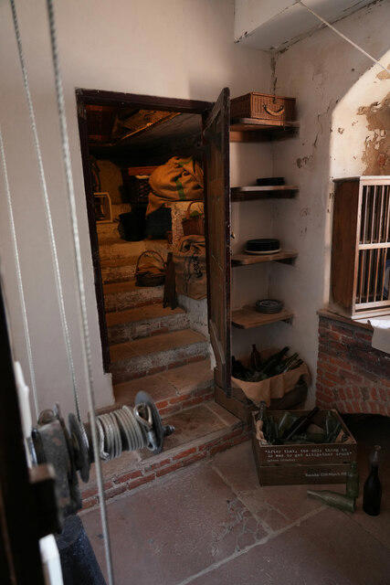 Photo could not load
NU1341 : A hidden nook
Malcolm Neal
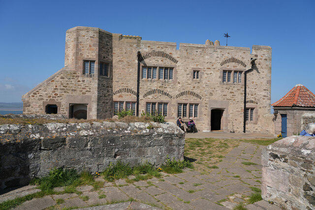 Photo could not load
NU1341 : The east side of the castle
Malcolm Neal
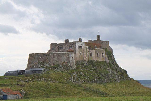 Photo could not load
NU1341 : The north side of Lindisfarne Castle
Jim Barton
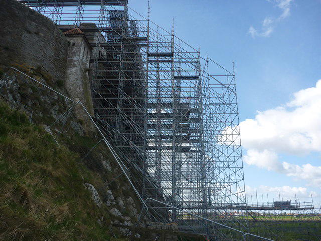 Photo could not load
NU1341 : Coastal Northumberland : Scaffolding At Lindisfarne Castle
Richard West
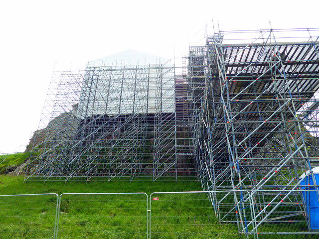 Photo could not load
NU1341 : Scaffolding around Lindisfarne Castle
PAUL FARMER
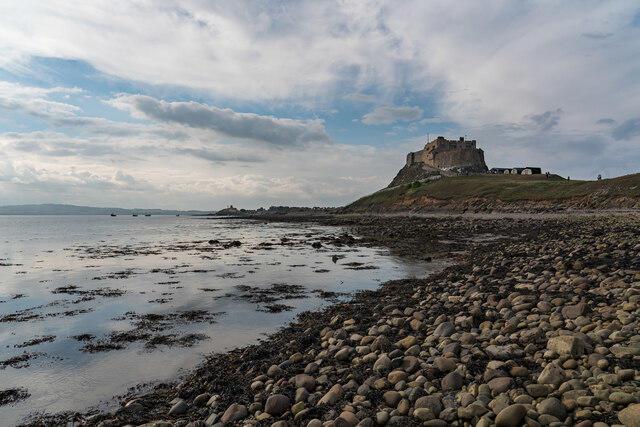 Photo could not load
NU1341 : Lindisfarne Castle, Holy Island
Brian Deegan
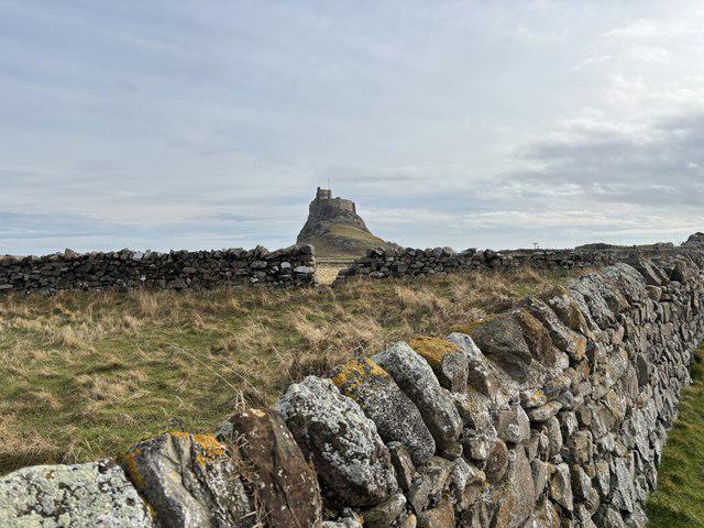 Photo could not load
NU1341 : Through the Walls to Lindisfarne Castle
Iain Lees
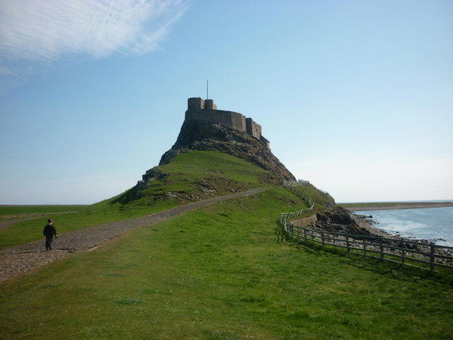 Photo could not load
NU1341 : Lindisfarne Castle, Holy Island
Ian S
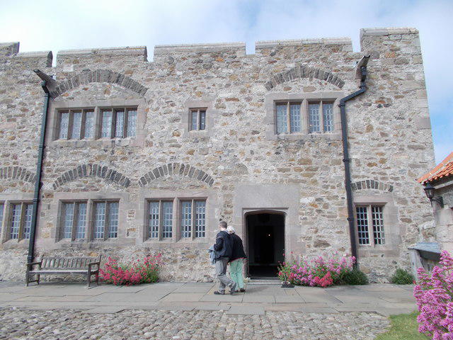 Photo could not load
NU1341 : Lindisfarne Castle terrace
norman griffin
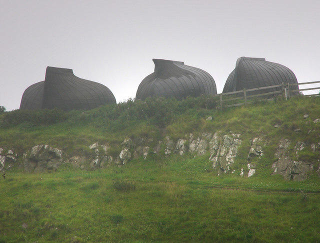
NU1341 : Boat sheds near Lindisfarne Castle
Chris Gunns
Hill facts and local notes
Classifications
Elevation
23m
75 ft
Prominence
23m
Coordinates
55.6691, -1.7852
NU136417
OS Map
75
Explorer: 340
At the Summit
The island features picturesque ruins of Lindisfarne Priory and a prominent castle on the hill, offering a delightful view of the surrounding area.
Terrain & Geology
Lindisfarne is composed predominantly of sandstone and other sedimentary rocks, giving the landscape its historical and scenic charm. Erosion has shaped its rugged coastline.
Views & Scenery
From certain vantage points, you can witness the Holy Island of Lindisfarne, the Northumberland coastline, and the stunning Bamburgh Castle in the distance.
History & Heritage
Name Origin
The name Lindisfarne comes from Old English 'Lindis' (the name of the Anglo-Saxon tribe) and 'farne' meaning 'island'.
Historical Significance
Historically significant as the site of the arrival of St. Aidan and the establishment of the monastery in 635 AD. It played a pivotal role in the spread of Christianity in Northern England.
Getting There & Facilities
Parking
There is a large car park near the Lindisfarne Visitor Centre in the village. Charges may apply depending on the season.
Public Transport
Public transport options are limited; however, bus services do run from nearby towns such as Berwick-upon-Tweed and Alnwick.
Nearby Facilities
The village has cafes, shops, and public toilets. Do stop by for a slice of local cake if you've worked up an appetite!
Safety Information
Known Hazards
- Footing can be slippery when wet, especially on coastal paths. Tides can also rise quickly, so ensure to check tide times when exploring around the shore.
General Safety Tips
- Check weather conditions before setting out
- Carry appropriate clothing and equipment
- Let someone know your planned route
- Take a map, compass, and GPS device
- Carry emergency supplies: food, water, first aid kit, torch
Hills
Some common questions about the hills answered
Are there group walks up Lindisfarne?
Many walkers use Walkmates to join or organise walks with others. You can check for group walks around Lindisfarne through the maps
Are there other walkers around Lindisfarne?
Activity varies by location and time, but Walkmates lets you see whether others have shared walks or shown interest in this area. Find other people through the walking friends search walking friends for Lindisfarne search or of course create your own walk for Lindisfarne
Can I organise a walk to Lindisfarne?
Yes. If there aren’t any walks listed already, you can create a walk and make it available for others to join.
If you're signed up to Walkmates, you can create a walk to Lindisfarne.
How do I find a walk up this hill?
There are often multiple ways to walk this hill, depending on experience and route preference. Walkmates helps you explore walks and routes that others have shared.
Can I suggest a new route up Lindisfarne?
Yes. You can suggest or create routes to share with others. Walkmates focuses on the social side of walking, so routes are used to help people organise walks and explore areas together, rather than as detailed navigation tools or route libraries.
Other uses really appreciate knowledgeable walkers sharing their routes. Share your favourite route to Lindisfarne here
The is an error or something incorrect about this hill. How do I let you know?
We always strive to keep the information on Walkmates as accurate as possible. If you find an error, please let us know through the contact form and we'll aim to correct it as quickly as possible
Community Discussion
Comments
Location
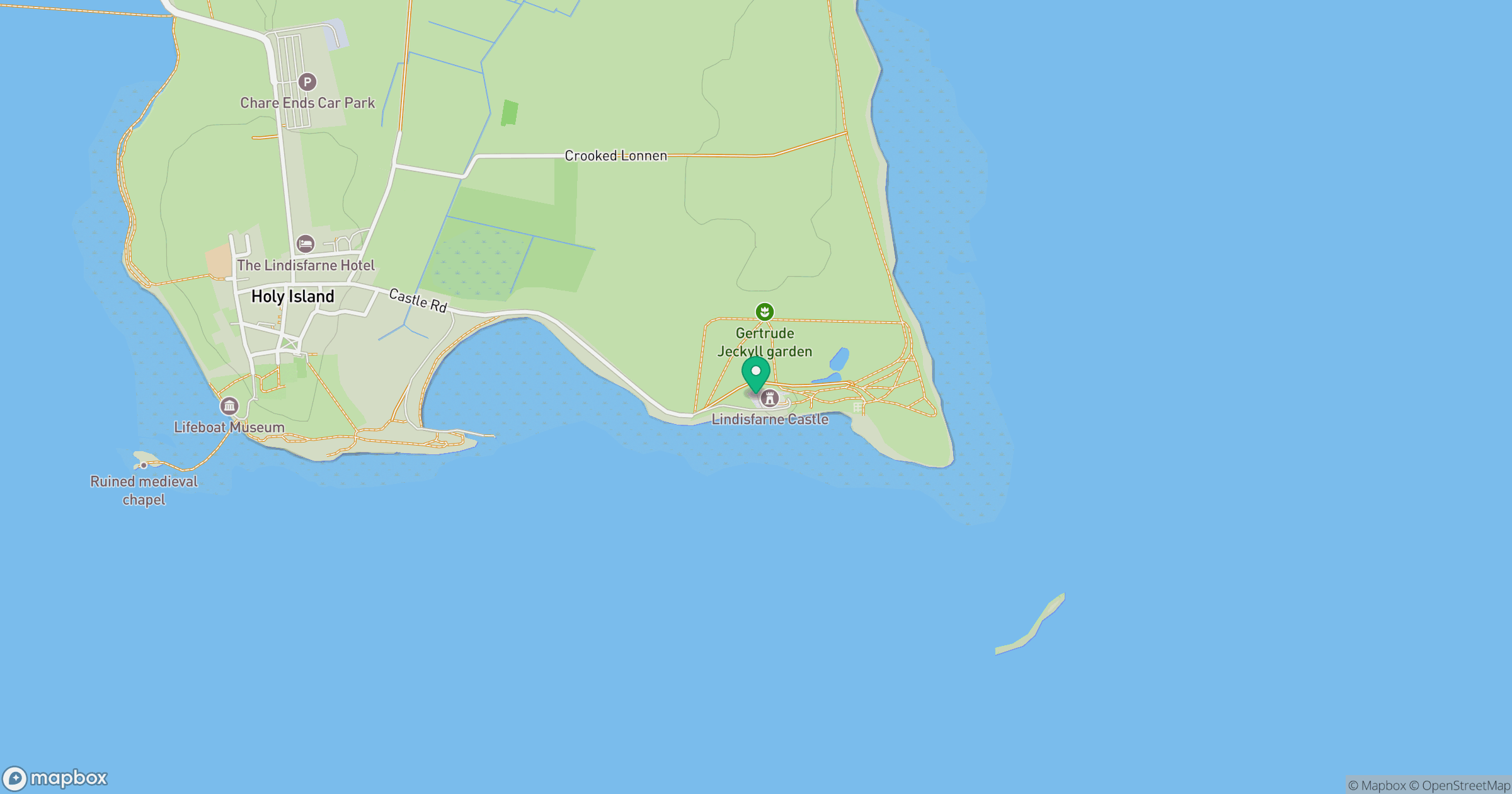
Grid reference: NU136417
View on OpenStreetMapOpens a map in a new tab, centred on the hill.




No comments yet. Be the first.