

Leckhampton Hill
Good walks are even better shared.
SO9418 : Toposcope on Leckhampton Hill
Philip Halling Photo source
Overview
Leckhampton Hill rises to 293 m on the Cotswold escarpment south of Cheltenham, with limestone grassland, former quarries and hillfort earthworks above the Severn Vale. Cheltenham Escarpment National Nature Reserve covers part of the Leckhampton Hill and Charlton Kings Common SSSI.
Leckhampton Hill
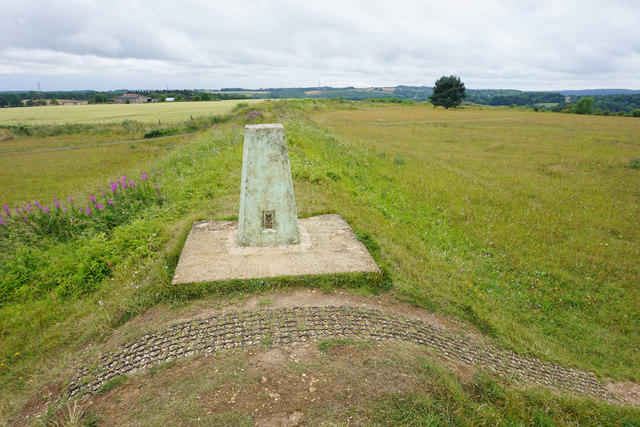
Leckhampton Hill rises to 293 m above the southern edge of Cheltenham. Its recorded high point at SO 94874 18413 is unmarked. The trig pillar sits on a hillfort rampart, and the topograph is a separate viewpoint. Preserve the distinction when visiting the summit.
Landscape and history
Jurassic limestone, grassland, woodland and old quarries shape the escarpment. The hillfort and round burial mound reflect prehistoric use; tramways and limekilns recall the quarrying industry. Leckhampton’s name is generally associated with a homestead growing leeks or vegetables.
Cheltenham Escarpment National Nature Reserve covers part of the Leckhampton Hill and Charlton Kings Common SSSI. Natural England’s notice was published on 4 June 2026 and records a declaration made on 4 March 2026.
Walking routes
- Brownstones hillfort and topograph circuit: the council’s 2.6 km return circuit from Brownstones Quarry car park. No official duration is supplied.
- Leckhampton Loop: the official 7.2 km return circuit from Seven Springs; the leaflet suggests 2½–3 hours and includes steep sections.
Use the named route maps and the full return descriptions in the route-planning notes. These figures do not establish a separately measured visit to the exact high point. Stile-free routes and the council’s sturdy-scooter circuit are not blanket access guarantees for the hill.
Access and care
There are car parks on Hartley Lane and Daisybank Road. Check route conditions, works notices and parking signs before travelling. The exposed scarp and quarries have steep edges; some descents are rough. Cattle use virtual fencing, so give them space and keep dogs controlled. Bring water and suitable footwear.
Views towards the Severn Vale, Malverns and Welsh hills depend on clear weather. Leave the archaeological remains and geological exposures undisturbed.
Explore routes near Leckhampton Hill
Walks starting near this hill. Open a route to check its map, distance and full itinerary.
Cheltenham Walk with Men Walking & Talking
View route
Winchcombe and Belas Knap: Cotswold Way and Sudeley Valley circuit
View route
Cirencester Walk with Men Walking & Talking
View route
Woodchester Park: Tinkley Gate, lakes and Mansion woodland walk
View route
Route planning notes
These notes describe possible approaches. Check a route's map and access information when planning your walk.
Brownstones hillfort and topograph circuit
Start and finish at Brownstones Quarry car park off Hartley Lane. Head northwest past the farm buildings, pass the gate and take the left fork to the gap in the hillfort earthworks. Cross the grass to the scarp, turn right to visit the topograph, then return to the earthwork gap. Follow the surfaced path, keeping left at the fork, to the sharp right bend; bear right and follow the track back to Brownstones. The council gives 2.6 km for this complete circuit but no duration. Its sturdy-mobility-scooter advice applies to this mapped network, including stone tracks, grass, gates and gradients up to 12%; it does not certify the exact unmarked high point. Check conditions before using mobility equipment.
Leckhampton Loop from Seven Springs
Start and finish at the lay-by opposite the Seven Springs pub, SO967170. Follow the Cotswold Way via the lane and meadow, climb onto Charlton Kings Common and follow the scarp to the hillfort viewpoint. Continue through the gap and along the hilltop, then leave the trail at the signed post for the steep woodland descent. Pass the quarry buildings, descend the old tramway to the gates, turn right and follow the lower road and tracks east. Rejoin the outward Cotswold Way and retrace it to Seven Springs. The official leaflet gives 7.2 km and 2½–3 hours for the full circuit, with no stiles but some steep sections. The Devil’s Chimney detour is optional; an exact-summit detour is not separately measured. Take care near the busy roundabouts.
Make a day of it, together
Find someone to share the walk with, or organise a day out along a route you like.
Photo Gallery
View all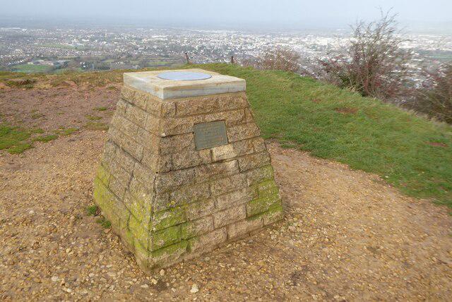 Photo could not load
SO9418 : Toposcope on Leckhampton Hill
Philip Halling
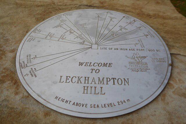 Photo could not load
SO9418 : Toposcope plate on Leckhampton
Philip Halling
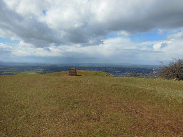 Photo could not load
SO9418 : The Topograph, Leckhampton Hill
Ian S
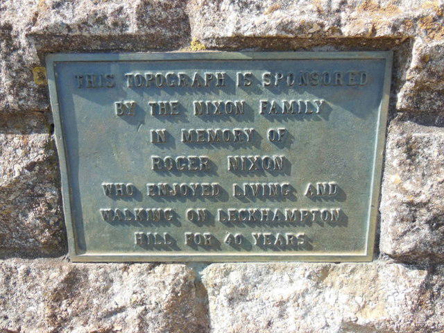 Photo could not load
SO9418 : The Topograph, Leckhampton Hill
Ian S
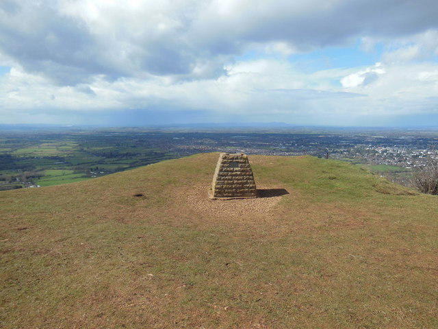 Photo could not load
SO9418 : The Topograph, Leckhampton Hill
Ian S
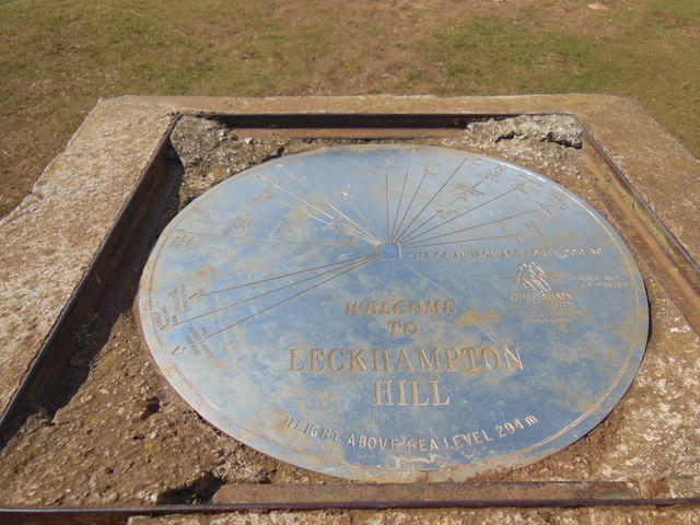 Photo could not load
SO9418 : The Topograph, Leckhampton Hill
Ian S
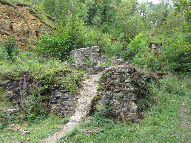 Photo could not load
SO9418 : Disused lime kilns on Leckhampton Hill
Gareth James
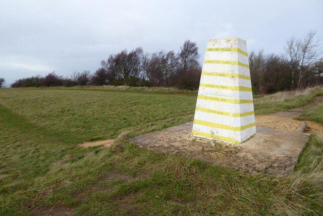 Photo could not load
SO9418 : Trig point on Leckhampton Hill
Philip Halling
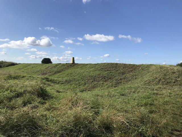 Photo could not load
SO9418 : Leckhampton hill fort
don cload
SO9418 : Trig point on Leckhampton Hill
Bill Boaden
Hill facts and local notes
Classifications
Elevation
293m
961 ft
Prominence
69m
Coordinates
51.8642, -2.0759
SO948184
OS Map
163
Explorer: 179
At the Summit
The recorded 293 m high point at SO 94874 18413 is unmarked. DoBIH notes that it is higher than the base of the ramparts but 1.65 m below the trig point's flush bracket. The trig pillar stands on the hillfort's eastern rampart; the topograph is a separate viewpoint feature. Neither should be substituted for the recorded high point.
Terrain & Geology
The escarpment exposes Jurassic rocks, notably the Middle Jurassic Inferior Oolite limestone sequence. These marine sediments are visible in natural outcrops and old quarries; limestone quarrying has strongly shaped the hillside.
Views & Scenery
The escarpment viewpoints look across Cheltenham and the Severn Vale towards the Malvern Hills. Distant Welsh hills, including the Brecon Beacons, can be visible in exceptionally clear conditions; visibility is weather-dependent.
History & Heritage
Name Origin
Leckhampton is generally interpreted as an Old English name for a homestead where leeks or other vegetables were grown.
Historical Significance
Leckhampton Camp is an Iron Age hillfort, with a round burial mound in a square enclosure nearby. Quarries, tramways and limekilns record the later limestone industry. The council bought the hill in 1927 and opened it to the public in 1929.
Getting There & Facilities
Parking
Brownstones Quarry car park off Hartley Lane is the start of the council’s short circuit. FOLK also identifies Salterley Quarry car park on Hartley Lane and Daisy Bank and Bridge car parks on Daisybank Road. Check local signs and works notices; capacity and availability are not guaranteed.
Public Transport
Cheltenham Spa is the nearest railway station identified by Natural England. The official Leckhampton Loop guide suggests buses to Seven Springs for that route. Check current operator timetables and the walking connection from your stop to the chosen route start.
Nearby Facilities
Bring water and supplies for the hill. The council lists nearby refreshments at Star Bistro in Ullenwood and the café at Crickley Hill Country Park, where accessible toilets are also listed. These are separate from the summit and Brownstones circuit; check opening arrangements.
Safety Information
Known Hazards
- Keep clear of steep scarp and quarry edges. Uneven stone tracks and steep descents can be slippery when wet.
- Galloway cattle graze the common using virtual fences. Give them space, keep dogs tightly controlled and check the council-linked live grazing map.
- The council’s longer Brownstones circuit uses Hartley Lane, a single-track road without pavement. This road section is not part of the short circuit described here.
- Check council and FOLK notices for path works, including Salterley Quarry approaches. A separate Cotswolds National Landscape route warns of a scoured descent unsuitable for mobility scooters, trampers or pushchairs.
General Safety Tips
- Check weather conditions before setting out
- Carry appropriate clothing and equipment
- Let someone know your planned route
- Take a map, compass, and GPS device
- Carry emergency supplies: food, water, first aid kit, torch
Hills
Some common questions about the hills answered
Are there group walks up Leckhampton Hill?
Many walkers use Walkmates to join or organise walks with others. You can check for group walks around Leckhampton Hill through the maps
Are there other walkers around Leckhampton Hill?
Activity varies by location and time, but Walkmates lets you see whether others have shared walks or shown interest in this area. Find other people through the walking friends search walking friends for Leckhampton Hill search or of course create your own walk for Leckhampton Hill
Can I organise a walk to Leckhampton Hill?
Yes. If there aren’t any walks listed already, you can create a walk and make it available for others to join.
If you're signed up to Walkmates, you can create a walk to Leckhampton Hill.
How do I find a walk up this hill?
There are often multiple ways to walk this hill, depending on experience and route preference. Walkmates helps you explore walks and routes that others have shared.
Can I suggest a new route up Leckhampton Hill?
Yes. You can suggest or create routes to share with others. Walkmates focuses on the social side of walking, so routes are used to help people organise walks and explore areas together, rather than as detailed navigation tools or route libraries.
Other uses really appreciate knowledgeable walkers sharing their routes. Share your favourite route to Leckhampton Hill here
The is an error or something incorrect about this hill. How do I let you know?
We always strive to keep the information on Walkmates as accurate as possible. If you find an error, please let us know through the contact form and we'll aim to correct it as quickly as possible
Community Discussion
Comments
Location
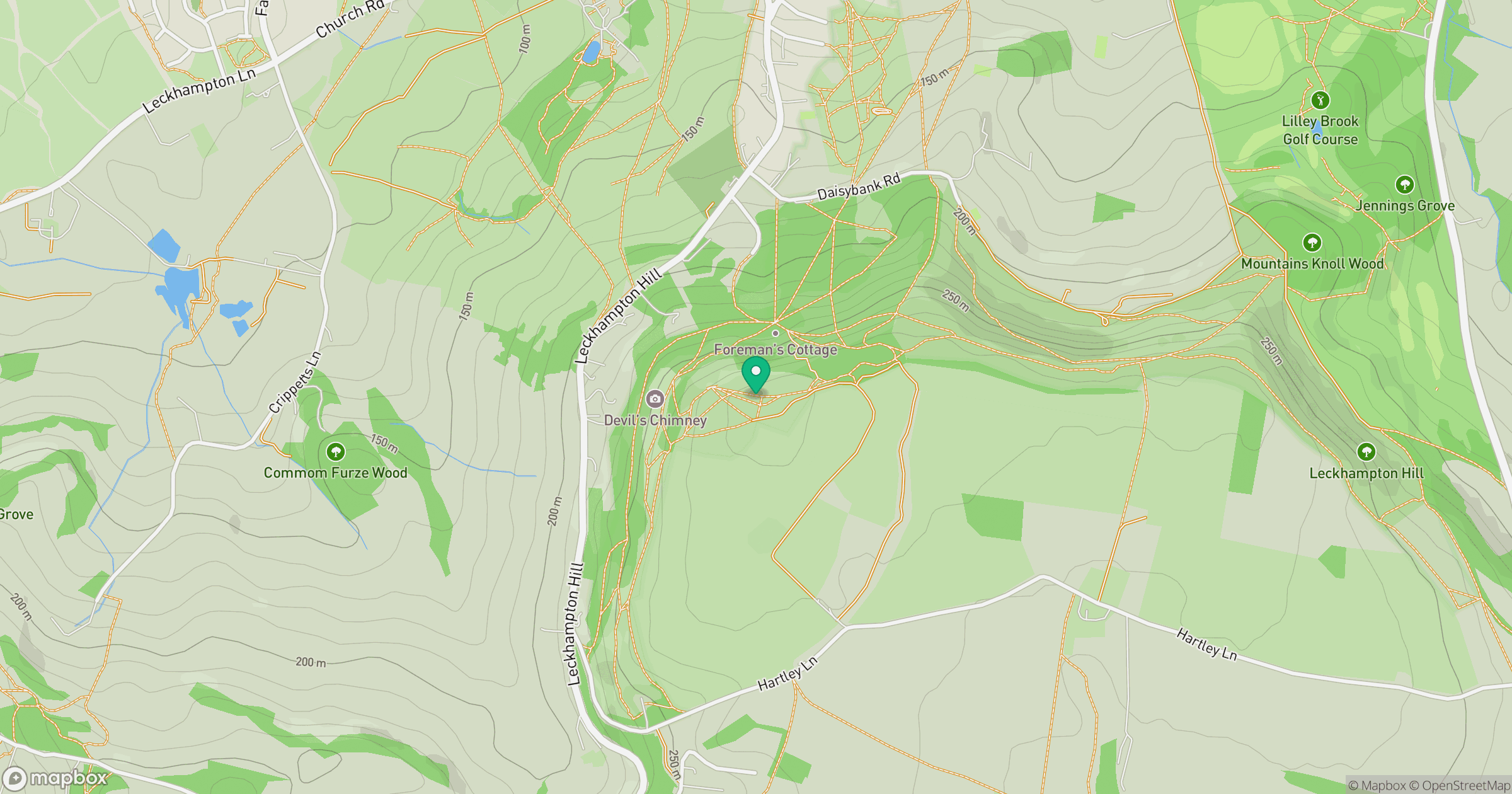
Grid reference: SO948184
View on OpenStreetMapOpens a map in a new tab, centred on the hill.
Nearby Hills
Worcestershire Beacon
425m
Titterstone Clee Hill
533m

The Wrekin
407m
Glastonbury Tor
158m
Long Mynd - Pole Bank
517m
No comments yet. Be the first.