

Knockiveagh
Good walks are even better shared.
J1837 : The summit of Knockiveagh from the Lisnacroppan Road
Eric Jones Photo source
Overview
Knockiveagh: A Hidden Gem in the Mourne Mountains
Nestled in the heart of Northern Ireland's glorious Mourne Mountains, Knockiveagh stands as a marvellous Marilyn, rising to an elevation of 553 meters. Often overshadowed by its towering neighbours, Slieve Donard and Slieve Commedagh, Knockiveagh offers a uniquely serene hiking experience.
Geology
The geology of Knockiveagh is quite fascinating, characterised mainly by granite and metamorphic rocks. These formations have been witness to millions of years of geological processes, resulting in stunning natural scenery that delights geologists and nature lovers alike. Just remember, while the rocks are old enough to know better, they might not tell you which way to go!
Routes
One of the most popular routes is the ascent from the Annalong Valley, a distance of approximately 6.5 km, which typically takes around 2.5 hours. This moderate trek mixes beautiful forest tracks and open grassy hillsides, making it a favorite among local hikers.
Summit Features
Upon reaching the summit, hikers are treated to a delightful stone cairn marking the peak. This isn't just any pile of stones; it’s a beacon for weary travellers! Enjoy the breathtaking views of the surrounding peaks that make the effort worthwhile.
Terrain
Expect a mix of rocky and grassy terrain, with some boggy bits that can feel like squelching through wet socks if you’re not careful! If it’s been raining, consider yourself forewarned about the mud.
Views
From the summit, Slieve Donard's grandeur greets you, along with the shimmering Irish Sea in the distance. Spring and autumn are particularly fine times for exploration, providing clarity and vibrant scenery that will have your Instagram popping!
Hazards
While Knockiveagh isn't notorious for danger, uneven paths can put a bit of a challenge in your step, particularly when conditions are wet. Bringing a map and compass is sensible as fog can descend faster than a double-decker bus in rush hour.
Nearby Summits
Not too far from Knockiveagh, the prestigious peaks of Slieve Donard and Slieve Commedagh offer further adventures for the keen hiker.
Access
Parking is easily accessible at the bottom of Annalong Valley, and public transport options are available from Newcastle to the nearby village, making a day out here as easy as pie. The nearest town of Newcastle has ample facilities, from eateries to public toilets, making it easy to refuel after your adventures.
History
The name Knockiveagh translates to 'hill of the plain' in Irish, a fitting title for such a gentle giant. Historically, the Mourne Mountains have been steeped in folklore, adding layers of cultural significance to your hiking experience.
In summary, Knockiveagh may not be the tallest peak, but it is certainly a delightful corner of the Mournes worth exploring! So lace up your boots, grab your walking stick, and perhaps a packed lunch — just don’t forget the camera!
Happy hiking!
Explore routes near Knockiveagh
Walks starting near this hill. Open a route to check its map, distance and full itinerary.
Scarva to Poyntzpass: Newry Canal and Lough Shark Return
View route
Castlewellan Forest Park: Lake, Arboretum and Mitchell's Lake Circuit
View route
Tollymore Forest Park: River Trail near Newcastle
View route
Silent Valley to Ben Crom Dam: Reservoir Road Walk, County Down
View route
Route planning notes
These notes describe possible approaches. Check a route's map and access information when planning your walk.
Knockiveagh from the Annalong Valley
A straightforward ascent from the picturesque Annalong Valley, offering a mix of forest tracks and open hillsides.
Make a day of it, together
Find someone to share the walk with, or organise a day out along a route you like.
Photo Gallery
View all Photo could not load
J1837 : The summit of Knockiveagh from the Lisnacroppan Road
Eric Jones
Hill facts and local notes
Classifications
Elevation
236m
774 ft
Prominence
147m
Coordinates
54.2754, -6.1862
J182378
OS Map
29
At the Summit
The summit is marked by a distinctive stone cairn and offers a breathtaking panorama of the surrounding mountains.
Terrain & Geology
The mountain is primarily composed of granite and metamorphic rocks, showcasing the geological history typical to the Mourne range.
Views & Scenery
From the summit, you can see Slieve Donard, the highest peak in the Mourne range, along with expansive views over the Irish Sea.
History & Heritage
Name Origin
The name Knockiveagh derives from the Irish 'Cnoc Mhaigh,' which translates to 'hill of the plain.'
Historical Significance
The Mourne Mountains have long been a site of myth and folklore, with Knockiveagh being one of the lesser-known peaks steeped in local legend.
Getting There & Facilities
Parking
Parking is available at the bottom of the Annalong Valley near the trailhead, with enough space for several cars.
Public Transport
Buses run from Newcastle to the Annalong village, which is approximately a 2 km walk from the trailhead.
Nearby Facilities
Cafes and restaurants are available in Newcastle, and public toilets can be found near the town centre.
Safety Information
Known Hazards
- Uneven terrain can be tricky, especially in wet conditions; watch your step! Fog can roll in quickly, so a map and compass are advisable.
General Safety Tips
- Check weather conditions before setting out
- Carry appropriate clothing and equipment
- Let someone know your planned route
- Take a map, compass, and GPS device
- Carry emergency supplies: food, water, first aid kit, torch
Hills
Some common questions about the hills answered
Are there group walks up Knockiveagh?
Many walkers use Walkmates to join or organise walks with others. You can check for group walks around Knockiveagh through the maps
Are there other walkers around Knockiveagh?
Activity varies by location and time, but Walkmates lets you see whether others have shared walks or shown interest in this area. Find other people through the walking friends search walking friends for Knockiveagh search or of course create your own walk for Knockiveagh
Can I organise a walk to Knockiveagh?
Yes. If there aren’t any walks listed already, you can create a walk and make it available for others to join.
If you're signed up to Walkmates, you can create a walk to Knockiveagh.
How do I find a walk up this hill?
There are often multiple ways to walk this hill, depending on experience and route preference. Walkmates helps you explore walks and routes that others have shared.
Can I suggest a new route up Knockiveagh?
Yes. You can suggest or create routes to share with others. Walkmates focuses on the social side of walking, so routes are used to help people organise walks and explore areas together, rather than as detailed navigation tools or route libraries.
Other uses really appreciate knowledgeable walkers sharing their routes. Share your favourite route to Knockiveagh here
The is an error or something incorrect about this hill. How do I let you know?
We always strive to keep the information on Walkmates as accurate as possible. If you find an error, please let us know through the contact form and we'll aim to correct it as quickly as possible
Community Discussion
Comments
Location
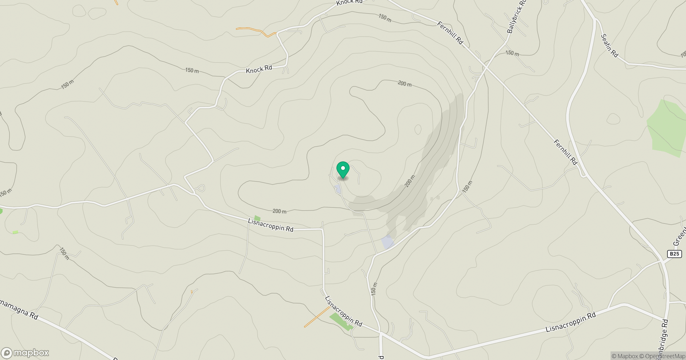
Grid reference: J182378
View on OpenStreetMapOpens a map in a new tab, centred on the hill.
No comments yet. Be the first.