

Haytor Rocks
Good walks are even better shared.
SX7577 : Teignbridge : Haytor Rocks
Lewis Clarke Photo source
Overview
Haytor Rocks is a 457 m granite tor on the eastern side of Dartmoor, above Haytor Vale and Bovey Tracey. Its two main outcrops overlook moorland and the South Devon coast. Paths from the roadside car parks reach the foot of the rocks, while longer walks explore the old quarries, granite tramway and Hound Tor. Climbing the rock tops involves exposed scrambling and can be left out of a walking visit.
Haytor Rocks
Haytor's two granite masses rise above the eastern edge of Dartmoor, with views over Devon towards the coast. The catalogue summit is 457 m. A short uphill walk reaches the foot of the tors; the old quarries and granite tramway give a longer outing a very different character.
Walking to the tors
Haytor upper car park on the B3387 is a convenient starting point. Follow the uphill path to the rocks and return the same way, or choose a mapped circuit through the quarries. Walking around the tors and between their two main outcrops gives broad views without going onto the rock tops.
The National Park's Haytor audio walk is a complete 10 km circuit from the visitor centre. It links Haytor Quarry, the tramway, Smallacombe Rocks, Becka Brook, Hound Tor's medieval settlement and rocks, Holwell Lawn and Greator Rocks, returning via Smallacombe and Haytor. The published allowance is about 3.5 hours. Expect steep climbs and rough or wet ground, and carry the route map.
The summit rocks
High Man and Low Man are climbing outcrops. The old cut steps are a scrambling way up, with worn footholds, exposed drops and no intact handrail. Rock-top climbing is optional and needs sound judgement; leave it out when wet, icy or windy.
Quarry heritage
The stone here is granite, exposed through long weathering and erosion. The nearby quarries show where it was cut for construction. George Templer's tramway, built in 1820, carried granite to the Stover Canal and onward to Teignmouth; its surviving stone rails are part of a scheduled monument.
Haytor Quarry is reached through access gates. Paths within it include narrow and steep sections, and the pools and quarry edges require care. Keep out of the water and supervise children around the workings. The National Park's Miles Without Stiles quarry walk is a separate lower-level outing, not an ascent of the summit rocks.
Views and nearby hills
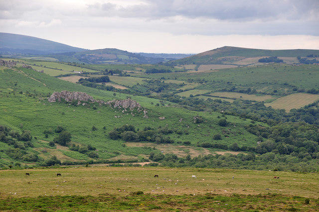
Clear weather brings views across eastern Dartmoor towards the Teign estuary and South Devon coast. Nearby summits include Hound Tor near Manaton (414 m) and Rippon Tor (476 m). Longer views depend on visibility rather than a particular season.
Planning a visit
There are upper, middle and lower car parks at Haytor, with parking charges. The visitor centre and public toilets are at the lower car park. Check opening times and on-site parking signs.
Public transport needs careful planning: Country Bus 193 has limited Wednesday and Friday journeys, while the 271 Haytor Hoppa is seasonal. Its published 2026 season ended on 19 September. Check the operator's current timetable and return journey before travelling.
Explore routes near Haytor Rocks
Walks starting near this hill. Open a route to check its map, distance and full itinerary.
Moretonhampstead to Lustleigh: Wray Valley woodland railway trail
View route
Castle Drogo and Fingle Bridge: Teign Gorge woodland circuit
View route
Exeter Canal, Double Locks and Countess Wear river circuit
View route
Killerton to Clyston Mill: Broadclyst farmland and heritage walk
View route
Route planning notes
These notes describe possible approaches. Check a route's map and access information when planning your walk.
Haytor Rocks from the upper car park
Walk uphill from Haytor upper car park on the B3387 to the foot of the two granite outcrops, then return the same way. Enjoy the views from the ground between the tors; reaching the rock tops involves exposed scrambling and is optional. The uphill moorland path can be uneven and slippery.
Haytor and Hound Tor: National Park audio walk
From Haytor Visitor Centre, follow the National Park circuit via Haytor Quarry, the granite tramway, Smallacombe Rocks and the Becka Brook clapper bridge to Hound Tor village and rocks. Return through Holwell Lawn and past Greator Rocks, recross the brook, then return via Smallacombe and Haytor Rocks. Allow about 3.5 hours for the full 10 km circuit, with steep, rough and sometimes wet ground; rock-top climbs are optional.
Haytor Rocks and quarries circuit
From the upper car park, visit Haytor Rocks, then Haytor Quarry through its access gates. Follow the granite tramway to Holwell Quarry, return to Rubble Heap Junction and visit Rubble Heap Quarry before crossing the moor back to Haytor and the car park. Keep clear of quarry edges and deep water. This is the Dartmoor Walking itinerary; its published distance labels disagree, so use its map to plan the complete walk.
Make a day of it, together
Find someone to share the walk with, or organise a day out along a route you like.
Photo Gallery
View all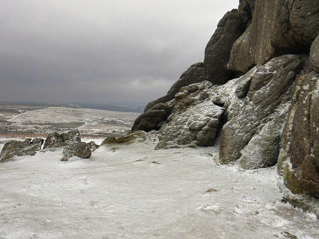 Photo could not load
SX7577 : Teignbridge : Haytor Rocks
Lewis Clarke
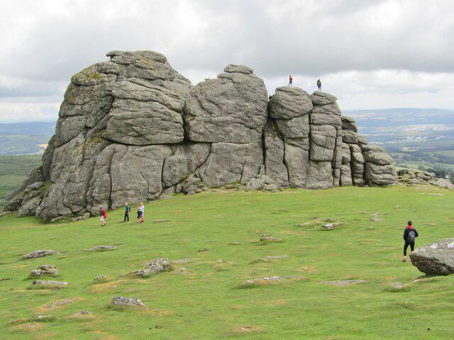 Photo could not load
SX7577 : Haytor Rocks
Colin Smith
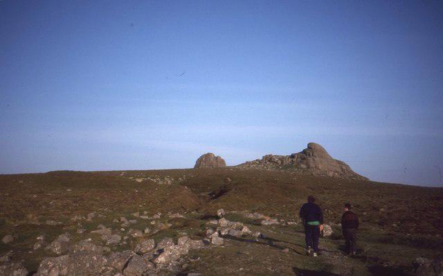 Photo could not load
SX7577 : Hay Tor Rocks
Richard Webb
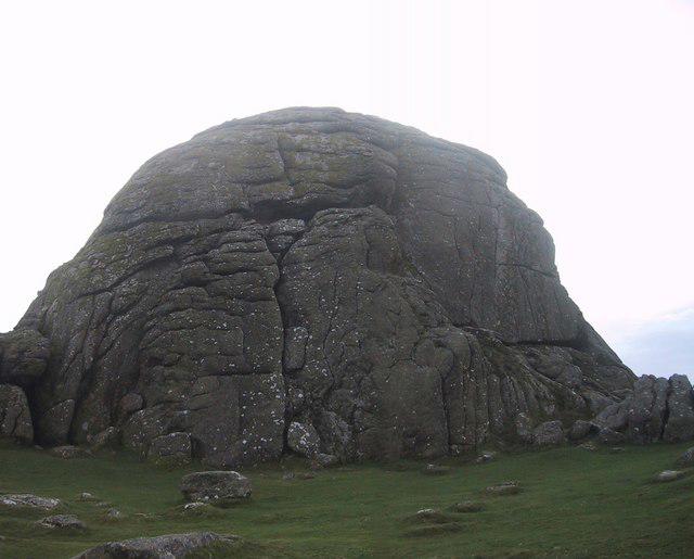 Photo could not load
SX7577 : Haytor Rocks
Sarah Charlesworth
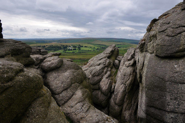 Photo could not load
SX7577 : Teignbridge : Dartmoor - Haytor
Lewis Clarke
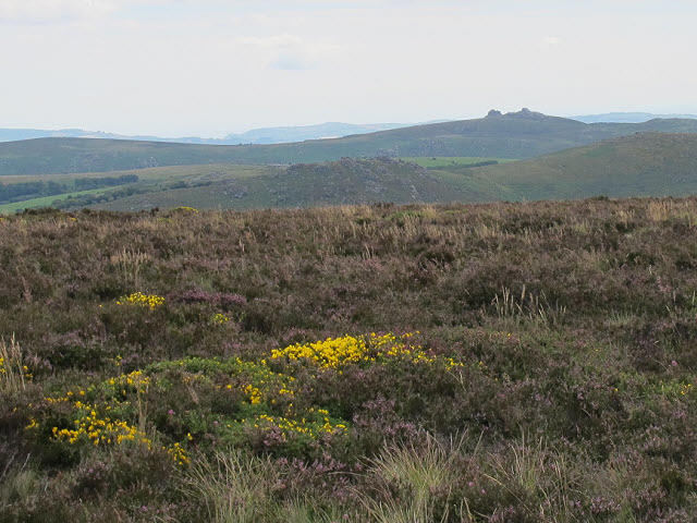 Photo could not load
SX7577 : Distant view of Haytor
Stephen Craven
 Photo could not load
SX7577 : Dartmoor - Buttercups and Haytor
Sloop John B
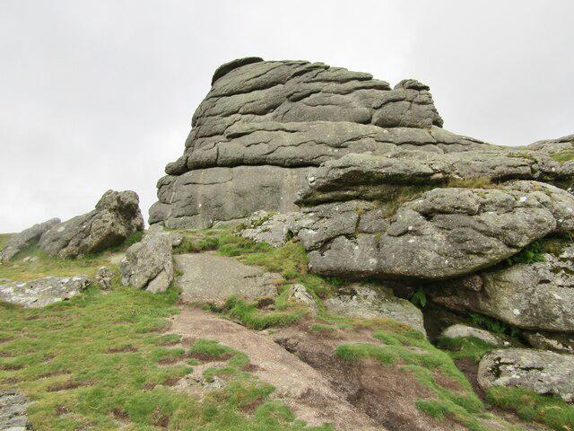 Photo could not load
SX7577 : Haytor Rocks
Colin Smith
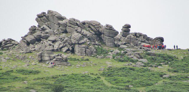 Photo could not load
SX7577 : Haytor Rocks
Colin Smith
SX7577 : Teignbridge : Dartmoor Scenery
Lewis Clarke
Hill facts and local notes
Classifications
Elevation
457m
1,499 ft
Prominence
67m
Coordinates
50.5798, -3.7568
SX757770
OS Map
191
Explorer: OL28N
At the Summit
Two prominent granite outcrops, High Man and Low Man. The summit feature is a rock tor. Old steps cut into the granite provide a scrambling ascent, with exposed drops and no intact handrail; the surrounding moorland offers views without climbing the rocks.
Terrain & Geology
Haytor exposes the Dartmoor granite, an intrusive igneous rock. Weathering along joints and the removal of surrounding material have left the blocky tor outcrops. Granite was also extracted from the nearby quarries, whose spoil heaps and stone tramway survive.
Views & Scenery
Views across eastern Dartmoor and the surrounding Devon countryside towards the Teign estuary and South Devon coast in clear weather. There are rewarding views from the ground around the tors as well as from the rock tops.
History & Heritage
Name Origin
Often interpreted as a form of High Tor, with Hey Tor used in historical accounts. Local-history sources give this explanation; the origin should not be treated as certain.
Historical Significance
The quarries below Haytor supplied granite for building works. George Templer built the granite-railed tramway in 1820 to carry stone to the Stover Canal for onward transport to Teignmouth. Surviving rails, quarry workings and machinery reveal this industrial history; the tramway is a scheduled monument.
Getting There & Facilities
Parking
Haytor upper car park on the B3387 (SX759767) is a convenient start for the direct uphill approach. The middle car park (SX763771) and lower car park beside Haytor Visitor Centre offer alternatives. Charges apply; check the on-site signs, payment arrangements and any overnight closure before setting out. Toilets are at the visitor centre by the lower car park.
Public Transport
Country Bus 193 serves Haytor Moorlands Hotel and Haytor Vale on Wednesdays and Fridays, excluding public holidays, with very limited journeys; check the direction and return options. The 271 Haytor Hoppa ran on Thursdays and Saturdays from 23 May to 19 September 2026 and has finished for that season. Recheck the operator's timetable before travelling.
Nearby Facilities
Haytor Visitor Centre is beside the lower car park, with visitor information and public toilets, including an adapted toilet and baby-changing facilities. Blue Badge parking is available there. Check the centre's current opening times; the summit itself has no facilities.
Safety Information
Known Hazards
- Exposed rock tops and steep drops: the worn rock steps require scrambling. Avoid climbing in wet, icy or strong-wind conditions.
- Uneven moorland paths and granite can be slippery; mist can make the many path junctions confusing. Carry a map and suitable clothing.
- Haytor Quarry has steep edges, deep water and old industrial remains. Use the access gates, supervise children and keep out of the pools.
- Longer Hound Tor circuits cross rough, sometimes wet ground and include steep climbs and a clapper-bridge crossing of Becka Brook.
Seasonal Hazards
Wet or icy granite makes the summit rocks hazardous, and strong winds increase exposure. Moorland and valley paths can be muddy after rain; check the forecast and allow for shorter daylight in winter.
General Safety Tips
- Check weather conditions before setting out
- Carry appropriate clothing and equipment
- Let someone know your planned route
- Take a map, compass, and GPS device
- Carry emergency supplies: food, water, first aid kit, torch
Hills
Some common questions about the hills answered
Are there group walks up Haytor Rocks?
Many walkers use Walkmates to join or organise walks with others. You can check for group walks around Haytor Rocks through the maps
Are there other walkers around Haytor Rocks?
Activity varies by location and time, but Walkmates lets you see whether others have shared walks or shown interest in this area. Find other people through the walking friends search walking friends for Haytor Rocks search or of course create your own walk for Haytor Rocks
Can I organise a walk to Haytor Rocks?
Yes. If there aren’t any walks listed already, you can create a walk and make it available for others to join.
If you're signed up to Walkmates, you can create a walk to Haytor Rocks.
How do I find a walk up this hill?
There are often multiple ways to walk this hill, depending on experience and route preference. Walkmates helps you explore walks and routes that others have shared.
Can I suggest a new route up Haytor Rocks?
Yes. You can suggest or create routes to share with others. Walkmates focuses on the social side of walking, so routes are used to help people organise walks and explore areas together, rather than as detailed navigation tools or route libraries.
Other uses really appreciate knowledgeable walkers sharing their routes. Share your favourite route to Haytor Rocks here
The is an error or something incorrect about this hill. How do I let you know?
We always strive to keep the information on Walkmates as accurate as possible. If you find an error, please let us know through the contact form and we'll aim to correct it as quickly as possible
Community Discussion
Comments
Location
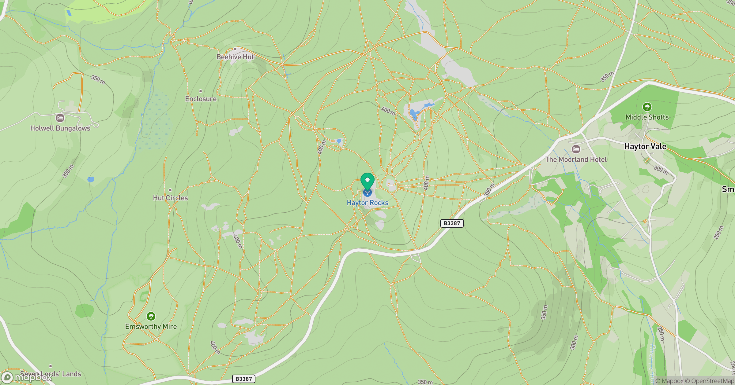
Grid reference: SX757770
View on OpenStreetMapOpens a map in a new tab, centred on the hill.
Nearby Hills

High Willhays
622m

Brent Tor
334m

Dunkery Beacon
520m
Brown Willy
420m
Rhossili Down - The Beacon
193m
No comments yet. Be the first.