

Danby High Moor
Good walks are even better shared.
NZ7001 : Seavy Hill
Colin Grice Photo source
Overview
Danby High Moor: A Hiker's Haven
Nestled in the heart of the North York Moors, Danby High Moor offers outdoor enthusiasts a slice of moorland magic. Standing at an elevation of 480 meters, it may not boast the tallest peak title, but the views are worth every step taken to reach the summit.
Geology
The geological composition consists predominantly of sandstone and shale, offering insights into the region's ancient past. The landscape has been sculpted by glaciation, resulting in an inspiring terrain for hikers and geology buffs alike.
Routes
The popular Moors Circuit is a moderate 10 km loop that showcases the quintessential beauty of the moorlands. It’s a fantastic choice for those looking to explore while enjoying panoramic views. Just remember, your boots may get muddy — but that’s all part of the adventure!
Summit Features
Upon reaching the summit, expect to find a quaint stone cairn and a timeworn trig point that helps guide explorers on their way. You've made it, and the views are your reward!
Terrain
The terrain is a mix of moorland; it ranges from gently rolling hills to rocky outcrops. While it’s generally friendly for walkers, keep an eye out for those unexpected bogs ready to give your shoes a thorough soaking!
Views
From the summit, on a day free of fog and clouds, witnesses will delight in views stretching to the Cleveland Hills and the North Sea — a fantastic backdrop for that all-important summit selfie.
Hazards
As with any moorland, weather changes can be as sudden as a bad joke at a comedy club, so it’s prudent to be prepared. Always carry adequate gear, and watch out for those unexpected bogs that seem to spring out of nowhere.
Nearby Summits
For those eager to continue their exploration, nearby summits such as Rosedale East Moor (490 meters) and Rosedale Nab (426 meters) offer additional opportunities to test your legs and soak in even more of the stunning moorland scenery.
Access
Access to the moor is straightforward. Parking at the Danby National Park Centre allows you to start your adventure with ease. If using public transport, a local bus service or a stroll from Danby train station gets you there comfortably.
Facilities
Once you've conquered the heights, you can pop into the nearby village of Danby for a bite at a local cafe — their pastries are renowned!
History
The name Danby reflects its ancient roots, deriving from Old Norse, adding a rich layer to your hiking experience. The area’s historical trails beckon to those curious about the paths once trodden by both men and sheep alike.
In conclusion, Danby High Moor may not be the grandest of peaks, but it sprawls out its beauty for every walker to appreciate, inviting you to venture forth and create your own stories. Happy hiking!
Explore routes near Danby High Moor
Walks starting near this hill. Open a route to check its map, distance and full itinerary.
Commondale and Hob Cross
View route
Grosmont to Beck Hole, Esk Valley Circular
View route
Dalby Forest Ellerburn Long Trail
View route
Dalby Forest Woodcock Way Long Loop from High Staindale
View route
Route planning notes
These notes describe possible approaches. Check a route's map and access information when planning your walk.
The Moors Circuit
A scenic loop that takes you around the expansive moorland, providing an immersive experience of the region's wild beauty.
Make a day of it, together
Find someone to share the walk with, or organise a day out along a route you like.
Photo Gallery
View all Photo could not load
NZ7001 : Old Boundary Marker on Loose How, Danby High Moor
Milestone Society
 Photo could not load
NZ7001 : Lyke Wake Walk over Seavy Hill
Di Brooksbank
 Photo could not load
NZ7001 : Old Boundary Marker near Loose Howe, Danby High Moor
Milestone Society
 Photo could not load
NZ7001 : Trig. Point and Cottongrass, Loose Howe
Mick Garratt
 Photo could not load
NZ7001 : Seavy Hill
Colin Grice
 Photo could not load
NZ7001 : Sinking Trig Pillar on Danby High Moor
David Brown
Hill facts and local notes
Classifications
Elevation
432m
1,417 ft
Prominence
79m
Coordinates
54.4013, -0.9204
NZ701011
OS Map
94
Explorer: OL26N OL27N
At the Summit
The summit is marked by a small stone cairn, and there is a weathered trig point that stands as a testament to the navigators of yore.
Terrain & Geology
The area is primarily composed of sandstone and shale, shaped by glacial activity, offering intriguing insights into the geological history of the North York Moors.
Views & Scenery
On a clear day, you can spot the distant Cleveland Hills and even the North Sea shimmering on the horizon.
History & Heritage
Name Origin
Danby is thought to derive from Old Norse, meaning 'Dǫndi's farm,' referring to a local landholder from the time of Viking settlements.
Historical Significance
The area has historical significance due to its established routes through the moors, used since ancient times by locals and walkers alike, not to mention being a favourite haunt for the occasional wayward sheep.
Getting There & Facilities
Parking
The nearest parking can be found at the Danby National Park Centre (Grid Ref: NZ708031), where ample space is available and the views are already a treat.
Public Transport
Local buses service nearby villages, and the nearest train station is at Danby, approximately 3 miles away.
Nearby Facilities
While you'll find no facilities on the hill, Danby village offers a few cafes and public toilets – essential for the 'refreshment break' after summiting.
Safety Information
Known Hazards
- Beware of sudden weather changes typical of moorland areas; poor visibility can occur rapidly. Additionally, treacherous bogs can provide a surprise splash – or a soggy shoe.
General Safety Tips
- Check weather conditions before setting out
- Carry appropriate clothing and equipment
- Let someone know your planned route
- Take a map, compass, and GPS device
- Carry emergency supplies: food, water, first aid kit, torch
Hills
Some common questions about the hills answered
Are there group walks up Danby High Moor?
Many walkers use Walkmates to join or organise walks with others. You can check for group walks around Danby High Moor through the maps
Are there other walkers around Danby High Moor?
Activity varies by location and time, but Walkmates lets you see whether others have shared walks or shown interest in this area. Find other people through the walking friends search walking friends for Danby High Moor search or of course create your own walk for Danby High Moor
Can I organise a walk to Danby High Moor?
Yes. If there aren’t any walks listed already, you can create a walk and make it available for others to join.
If you're signed up to Walkmates, you can create a walk to Danby High Moor.
How do I find a walk up this hill?
There are often multiple ways to walk this hill, depending on experience and route preference. Walkmates helps you explore walks and routes that others have shared.
Can I suggest a new route up Danby High Moor?
Yes. You can suggest or create routes to share with others. Walkmates focuses on the social side of walking, so routes are used to help people organise walks and explore areas together, rather than as detailed navigation tools or route libraries.
Other uses really appreciate knowledgeable walkers sharing their routes. Share your favourite route to Danby High Moor here
The is an error or something incorrect about this hill. How do I let you know?
We always strive to keep the information on Walkmates as accurate as possible. If you find an error, please let us know through the contact form and we'll aim to correct it as quickly as possible
Community Discussion
Comments
Location
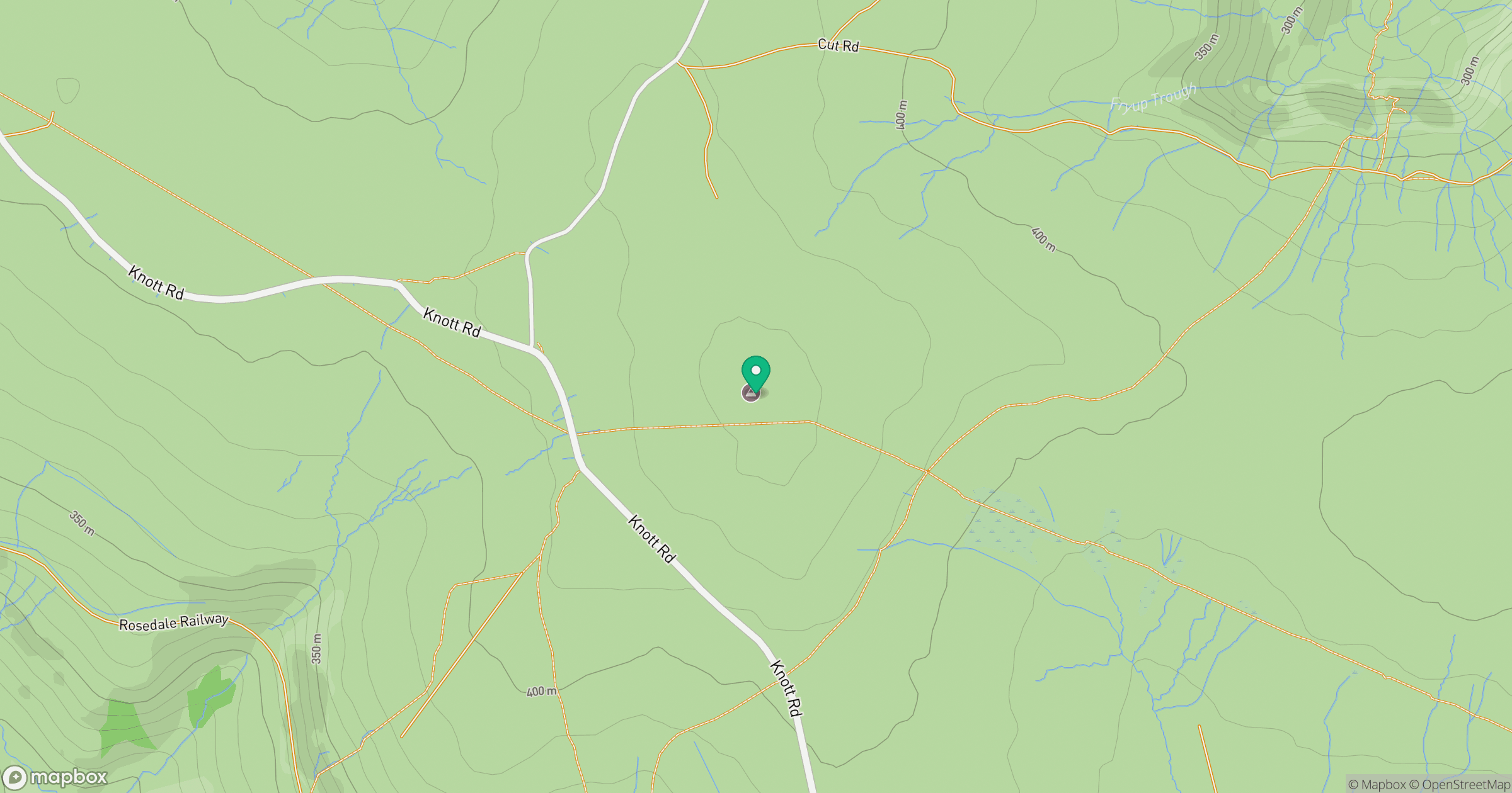
Grid reference: NZ701011
View on OpenStreetMapOpens a map in a new tab, centred on the hill.
Nearby Hills
Rombalds Moor [Ilkley Moor]
402m
Buckden Pike
702m
Pen-y-ghent
694m
Nine Standards Rigg
662m
Kinder Scout
636m
No comments yet. Be the first.