

Carrickarede Island
Good walks are even better shared.
Overview
Carrickarede Island
Nestled along the stunning Causeway Coast of Northern Ireland, Carrickarede Island is a hidden gem that promises both adventure and breathtaking scenery. Famous for its Carrickarede Rope Bridge, the island is not so much a towering peak, but rather a dramatic outcrop that rewards its visitors with splendid views of the rugged coastline and the distant Scottish Isles.
Geology
The rock formations on Carrickarede tell a tale that dates back to the Carboniferous period. Composed mainly of limestone and sandstone, the island's captivating cliffs have been artistically sculpted by the relentless forces of the Atlantic. The rich geological history here is as layered as the views are breathtaking!
Routes
The main route, known as the Carrickarede Rope Bridge Path, offers an accessible and scenic journey to the island. At just 1.5 km, it’s a leisurely walk suitable for all ages. One can't help but take a moment to appreciate the view of the bridge itself as it's suspended over a staggering 30 meters above the sea! Just imagine the adrenalin rush when walking across – don’t look down too much!
Summit Features
While Carrickarede doesn’t boast a traditional summit, the highest point on the island offers panoramic views that are simply unmatched. Stand at the edge and soak up the sights of vibrant wildflowers, radiant blue waters, and steep cliff faces that seem to plunge into the ocean. Just be careful to keep your distance from the edges unless you fancy a swim!
Terrain Type
Expect a mix of rocky terrain complemented by green patches of grass. The path can occasionally be slippery, especially when the weather has a moment of melodrama, which, let’s face it, is quite common in Northern Ireland!
Views
From the top, the sights are nothing short of spectacular. On a clear day, be sure to look out for Rathlin Island and even the misty outlines of Scotland. The best seasons to visit are spring and summer when the wildflowers burst into colour and the sun does its best to show off. Just don’t forget your camera – or your sunglasses!
Hazards
While the views are enchanting, it's important to be cautious. The coastal winds can be fierce, and paths can be slippery, especially after rain. Keep an eye out for nesting seabirds; they may be swooping in for a closer look at you!
Access
The Carrickarede Visitor Centre provides the nearest parking and is conveniently located just a short stroll from the rope bridge launch point. Public transport options are available from Ballycastle, ensuring you don’t have to pedal to get to this slice of heaven. The charming village of Ballintoy is nearby – perfect for a pint after your adventure!
Facilities
For those planning to stay a while, the Visitor Centre offers restrooms and a lovely café. Did someone say tea and scones post-hike? Yes, please!
History
The name ‘Carrickarede’ draws from the Gaelic language, meaning ‘rock in the road’, underscoring its role as a seafarer’s landmark. Historically, the island was significant for fishing and has deep cultural roots in the local community.
In closing, Carrickarede Island is a delightful escape for hikers and adventurers alike, offering a smorgasbord of stunning sights, rich history, and a sprinkle of sea breeze fun. Just remember to take the usual hiking precautions, and you’ll be all set for a fantastic day out!
Explore routes near Carrickarede Island
Walks starting near this hill. Open a route to check its map, distance and full itinerary.
Portballintrae to Giant's Causeway: railway path and Blue Trail return
View route
Belfast street-art walk
View route
Belfast street-art walk
View route
Route planning notes
These notes describe possible approaches. Check a route's map and access information when planning your walk.
Carrick-a-Rede Rope Bridge Walk
This iconic route starts at the Carrick-a-Rede car park and follows a well-maintained coastal path leading directly to the famous Carrick-a-Rede Rope Bridge. The walk offers stunning views of the Antrim coastline and Rathlin Island. The highlight is crossing the rope bridge to reach Carrickarede Island. Ensure to check bridge access availability before visiting.
Ballintoy to Carrick-a-Rede Coastal Walk
This longer coastal route begins in the picturesque village of Ballintoy. The path takes you along rugged cliffs, sandy beaches, and rock formations, with plenty of opportunities to spot seabirds and other wildlife. You’ll finish at the Carrick-a-Rede Rope Bridge, where you can explore Carrickarede Island. It’s a scenic but slightly challenging route with some uneven terrain.
Whitepark Bay to Carrick-a-Rede
This breathtaking linear walk begins at Whitepark Bay, a beautiful sandy beach, and follows the coastline westwards to Carrick-a-Rede. The route passes through Ballintoy and offers stunning views of the North Atlantic, as well as historical landmarks. Upon reaching Carrick-a-Rede, you can cross the rope bridge to visit the island.
Carrick-a-Rede and Larrybane Quarry Loop
This circular walk starts at the Carrick-a-Rede car park and includes a visit to Larrybane Quarry, a dramatic limestone quarry with historical significance. The route then leads to the Carrick-a-Rede Rope Bridge and island, offering diverse scenery, including cliffs, wildflowers, and coastal views. A shorter but varied route for those seeking a mix of history and nature.
Causeway Coast Way: Carrick-a-Rede Section
This segment of the famous Causeway Coast Way includes a walk to Carrick-a-Rede as part of a longer journey along Northern Ireland’s stunning coastline. Starting from either Ballycastle or Ballintoy, this route provides a mix of rugged paths, cliffside views, and cultural landmarks. It’s a longer and more demanding option, ideal for experienced walkers.
Make a day of it, together
Find someone to share the walk with, or organise a day out along a route you like.
Photo Gallery
View all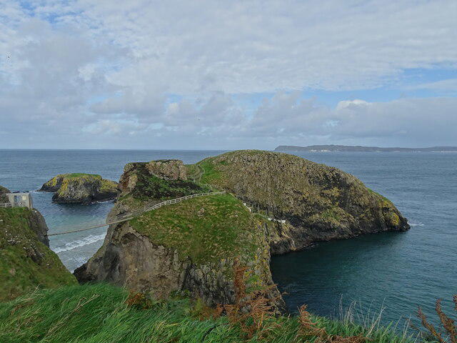 Photo could not load
D0644 : Carrick-a-Rede rope bridge
Matthew Chadwick
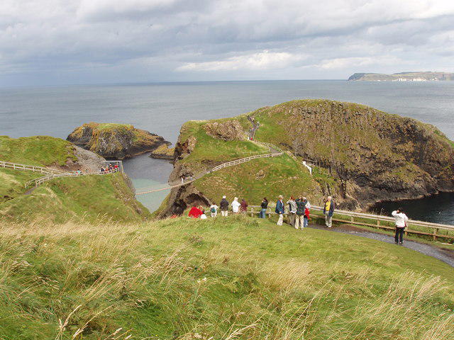 Photo could not load
D0644 : Carrick-a-rede rope bridge and viewpoint
David Hawgood
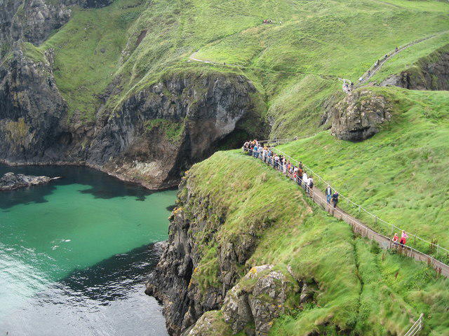 Photo could not load
D0644 : Queue for Carrick-a-Rede Rope Bridge
Sue Adair
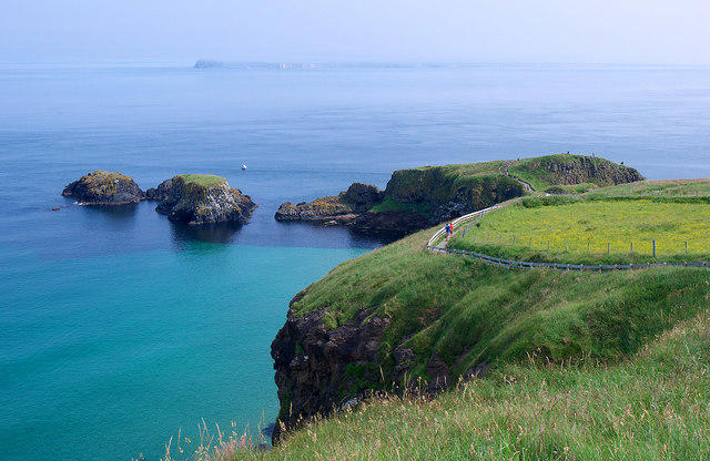 Photo could not load
D0644 : Towards Carrick-a-Rede
Rossographer
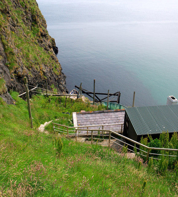 Photo could not load
D0644 : Salmon fishery, Carrickarede
Rossographer
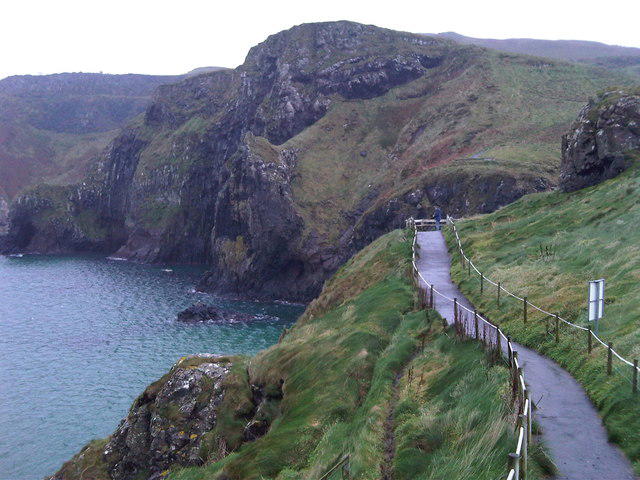 Photo could not load
D0644 : Path leading to footbridge
Robert Matin
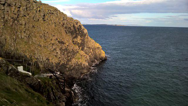 Photo could not load
D0644 : Rescue is at hand
Chris Morgan
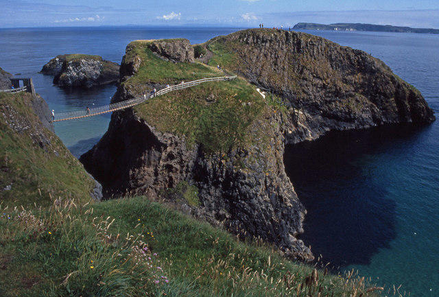 Photo could not load
D0644 : Carrick-a-Rede
Ian Taylor
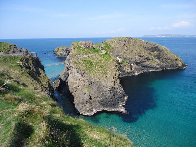 Photo could not load
D0644 : Carrick-a-rede Island and the rope bridge
Michael Earnshaw
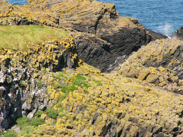
D0645 : Rocks on Carrickarade Island
Chris Gunns
Hill facts and local notes
Classifications
Elevation
51m
167 ft
Prominence
51m
Coordinates
55.2406, -6.3312
D062450
OS Map
5
At the Summit
The island features rugged cliffs and is famous for its suspension bridge. There is no formal summit as such, but the highest point offers stunning panoramas.
Terrain & Geology
Carrickarede Island is primarily composed of limestone and sandstone which were formed during the Carboniferous period. Its dramatic cliffs are the result of erosion from the Atlantic Ocean, presenting a fascinating tableau of natural history.
Views & Scenery
Picturesque views of the nearby coastline, Rathlin Island, and the Scottish Isles on a clear day.
History & Heritage
Name Origin
The name 'Carrickarede' translates from Gaelic as 'rock in the road', pointing to its historical significance as a navigational landmark.
Historical Significance
The island has a rich maritime history, famously linked with salmon fishing and offers a glimpse into Northern Ireland’s cultural heritage.
Getting There & Facilities
Parking
Carrickarede Visitor Centre offers ample parking just a short walk from the starting point.
Public Transport
Bus services operate from Ballycastle to the Carrickarede area, making it accessible without a car.
Nearby Facilities
The Carrickarede Visitor Centre provides restrooms and a small café for refreshments, perfect for a post-hike snack.
Safety Information
Known Hazards
- Strong coastal winds, slippery paths near the cliffs, and wildlife such as nesting seabirds that may swoop if disturbed.
General Safety Tips
- Check weather conditions before setting out
- Carry appropriate clothing and equipment
- Let someone know your planned route
- Take a map, compass, and GPS device
- Carry emergency supplies: food, water, first aid kit, torch
Hills
Some common questions about the hills answered
Are there group walks up Carrickarede Island?
Many walkers use Walkmates to join or organise walks with others. You can check for group walks around Carrickarede Island through the maps
Are there other walkers around Carrickarede Island?
Activity varies by location and time, but Walkmates lets you see whether others have shared walks or shown interest in this area. Find other people through the walking friends search walking friends for Carrickarede Island search or of course create your own walk for Carrickarede Island
Can I organise a walk to Carrickarede Island?
Yes. If there aren’t any walks listed already, you can create a walk and make it available for others to join.
If you're signed up to Walkmates, you can create a walk to Carrickarede Island.
How do I find a walk up this hill?
There are often multiple ways to walk this hill, depending on experience and route preference. Walkmates helps you explore walks and routes that others have shared.
Can I suggest a new route up Carrickarede Island?
Yes. You can suggest or create routes to share with others. Walkmates focuses on the social side of walking, so routes are used to help people organise walks and explore areas together, rather than as detailed navigation tools or route libraries.
Other uses really appreciate knowledgeable walkers sharing their routes. Share your favourite route to Carrickarede Island here
The is an error or something incorrect about this hill. How do I let you know?
We always strive to keep the information on Walkmates as accurate as possible. If you find an error, please let us know through the contact form and we'll aim to correct it as quickly as possible
Community Discussion
Comments
Location
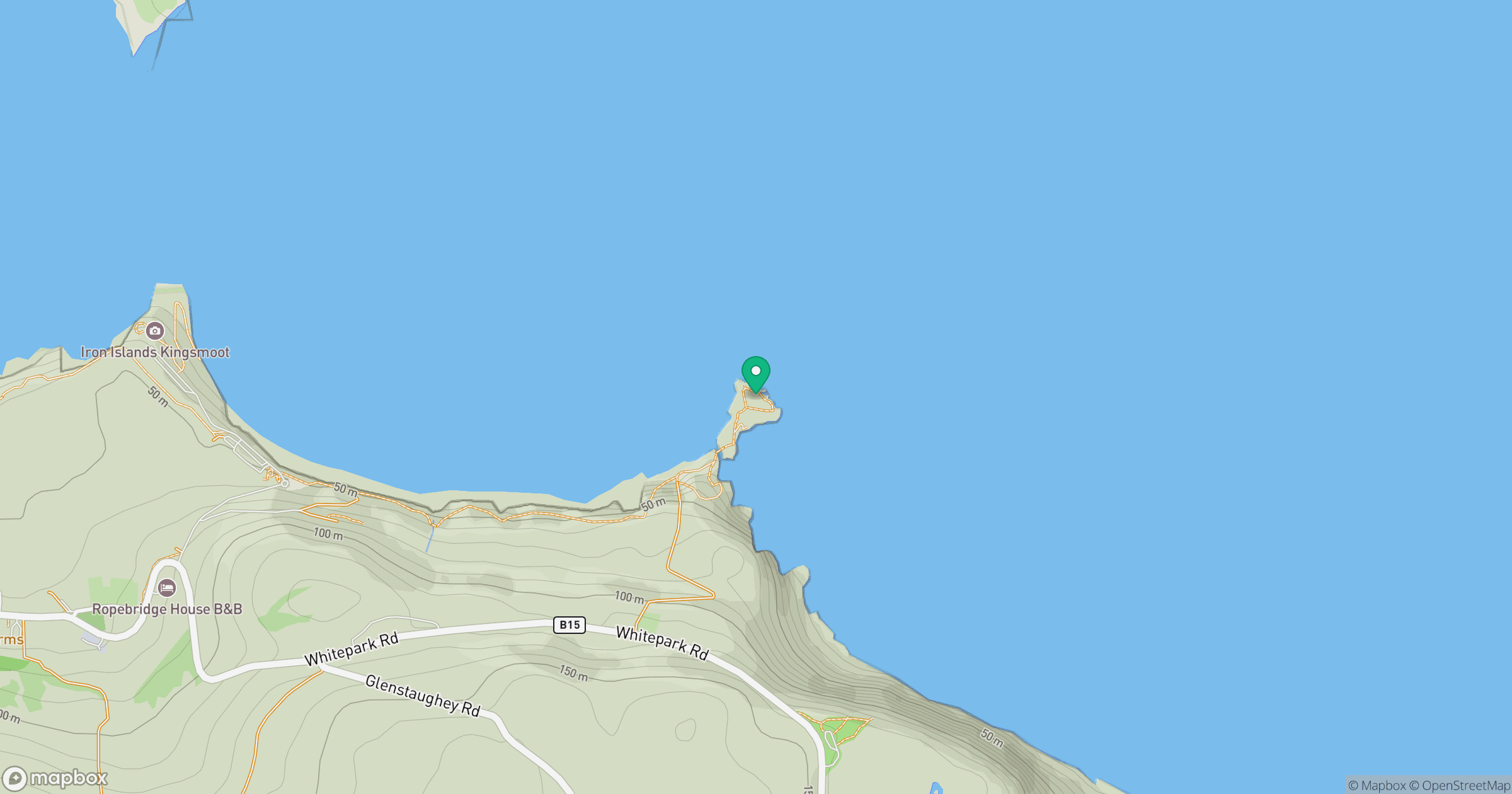
Grid reference: D062450
View on OpenStreetMapOpens a map in a new tab, centred on the hill.
No comments yet. Be the first.