

Carnan Cruithneachd
Good walks are even better shared.
NG9925 : Carnan Cruithneachd
Jean-Marc Jossinet Photo source
Overview
Carnan Cruithneachd
Located in the North West Highlands of Scotland, Carnan Cruithneachd stands at a respectable 796 meters above sea level. This humble mountain may not be the tallest of the bunch, but it offers adventurers a rewarding trek and exceptional views that make it a must-visit.
Geology
The mountain's structure is primarily composed of ancient schists and gneisses, formed through intense geological processes over millions of years. The complex layering of these rocks is a testament to the shifting nature of the Earth. Hiking here isn't just exercise; it's like walking through history!
Routes
Kintail Approach
This is the most popular route, starting from the Kintail area. It’s 10 km long and usually takes about 4 hours to reach the summit. While you might work up a bit of a sweat on the steeper portions, the vistas will keep your spirits high! Remember to bring your water and possibly a snack; hiking does work up an appetite!
Summit Features
At the summit, you’ll find a sturdy cairn and a trig point marking your triumph, perfect for those victory selfies. You’ve earned it!
Terrain Type
The trek provides a delightful mix of rocky paths and grassy expanses, with occasional soggy spots — a sure sign that Scotland's weather has had its say. A good pair of waterproof boots is a friend indeed!
Views
The views from Carnan Cruithneachd are nothing short of spectacular. On a clear day, catch sight of the majestic Isle of Skye and the glistening Loch Duich. The best time for these breathtaking vistas is during late spring to early autumn when the heather decorates the hills in purple hues.
Hazards
Be wary of sudden weather changes! They can be as surprising as finding out your teabag is empty just when you fancy a cuppa. Slippery rocks and boggy patches can be tricky, so keep your wits about you!
Nearby Summits
If you're feeling particularly adventurous, consider tackling nearby peaks such as Beinn Fhada and Maol Chean-dearg, both offering unique experiences and panoramic views.
Access
Parking is available at the end of the road leading into Kintail. If you're relying on public transport, buses from Inverness will get you close enough to start your hike. The nearest town with essential facilities is Kyle of Lochalsh, which offers various cafés to refuel after conquering the mountain.
Facilities
While there are not many facilities right next to Carnan Cruithneachd, the town of Kyle of Lochalsh boasts cafés and shops where you can grab a bite or take advantage of the public toilets.
History
The name 'Carnan Cruithneachd' beautifully captures a slice of Scotland's heritage, translating to 'Mound of the Pict'. This mountain, steeped in history, is a lovely reminder of the early Gaelic culture.
In summary, if you ever find yourself looking at Carnan Cruithneachd, remember that great adventures await. Prepare well, respect the terrain, and don’t forget to enjoy the journey. Happy hiking!
Explore routes near Carnan Cruithneachd
Walks starting near this hill. Open a route to check its map, distance and full itinerary.
Glen Affric: Coire Loch Woodland Trail
View route
Beinn Eighe Lancaster Wreckage at Coire Mhic Fhearchair
View route
Fort Augustus to Kytra Lock: Caledonian Canal Towpath
View route
Fairy Lochs Liberator Wreckage Circuit
View route
Route planning notes
These notes describe possible approaches. Check a route's map and access information when planning your walk.
Kintail Approach
A fabulous route starting from the Kintail area, offering stunning views and a moderately challenging ascent. Be prepared for a few steep bits — the mountain likes to keep you on your toes.
Make a day of it, together
Find someone to share the walk with, or organise a day out along a route you like.
Photo Gallery
View all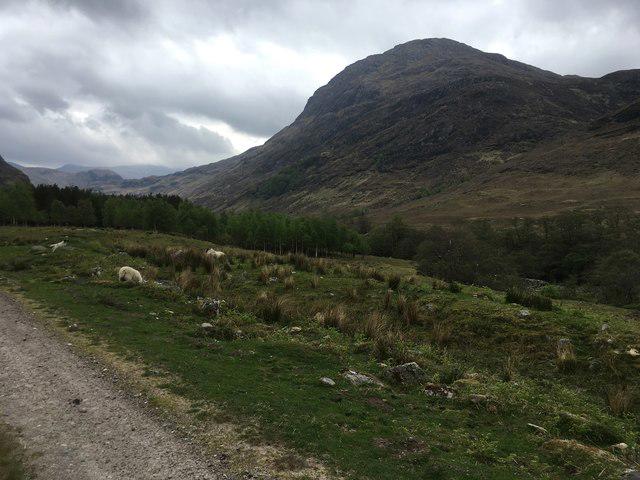 Photo could not load
NG9925 : Carnan Cruithneachd
Jean-Marc Jossinet
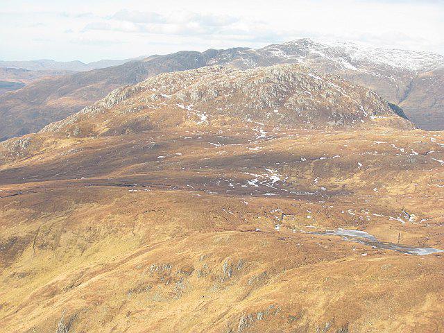 Photo could not load
NG9925 : Carnan Cruithneachd
Richard Webb
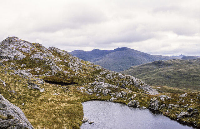 Photo could not load
NG9925 : Rocky ridge rising to summit of Carnan Cruithneachd
Trevor Littlewood
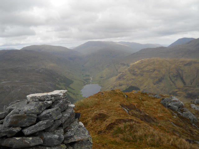 Photo could not load
NG9925 : Summit of Carnan Cruithneachd
David Brown
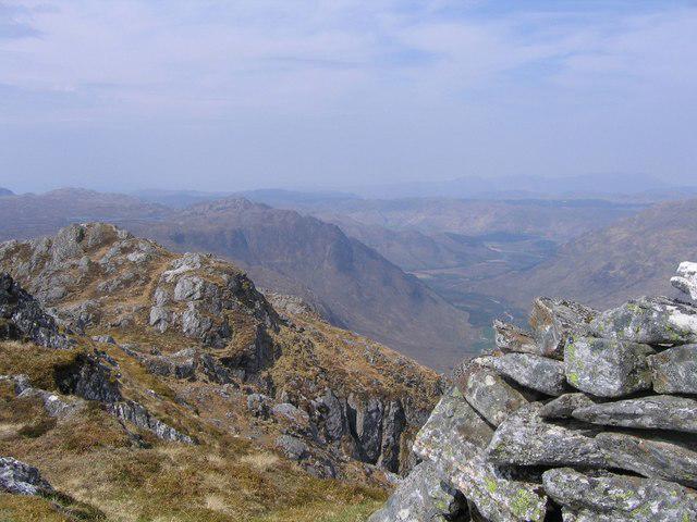 Photo could not load
NG9925 : Summit of Carnan Cruithneachd
Andrew Spenceley
Hill facts and local notes
Classifications
Elevation
728m
2,388 ft
Prominence
220m
Coordinates
57.2789, -5.3286
NG994258
OS Map
25 33
Explorer: 414N
At the Summit
The summit features a prominent cairn and a small trig point, perfect for that all-important Instagram snapshot. Just don’t forget to include your grinning mug!
Terrain & Geology
Carnan Cruithneachd is primarily composed of ancient schists and gneisses, which are notable for their complex layering and folding due to metamorphic processes. These rocks tell a tale of geological upheaval over millions of years, much like an epic saga full of twists and turns.
Views & Scenery
From the summit, enjoy panoramic views of the surrounding Hebridean Islands, including the stunning Isle of Skye, and the shimmering waters of Loch Duich. The sight is as breathtaking as finding an extra chip at the bottom of the packet!
History & Heritage
Name Origin
The name 'Carnan Cruithneachd' translates roughly to 'Mound of the Pict', reflecting its connections to early Scottish history and the enigmatic Picts who roamed this landscape millennia ago.
Historical Significance
The mountain holds cultural significance as part of the ancient Gaelic landscape and is steeped in local folklore that can make the hair on your neck stand as you hike.
Getting There & Facilities
Parking
There is ample parking available at the end of the road leading into Kintail. Please make sure to park responsibly to avoid adding extra stress to the locals (and their sheep).
Public Transport
The nearest bus service is from Inverness, which connects with public transport options leading to Kintail. Check the local timetables — they tend to be as reliable as a raincoat in Scotland!
Nearby Facilities
Facilities are quite limited in the immediate vicinity, but Kyle of Lochalsh has several cafés and shops, as well as public toilets. Perfect for a post-hike tea and cake!
Safety Information
Known Hazards
- Potential for sudden weather changes, slippery rocks, and boggy patches. Watch your step; the mountain has a sneaky sense of humour!
General Safety Tips
- Check weather conditions before setting out
- Carry appropriate clothing and equipment
- Let someone know your planned route
- Take a map, compass, and GPS device
- Carry emergency supplies: food, water, first aid kit, torch
Hills
Some common questions about the hills answered
Are there group walks up Carnan Cruithneachd?
Many walkers use Walkmates to join or organise walks with others. You can check for group walks around Carnan Cruithneachd through the maps
Are there other walkers around Carnan Cruithneachd?
Activity varies by location and time, but Walkmates lets you see whether others have shared walks or shown interest in this area. Find other people through the walking friends search walking friends for Carnan Cruithneachd search or of course create your own walk for Carnan Cruithneachd
Can I organise a walk to Carnan Cruithneachd?
Yes. If there aren’t any walks listed already, you can create a walk and make it available for others to join.
If you're signed up to Walkmates, you can create a walk to Carnan Cruithneachd.
How do I find a walk up this hill?
There are often multiple ways to walk this hill, depending on experience and route preference. Walkmates helps you explore walks and routes that others have shared.
Can I suggest a new route up Carnan Cruithneachd?
Yes. You can suggest or create routes to share with others. Walkmates focuses on the social side of walking, so routes are used to help people organise walks and explore areas together, rather than as detailed navigation tools or route libraries.
Other uses really appreciate knowledgeable walkers sharing their routes. Share your favourite route to Carnan Cruithneachd here
The is an error or something incorrect about this hill. How do I let you know?
We always strive to keep the information on Walkmates as accurate as possible. If you find an error, please let us know through the contact form and we'll aim to correct it as quickly as possible
Community Discussion
Comments
Location
View the hill's mapped position and surrounding paths.
Grid reference: NG994258
View on OpenStreetMapOpens a map in a new tab, centred on the hill.
No comments yet. Be the first.