

Braigh nan Uamhachan
Good walks are even better shared.
NM9786 : Braigh nan Uamhachan
John Ferguson Photo source
Overview
Braigh nan Uamhachan
Overview
Rising proudly at 669 meters, Braigh nan Uamhachan is a notable Marilyn in the Scottish Highlands. Its striking elevation and scenic routes make it a favourite among hikers looking for adventure and breathtaking views.
Geology
The composition of schist gives the mountain its rugged terrain and unique topography. The geological characteristics not only shape the physical landscape but also provide insights into Scotland's ancient geology. It's a great place to contemplate just how long it's taken to create such beauty—and how long it might take to climb it on a rainy day!
Routes
The most popular route to the summit begins at Bealach an Aonaich. This path stretches approximately 10.5 km round trip and is estimated to take about 4.5 hours. While it can be steep in places, the journey rewards you with sweeping vistas that make every drop of sweat worthwhile.
Summit Features
At the summit, you'll find a humble cairn, a traditional marker that has witnessed many adventurers, some perhaps pondering their existence at such heights, while others are just thrilled to reach the top!
Terrain Type
Expect a mixture of grassy slopes, rocky outcrops, and the occasional boggy patch that demands careful navigation. A sturdy pair of boots is highly recommended—think of it as your mountain-hiking safety net!
Views
From the top, the views are nothing short of spectacular, with the nearby glens and lochs laid out like an artist's masterpiece. The best times to soak in these sights are during the crisp days of spring or autumn when clarity complements the vibrant colors.
Hazards
It's wise to stay aware of the changing weather conditions that can sweep across the Highlands unexpectedly. Wet rocks can make footing tricky, so proceed with care—nobody wants to slip and take an unscheduled dip!
Nearby Summits
Just a stone's throw away is Beinn an Lochain, which rises to 743 meters. If you’re feeling particularly adventurous, consider adding it to your itinerary!
Access
The nearest parking is conveniently located at the starting point of your hike, but don’t dawdle—spaces fill up faster than a Highland cow can graze! Public transport options are sparse, so bring your best pair of walking boots or consider arranging a taxi from Lochgoilhead, the nearest town, where essential facilities can also be found.
Facilities
While there’s not much in the way of facilities near the mountain, Lochgoilhead has a few cafes and public toilets that can be quite handy before or after your hike.
History
Braigh nan Uamhachan translates to 'The Height of the Caves', which gives you a glimpse into the mountain’s enriching history. It’s said that the area is steeped in folklore, perfect for those who enjoy a good tale while walking the trails.
Make sure you’re adequately prepared and pack your sense of adventure!
Explore routes near Braigh nan Uamhachan
Walks starting near this hill. Open a route to check its map, distance and full itinerary.
Banavie to Glen Loy Aqueduct: Neptune’s Staircase Canal Towpath
View route
Ben Nevis via Mountain Path
View route
Fort Augustus to Kytra Lock: Caledonian Canal Towpath
View route
Glen Affric: Coire Loch Woodland Trail
View route
Route planning notes
These notes describe possible approaches. Check a route's map and access information when planning your walk.
Bealach an Aonaich Route
A moderate ascent beginning at the Bealach an Aonaich, involving steep sections but rewarding views.
Make a day of it, together
Find someone to share the walk with, or organise a day out along a route you like.
Photo Gallery
View all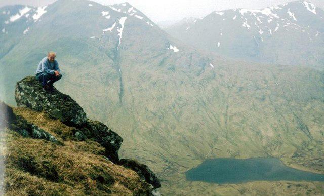 Photo could not load
NM9786 : Braigh nan Uamhachan
John Ferguson
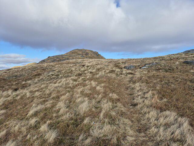 Photo could not load
NM9786 : Rough path on Braigh nan Uamhachan
Steven Brown
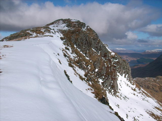 Photo could not load
NM9786 : Braigh nan Uamhachan summit
Stephen Middlemiss
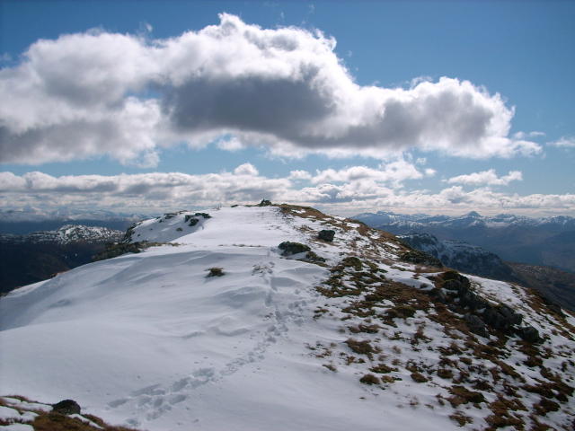 Photo could not load
NM9786 : Braigh nan Uamhachan summit
Stephen Middlemiss
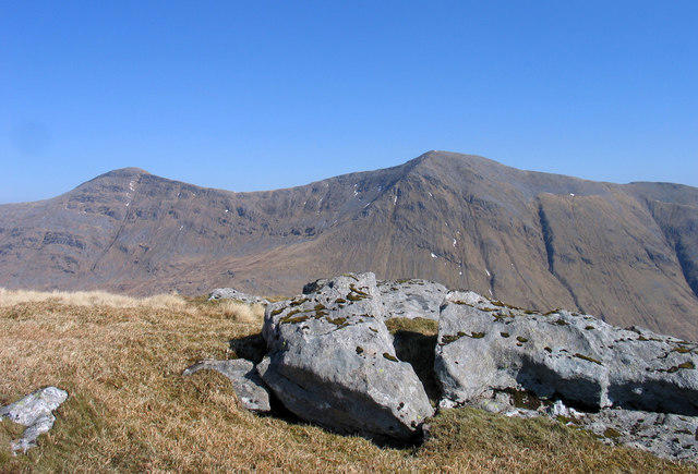 Photo could not load
NM9786 : Rocks at summit of Bràigh nan Uamhachan
Trevor Littlewood
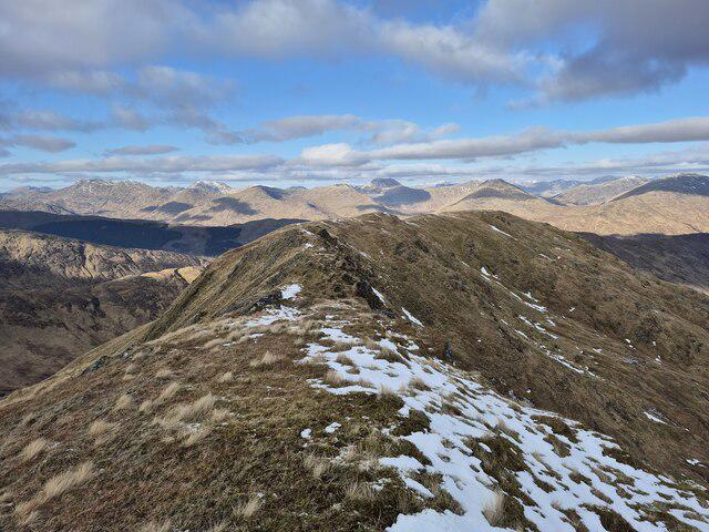 Photo could not load
NM9786 : Ridge of Braigh nan Uamhachan
Steven Brown
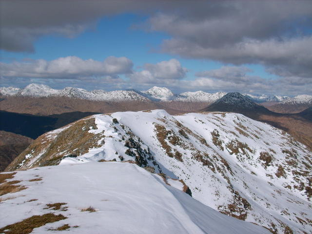 Photo could not load
NM9786 : The summit ridge
Stephen Middlemiss
Hill facts and local notes
Classifications
Elevation
765m
2,510 ft
Prominence
276m
Coordinates
56.9274, -5.3286
NM975867
OS Map
40
Explorer: 398E
At the Summit
The summit hosts a modest cairn, offering a great place to rest and reflect on the journey well-hiked – and maybe to contemplate the meaning of life. Or just take a selfie.
Terrain & Geology
The mountain is primarily composed of schist, a metamorphic rock that gives it a rugged character. The underlying geology contributes to the formation of various landscapes in the region, making for interesting geological exploration.
Views & Scenery
From the summit, one can see the vast expanse of the surrounding glens, the shimmering lochs, and if you're lucky (and squinting), the peaks of the distant Arran mountains.
History & Heritage
Name Origin
The name 'Braigh nan Uamhachan' translates to 'The Height of the Caves', hinting at the geological features in the area.
Historical Significance
The mountain is part of a landscape steeped in Scottish history, often referenced in folklore and local tales.
Getting There & Facilities
Parking
There's a small car park at the start of the Bealach an Aonaich route, suitable for several vehicles but can fill quickly during peak times.
Public Transport
Public transport options are limited, but local bus services run to nearby towns like Lochgoilhead. A taxi may be required to reach the trailhead.
Nearby Facilities
Facilities are minimal in the immediate vicinity, but Lochgoilhead offers a few cafes and public toilets.
Safety Information
Known Hazards
- Beware of sudden weather changes, as the Highlands can be unpredictable. Be cautious of slippery rocks, particularly when wet.
General Safety Tips
- Check weather conditions before setting out
- Carry appropriate clothing and equipment
- Let someone know your planned route
- Take a map, compass, and GPS device
- Carry emergency supplies: food, water, first aid kit, torch
Hills
Some common questions about the hills answered
Are there group walks up Braigh nan Uamhachan?
Many walkers use Walkmates to join or organise walks with others. You can check for group walks around Braigh nan Uamhachan through the maps
Are there other walkers around Braigh nan Uamhachan?
Activity varies by location and time, but Walkmates lets you see whether others have shared walks or shown interest in this area. Find other people through the walking friends search walking friends for Braigh nan Uamhachan search or of course create your own walk for Braigh nan Uamhachan
Can I organise a walk to Braigh nan Uamhachan?
Yes. If there aren’t any walks listed already, you can create a walk and make it available for others to join.
If you're signed up to Walkmates, you can create a walk to Braigh nan Uamhachan.
How do I find a walk up this hill?
There are often multiple ways to walk this hill, depending on experience and route preference. Walkmates helps you explore walks and routes that others have shared.
Can I suggest a new route up Braigh nan Uamhachan?
Yes. You can suggest or create routes to share with others. Walkmates focuses on the social side of walking, so routes are used to help people organise walks and explore areas together, rather than as detailed navigation tools or route libraries.
Other uses really appreciate knowledgeable walkers sharing their routes. Share your favourite route to Braigh nan Uamhachan here
The is an error or something incorrect about this hill. How do I let you know?
We always strive to keep the information on Walkmates as accurate as possible. If you find an error, please let us know through the contact form and we'll aim to correct it as quickly as possible
Community Discussion
Comments
Location
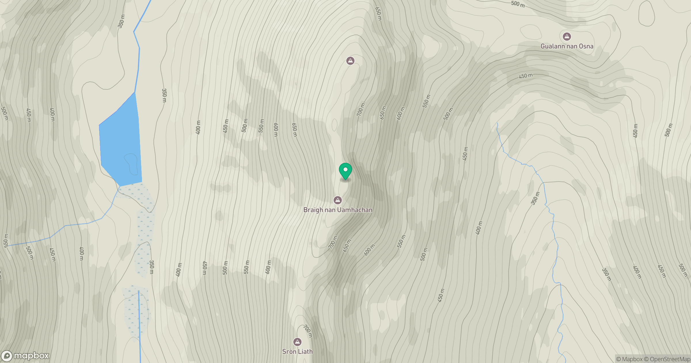
Grid reference: NM975867
View on OpenStreetMapOpens a map in a new tab, centred on the hill.
No comments yet. Be the first.