

Baildon Hill
Good walks are even better shared.
SE1440 : Round pond, Baildon Moor
Humphrey Bolton Photo source
Overview
Baildon Hill
Nestled in the picturesque Yorkshire landscape, Baildon Hill stands proudly at 244 meters above sea level, offering an accessible adventure for both seasoned hikers and casual wanderers. Known as a 'Marilyn', it boasts a prominence that can convince even the most skeptical of adventurers that they’re near something special.
Geology
The hill’s rugged features are primarily made up of Millstone Grit. This particular type of coarse sandstone might not win any beauty contests, but it offers a robust environment for a variety of flora and fauna. Glacial movements have played a significant role in shaping the area, resulting in intriguing formations that can spark the curiosity of any budding geologist.
Routes
Several paths lead to the summit of Baildon Hill:
- Baildon to the Summit: This easy route spans approximately 3.5 kilometers, perfect for families and newcomers to hiking. You’ll wander through charming woodlands before finding yourself eye-to-eye with the famous trig point!
- The Hill Circular Trail: For those looking to stretch their legs a bit more, this 5.0-kilometer loop will guide you through a variety of terrains while showcasing the scenic Aire Valley. Expect a leisurely pace, perfect for enjoying the sights.
Summit Features
Upon reaching the summit, hikers are greeted by a trig point – a delightful spot for that perfect selfie! More importantly, the surrounding grassy area offers a prime location for a picnic while soaking in the stunning views.
Terrain
The terrain is primarily grassy, dotted with rocky outcrops that add character to your jaunt. Keep an eye out for the odd muddy patch after the rain, which can be more challenging than it sounds!
Views
The vistas from Baildon Hill are truly breathtaking. On a clear day, look out over the Wharfe Valley and even catch a glimpse of Leeds in the distance. Spring and autumn are particularly magical times to visit, as the landscape bursts into colour.
Hazards
While the trails are mostly straightforward, exercise caution for the uneven greens and occasional puddles. And don’t forget to keep your furry friends leashed around livestock!
Access
Getting to Baildon Hill is a breeze. With free parking available at the Baildon Road car park, arriving by car is convenient. If you’re reliant on public transport, the local bus services from Bradford make hopping onto your hiking adventure smooth and easy. The nearest town, Baildon, buzzes with cafes and warmth, perfect for a post-hike treat.
Facilities
After tackling the heights of Baildon Hill, pop into one of the local cafes to refuel. Public toilets are also available nearby, so you won’t have to hold that latte for too long!
History
The name 'Baildon' opens a window into the past, possibly indicating a 'bailiff's hill', a nod to its historical significance in the region. Discover how this hill has been a part of human history for ages, home to ancient rock carvings and remnants of an Iron Age hillfort that echo times long gone.
Overall, Baildon Hill is not just a hike, it's an exploring adventure that blends nature with a touch of history. So, lace up those boots, grab some snacks, and off you go to discover the charm of Baildon Hill!
Happy Hiking!
Explore routes near Baildon Hill
Walks starting near this hill. Open a route to check its map, distance and full itinerary.
Saltaire to Bingley Five Rise Locks
View route
St Ives Reservoir and Water Garden Loops
View route
Silsden to Kildwick Canal Walk
View route
Spen Valley Greenway from Oakenshaw
View route
Route planning notes
These notes describe possible approaches. Check a route's map and access information when planning your walk.
Baildon to the Summit
A relatively straightforward path that offers a delightful ramble through woodland and open fields before reaching the summit, perfect for families and newcomers.
The Hill Circular Trail
This circular route combines paths and bridleways, giving hikers the chance to explore the local landscape, including scenic views over the Aire Valley.
Make a day of it, together
Find someone to share the walk with, or organise a day out along a route you like.
Photo Gallery
View all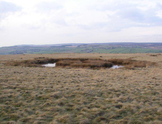 Photo could not load
SE1440 : Round pond, Baildon Moor
Humphrey Bolton
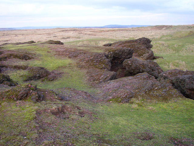 Photo could not load
SE1440 : On top of the cinder rocks, Baildon Moor
Humphrey Bolton
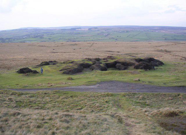 Photo could not load
SE1440 : The cinder rocks, Baildon Moor
Humphrey Bolton
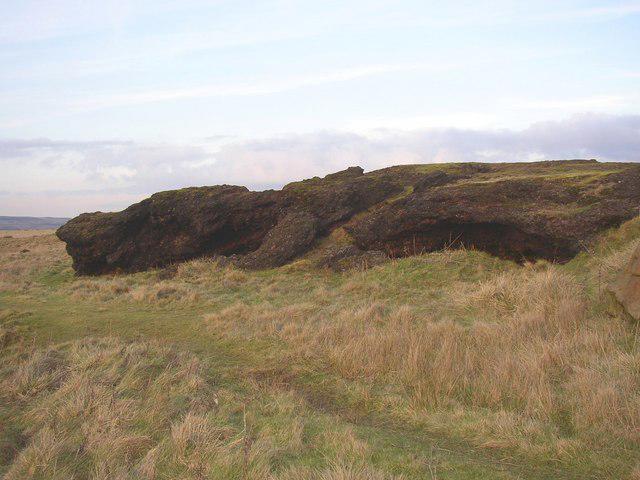 Photo could not load
SE1440 : The cinder rocks, Baildon Moor
Humphrey Bolton
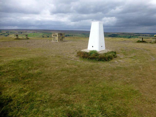 Photo could not load
SE1440 : Baildon Hill
Rude Health
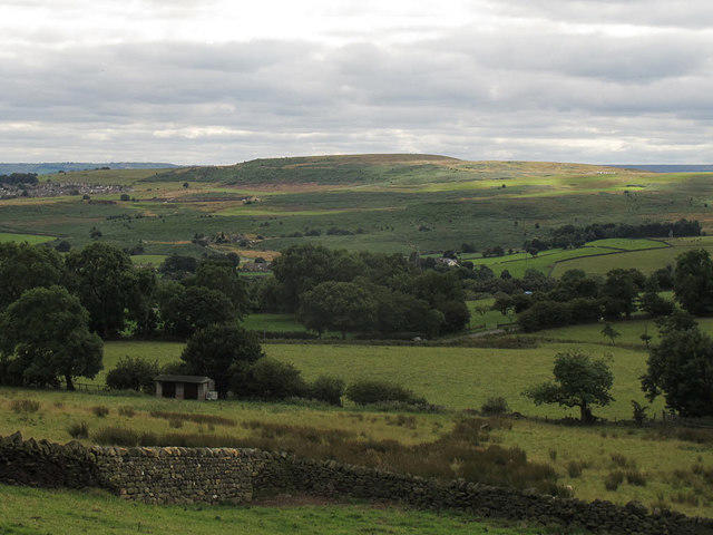 Photo could not load
SE1440 : Baildon Hill
Stephen Craven
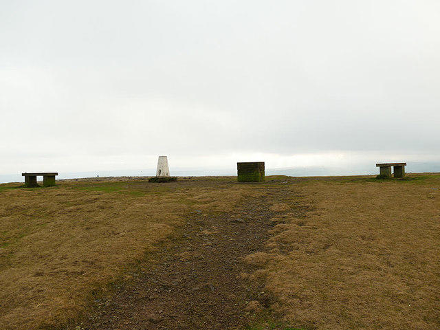 Photo could not load
SE1440 : The summit of Baildon Hill
Stephen Craven
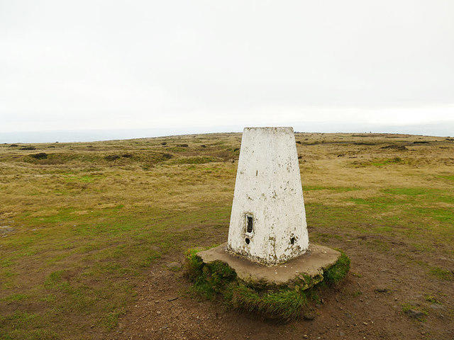 Photo could not load
SE1440 : Triangulation pillar on Baildon Hill
Stephen Craven
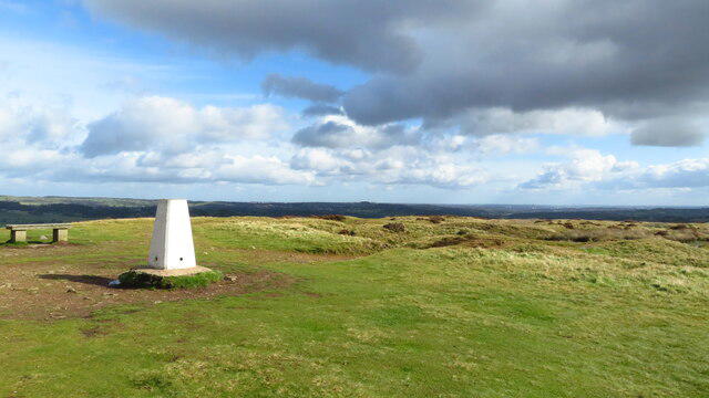 Photo could not load
SE1440 : Trig point on summit of Baildon Moor
Colin Park
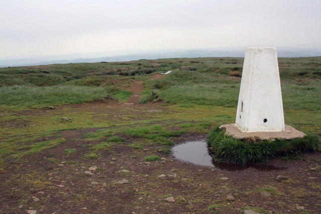
SE1440 : Trig point on Baildon Hill
Roger Templeman
Hill facts and local notes
Classifications
Elevation
282m
925 ft
Prominence
68m
Coordinates
53.8568, -1.7866
SE141400
OS Map
104
Explorer: 288N 297
At the Summit
The summit is marked by a distinctive trig point, offering panoramic views over the nearby moors and valleys, alongside open grassy areas perfect for a picnic.
Terrain & Geology
Baildon Hill predominantly features Millstone Grit, a coarse sandstone which contributes to its rugged terrain. The hill's geological structure has been shaped by glacial activity, leaving behind unique rock formations and a variety of flora and fauna in its diverse ecosystems.
Views & Scenery
From the summit, you can spot the picturesque landscape of the Wharfe Valley, as well as the distant peaks of the Yorkshire Dales. On a clear day, even the city of Leeds can be glimpsed.
History & Heritage
Name Origin
The name 'Baildon' possibly derives from 'Bail' meaning 'bailiff's hill', referencing its historical significance in local governance.
Historical Significance
Historically, Baildon Hill has been a site of human activity for millennia, featuring ancient rock carvings and a nearby Iron Age hillfort.
Getting There & Facilities
Parking
Free parking is available at the Baildon Road car park, just a short distance from the hill, accommodating around 30 vehicles. It can fill up quickly on sunny weekends.
Public Transport
Regular bus services run from Bradford to Baildon, with the nearest stop located a short walk from the hill's entrance.
Nearby Facilities
There are several cafes in Baildon village for a well-deserved coffee or snack after your hike, along with public toilets nearby.
Safety Information
Known Hazards
- Watch out for uneven terrain and the occasional muddy patch, especially after rainfall. There are cattle in pastures, so keep dogs on leads.
General Safety Tips
- Check weather conditions before setting out
- Carry appropriate clothing and equipment
- Let someone know your planned route
- Take a map, compass, and GPS device
- Carry emergency supplies: food, water, first aid kit, torch
Hills
Some common questions about the hills answered
Are there group walks up Baildon Hill?
Many walkers use Walkmates to join or organise walks with others. You can check for group walks around Baildon Hill through the maps
Are there other walkers around Baildon Hill?
Activity varies by location and time, but Walkmates lets you see whether others have shared walks or shown interest in this area. Find other people through the walking friends search walking friends for Baildon Hill search or of course create your own walk for Baildon Hill
Can I organise a walk to Baildon Hill?
Yes. If there aren’t any walks listed already, you can create a walk and make it available for others to join.
If you're signed up to Walkmates, you can create a walk to Baildon Hill.
How do I find a walk up this hill?
There are often multiple ways to walk this hill, depending on experience and route preference. Walkmates helps you explore walks and routes that others have shared.
Can I suggest a new route up Baildon Hill?
Yes. You can suggest or create routes to share with others. Walkmates focuses on the social side of walking, so routes are used to help people organise walks and explore areas together, rather than as detailed navigation tools or route libraries.
Other uses really appreciate knowledgeable walkers sharing their routes. Share your favourite route to Baildon Hill here
The is an error or something incorrect about this hill. How do I let you know?
We always strive to keep the information on Walkmates as accurate as possible. If you find an error, please let us know through the contact form and we'll aim to correct it as quickly as possible
Community Discussion
Comments
Location
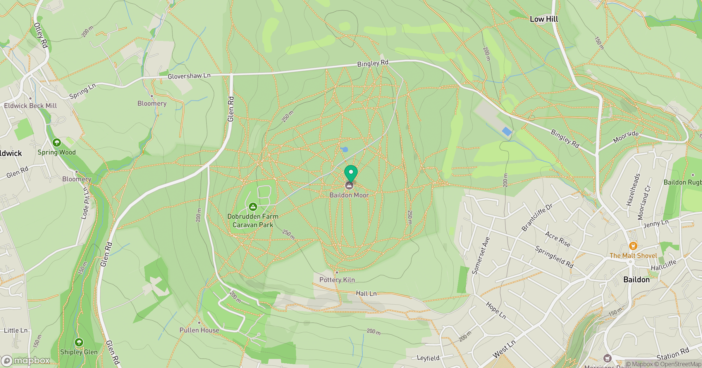
Grid reference: SE141400
View on OpenStreetMapOpens a map in a new tab, centred on the hill.
Nearby Hills
Rombalds Moor [Ilkley Moor]
402m
Buckden Pike
702m

Kinder Scout
636m

Pendle Hill
557m

Pen-y-ghent
694m
No comments yet. Be the first.