

Slieve Corragh
Good walks are even better shared.
J3328 : Crags rising to the Slieve Corragh-Slieve Commedagh ridge from the Pot of Legawherry
Eric Jones Photo source
Overview
Slieve Corragh: A Peak of Popularity
Nestled in the magnificent Mourne Mountains, Slieve Corragh stands proud at 674 meters, marking itself as a Marilyn with an impressive prominence of 196 meters. This mountain is a well-loved spot for both seasoned hikers and casual walkers looking to soak in the natural beauty.
Geology
Slieve Corragh boasts a rich geological history, primarily composed of granite—perfect for those who enjoy exploring rocky terrain. The stunning formations formed through relentless glacial movement offer a delightful challenge and a feast for the eyes.
Routes
There are a couple of popular routes to the summit:
Mourne Wall Route
- Distance: 8.5 km
- Time: Approximately 3 hours
- Difficulty: Moderate
This scenic route meanders alongside the historic Mourne Wall, constructed in the 19th century and immensely popular with hikers.
From Carrick Little
- Distance: 4.5 km
- Time: Approximately 1.5 hours
- Difficulty: Moderate
Ideal for a quick outing, this route offers a more direct ascent to the summit, the perfect choice for those with a busy schedule.
Summit Features
At the top, the humble cairn provides a gathering place for breathless hikers to take in the views—though beware of those wind-swept hats!
Terrain Type
Be prepared for rocky challenges and grassy meadows, with a sprinkle of boggy sections that may require nimble footwork. A sturdy pair of boots and a healthy sense of adventure are the keys to a successful trek.
Views
The views from Slieve Corragh are simply breathtaking! On a clear day, revel in panoramic sights of the other stunning Mourne peaks, and perhaps offer a wave to the folks at the coast of County Down—not that they'll be able to wave back!
Best Seasons
Spring and autumn paint the landscape in vibrant hues, perfect for a picture or two—just don't forget to look up more often than not!
Hazards
Be cautious of changing weather conditions and slippery terrain. A good rule of thumb is to pack a raincoat, regardless of the forecast!
Nearby Summits
For those looking to extend their adventures, nearby peaks include Slieve Donard and Slieve Bearnagh, both of which offer additional routes and stunning views.
Access
Nearest Parking
Carrick Little car park is situated conveniently near the trailhead, ensuring easy access to the mountain.
Public Transport
Buses operate from Newcastle, allowing occasional hikers to reach important access points in the Mournes. Just remember to check the afternoon schedule to avoid being left high and dry!
Nearest Town
Newcastle has all the amenities you might need, from cozy coffee shops to essential shops for any forgotten items.
Facilities
Newcastle is teeming with cafes and restaurants, but facilities near the mountain are scarce, so plan ahead to avoid a rushed lunch!
History
The name Slieve Corragh reflects the mountain's rugged nature, rooted deeply in Irish culture and folklore. Throughout history, these mountains have housed countless stories and traditions.
In conclusion, Slieve Corragh stands as a testament to natural beauty and adventure. Whether you're a seasoned peak bagger or just out for a leisurely stroll, this mountain offers a unique slice of the Mournes you won't soon forget.
Explore routes near Slieve Corragh
Walks starting near this hill. Open a route to check its map, distance and full itinerary.
Tollymore Forest Park: River Trail near Newcastle
View route
Tollymore Forest Park: Mountain and Drinns Trail
View route
Newcastle, Co. Down (NI) with Men Walking & Talking
View route
Silent Valley to Ben Crom Dam: Reservoir Road Walk, County Down
View route
Route planning notes
These notes describe possible approaches. Check a route's map and access information when planning your walk.
Mourne Wall Route
Starting from the B190 road, this route follows the historic Mourne Wall, winding through the rolling terrain and offering stunning views of the surrounding peaks.
From Carrick Little
This shorter ascent begins at Carrick Little and rises steadily along a well-defined path, perfect for those looking to stretch their legs without the long trek.
Make a day of it, together
Find someone to share the walk with, or organise a day out along a route you like.
Photo Gallery
View all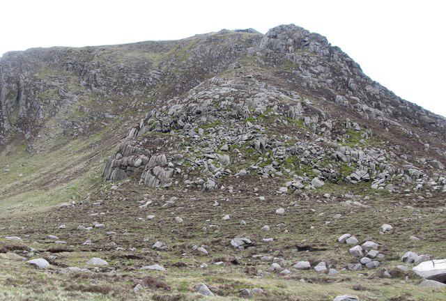 Photo could not load
J3328 : Crags rising to the Slieve Corragh-Slieve Commedagh ridge from the Pot of Legawherry
Eric Jones
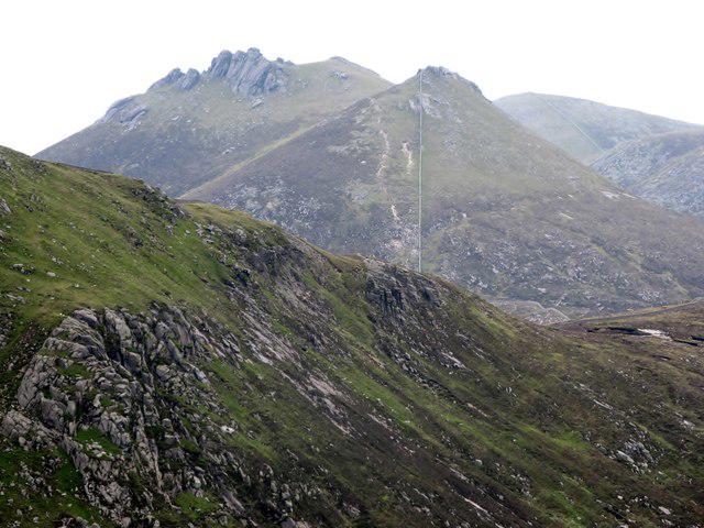 Photo could not load
J3328 : Crags on Slieve Corragh
Eric Jones
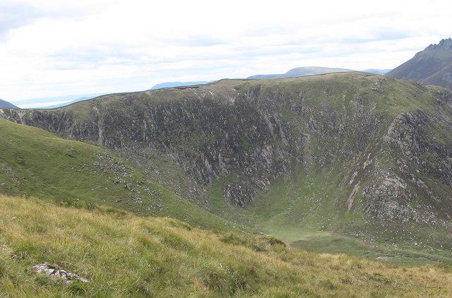 Photo could not load
J3328 : The Slieve Corragh-Slieve Commedagh section of the ridge from Shan Slieve
Eric Jones
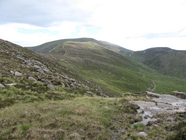 Photo could not load
J3328 : View from the Diamond Rocks area along the Slievenaglogh-Slieve Corragh - Slieve Commedagh Ridge
Eric Jones
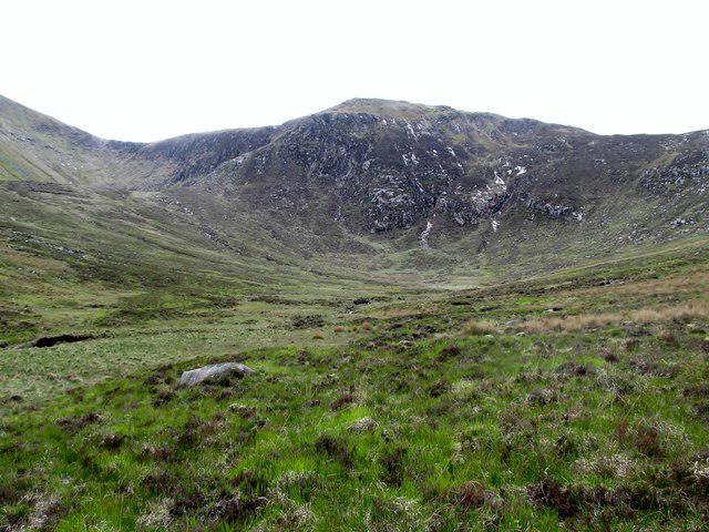 Photo could not load
J3328 : The trough end of the Spinkwee Valley
Eric Jones
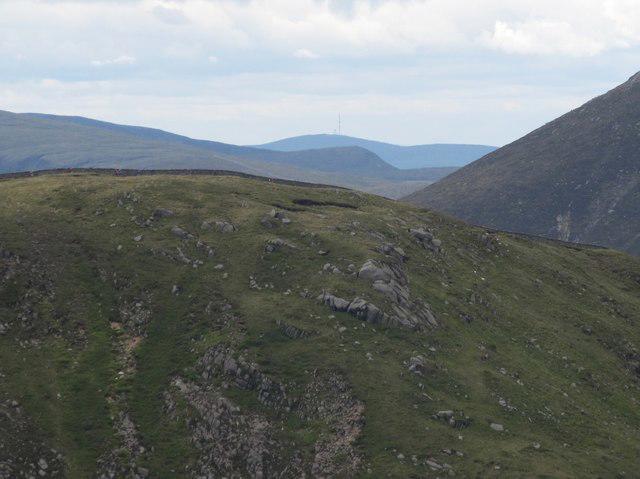 Photo could not load
J3328 : View towards the Irish Republic across the summit of Slieve Corragh
Eric Jones
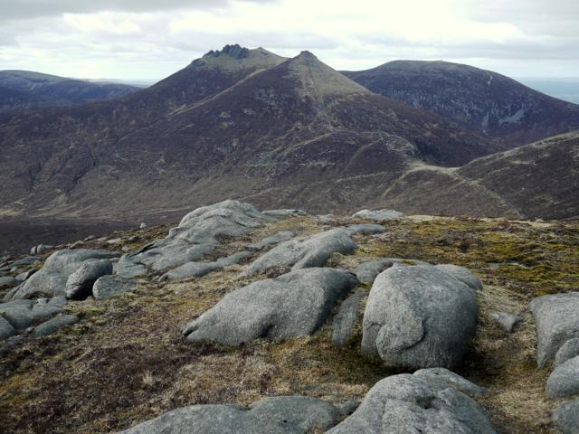 Photo could not load
J3328 : The summit of Slieve Corragh
Rossographer
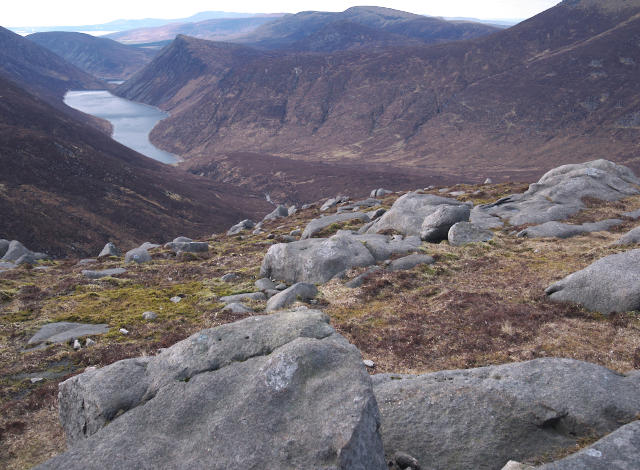 Photo could not load
J3328 : The summit of Slieve Corragh
Rossographer
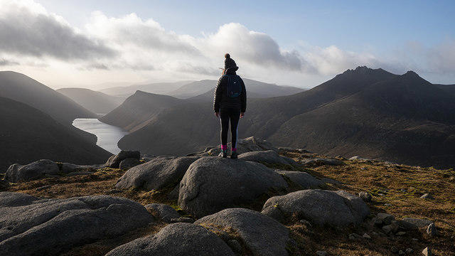 Photo could not load
J3328 : Slieve Corragh summit
Rossographer
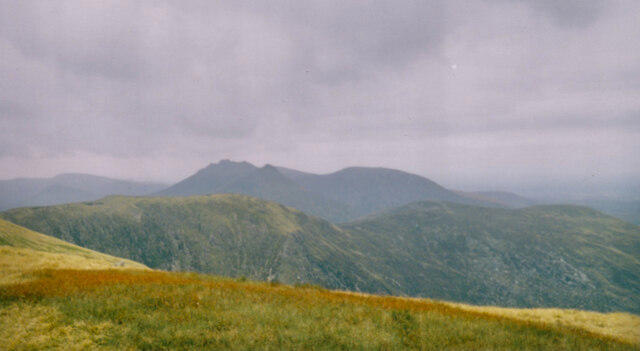
J3328 : The Slieve Corragh-Slievenaglogh ridge from Slieve Commedagh
Eric Jones
Hill facts and local notes
Classifications
Elevation
642m
2,106 ft
Prominence
22m
Coordinates
54.1890, -5.9525
J337285
OS Map
29
At the Summit
At the summit of Slieve Corragh, you can find a modest cairn marking the highest point. The summit is relatively flat, offering space to take in the breathtaking views without feeling rushed.
Terrain & Geology
Slieve Corragh is primarily comprised of granite, which is characteristic of the Mourne Mountains. This sturdy rock has weathered over millennia to provide a stunning array of landscapes and crags. The underlying geology, shaped by glacial activity, makes it a fascinating location for both geologists and casual hikers alike.
Views & Scenery
From the summit, gaze upon the splendor of the Mourne mountains, the sprawling landscape of the countryside, and, on clear days, even the coast of County Down.
History & Heritage
Name Origin
The name Slieve Corragh is derived from the Irish 'Sliabh Corrachtach', meaning 'mountain of the corraghs', which refers to the rugged crags typical of the Mourne landscape.
Historical Significance
The Mourne Mountains have been significant in Irish folklore and culture, serving as a backdrop for numerous stories and legends over the centuries.
Getting There & Facilities
Parking
There is a car park at Carrick Little, located just off the B190 road, providing a convenient starting point.
Public Transport
Bus services operate from Newcastle to various points around the Mourne Mountains, though check local schedules as they may vary.
Nearby Facilities
In Newcastle, you'll find plenty of cafes, restaurants, and public toilets. Note that facilities close to the mountain are limited, so plan accordingly!
Safety Information
Known Hazards
- Variable weather conditions can change quickly, so be prepared for anything from sunshine to sudden rain. Wet and boggy areas may be slippery, so watch your step!
General Safety Tips
- Check weather conditions before setting out
- Carry appropriate clothing and equipment
- Let someone know your planned route
- Take a map, compass, and GPS device
- Carry emergency supplies: food, water, first aid kit, torch
Hills
Some common questions about the hills answered
Are there group walks up Slieve Corragh?
Many walkers use Walkmates to join or organise walks with others. You can check for group walks around Slieve Corragh through the maps
Are there other walkers around Slieve Corragh?
Activity varies by location and time, but Walkmates lets you see whether others have shared walks or shown interest in this area. Find other people through the walking friends search walking friends for Slieve Corragh search or of course create your own walk for Slieve Corragh
Can I organise a walk to Slieve Corragh?
Yes. If there aren’t any walks listed already, you can create a walk and make it available for others to join.
If you're signed up to Walkmates, you can create a walk to Slieve Corragh.
How do I find a walk up this hill?
There are often multiple ways to walk this hill, depending on experience and route preference. Walkmates helps you explore walks and routes that others have shared.
Can I suggest a new route up Slieve Corragh?
Yes. You can suggest or create routes to share with others. Walkmates focuses on the social side of walking, so routes are used to help people organise walks and explore areas together, rather than as detailed navigation tools or route libraries.
Other uses really appreciate knowledgeable walkers sharing their routes. Share your favourite route to Slieve Corragh here
The is an error or something incorrect about this hill. How do I let you know?
We always strive to keep the information on Walkmates as accurate as possible. If you find an error, please let us know through the contact form and we'll aim to correct it as quickly as possible
Community Discussion
Comments
Location
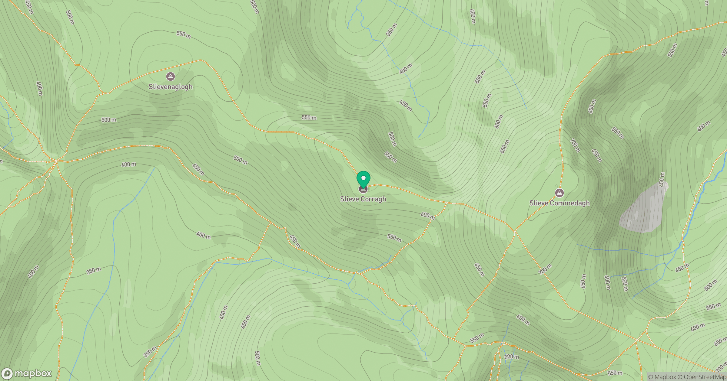
Grid reference: J337285
View on OpenStreetMapOpens a map in a new tab, centred on the hill.
Nearby Hills
Slieve Commedagh
767m
Slievelamagan
702m
Slieve Donard
850m
Slieve Bearnagh
739m
Slieve Binnian
746m
No comments yet. Be the first.