

Salisbury Crags
Good walks are even better shared.
NT2673 : Salisbury Crags
Paul Gillett Photo source
Overview
Salisbury Crags
Salisbury Crags is a breathtaking natural formation located just east of Edinburgh, Scotland. Rising to an elevation of 250 meters, these volcanic cliffs offer not just a good workout for your legs, but also stunning views that make every step worth it.
Geology
Comprising volcanic rock, notably basalt and volcanic ash, Salisbury Crags are remnants of Arthur’s Seat, an extinct volcano. This geological feature is not only fascinating but also tells the tale of fiery activity beneath the Earth’s surface—slightly more exciting than your usual walk in the park!
Routes
The most popular route to the summit is the Crags Path, a 1.5 km jaunt that winds through the fascinating rocky terrain. Expect a decent workout as you tackle moderate inclines that reward hikers with stunning vistas upon reaching the summit.
Summit Features
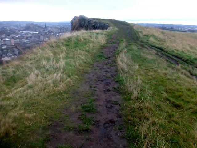
At the top, you won't find a trig point to mark your conquest (sorry!), but the rocky outcrops provide a perfect spot to catch your breath and soak in the view. It's essentially a natural lookout post—just remember to keep an eye on where you’re stepping!
Views
Once you’ve caught your breath (and maybe taken a selfie), enjoy the panoramic views of Edinburgh. The majestic Edinburgh Castle is unmistakable in the skyline, alongside Calton Hill’s iconic monuments and the sprawling city below. If you’re lucky, you might catch a glimpse of a sheep contemplating life’s great mysteries.
Hazards
While the views are spectacular, the terrain can be tricky. Ensure you stay away from the edge as steep drops are present, and tread carefully on the rocky surfaces that can be loose. Proper hiking boots are highly recommended.
Nearby Summits
Don’t forget that just a stone's throw away are other incredible hills, notably Arthur's Seat and Blackford Hill, both offering their own unique landscapes and views.
Access
For those driving, parking can be found on the surrounding roads, though space might be scarce on busy days. If taking public transport, multiple bus routes service the area, making it easy to reach this impressive site. The closest town is Edinburgh, making it a popular destination for residents and tourists alike.
Facilities
If you’re in need of facilities, the Holyrood visitor centre provides public toilets, and for a post-hike pick-me-up, drop by the café—it’s a perfect spot for tea and cake!
History
The name 'Salisbury' has roots that date back to old English, meaning 'the dwelling by the river.' The Crags hold cultural significance, too, having long served as a gathering point and a lookout for locals and visitors.
So lace up your boots, grab a friend or two, and head out to explore the beauty of Salisbury Crags. It's a delightful mix of nature, history, and breathtaking views, making it a must-visit on your Edinburgh excursion!
Explore routes near Salisbury Crags
Walks starting near this hill. Open a route to check its map, distance and full itinerary.
To Absent Friends: Holyrood Park walk
View route
Artists’ walk in Craigmillar Castle Park (group meeting)
View route
Dalkeith Country Park: Estate and North Woods Green Trail
View route
East Calder: Almondell, Mandela Bridge and River Almond Circuit
View route
Route planning notes
These notes describe possible approaches. Check a route's map and access information when planning your walk.
Radial Walk from Holyrood Park
Begin your walk at the Holyrood Park car park. Follow the well-marked path leading up towards Salisbury Crags, providing stunning views of Edinburgh’s cityscape. The route loops back via the Queen's Drive, offering a gradual descent and an opportunity to explore the surrounding landscape.
Salisbury Crags Circular Trail
This circular route starts at the Holyrood Palace entrance and ascends to the base of Salisbury Crags. Follow the Radical Road, a path that skirts along the crag's edge, offering panoramic views over Edinburgh. Descend back via the lower loop near St Margaret's Loch.
Salisbury Crags and Arthur’s Seat Combo
Start at the Holyrood Park Visitor Centre and first ascend the Salisbury Crags via the Radical Road. Then continue the climb towards Arthur’s Seat for an extended hike. Descend via the Dunsapie Loch path back to the starting point.
Radical Road Out-and-Back
This shorter option begins at Holyrood Park and focuses on the Radical Road. Walk along the base of Salisbury Crags, then return along the same path, making it a straightforward route for less experienced walkers.
Salisbury Crags Scenic Loop with Dynamic Earth
Start from the Dynamic Earth science centre and take the path leading to Holyrood Park. Ascend to Salisbury Crags, taking in breathtaking views, before looping back through the park and returning to Dynamic Earth.
Make a day of it, together
Find someone to share the walk with, or organise a day out along a route you like.
Photo Gallery
View all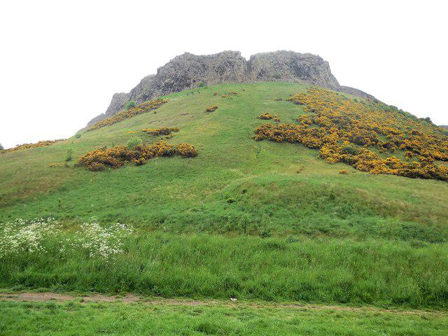 Photo could not load
NT2673 : Salisbury Crags
Paul Gillett
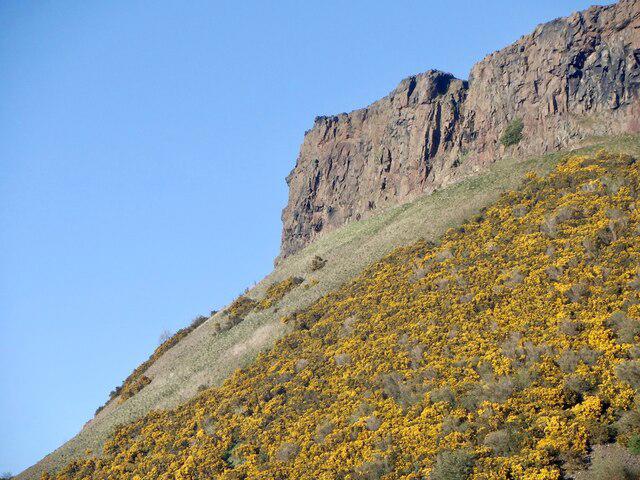 Photo could not load
NT2673 : Salisbury Crags
Richard Webb
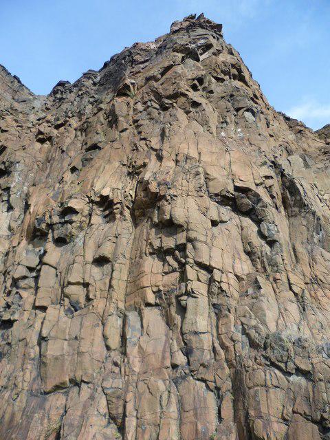 Photo could not load
NT2673 : Part of Salisbury Crags
kim traynor
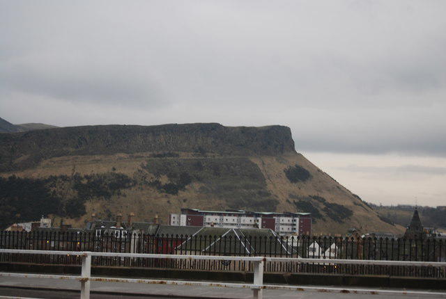 Photo could not load
NT2673 : Salisbury Crags
N Chadwick
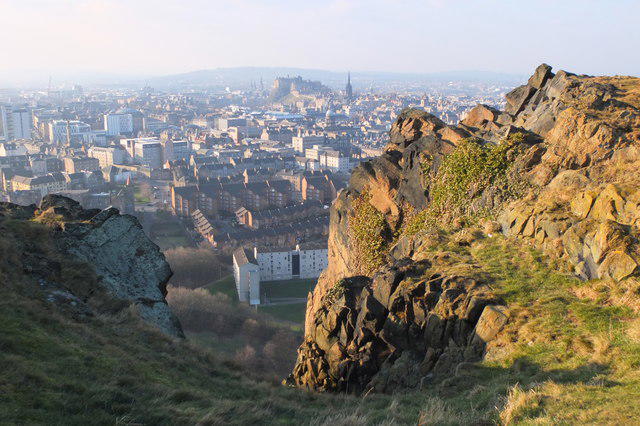 Photo could not load
NT2673 : Edinburgh Castle from the top of Cat Nick gully, Salisbury Crags
Jim Barton
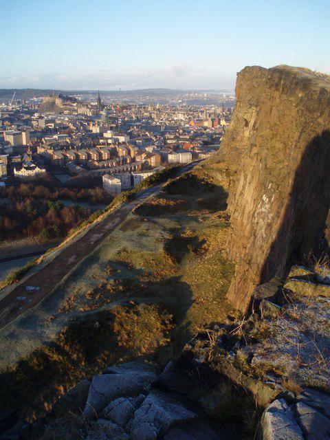 Photo could not load
NT2673 : Christmas Day, Crags
Adam Ward
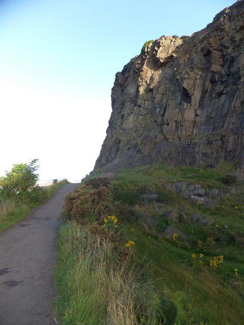 Photo could not load
NT2673 : Footpath on Salisbury Crags
David Smith
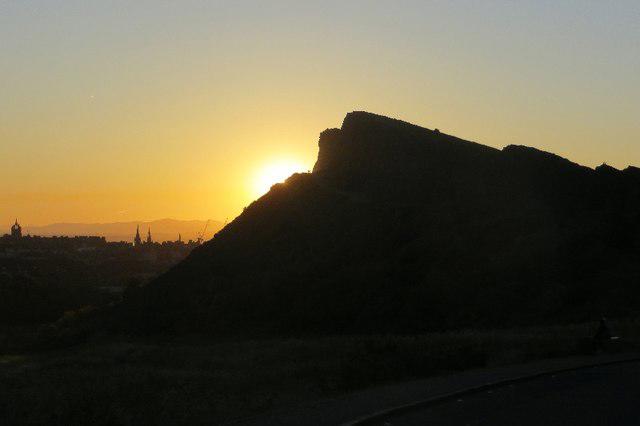 Photo could not load
NT2673 : Edinburgh sunset
Richard Webb
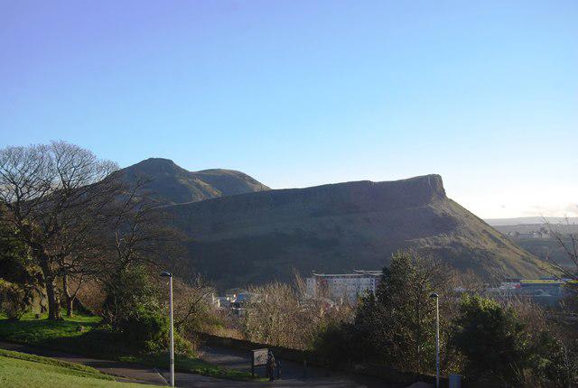 Photo could not load
NT2673 : Cat Nick
Matthew Chadwick
NT2673 : Salisbury Crags
Rude Health
Hill facts and local notes
Classifications
Elevation
174m
571 ft
Prominence
63m
Coordinates
55.9453, -3.1752
NT267731
OS Map
66
Explorer: 350
At the Summit
The summit features impressive rocky outcrops and panoramic views. There is no trig point, but the natural rock formations will have you feeling on top of the world.
Terrain & Geology
Salisbury Crags are composed primarily of volcanic rock, specifically volcanic ash and basalt. These striking cliffs are remnants of Arthur’s Seat, part of a long-extinct volcano. Geologically speaking, it's a hot spot in more ways than one!
Views & Scenery
From the summit, hikers are rewarded with spectacular views of Edinburgh, including the iconic Edinburgh Castle, Calton Hill, and Arthur's Seat itself. You might even spot a few sheep taking in the scenery!
History & Heritage
Name Origin
The name 'Salisbury' is believed to derive from the old English 'Sælesbyrig', meaning 'the dwelling of the dwellers by the river.'
Historical Significance
Salisbury Crags have significant historical importance, having been a site for gatherings and a viewpoint for centuries. They are part of the ancient landscape that surrounds Edinburgh.
Getting There & Facilities
Parking
Parking is available on the roads surrounding Holyrood Park, but space can be limited. It's best to arrive early, especially on weekends.
Public Transport
Frequent bus services run from the city centre to Holyrood Park; options include buses 2, 33, or 30.
Nearby Facilities
Public toilets are located at the Holyrood visitor centre. There are also cafes nearby, such as the Holyrood Park Café, perfect for a post-hike cuppa.
Safety Information
Known Hazards
- Steep drops and loose rocks. Be cautious near the edges and wear appropriate footwear.
General Safety Tips
- Check weather conditions before setting out
- Carry appropriate clothing and equipment
- Let someone know your planned route
- Take a map, compass, and GPS device
- Carry emergency supplies: food, water, first aid kit, torch
Hills
Some common questions about the hills answered
Are there group walks up Salisbury Crags?
Many walkers use Walkmates to join or organise walks with others. You can check for group walks around Salisbury Crags through the maps
Are there other walkers around Salisbury Crags?
Activity varies by location and time, but Walkmates lets you see whether others have shared walks or shown interest in this area. Find other people through the walking friends search walking friends for Salisbury Crags search or of course create your own walk for Salisbury Crags
Can I organise a walk to Salisbury Crags?
Yes. If there aren’t any walks listed already, you can create a walk and make it available for others to join.
If you're signed up to Walkmates, you can create a walk to Salisbury Crags.
How do I find a walk up this hill?
There are often multiple ways to walk this hill, depending on experience and route preference. Walkmates helps you explore walks and routes that others have shared.
Can I suggest a new route up Salisbury Crags?
Yes. You can suggest or create routes to share with others. Walkmates focuses on the social side of walking, so routes are used to help people organise walks and explore areas together, rather than as detailed navigation tools or route libraries.
Other uses really appreciate knowledgeable walkers sharing their routes. Share your favourite route to Salisbury Crags here
The is an error or something incorrect about this hill. How do I let you know?
We always strive to keep the information on Walkmates as accurate as possible. If you find an error, please let us know through the contact form and we'll aim to correct it as quickly as possible
Community Discussion
Comments
Location
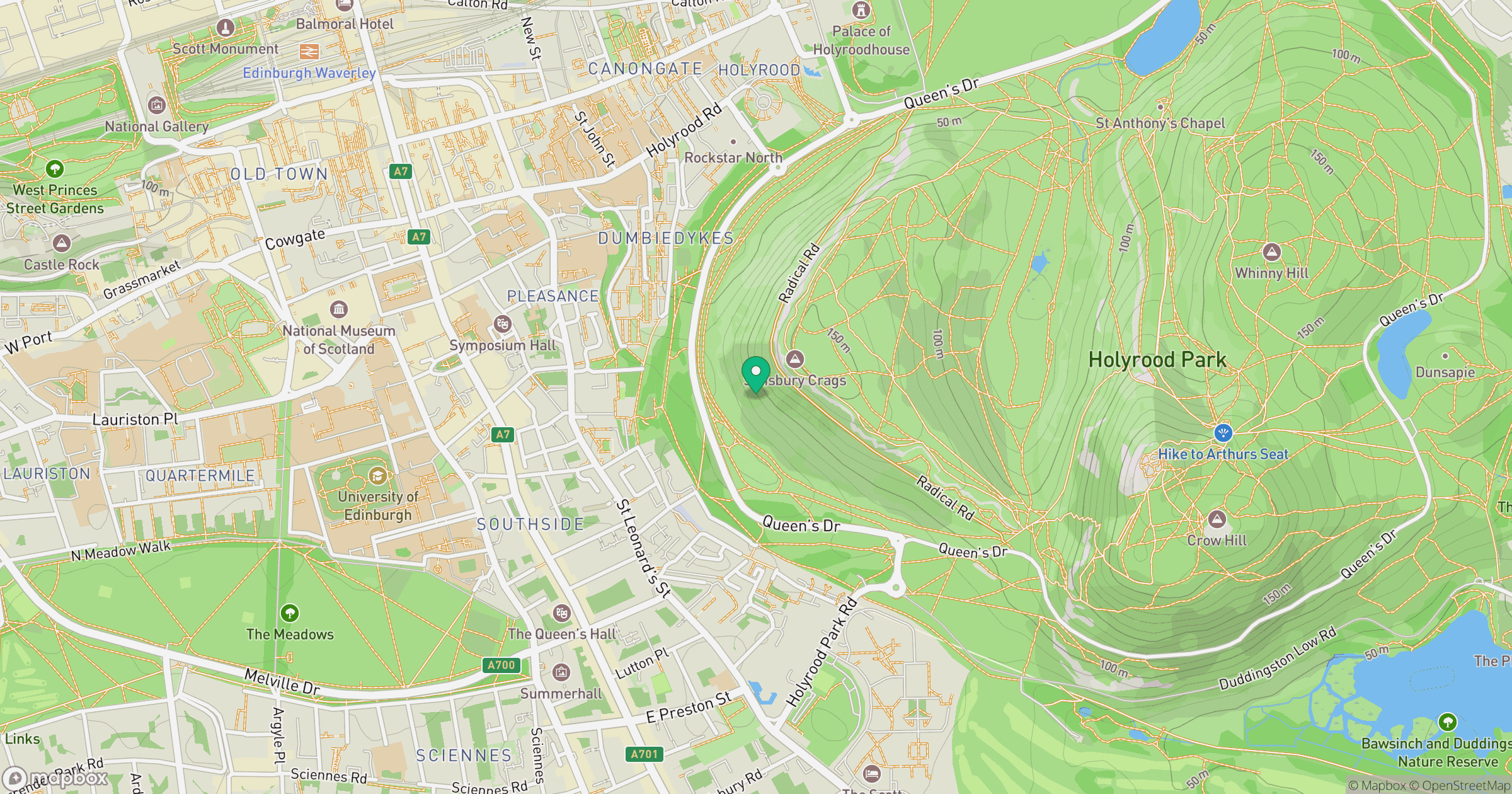
Grid reference: NT267731
View on OpenStreetMapOpens a map in a new tab, centred on the hill.


No comments yet. Be the first.