

Old Man of Stoer South Stack
Good walks are even better shared.
NC0135 : The Old Man of Stoer
David Brown Photo source
Overview
Old Man of Stoer South Stack
Overview
The Old Man of Stoer South Stack is not just another bump on the Scottish Highlands map; it's an experience waiting to be explored. With its elevation of 60 meters, this Marilyn offers both a modest challenge and a hearty dose of scenic beauty.
Geology
Primarily formed from Cambrian sandstone, the geology around here tells a tale of ages gone by, carved out by the elements. You can't help but feel a connection to the earth, possibly while questioning your life choices standing on the edge of a cliff.
Routes
Stoer Lighthouse Circular
- Distance: 5.0 km
- Time: Approximately 2.5 hours
- Difficulty: Moderate
This route starts at the picturesque Stoer Lighthouse. Enjoy a leisurely walk along coastal paths, where breathtaking views are as common as the occasional gust of wind that nearly takes your hat off.
Summit Features
At the summit, you'll find a rocky outcrop complete with a trig point that overlooks the Atlantic. It's a fantastic spot for photos — although be wary of the wind that likes to photobomb.
Terrain
The terrain is a mix of rocky surfaces and boggy patches, ideal for adventurous souls but may require some careful stepping if you prefer to keep your shoes dry.
Views
From the summit, the sweeping views of the Atlantic Ocean are unmatched. On clear days, you can see as far as the eye can wander, spotting the Old Man of Stoer in the distance if you're particularly lucky.
Best Seasons
Spring and late summer are the best times to visit, when the weather is milder, and the views are clearer. Just remember: always bring a waterproof coat, just in case the Scottish weather decides to show its true colours.
Hazards
Take heed of the steep cliffs and slippery rocks. Always keep your bearings, ideally before trying to take that ‘perfect’ selfie at the edge. Safety first, photos second!
Nearby Summits
The Old Man of Stoer stands close by, a cheeky little fellow that adds to the allure of this area, standing proud at the same elevation.
Access
Nearest Parking
Your adventure starts at Stoer Lighthouse, where parking is free and just a short walk from the trailhead:
Public Transport
Be mindful that public transport options are limited, so a friendly local or a good map could be your best bet for getting here.
Nearest Town
Lochinver is the closest town, where you can also indulge in a quick refreshment or two after your hike.
Facilities
Refreshments can be found at the nearby café, and facilities include toilets that are usually well-maintained for weary travellers.
History
The name 'Stoer' reflects a rich history of both Norse and local heritage. This area is steeped in tales of the sea and local legends, weaving a rich tapestry that reflects its cultural roots.
In summary, Old Man of Stoer South Stack is a gem in the Scottish Highlands that promises adventure and awe in equal measure. Grab your hiking boots and camera — you won't regret it!
Explore routes near Old Man of Stoer South Stack
Walks starting near this hill. Open a route to check its map, distance and full itinerary.
Ben Klibreck
View route
Fairy Lochs Liberator Wreckage Circuit
View route
Beinn Eighe Lancaster Wreckage at Coire Mhic Fhearchair
View route
Loch Migdale from Torroy: Spinningdale pinewood and loch shore walk
View route
Route planning notes
These notes describe possible approaches. Check a route's map and access information when planning your walk.
Classic Old Man of Stoer Circular Route
This well-known route starts from the car park near Stoer Lighthouse. It follows a coastal path to the iconic Old Man of Stoer sea stack. The trail offers stunning views of the Atlantic Ocean and traverses rugged terrain. After taking time to admire the stack, walkers return via the same path or loop slightly inland for variety.
Old Man of Stoer via Clashnessie
This longer route begins at the village of Clashnessie. The path winds along the coastline, offering breathtaking views of cliffs and beaches before reaching the Old Man of Stoer. A more challenging option, it rewards walkers with dramatic landscapes and a sense of remoteness.
Old Man of Stoer Short Out-and-Back
Ideal for those with limited time, this route takes a direct path from the Stoer Lighthouse car park to the Old Man of Stoer. It's a straightforward out-and-back trail that still provides fantastic views of the sea stack and surrounding cliffs.
Stoer Head Coastal Exploration
This extended route follows the coastal path from the Stoer Lighthouse, passing the Old Man of Stoer and continuing along the cliffs to Stoer Head. The path is rugged and undulating, with opportunities to spot wildlife such as seals and seabirds.
Old Man of Stoer and Culkein Bay Loop
A scenic loop that combines a visit to the Old Man of Stoer with a detour to Culkein Bay. Starting at Stoer Lighthouse, the route follows the coastline to the sea stack before heading inland to Culkein Bay and looping back. It provides a mix of coastal and inland scenery.
Make a day of it, together
Find someone to share the walk with, or organise a day out along a route you like.
Photo Gallery
View all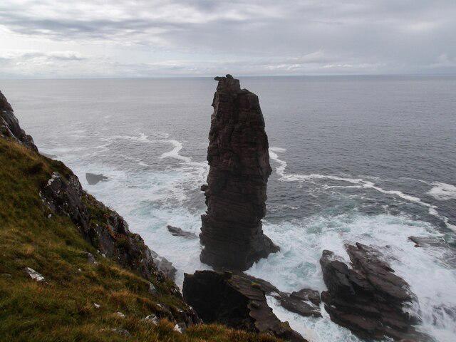 Photo could not load
NC0135 : The Old Man of Stoer
David Brown
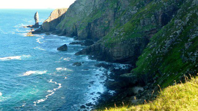 Photo could not load
NC0134 : Cliffs below Sithean Mor
Gordon Brown
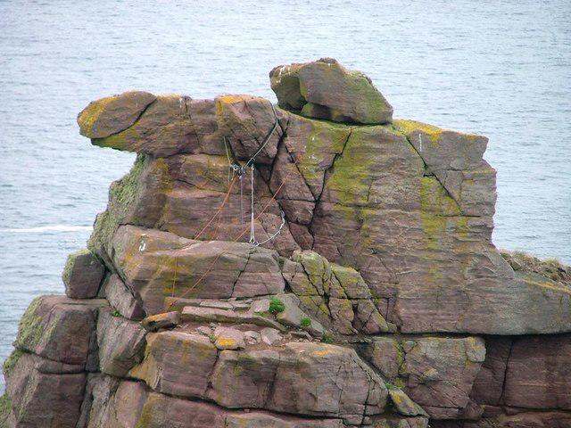 Photo could not load
NC0135 : Climbing Rubbish, Old Man of Stoer
Mick Garratt
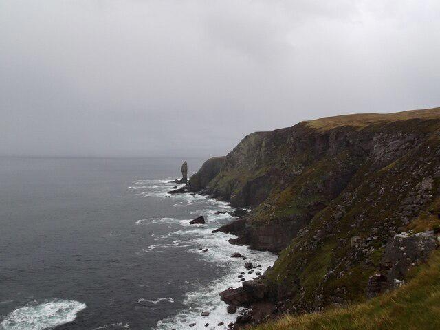 Photo could not load
NC0134 : Cliffs south of the Old Man
David Brown
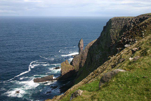 Photo could not load
NC0134 : Western slopes of Sidhean Mor
Bob Jones
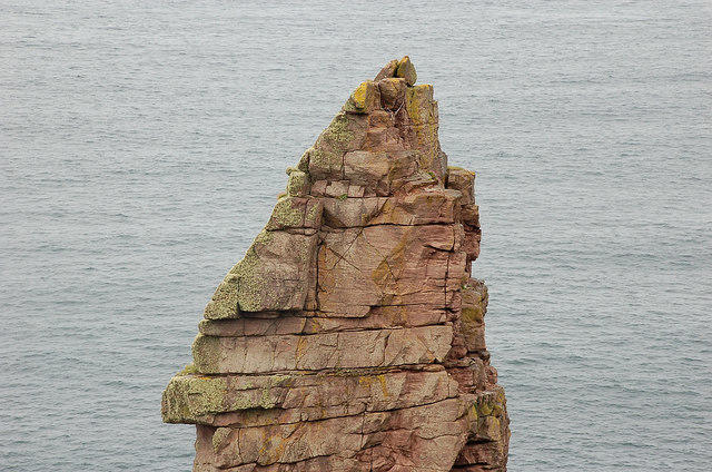 Photo could not load
NC0135 : Top part of the Old Man of Stoer
Jim Barton
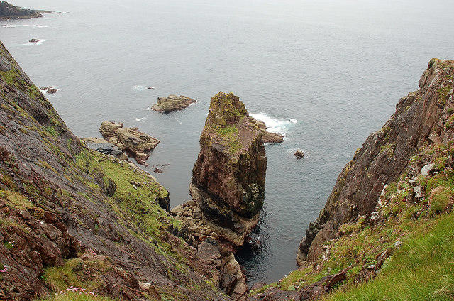 Photo could not load
NC0135 : Smaller sea stack, Point of Stoer
Jim Barton
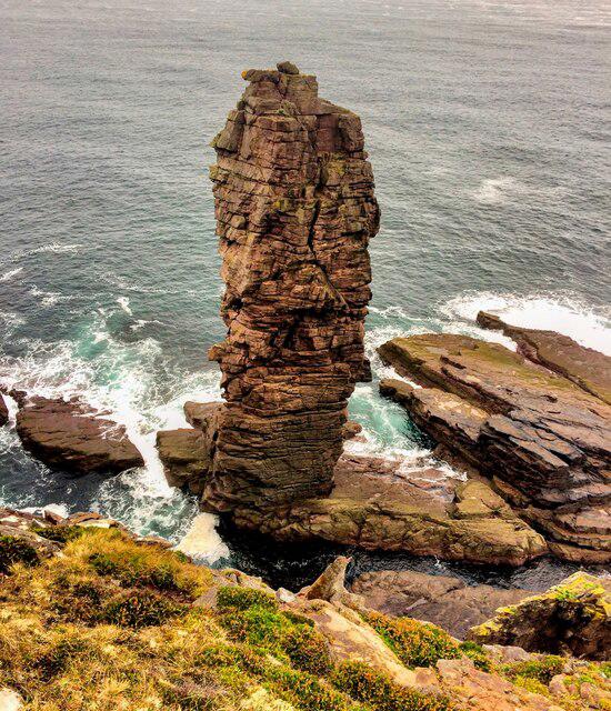 Photo could not load
NC0135 : The Old Man of Stoer
Iain Lees
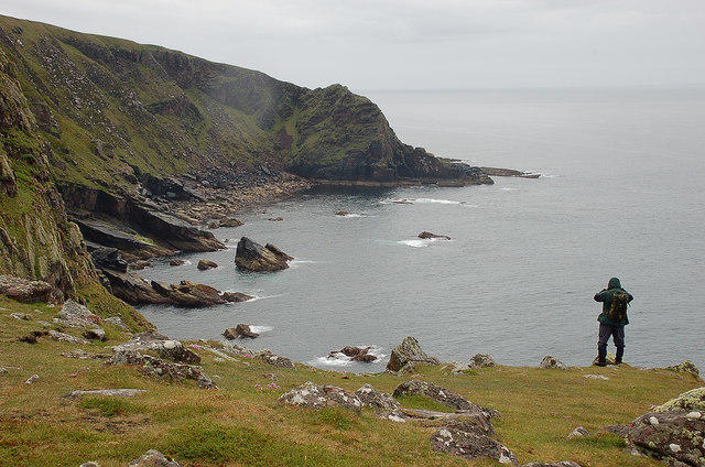 Photo could not load
NC0135 : Coast SW of Old Man of Stoer
Jim Barton
Hill facts and local notes
Classifications
Elevation
36m
118 ft
Prominence
36m
Coordinates
58.2587, -5.3851
NC015350
OS Map
15
Explorer: 442W
At the Summit
The summit features a rocky outcrop with breathtaking views, and a rather cheeky trig point that stands proudly like a sentinel over the sea.
Terrain & Geology
The Old Man of Stoer South Stack is primarily composed of Cambrian sandstone, featuring dramatic cliffs eroded by the relentless forces of nature, creating stunning landscapes that could easily be the backdrop for a Highland romance film.
Views & Scenery
View the vastness of the Atlantic Ocean, the ruggedness of nearby cliffs, and possibly spot the Old Man of Stoer himself (well, not really, but it's a nice thought).
History & Heritage
Name Origin
The name 'Stoer' derives from the Norse word 'stoer', meaning 'a place of great wealth' – or at least that's what the locals tell themselves.
Historical Significance
The area is rich in history, being steeped in tales of maritime exploits and local folklore, where legends meet breathtaking landscapes.
Getting There & Facilities
Parking
Parking available at Stoer Lighthouse, approximately a short walk from the start of the route.
Public Transport
Limited bus service from nearby towns. Best to plan ahead or hitch a ride with a friendly local.
Nearby Facilities
One café at Stoer Lighthouse provides refreshments, and toilets are available nearby—don't forget your change!
Safety Information
Known Hazards
- Steep cliffs, unpredictable weather, and slippery rocks can pose risks. Always watch your step, especially if you have leads in your pockets.
General Safety Tips
- Check weather conditions before setting out
- Carry appropriate clothing and equipment
- Let someone know your planned route
- Take a map, compass, and GPS device
- Carry emergency supplies: food, water, first aid kit, torch
Hills
Some common questions about the hills answered
Are there group walks up Old Man of Stoer South Stack?
Many walkers use Walkmates to join or organise walks with others. You can check for group walks around Old Man of Stoer South Stack through the maps
Are there other walkers around Old Man of Stoer South Stack?
Activity varies by location and time, but Walkmates lets you see whether others have shared walks or shown interest in this area. Find other people through the walking friends search walking friends for Old Man of Stoer South Stack search or of course create your own walk for Old Man of Stoer South Stack
Can I organise a walk to Old Man of Stoer South Stack?
Yes. If there aren’t any walks listed already, you can create a walk and make it available for others to join.
If you're signed up to Walkmates, you can create a walk to Old Man of Stoer South Stack.
How do I find a walk up this hill?
There are often multiple ways to walk this hill, depending on experience and route preference. Walkmates helps you explore walks and routes that others have shared.
Can I suggest a new route up Old Man of Stoer South Stack?
Yes. You can suggest or create routes to share with others. Walkmates focuses on the social side of walking, so routes are used to help people organise walks and explore areas together, rather than as detailed navigation tools or route libraries.
Other uses really appreciate knowledgeable walkers sharing their routes. Share your favourite route to Old Man of Stoer South Stack here
The is an error or something incorrect about this hill. How do I let you know?
We always strive to keep the information on Walkmates as accurate as possible. If you find an error, please let us know through the contact form and we'll aim to correct it as quickly as possible
Community Discussion
Comments
Location
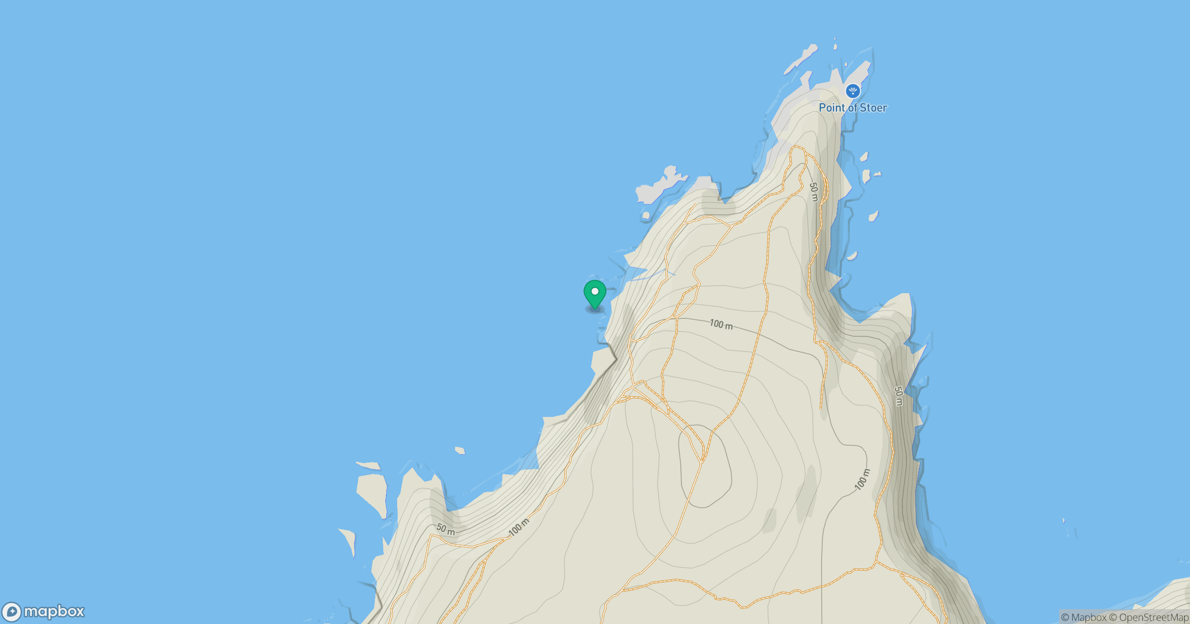
Grid reference: NC015350
View on OpenStreetMapOpens a map in a new tab, centred on the hill.
No comments yet. Be the first.