

Mullach Clach a' Bhlair
Good walks are even better shared.
NN8892 : Wind stunted vegetation on the brow of Mullach Clach a' Bhlàir
Alan Reid Photo source
Overview
Mullach Clach a' Bhlair
It's hard to ignore the majestic Mullach Clach a' Bhlair, rising proudly at 1109 meters above sea level. Nestled in the Scottish Highlands, this Munro offers a challenging yet rewarding experience for hikers and outdoor enthusiasts alike.
Geology
Historically, the land here tells tales far older than even your grandparents. Made up predominantly of schists and gneisses, the geological formations speak of ancient processes that shaped our planet. The exposed rocky cliff faces provide both beauty and a hint of danger—so don't wear your best shoes unless you're keen on a bit of mud!
Routes
Two popular routes to the summit invite you:
Glen Feshie Route
- Distance: 14.0 km
- Time: Approximately 5.5 hours
- Difficulty: Moderate
- The scenery is downright picturesque, with views to write home about.
Approach from Auchlean
- Distance: 12.0 km
- Time: About 4.5 hours
- Difficulty: Easy
- Great for those less inclined to tackle steep paths or who wish to enjoy nature at a gentler pace.
Summit Features
Once you make it to the top, you’re greeted by a sturdy stone cairn and panoramic vistas that stretch on forever. Don’t forget your camera; Instagram won’t know what hit it!
Terrain Type
Expect a bit of everything: rocky scrambles, soft grassy mounds, and those charming boggy bits that encourage a careful step. Good hiking boots are a must!
Views
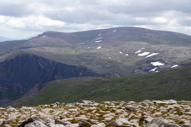
The summit offers breathtaking views of the Cairngorms and Monadhliath Mountains. Whether you're looking for a peaceful moment or are eager to spot the elusive red deer, there's something for everyone. The best time for views? Late spring through early autumn, especially in the golden light of early morning or late afternoon.
Hazards
While the views are stunning, be aware of the unpredictable Scottish weather. A sunny morning can turn foggy faster than you can say ‘Where's my other sock?’ Prepare accordingly and keep an eye on the forecast!
Access
Parking can be found at Auchlean car park, located just off the B970. Commuting via public transport is possible; just catch the bus from Aviemore, but slip on your hiking boots for the walk to the trailhead.
Facilities
Post-hike, head back to Aviemore for a celebratory meal and a well-deserved slice of cake—trust me, you’ll have earned it! Facilities abound, ensuring you’re well-fed and refreshed.
History
The name itself holds weight, translating to 'the hill of the stone of Blair.’ The mountain stands proudly in the Cairngorms National Park, an area steeped in history and rich in natural beauty, making it a worthwhile venture for any adventurous soul.
Go forth and conquer!
Explore routes near Mullach Clach a' Bhlair
Walks starting near this hill. Open a route to check its map, distance and full itinerary.
Rothiemurchus: Beaver Trail and Lochan Mor
View route
Aviemore: Loch an Eilein and the Croft Track from Rothiemurchus
View route
Loch Muick full circuit from Spittal of Glen Muick
View route
Aberfeldy: Glassie Woodland and River Tay Circular
View route
Route planning notes
These notes describe possible approaches. Check a route's map and access information when planning your walk.
Glen Feshie Route
A scenic route starting from Glen Feshie that offers stunning views of the surrounding landscape and takes you through picturesque trails.
Approach from Auchlean
This route features a gradual ascent, making it suitable for those looking for a slightly easier stroll up the Munro.
Make a day of it, together
Find someone to share the walk with, or organise a day out along a route you like.
Photo Gallery
View all Photo could not load
NN8892 : Wind stunted vegetation on the brow of Mullach Clach a' Bhlàir
Alan Reid
 Photo could not load
NN8892 : Mullach Clach a' Bhlair : Munro No 114
Graham Ellis
 Photo could not load
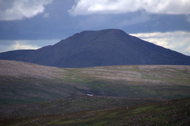
NN8892 : The summit of Mullach Clach a' Bhlair.
Colin Park
 Photo could not load
NN8892 : Summit Cairn
Liz Gray
 Photo could not load
NN8892 : Mullach Clach a'Bhlair
John S Ross
 Photo could not load
NN8892 : Summit Cairn, Mullach Clach a Bhlair
David Bremner
 Photo could not load
NN8892 : Mullach Clach a' Bhlair
William Starkey
 Photo could not load
NN8892 : Summit cairn of Mullach Clach a Bhlair
Julian Paren
 Photo could not load
NN8892 : Cairn on the summit plateau of Mullach Clach a' Bhlair
Steven Brown
 Photo could not load
NN8892 : Quad Bike on Mullach Clach a' Bhlair
Adam Ward
Hill facts and local notes
Classifications
Elevation
1,019m
3,343 ft
Prominence
105m
Coordinates
57.0119, -3.8413
NN882927
OS Map
35 43
Explorer: OL57S 403S
At the Summit
The summit boasts a sizeable stone cairn marking the pinnacle, providing a perfect backdrop for that coveted summit selfie. There's also a wonderful expansive view stretching in all directions.
Terrain & Geology
Mullach Clach a' Bhlair is primarily composed of schists and gneisses, typical of the ancient Caledonian geology found throughout the Highlands. The distinctive rocky outcrops give the mountain its rugged charm.
Views & Scenery
From the summit, you can catch sight of the stunning Cairngorms, the Monadhliath Mountains, and Loch Einich. On a clear day, you'll see for miles and possibly catch a glimpse of wildlife, or at least a fellow hiker snoozing.
History & Heritage
Name Origin
The name 'Mullach Clach a' Bhlair' translates to 'the hill of the stone of Blair,' which likely refers to some ancient significance tied to the area.
Historical Significance
The mountain is a part of the Cairngorms National Park, an area rich in history including the legacy of the Scottish clans and the beautiful natural landscapes.
Getting There & Facilities
Parking
The closest parking is at the end of the track off the B970, at the Auchlean car park, which has spaces for several vehicles.
Public Transport
Buses from nearby towns, such as Aviemore, run to the B970 road, with a bit of a walk to the car park.
Nearby Facilities
In Aviemore, you’ll find cafes, restaurants, and public toilets to prepare for your adventure or celebrate post-hike with a slice of cake.
Safety Information
Known Hazards
- Watch out for sudden weather changes common in the Highlands; fog can roll in quicker than a surprising plot twist in a thriller novel. Be cautious of slippery paths, especially during rain or frost.
General Safety Tips
- Check weather conditions before setting out
- Carry appropriate clothing and equipment
- Let someone know your planned route
- Take a map, compass, and GPS device
- Carry emergency supplies: food, water, first aid kit, torch
Hills
Some common questions about the hills answered
Are there group walks up Mullach Clach a' Bhlair?
Many walkers use Walkmates to join or organise walks with others. You can check for group walks around Mullach Clach a' Bhlair through the maps
Are there other walkers around Mullach Clach a' Bhlair?
Activity varies by location and time, but Walkmates lets you see whether others have shared walks or shown interest in this area. Find other people through the walking friends search walking friends for Mullach Clach a' Bhlair search or of course create your own walk for Mullach Clach a' Bhlair
Can I organise a walk to Mullach Clach a' Bhlair?
Yes. If there aren’t any walks listed already, you can create a walk and make it available for others to join.
If you're signed up to Walkmates, you can create a walk to Mullach Clach a' Bhlair.
How do I find a walk up this hill?
There are often multiple ways to walk this hill, depending on experience and route preference. Walkmates helps you explore walks and routes that others have shared.
Can I suggest a new route up Mullach Clach a' Bhlair?
Yes. You can suggest or create routes to share with others. Walkmates focuses on the social side of walking, so routes are used to help people organise walks and explore areas together, rather than as detailed navigation tools or route libraries.
Other uses really appreciate knowledgeable walkers sharing their routes. Share your favourite route to Mullach Clach a' Bhlair here
The is an error or something incorrect about this hill. How do I let you know?
We always strive to keep the information on Walkmates as accurate as possible. If you find an error, please let us know through the contact form and we'll aim to correct it as quickly as possible
Community Discussion
Comments
Location
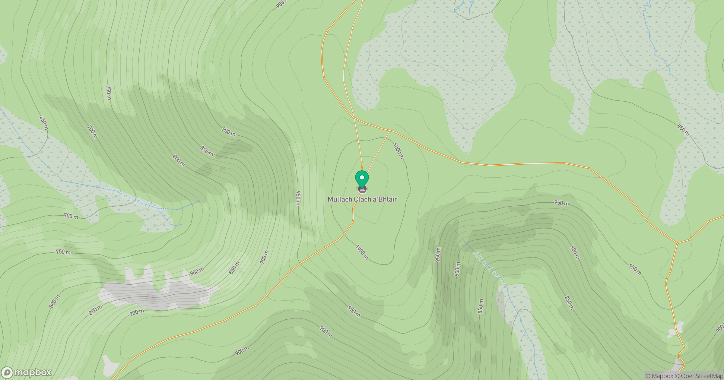
Grid reference: NN882927
View on OpenStreetMapOpens a map in a new tab, centred on the hill.
No comments yet. Be the first.