

Lost Lad
Good walks are even better shared.
SK1991 : Path to Lost Lad
Andrew Hill Photo source
Overview
Lost Lad: A Hidden Gem in the Peak District
Lost Lad, towering at 614 meters, may not command as much attention as its taller counterparts, but don’t let its name fool you – it’s a brilliant hike waiting to be explored!
Geology
Lost Lad is primarily made of gritstone, renowned for its ruggedness and resilience. This geological wonder makes it a favourite among climbers and hikers alike, offering plenty of craggy features and stunning views of the surrounding terrain. The area’s unique geology supports diverse wildlife, with pockets of heather and bilberry providing sustenance for the local fauna.
Routes
Two popular routes await eager explorers. The Edale Circular is a moderate 8 km trek that can be completed in about 3.5 hours, taking you through quaint countryside and to the summit where you can breathe in the beauty of the Peak District.
For those feeling adventurous, the Hollins Cross Route offers a challenging 5.5 km path, perfect for the more enthusiastic hiker. This steeper trail is a quick 2-hour jaunt that won’t fail to reward your efforts with breathtaking vistas.
Summit Features
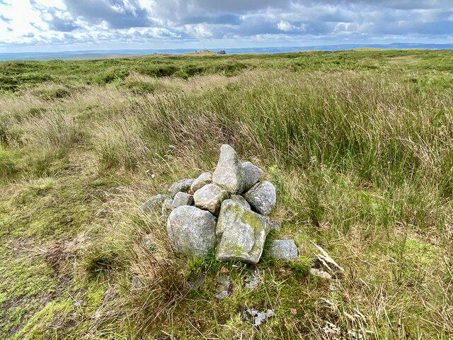
The summit is adorned with a modest cairn, a favourite spot for those looking to capture the scenic beauty. From the top, the view stretches out gloriously, with Kinder Scout and the Edale Valley embracing the landscape.
Terrain
Expect a mix of rocky ground and lush grassy patches with the occasional boggy spot to test your boots. Proper hiking shoes will serve you well, particularly after rain.
Views
Stand atop Lost Lad, and on a clear day, you might just see Kinder Scout peeking from the north and the beautiful expanse of the Edale Valley. The spring and autumn months are particularly enchanting when nature flaunts its vivid colours.
Hazards
As with any great adventure, precautions are key! Watch out for rapidly changing weather conditions, and tread carefully in the boggy areas to avoid unexpected encounters with mud.
Nearby Summits
For those with a thirst for exploration, the majestic Kinder Scout lies to the northwest, and Mam Tor to the south, both ready to offer additional adventures.
Access
Convenient access to Lost Lad is found in the village of Edale, where parking is available. If you prefer not to drive, the train station will whisk you from bustling Manchester straight to this peaceful haven.
Facilities
Once you’ve conquered the mountain, treat yourself to refreshments in one of Edale’s charming cafes or pubs. Toilets are also readily accessible in the village.
History
The origins of the name ‘Lost Lad’ may be traced back to Norse times, hinting at the historical significance of sheep farming in the region. A stroll through the area reflects centuries of human interaction with this rugged landscape.
In summary, Lost Lad is a delightful spot for hikers seeking a little solace and stunning views without the hassle of the more crowded peaks. Grab your boots, pack your spirit of adventure, and prepare to explore one of the Peak District’s hidden treasures!
Explore routes near Lost Lad
Walks starting near this hill. Open a route to check its map, distance and full itinerary.
Ladybower Reservoir: Lost Villages Circuit from Fairholmes
View route
Kinder Scout from Edale Circular
View route
Hope Valley sunrise hike
View route
Langsett Northern Shore and Woodland
View route
Route planning notes
These notes describe possible approaches. Check a route's map and access information when planning your walk.
Edale Circular
A well-loved route starting from the charming village of Edale, this circular walk takes you past scenic landscapes and ascends to the summit of Lost Lad.
Hollins Cross Route
A direct route via Hollins Cross provides a slightly steeper ascent for those seeking a challenge, offering great views along the way.
Make a day of it, together
Find someone to share the walk with, or organise a day out along a route you like.
Photo Gallery
View all Photo could not load
SK1991 : Path to Lost Lad
Andrew Hill
 Photo could not load
SK1991 : Lost Lad Cairn
John Fielding
 Photo could not load
SK1991 : Summit of Lost Lad
Espresso Addict
 Photo could not load
SK1991 : Toposcope at Lost Lad
John Fielding
 Photo could not load
SK1991 : Lost Lad
Steve Partridge
 Photo could not load
SK1991 : Toposcope and Cairn on Lost Lad
Steve Partridge
 Photo could not load
SK1991 : Toposcope and cairn on Lost Lad.
steven ruffles
 Photo could not load
SK1991 : Lost Lad
John Slater
 Photo could not load
SK1991 : Cairn on Lost Lad
Graham Hogg

SK1991 : Cairn on Lost Lad and view to Howshaw Tor
Neil Theasby
Hill facts and local notes
Classifications
Elevation
519m
1,703 ft
Prominence
10m
Coordinates
53.4174, -1.7105
SK193912
OS Map
110
Explorer: OL1E
At the Summit
The summit is marked by a small but distinctive cairn and offers a panoramic view of the surrounding moorlands.
Terrain & Geology
The mountain is predominantly composed of gritstone, a type of sandstone highly resistant to erosion, giving rise to rugged cliffs and impressive crags. It has a rich natural habitat which is home to a variety of flora and fauna.
Views & Scenery
On a clear day, you can see the rolling hills and valleys of the Peak District, including the iconic Kinder Scout to the northwest and the picturesque Edale Valley below.
History & Heritage
Name Origin
The name 'Lost Lad' is thought to derive from old Norse elements, potentially referring to 'lost' sheep or a 'lad' from the area.
Historical Significance
Lost Lad is part of a larger historical landscape, rich with ancient trails used by farmers and shepherds for centuries.
Getting There & Facilities
Parking
The nearest parking is available at Edale, from where several trails begin. Be mindful of parking charges.
Public Transport
Regular train services run to Edale station from Manchester, providing a scenic arrival to your adventure.
Nearby Facilities
In Edale, you’ll find cafes and pubs for a well-deserved meal post-hike. Public toilets are also available in the village.
Safety Information
Known Hazards
- Watch out for sudden changes in weather; the moor can be deceptive. A sturdy pair of walking boots is recommended, and avoid the boggy areas unless you fancy a quick mud bath.
General Safety Tips
- Check weather conditions before setting out
- Carry appropriate clothing and equipment
- Let someone know your planned route
- Take a map, compass, and GPS device
- Carry emergency supplies: food, water, first aid kit, torch
Hills
Some common questions about the hills answered
Are there group walks up Lost Lad?
Many walkers use Walkmates to join or organise walks with others. You can check for group walks around Lost Lad through the maps
Are there other walkers around Lost Lad?
Activity varies by location and time, but Walkmates lets you see whether others have shared walks or shown interest in this area. Find other people through the walking friends search walking friends for Lost Lad search or of course create your own walk for Lost Lad
Can I organise a walk to Lost Lad?
Yes. If there aren’t any walks listed already, you can create a walk and make it available for others to join.
If you're signed up to Walkmates, you can create a walk to Lost Lad.
How do I find a walk up this hill?
There are often multiple ways to walk this hill, depending on experience and route preference. Walkmates helps you explore walks and routes that others have shared.
Can I suggest a new route up Lost Lad?
Yes. You can suggest or create routes to share with others. Walkmates focuses on the social side of walking, so routes are used to help people organise walks and explore areas together, rather than as detailed navigation tools or route libraries.
Other uses really appreciate knowledgeable walkers sharing their routes. Share your favourite route to Lost Lad here
The is an error or something incorrect about this hill. How do I let you know?
We always strive to keep the information on Walkmates as accurate as possible. If you find an error, please let us know through the contact form and we'll aim to correct it as quickly as possible
Community Discussion
Comments
Location
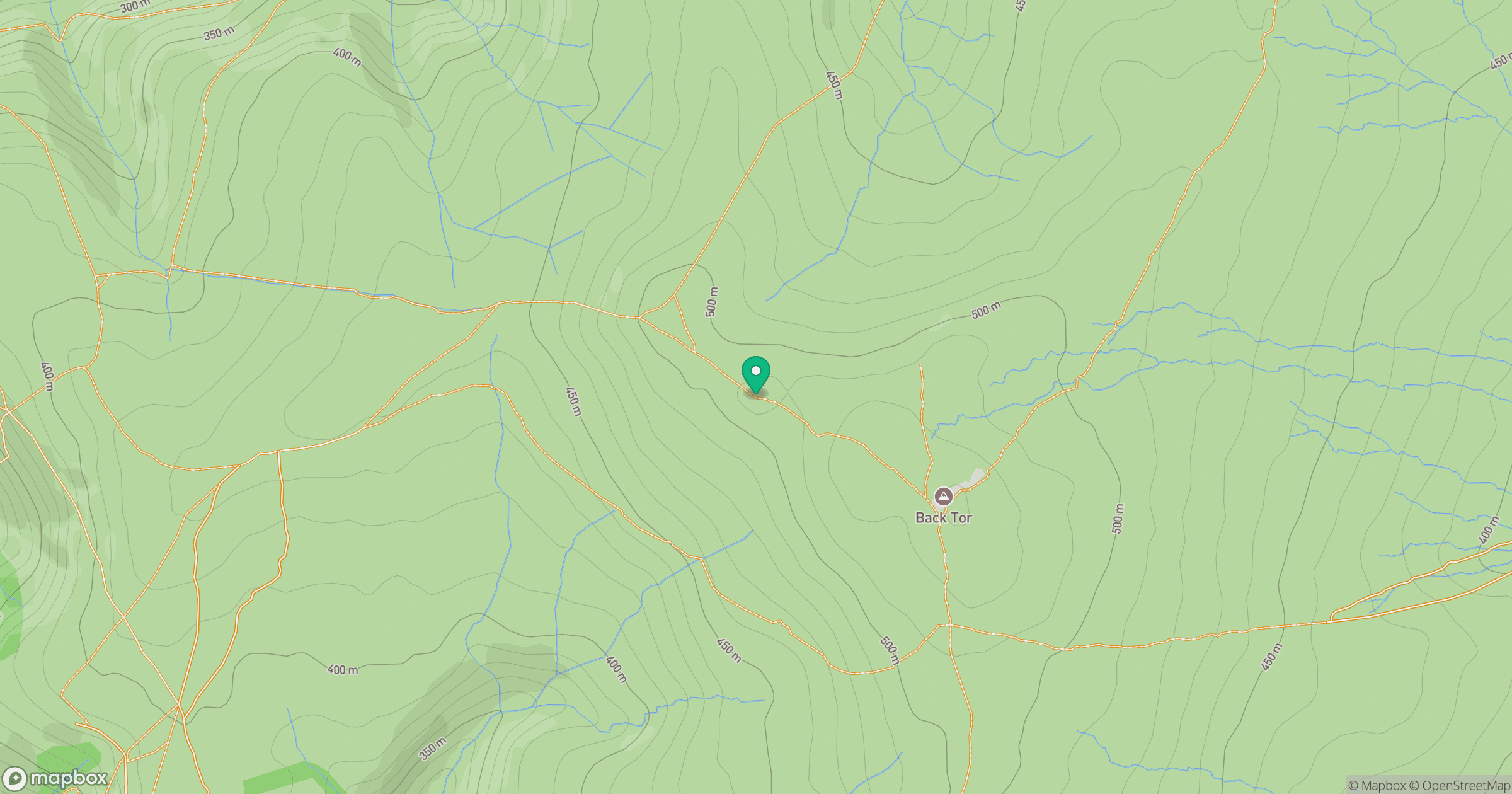
Grid reference: SK193912
View on OpenStreetMapOpens a map in a new tab, centred on the hill.
Nearby Hills
Kinder Scout
636m
The Roaches
505m
Rombalds Moor [Ilkley Moor]
402m
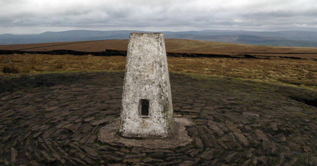
Pendle Hill
557m
Winter Hill
456m
No comments yet. Be the first.