

Hampsfell
Good walks are even better shared.
SD3979 : Hampsfell Hospice 1965
Jim Barton Photo source
Overview
Hampsfell: A Peak to Remember
Hampsfell is not just any hill; it’s a Marilyn! At an elevation of 220 meters, this charming little peak, located in the stunning Lake District, might just steal your heart (and your breath, if you’re not careful).
Geology
The landscape boasts limestone geology, leading to unique karst features that are not only a visual treat but also foster diverse plant and animal life. So, keep your eyes peeled for the unique flora!
Routes
The most popular route starts from Grange-over-Sands. It’s an easy 3.5 km walk that can be tackled in about 1.5 hours. The path takes you through delightful woodlands, giving you a gentle ascent that’s as friendly as a cup of Yorkshire tea.
Summit Features
When you finally reach the top, you’ll be rewarded with a stunning view and a lovely limestone cross that serves as both a marker and an excellent Instagram backdrop!
Terrain Type
Expect a mix of grassy expanses with some rocky outcrops. It’s well-maintained, making it accessible for most, unless you’ve recently made friends with a couch.
Views
The views from Hampsfell are truly magnificent. With Morecambe Bay stretching out below and the picturesque Cumbrian Fells in the distance, it’s a feast for the eyes. The best seasons to visit are spring and autumn when nature puts on quite the display.
Hazards
While the routes are generally safe, be cautious in wet weather; the paths can be a bit slippery, which could turn your walk into an impromptu sliding competition.
Nearby Summits
If you’re feeling adventurous, consider tackling nearby peaks such as Black Coombe and Whitbarrow, which add a little more spice to your hike.
Access
Grange-over-Sands makes for an easy start, with nearby parking and public transport options. Trains from Lancaster and Barrow-in-Furness regularly serve the station, making it a breeze to get to.
Facilities
You won’t go hungry or thirsty, as Grange-over-Sands has several cafes and pubs waiting to serve you after your trek. And yes, there are public toilets, because everyone needs to take a break now and then!
History
Hampsfell has a rich history, dating back to Victorian times when it was celebrated for its fresh air. The name itself hints at its Nordic roots, conjuring images of ancient hills and sacred places.
So lace up your boots, grab a friend, and head on out to Hampsfell. You might just find that this little Marilyn holds a big place in your heart!
Explore routes near Hampsfell
Walks starting near this hill. Open a route to check its map, distance and full itinerary.
Sizergh: Park End Moss and Brigsteer Park Wood Circuit
View route
Bolton-le-Sands to Hest Bank: Lancaster Canal Towpath Return
View route
Coniston to Tarn Hows: Monk Coniston Gardens and Woodland Circuit
View route
Tarn Hows Fast Route
View route
Route planning notes
These notes describe possible approaches. Check a route's map and access information when planning your walk.
Hampsfell from Grange-over-Sands
A popular route starting from Grange-over-Sands that leads you through woodland and up a gentle slope to the summit.
Make a day of it, together
Find someone to share the walk with, or organise a day out along a route you like.
Photo Gallery
View all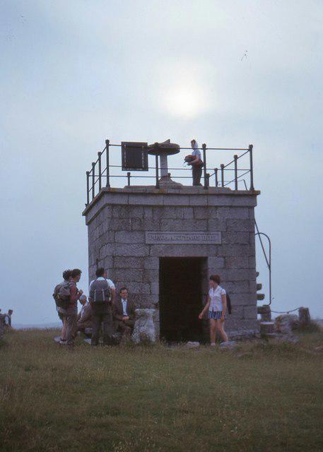 Photo could not load
SD3979 : Hampsfell Hospice 1965
Jim Barton
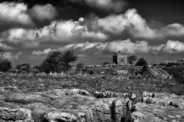 Photo could not load
SD3979 : Black & White Hospice
Nick Thorne - Bodian Photography
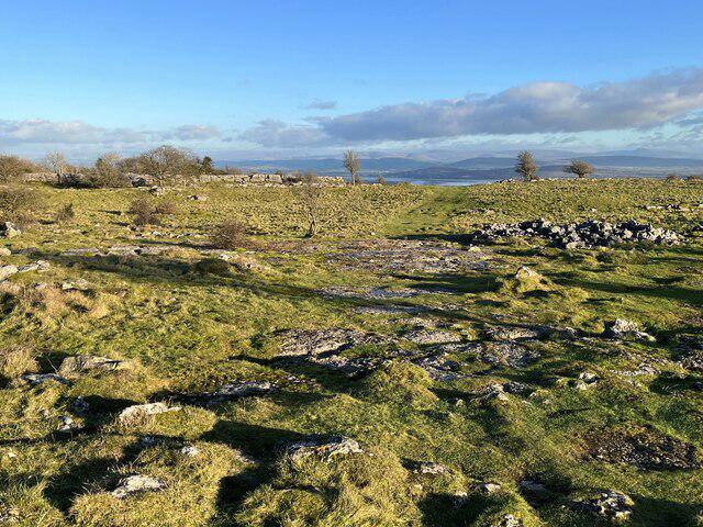 Photo could not load
SD3979 : Path on Hampsfell
Adrian Taylor
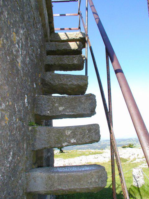 Photo could not load
SD3979 : Steps to the roof of the hospice
Dave Gray
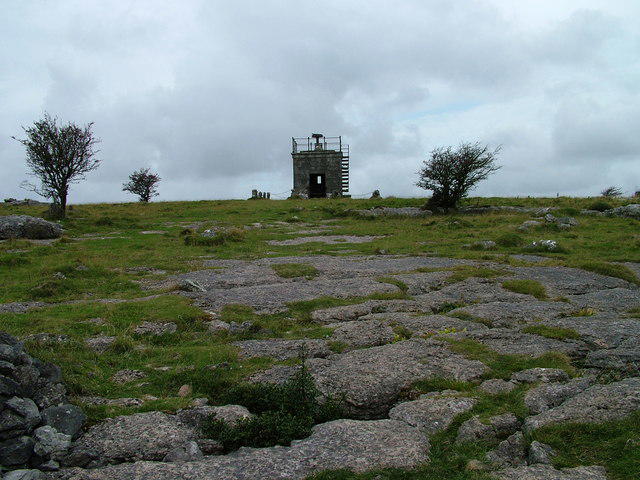 Photo could not load
SD3979 : Hampsfell Hospice
David Brown
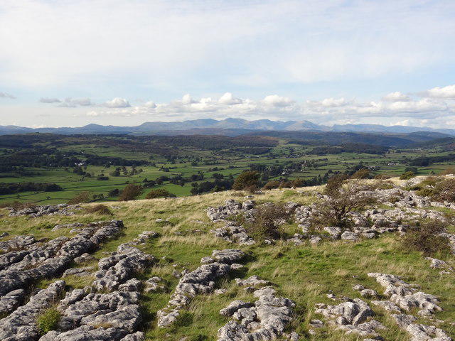 Photo could not load
SD3979 : Hampsfell
Bryan Pready
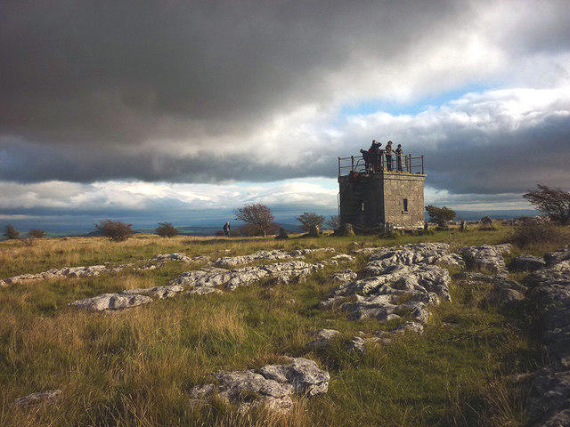 Photo could not load
SD3979 : People gather at the Hospice, Hampsfell
Karl and Ali
 Photo could not load
SD3979 : Hospice of Hampsfell
Mick Garratt
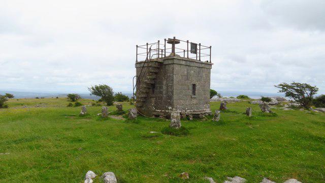 Photo could not load
SD3979 : Hospice on Hampsfell
Colin Park
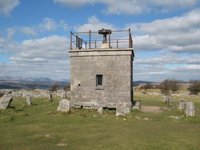
SD3979 : Hampsfell Hospice
Adrian Taylor
Hill facts and local notes
Classifications
Elevation
222m
728 ft
Prominence
101m
Coordinates
54.2076, -2.9221
SD399794
OS Map
96 97
Explorer: OL7S
At the Summit
At the summit, you'll find a prominent limestone cross which doubles as a great spot for a photo op and a handy navigation aid.
Terrain & Geology
The underlying rock of Hampsfell is primarily limestone, leading to interesting karst features and a diverse range of flora and fauna.
Views & Scenery
From the summit, enjoy sweeping views of Morecambe Bay, the Cumbrian Fells, and on a clear day, even as far as the Isle of Man!
History & Heritage
Name Origin
The name 'Hampsfell' is thought to derive from Old Norse, meaning 'hill of the hamps' or 'bed'.
Historical Significance
The area has been a popular spot for visitors since Victorian times, often associated with health and wellbeing due to its fresh air and views.
Getting There & Facilities
Parking
There is a small parking area at Grange-over-Sands, just a short walk from the trailhead.
Public Transport
Regular train services to Grange-over-Sands from Lancaster and Barrow-in-Furness; the station is about 1 mile from the start of the route.
Nearby Facilities
Grange-over-Sands boasts a variety of cafes, pubs, and shops, as well as public toilets for convenience.
Safety Information
Known Hazards
- While the routes are generally safe, be cautious in wet conditions as the paths can become slippery.
General Safety Tips
- Check weather conditions before setting out
- Carry appropriate clothing and equipment
- Let someone know your planned route
- Take a map, compass, and GPS device
- Carry emergency supplies: food, water, first aid kit, torch
Hills
Some common questions about the hills answered
Are there group walks up Hampsfell?
Many walkers use Walkmates to join or organise walks with others. You can check for group walks around Hampsfell through the maps
Are there other walkers around Hampsfell?
Activity varies by location and time, but Walkmates lets you see whether others have shared walks or shown interest in this area. Find other people through the walking friends search walking friends for Hampsfell search or of course create your own walk for Hampsfell
Can I organise a walk to Hampsfell?
Yes. If there aren’t any walks listed already, you can create a walk and make it available for others to join.
If you're signed up to Walkmates, you can create a walk to Hampsfell.
How do I find a walk up this hill?
There are often multiple ways to walk this hill, depending on experience and route preference. Walkmates helps you explore walks and routes that others have shared.
Can I suggest a new route up Hampsfell?
Yes. You can suggest or create routes to share with others. Walkmates focuses on the social side of walking, so routes are used to help people organise walks and explore areas together, rather than as detailed navigation tools or route libraries.
Other uses really appreciate knowledgeable walkers sharing their routes. Share your favourite route to Hampsfell here
The is an error or something incorrect about this hill. How do I let you know?
We always strive to keep the information on Walkmates as accurate as possible. If you find an error, please let us know through the contact form and we'll aim to correct it as quickly as possible
Community Discussion
Comments
Location
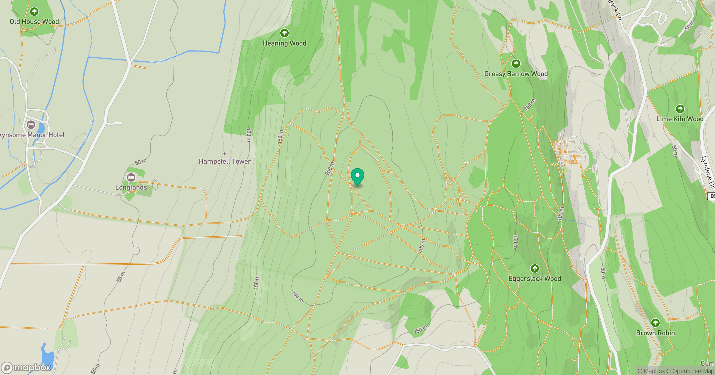
Grid reference: SD399794
View on OpenStreetMapOpens a map in a new tab, centred on the hill.
![The Old Man of Coniston [Coniston Old Man]](https://cdn.walkmates.com/gallery-images/0c140e91269b49abbee339fc41828d25.jpg)
No comments yet. Be the first.