

Great Mell Fell
Good walks are even better shared.
Overview
Great Mell Fell
Great Mell Fell is a rounded, largely grass-covered hill near Troutbeck, north of Ullswater. Its 536.6-metre summit stands apart from the main Lakeland ridges, giving it a different character from the long mountain chains farther west. It belongs to Wainwright's Eastern Fells and is also a Marilyn, with just over 200 metres of prominence.
The hill's appeal lies in the changes within a comparatively short climb. A lane-side start leads through bracken and scattered trees to open grassland, with a broad summit above the neighbouring fields. Little Mell Fell is a separate hill to the south-east, not a second summit on the same continuous ridge. Plan it as a distinct outing rather than assuming that a short walk over Great Mell automatically includes both.
Woodland and exposed upper slopes
The lower eastern slopes contain Routing Wood, where oak, rowan, birch, holly and Scots pine form mixed woodland. The transition to open fell is gradual: individual trees stand above the denser woods, some bent and shaped by exposure. Roots, fallen branches and uneven ground are part of the walking terrain rather than a maintained parkland surface.
The woodland supports animals including roe deer and badgers, and green woodpeckers nest here. A walk is not a guarantee of seeing any of them. Keeping dogs close, leaving dead wood undisturbed and giving grazing animals space helps protect the quieter parts of the fell.
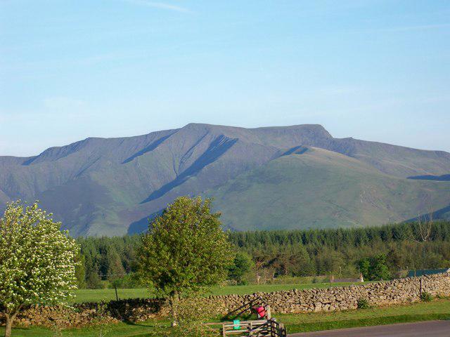
Higher up, tussocky grass and wet hollows replace much of the woodland. The broad summit opens towards Blencathra and the ridges around Bannerdale. The Helvellyn range lies to the south-west, while the outlook east extends towards the Eden Valley and Pennines. Cloud on the higher fells can change the view substantially even when Great Mell itself is clear.
A hill built from older hills
Great Mell Fell is underlain by Mell Fell Conglomerate, a sedimentary rock assembled from fragments of still older rocks. Many of the fragments came from the Borrowdale volcanic rocks and the sedimentary succession now called the Windermere Supergroup. The conglomerate records the erosion and transport of an earlier mountain landscape.
Its likely age is Late Devonian, although the absence of fossils makes that dating tentative. Water carried the coarse material through braided river channels and spread it across adjoining alluvial fans in a generally arid continental setting. Over time those deposits became rock.
The rounded outline alone does not tell the full story: the rocks within the hill preserve evidence of an earlier landscape.
The prehistoric summit
The top contains a protected prehistoric bowl barrow as well as the summit cairn. The archaeological mound is low and easily overlooked, but it is more than an accumulation of stones left by walkers. Earth and stone were used to construct a funerary monument, with a shallow surrounding ditch separated from the mound by a level strip of ground.
Bowl barrows belong to a long prehistoric tradition. This example is associated with the Late Neolithic and Bronze Age, but an exact construction date is not established.
An Ordnance Survey column formerly stood on the mound; its removal caused some surface damage. The surviving monument remains legally protected. Do not add stones, dig into the mound or rearrange the cairn. Treat the summit as an archaeological place as well as a viewpoint.
Walking from the south-east
A compact out-and-back begins at the rough roadside pull-in at NY407246. Follow the track to the second National Trust gate or adjacent stile, then climb beside the fence and bear right towards the broad upper ridge as the trees thin. Reach the summit and return along the same approach.
This complete return itinerary is about 3.5 kilometres. Woodland detours or a separate Little Mell Fell ascent are additional outings, not part of that figure. Carry a suitable map and identify the return line before leaving the summit in mist.
Planning and care
Roadside space is very limited. Keep the lane, gates and farm access clear, and have another plan if there is no suitable space. Bring water, food and the equipment needed for changing weather rather than relying on facilities at the start.
The hill is modest by Lakeland standards, but short distance does not remove the difficulties of rough ground. Mud, roots, wet grass and boggy hollows can slow progress. Snow or ice makes the same slopes a different proposition. Leave time for the full descent, take waterproof clothing and use the forecast and your own experience to decide whether conditions suit the outing.
Explore routes near Great Mell Fell
Public walks starting within 80 km of this hill. Nearby does not mean a route reaches the summit; check its map and access before setting out.
Bannerdale Crags from Mungrisdale Wainwright
View route
Helvellyn via Striding Edge
View route
Striding Edge, Helvellyn and Catstye Cam
View route
Mungrisdale Common and Bowscale Fell from Mosedale Valley Wainwright
View route
Route planning notes
These notes describe possible approaches, not verified navigable routes or permission to cross land. Check current paths, local access rules and conditions before setting out.
Great Mell Fell from the south-east, out and back
Start and finish at the rough roadside pull-in at NY407246. Use the track and second National Trust gate or adjacent stile, climb beside the fence and bear right towards the broad upper ridge and summit. Return by the same approach. About 3.5 km for the complete return; woodland detours and Little Mell Fell are excluded.
Make a day of it, together
Find someone to share the walk with, or organise a day out along a route you like.
Photo Gallery
View all Photo could not load
NY3925 : Tree on the northern face of Great Mell Fell
Graham Robson
 Photo could not load
NY3925 : Twisted trees on Great Mell Fell
Graham Robson
 Photo could not load
NY3925 : Great Mell Fell Summit
Shaun Ferguson
 Photo could not load
NY3925 : Summit Cairn, Great Mell Fell
Michael Graham
 Photo could not load
NY3925 : Looking towards Cross Fell
T Eyre
 Photo could not load
NY3925 : Summit Cairn, Great Mell Fell
Michael Graham
 Photo could not load
NY3925 : Looking south from Great Mell Fell
T Eyre
 Photo could not load
NY3925 : Looking towards Saddleback
T Eyre
 Photo could not load
NY3925 : On Great Mell Fell
Michael Graham

NY3925 : View from Great Mell Fell in the Lake District
Zoe Blackbourn
Hill facts and local notes
Classifications
Elevation
537m
1,760 ft
Prominence
201m
Coordinates
54.6199, -2.9356
NY396253
OS Map
90
Explorer: OL5S
At the Summit
Cairn at the 536.6 m summit, NY396253. The summit also contains a protected prehistoric bowl barrow; do not move stones or disturb the mound.
Terrain & Geology
Mell Fell Conglomerate, with fragments chiefly of older Borrowdale volcanic and Windermere sedimentary rocks. Alluvial fans and braided river channels deposited it in a continental setting. Late Devonian age is likely but tentative because fossils are absent.
Views & Scenery
Blencathra and Bannerdale Crags are prominent from the top, with views towards the Helvellyn range and across to Little Mell Fell, subject to visibility.
History & Heritage
Historical Significance
A protected prehistoric bowl barrow occupies the summit, with a mound, surrounding ditch and intervening level strip. It is associated with the Late Neolithic and Bronze Age; no exact construction date is established.
Getting There & Facilities
Check current local access restrictions, parking rules and transport timetables before travelling. These notes do not confirm public access to the summit.
Parking
Very limited rough roadside space at NY407246, south-east of the fell. Keep the lane, gates and farm access clear.
Safety Information
Known Hazards
- Mud, roots, fallen branches, wet grass and boggy ground can make progress slippery and uneven.
- Cloud can obscure the broad summit and the correct return line.
- The summit bowl barrow is a protected archaeological monument; do not disturb stones or earth.
Seasonal Hazards
Snow and ice change the difficulty of the slopes. Allow enough daylight for the full return and take suitable clothing for exposed conditions.
General Safety Tips
- Check weather conditions before setting out
- Carry appropriate clothing and equipment
- Let someone know your planned route
- Take a map, compass, and GPS device
- Carry emergency supplies: food, water, first aid kit, torch
Hills
Some common questions about the hills answered
Are there group walks up Great Mell Fell?
Many walkers use Walkmates to join or organise walks with others. You can check for group walks around Great Mell Fell through the maps
Are there other walkers around Great Mell Fell?
Activity varies by location and time, but Walkmates lets you see whether others have shared walks or shown interest in this area. Find other people through the walking friends search walking friends for Great Mell Fell search or of course create your own walk for Great Mell Fell
Can I organise a walk to Great Mell Fell?
Yes. If there aren’t any walks listed already, you can create a walk and make it available for others to join.
If you're signed up to Walkmates, you can create a walk to Great Mell Fell.
How do I find a walk up this hill?
There are often multiple ways to walk this hill, depending on experience and route preference. Walkmates helps you explore walks and routes that others have shared.
Can I suggest a new route up Great Mell Fell?
Yes. You can suggest or create routes to share with others. Walkmates focuses on the social side of walking, so routes are used to help people organise walks and explore areas together, rather than as detailed navigation tools or route libraries.
Other uses really appreciate knowledgeable walkers sharing their routes. Share your favourite route to Great Mell Fell here
The is an error or something incorrect about this hill. How do I let you know?
We always strive to keep the information on Walkmates as accurate as possible. If you find an error, please let us know through the contact form and we'll aim to correct it as quickly as possible
Community Discussion
Comments
Location
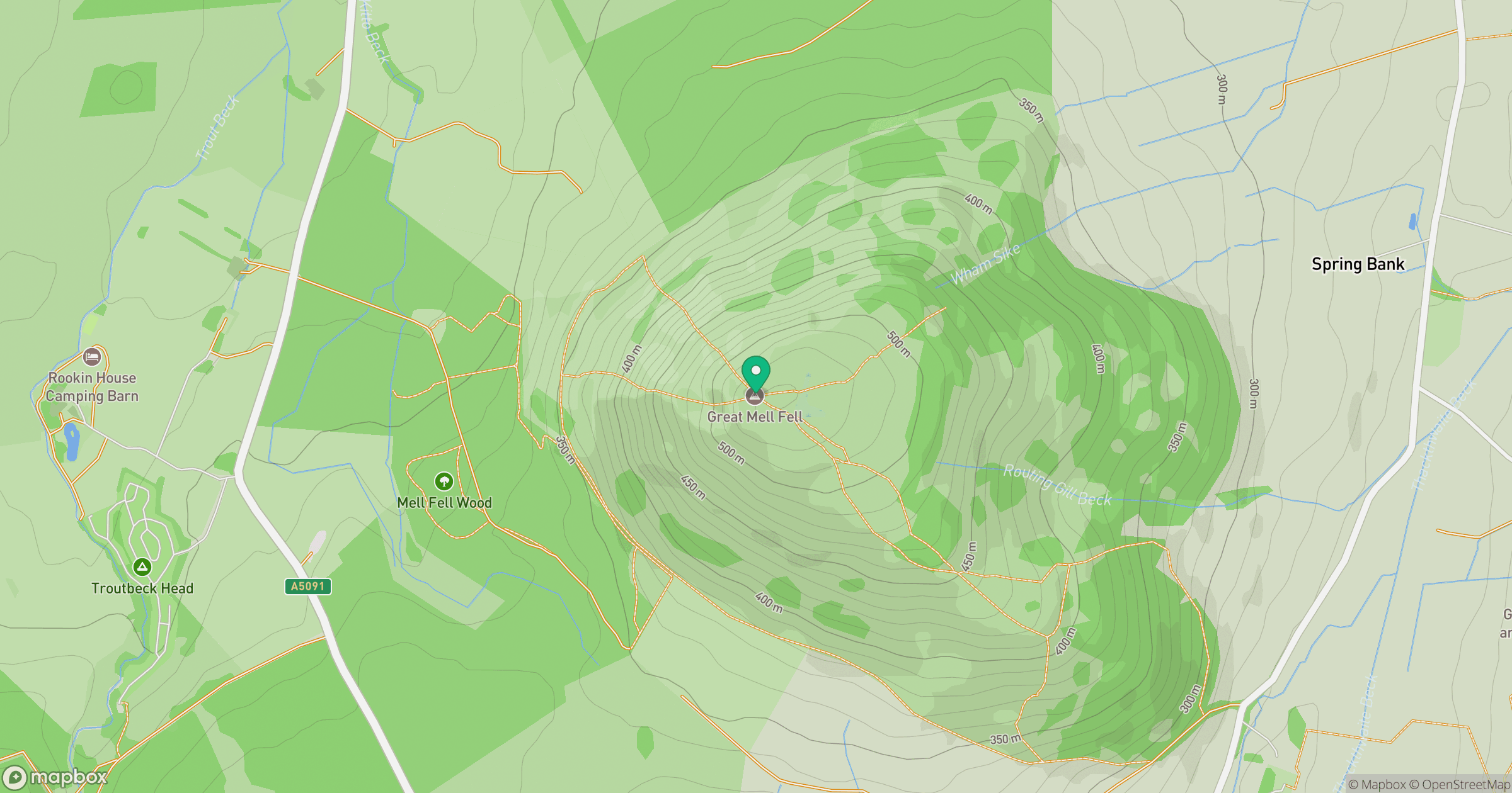
Grid reference: NY396253
View on OpenStreetMapOpens a map in a new tab, centred on the hill.
Hills within 30 km
Straight-line distance, not a walking route or confirmation of access.
No comments yet. Be the first.