

Great Carrs
Good walks are even better shared.
Overview
A 785-metre Wainwright above Wrynose Pass, distinct from neighbouring Swirl How.
Great Carrs
Great Carrs is a 785-metre Wainwright in the southern Lake District. Its cairn stands on rock at NY 27079 00949, with a recorded prominence of 23 metres. Swirl How is a separate, higher summit to the south-east. Summit record.
The summit and its setting
The northern cairn is the Wainwright top, in The Southern Fells. From here, Crinkle Crags and Bowfell frame the northern outlook; Skiddaw can appear in the distance on a clear day. The Halifax memorial further along the ridge is a separate landmark, not the summit cairn. Summit identification and views.
Great Carrs and Grey Friar from Wrynose Pass
WalkLakes records 7.5 km and 508 m of ascent for this circuit from NY276026. Its 2 hours 21 minutes is a minimum; allow extra time for navigation, stops and conditions. Circuit measurements.
From the top of Wrynose Pass, take the southbound path across the wet stepping-stone section. Climb to the cairned junction on Wet Side Edge and note it for the return. Turn right along the ridge, then keep to the upper line over Little Carrs and climb the rocky ground to Great Carrs. Ridge approach.
Pass the memorial and cross Fairfield col. Climb Grey Friar’s rocky eastern side to its two cairns; the left, south-eastern cairn marks the summit. Across to Grey Friar.
Retrace to Fairfield, then take the leftward path below Great Carrs to the gap between Little Carrs and Hell Gill Pike. Visit Hell Gill Pike and follow Wet Side Edge to the cairned junction. Turn left down the outward path to Wrynose Pass. Return route.
An extension to Swirl How adds distance and climbing.
Volcanic rock
The summit lies on the Long Top Tuff Member, within the Airy’s Bridge Tuff Formation and Borrowdale Volcanic Group. These are Ordovician volcanic rocks. Local geology.
The British Geological Survey describes rhyolitic tuff and lapilli-tuff, with layers of finer tuff and local volcanic breccia. These rocks preserve ash and larger fragments produced by ancient eruptions. Leave the outcrops intact. Rock-unit description.
The Halifax memorial
The memorial commemorates the eight crew members of Halifax LL505 who died here on 22 October 1944. Aircraft undercarriage remains lie beside a cairn and cross. IWM records a replacement slate plaque in 2005 and rebuilding of the cairn with a new cross in 2014. Treat this as a place of remembrance and leave all wreckage undisturbed. War Memorials Register.
Parking, transport and access
There are small, informal parking spaces near the top of Wrynose Pass and Three Shire Stone. The approach road is steep and narrow. Park only where permitted, leaving passing places and the road clear; have another plan if the spaces are occupied. Start and parking.
Check road conditions before travelling and obey closure signs. In October 2026, the council reported new remotely operated adverse-weather closure signs at Wrynose Pass. A clear road in the valley does not establish that the pass is usable. Council winter advice.
Stagecoach 516 links Ambleside with Elterwater and Dungeon Ghyll, but does not call at this Wrynose Pass start. A bus-based outing needs a separately planned connection and different walking totals. Check the timetable for your date and the return journey. Current 516 timetable.
Consult current access information and respect temporary restrictions and signs on the ground. Keep dogs under close control. Access guidance.
Before setting out
Stay back from Greenburn’s cliff edge, especially in cloud. Cliff warning.
Check a mountain forecast, carry a map and compass, waterproofs, warm layers, food, water and a torch, and leave your route with someone. Avoid the ridge in high winds or storms. Snow and ice demand winter skills and equipment; finish before dark. In an emergency call 999 or 112, ask for Police, then Mountain Rescue. Walking safety.
Explore routes near Great Carrs
Public walks starting within 80 km of this hill. Nearby does not mean a route reaches the summit; check its map and access before setting out.
Great Carrs Halifax Wreckage from Wrynose Pass
View route
Tarn Hows Fast Route
View route
Coniston to Tarn Hows: Monk Coniston Gardens and Woodland Circuit
View route
Grizedale: Silurian Way walking trail
View route
Route planning notes
These notes describe possible approaches, not verified navigable routes or permission to cross land. Check current paths, local access rules and conditions before setting out.
Great Carrs and Grey Friar from Wrynose Pass
Return below Great Carrs via Hell Gill Pike and Wet Side Edge.
Make a day of it, together
Find someone to share the walk with, or organise a day out along a route you like.
Photo Gallery
View all Photo could not load
NY2700 : Swirl How Cairn
Darren Haddock
 Photo could not load
NY2700 : Memorial Cairn, Great Carrs
Graham Robson
 Photo could not load
NY2700 : Above Broad Slack
Michael Graham
 Photo could not load
NY2701 : Footpath on Little Carrs ridge
Tom Richardson
 Photo could not load
NY2700 : Great Carrs
Michael Graham
 Photo could not load
NY2700 : Cairn on Great Carrs
Tom Richardson
 Photo could not load
NY2600 : On Grey Friar
Michael Graham
 Photo could not load
NY2700 : Memorial Cairn
Steve Carter
 Photo could not load
NY2700 : From Great Carrs
Michael Graham

NY2700 : Remembrance on Great Carrs
Steve Carter
Hill facts and local notes
Classifications
Elevation
785m
2,575 ft
Prominence
23m
Coordinates
54.3988, -3.1247
NY270009
OS Map
89 90
Explorer: OL6N
At the Summit
Northern cairn on rock at NY 27079 00949; separate from the Halifax memorial.
Terrain & Geology
Long Top Tuff Member: rhyolitic tuff and lapilli-tuff, with local breccia; part of the Borrowdale Volcanic Group.
Views & Scenery
Crinkle Crags and Bowfell to the north; distant Skiddaw in clear weather.
History & Heritage
Historical Significance
A memorial honours the eight crew of Halifax LL505, killed here on 22 October 1944.
Getting There & Facilities
Check current local access restrictions, parking rules and transport timetables before travelling. These notes do not confirm public access to the summit.
Parking
Limited informal parking near Three Shire Stone, Wrynose Pass. Keep passing places and the road clear.
Public Transport
Stagecoach 516 serves Ambleside, Elterwater and Dungeon Ghyll, not Wrynose Pass. Plan the onward connection and check return services.
Nearby Facilities
Carry food and drinking water; plan any toilet or refreshment stop before reaching the pass.
Safety Information
Known Hazards
- Steep drops above Greenburn; keep back from edges.
- Low cloud can obscure the return junction on Wet Side Edge.
- Wet rock, strong winds and poor visibility increase the difficulty.
Seasonal Hazards
Snow and ice require winter equipment and skills. Wrynose Pass may close in severe weather.
General Safety Tips
- Check weather conditions before setting out
- Carry appropriate clothing and equipment
- Let someone know your planned route
- Take a map, compass, and GPS device
- Carry emergency supplies: food, water, first aid kit, torch
Hills
Some common questions about the hills answered
Are there group walks up Great Carrs?
Many walkers use Walkmates to join or organise walks with others. You can check for group walks around Great Carrs through the maps
Are there other walkers around Great Carrs?
Activity varies by location and time, but Walkmates lets you see whether others have shared walks or shown interest in this area. Find other people through the walking friends search walking friends for Great Carrs search or of course create your own walk for Great Carrs
Can I organise a walk to Great Carrs?
Yes. If there aren’t any walks listed already, you can create a walk and make it available for others to join.
If you're signed up to Walkmates, you can create a walk to Great Carrs.
How do I find a walk up this hill?
There are often multiple ways to walk this hill, depending on experience and route preference. Walkmates helps you explore walks and routes that others have shared.
Can I suggest a new route up Great Carrs?
Yes. You can suggest or create routes to share with others. Walkmates focuses on the social side of walking, so routes are used to help people organise walks and explore areas together, rather than as detailed navigation tools or route libraries.
Other uses really appreciate knowledgeable walkers sharing their routes. Share your favourite route to Great Carrs here
The is an error or something incorrect about this hill. How do I let you know?
We always strive to keep the information on Walkmates as accurate as possible. If you find an error, please let us know through the contact form and we'll aim to correct it as quickly as possible
Community Discussion
Comments
Location
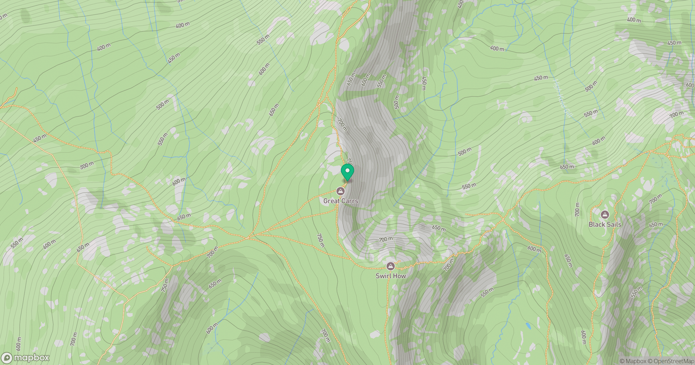
Grid reference: NY270009
View on OpenStreetMapOpens a map in a new tab, centred on the hill.
Hills within 30 km
Straight-line distance, not a walking route or confirmation of access.
Wetherlam
763m

The Old Man of Coniston [Coniston Old Man]
802m
Pike of Blisco
703m
Dow Crag
778m

Crinkle Crags - Long Top [Second Crinkle]
859m
No comments yet. Be the first.