

Force Crag
Good walks are even better shared.
NY1921 : Coledale Beck
Michael Graham Photo source
Overview
Hiking Force Crag
Force Crag, a lesser-known gem of the Lake District, offers hikers a delightful escape into nature. With its moderate elevation of 577 meters, it’s perfect for those looking to enjoy a day out without exhausting themselves completely.
Geology
What makes Force Crag particularly intriguing is its geological makeup. The mountain consists largely of Skiddaw slate, a rock type that was created under intense pressure, giving it a unique texture and appearance. It’s a reminder that the mountains can share their ancient stories if you're just willing to stop and listen.
Route Details
The most popular route begins in the Newlands Valley and is approximately 6.5 km long. It typically takes around 3.5 hours to complete, making it achievable for a wide range of abilities. This trail is slightly challenging due to its gradient and rocky terrain, but don't let that put you off - a rewarding view awaits!
Summit Features
Upon reaching the summit of Force Crag, you'll be greeted by a modest cairn and a delightful stone shelter. It’s the perfect vantage point to pause and catch your breath while soaking in panoramic views. Don’t forget to take a photo for your social media; bragging rights are always a bonus!
Terrain
Expect a mix of rocky and grassy paths, sprinkled with the occasional muddy patch that could potentially swallow a boot if you’re not careful! This variety keeps your hike interesting, albeit a bit tricky at times.
Views
The view from the summit is nothing short of spectacular. On a clear day, you’ll enjoy sights of Derwentwater, the fells, and in the distance, possibly Scafell Pike. A perfect picnic spot - unless you’ve brought soggy sandwiches!
Hazards
While not overly hazardous, take caution with loose rocks underfoot and the potential for muddy paths, especially after rainfall. Your boots will thank you for keeping them dry!
Nearby Summits
For those looking to extend their adventure, consider summiting nearby hills like Raise or Grisedale Pike, which offer equally breathtaking views and additional challenges.
Access
Accessing Force Crag is relatively straightforward. The nearest parking is at Newlands Valley, which fills up quicker than a tea kettle at a bus stop on a rainy day. If you prefer public transport, check services operating out of Keswick, which isn’t far from the route.
Facilities
Before or after your hike, Keswick offers a variety of cafes and public toilets, ensuring you're well-equipped for your outdoor adventure.
History
The name ‘Force Crag’ intriguingly hints at its past, deriving from Old Norse meaning ‘waterfall’. The area was once known for its lead mining, leaving behind a historical footprint worth noting as you traverse the landscape.
Enjoy your hike on Force Crag, where nature meets history in a splendid embrace! Don’t forget to leave no trace and respect the great outdoors - the only thing that should remain after your visit is footprints!
Explore routes near Force Crag
Walks starting near this hill. Open a route to check its map, distance and full itinerary.
Whinlatter dark skies walk
View route
Whinlatter dark skies walk
View route
Scafell Pike from Seathwaite via the Corridor Route
View route
Steeple, Scoat Fell and Haycock from Ennerdale
View route
Route planning notes
These notes describe possible approaches. Check a route's map and access information when planning your walk.
Force Crag from the Newlands Valley
A popular route starting from the picturesque Newlands Valley, offering stunning vistas and a moderate hike.
Make a day of it, together
Find someone to share the walk with, or organise a day out along a route you like.
Photo Gallery
View all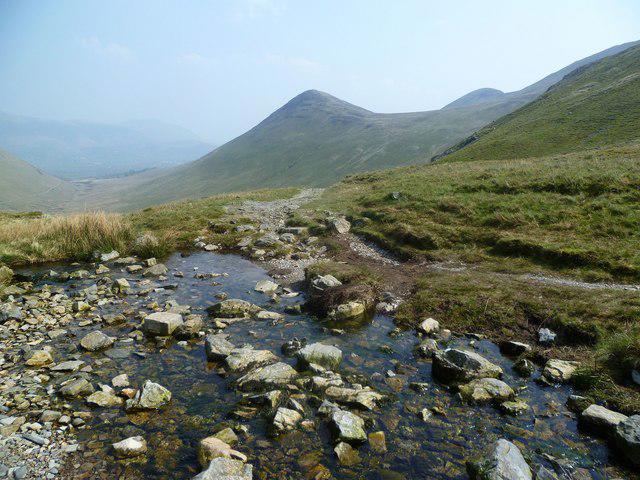 Photo could not load
NY1921 : Coledale Beck
Michael Graham
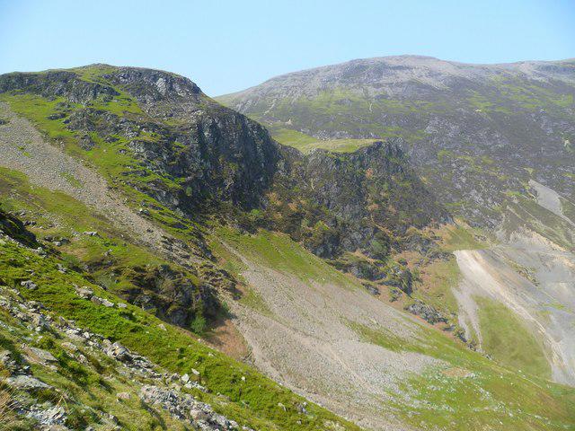 Photo could not load
NY1921 : Force Crag
Michael Graham
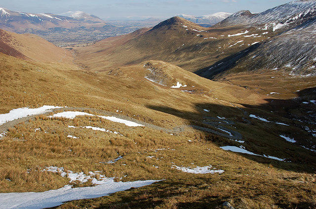 Photo could not load
NY1921 : Zig-zag path towards Force Crag
Jim Barton
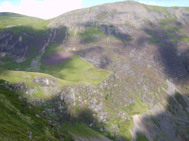 Photo could not load
NY1921 : Force Crag
Michael Graham
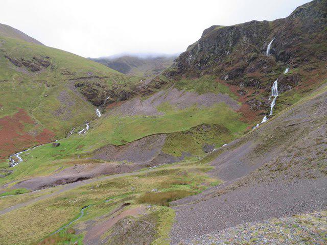 Photo could not load
NY1921 : The head of Coledale from Force Crag Mine
Chris Allen
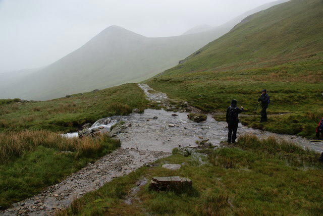 Photo could not load
NY1921 : A stream to be forded near Force Crag
Bill Boaden
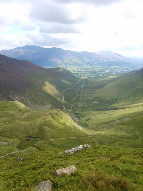 Photo could not load
NY1921 : Looking down Coledale
Michael Graham
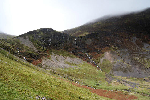 Photo could not load
NY1921 : Force Crag
Andy Waddington
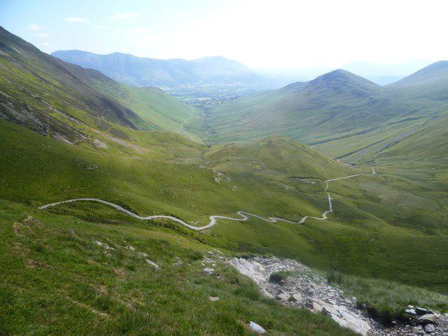 Photo could not load
NY1921 : Descending Coledale Hause
Michael Graham
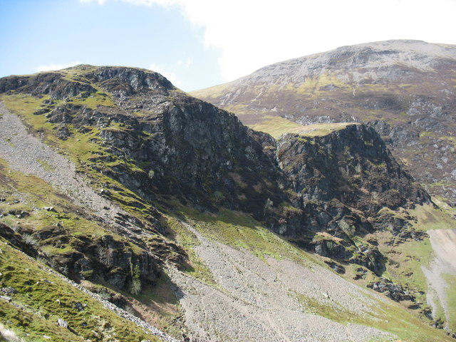
NY1921 : Force Crag
David Purchase
Hill facts and local notes
Classifications
Elevation
475m
1,558 ft
Prominence
8m
Coordinates
54.5808, -3.2456
NY195213
OS Map
89 90
Explorer: OL4S
At the Summit
The summit features a small cairn and a stone shelter that provides a perfect spot for a quick break and a bite to eat, whilst you contemplate the beauty of the surroundings.
Terrain & Geology
Force Crag is primarily composed of Skiddaw slate, which is a sedimentary rock formed during the Ordovician period. The striking topography will have you scratching your head, trying to figure out how nature made it so marvellous.
Views & Scenery
From the summit, hikers can enjoy views of Derwentwater, the surrounding fells, and on clear days, a glimpse of the mighty Scafell Pike.
History & Heritage
Name Origin
The name 'Force' is derived from the Old Norse word 'fors', meaning waterfall. It perfectly describes the nearby Force Crag Mine area which once prospered from lead mining.
Historical Significance
Historically, Force Crag was notable for its mining activities, contributing to the industrial heritage of the Lake District.
Getting There & Facilities
Parking
There’s parking available at the Newlands Valley car park, which accommodates a good number of vehicles but can fill up quickly on weekends.
Public Transport
The nearest bus stop is located in Keswick, with services available to the Newlands Valley area. It's advisable to check local bus schedules prior to your trip.
Nearby Facilities
There are public toilets and several cafes in Keswick providing a warm cup of tea and a slice of cake, ensuring you’re well-fed before or after your hike.
Safety Information
Known Hazards
- Loose rocks on the ascent can cause slips, particularly in wet weather. Always watch your step and try to avoid the 'dance of the wobbling boulders'.
- Occasional deep bogs can catch you by surprise, so waterproof boots are a must to prevent soggy socks.
General Safety Tips
- Check weather conditions before setting out
- Carry appropriate clothing and equipment
- Let someone know your planned route
- Take a map, compass, and GPS device
- Carry emergency supplies: food, water, first aid kit, torch
Hills
Some common questions about the hills answered
Are there group walks up Force Crag?
Many walkers use Walkmates to join or organise walks with others. You can check for group walks around Force Crag through the maps
Are there other walkers around Force Crag?
Activity varies by location and time, but Walkmates lets you see whether others have shared walks or shown interest in this area. Find other people through the walking friends search walking friends for Force Crag search or of course create your own walk for Force Crag
Can I organise a walk to Force Crag?
Yes. If there aren’t any walks listed already, you can create a walk and make it available for others to join.
If you're signed up to Walkmates, you can create a walk to Force Crag.
How do I find a walk up this hill?
There are often multiple ways to walk this hill, depending on experience and route preference. Walkmates helps you explore walks and routes that others have shared.
Can I suggest a new route up Force Crag?
Yes. You can suggest or create routes to share with others. Walkmates focuses on the social side of walking, so routes are used to help people organise walks and explore areas together, rather than as detailed navigation tools or route libraries.
Other uses really appreciate knowledgeable walkers sharing their routes. Share your favourite route to Force Crag here
The is an error or something incorrect about this hill. How do I let you know?
We always strive to keep the information on Walkmates as accurate as possible. If you find an error, please let us know through the contact form and we'll aim to correct it as quickly as possible
Community Discussion
Comments
Location
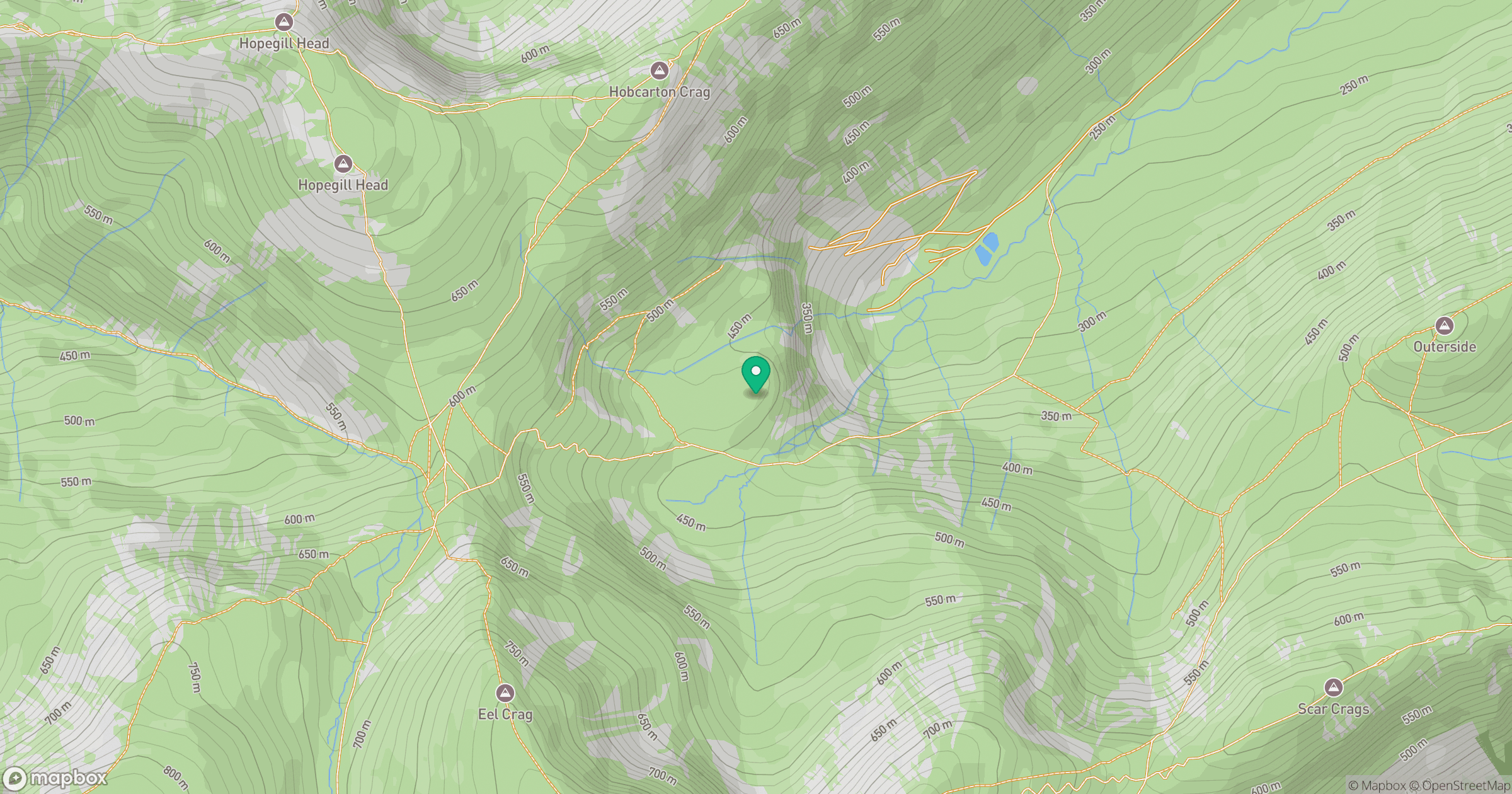
Grid reference: NY195213
View on OpenStreetMapOpens a map in a new tab, centred on the hill.
Nearby Hills
Crag Hill [Eel Crag]
839m
Grisedale Pike
790m
Grasmoor
852m
Fleetwith Pike
649m
High Stile [Grey Crag - High Stile]
806m
No comments yet. Be the first.