

Dunadd
Good walks are even better shared.
NR8393 : Exploring Dunadd
Jonathan Thacker Photo source
Overview
Dunadd: A Walk Through History
Dunadd, rising at 147 meters above sea level, is not just another hill; it’s a portal to the past! Known for its rich history as a royal fort, Dunadd is a prominent feature in Argyll and Bute, awaiting explorers with open arms (and maybe a friendly sheep).
Geology
Dunadd showcases fascinating volcanic rock formations that narrate the story of prehistoric eruptions and the geological turmoil of the region. Layers of lava flows and sedimentary deposits can be gesehen as a reminder of the earth's dynamic history – no geology degree required!
Access
To begin your adventure, head over to the Kilmartin Museum parking lot where you can also grab a bite at the café. Yes, nothing like a full stomach to tackle some gravelly footpaths! You can easily reach Kilmartin via public transports such as buses, but do check the schedule; after all, you don’t want to miss out!
The Route
The main route from Kilmartin is a delightful 2-kilometer jaunt that offers a relaxing trek suitable for families and those simply looking to soak up some heritage. The path is well-travelled, making it a safe option for newcomers to hiking in Scotland.
Summit Features
Standing tall at the top, you will find ruins of an ancient fortress and remarkable carved stones - a true selfie spot for history buffs! The summit is rocky, offering stunning views of the Kilmartin Glen and beyond. If you're lucky, you might just spot a local deer pondering life’s great questions.
Views
Make sure you bring your camera! The view from the top is nothing short of breathtaking, with rolling hills, ancient woodland, and an abundance of wildlife painting a picturesque scene that would inspire even the laziest of Instagrammers. For optimal photo opportunities, spring and autumn are your best bet; the colours will have you shouting ‘Scottish autumn is a thing of beauty!’
Hazards
Despite its friendly appearance, keep an eye on the conditions underfoot, especially when it’s wet. Slippery rocks can make descent a tad more exciting than anticipated, so come prepared (and in good spirits) if the weather turns.
Facilities
A little something to fuel your journey! The Kilmartin Museum not only offers toilets but also a café for some well-deserved refreshments after your adventure.
History
Now, let’s not overlook the history. Dunadd was once home to the Kings of Dal Riata, establishing it as a focal point in Scotland's historical narrative. The meaning of its name, ‘fort of Aod,’ echoes the ancient lineage that may make you feel a sense of royal privilege as you stand upon its summit.
So, lace up your hiking boots, grab your walking stick, and let Dunadd unveil its history, spectacular views, and the charm that every good Scottish hill should boast! Don't forget to try your luck at spotting some local fauna along the way.
Happy hiking!
Explore routes near Dunadd
Walks starting near this hill. Open a route to check its map, distance and full itinerary.
Crinan Canal: Bellanoch and Dunardry towpath return
View route
Glen Kin group walk
View route
Bishop’s Glen group walk
View route
West Bay morning walk and silent disco
View route
Route planning notes
These notes describe possible approaches. Check a route's map and access information when planning your walk.
Dunadd Historic Circular Walk
This route starts at the car park near the Dunadd Fort entrance and takes you on a historic journey to the summit of Dunadd Hill. The path is well-marked, weaving through surrounding farmland before ascending to the fort. At the summit, enjoy panoramic views and explore the ancient carvings thought to be linked to the early Kings of Dalriada.
Dunadd and River Add Loop
Beginning at the Dunadd Fort car park, this route combines a visit to the summit of Dunadd with a scenic walk along the River Add. After descending the hill, follow the riverbank for a tranquil walk through lush landscapes before looping back to the starting point.
Dunadd and Crinan Canal Trail
This longer route links Dunadd with the Crinan Canal, offering a mix of history and scenic beauty. After exploring the summit of Dunadd, follow paths leading to the canal towpath. Enjoy a flat walk along the canal with opportunities to spot wildlife and take in the views before returning to the starting point.
Dunadd to Moine Mhor Nature Reserve
This route connects the historic site of Dunadd with the expansive Moine Mhor Nature Reserve. After summiting Dunadd, head west towards the nature reserve, where you'll encounter raised bog landscapes, birdwatching opportunities, and interpretive trails. This walk combines cultural and natural highlights.
Extended Dunadd and Kilmartin Glen Exploration
This comprehensive route includes a climb to the summit of Dunadd as well as a broader exploration of Kilmartin Glen's prehistoric sites. Descend from Dunadd and follow marked trails to standing stones, cairns, and other archaeological features, making this an immersive historical walk.
Make a day of it, together
Find someone to share the walk with, or organise a day out along a route you like.
Photo Gallery
View all Photo could not load
NR8393 : Dunadd - the entrance
David Wyatt
 Photo could not load
NR8393 : The Anointing Stoup, Dunadd Fort
Rich Tea
 Photo could not load
NR8393 : Dunadd - Looking back down the path
Rob Farrow
 Photo could not load
NR8393 : Summit of Dunadd
Iain Russell
 Photo could not load
NR8393 : The summit of Dunadd Fort
Gordon Brown
 Photo could not load
NR8393 : Dunadd fort
Bob Embleton
 Photo could not load
NR8393 : Dunadd and Mòine Mhòr
Richard Webb
 Photo could not load
NR8393 : Dunadd - the 'inner fort'
David Wyatt
 Photo could not load
NR8393 : Dunadd Fort
G Laird

NR8393 : Exploring Dunadd
Jonathan Thacker
Hill facts and local notes
Classifications
Elevation
55m
180 ft
Prominence
48m
Coordinates
56.0857, -5.4788
NR836935
OS Map
55
Explorer: 358N
At the Summit
The summit is marked by an ancient fortress site featuring the remains of a hill fort and a prominent rock outcrop with carvings, offering an authentic taste of Scotland's past.
Terrain & Geology
Dunadd is primarily composed of volcanic rock, with evidence of ancient lava flows and layers of sedimentary deposits. These geological features are a testament to the area's volcanic activity millions of years ago.
Views & Scenery
From the summit, one can enjoy panoramic views of the Kilmartin Glen, the surrounding hills, and, on a clear day, even as far as the islands of Jura and Islay.
History & Heritage
Name Origin
The name Dunadd is derived from the Gaelic 'Dun Aod,' which means 'fort of Aod' – suggesting a rich history of human habitation since prehistoric times.
Historical Significance
Dunadd was the seat of the Kings of Dal Riata, making it a site of immense historical importance and a significant location in Scottish history.
Getting There & Facilities
Parking
Parking is available at the Kilmartin Museum car park, from which the route to Dunadd begins.
Public Transport
Kilmartin can be accessed by bus services from nearby towns, but check local schedules as they may be limited.
Nearby Facilities
The Kilmartin Museum features a café and toilets, perfect for a pre-hike snack or a post-hike refreshment.
Safety Information
Known Hazards
- Some rocky sections may be slippery, especially in wet weather. Additionally, be mindful of low visibility in foggy conditions.
General Safety Tips
- Check weather conditions before setting out
- Carry appropriate clothing and equipment
- Let someone know your planned route
- Take a map, compass, and GPS device
- Carry emergency supplies: food, water, first aid kit, torch
Hills
Some common questions about the hills answered
Are there group walks up Dunadd?
Many walkers use Walkmates to join or organise walks with others. You can check for group walks around Dunadd through the maps
Are there other walkers around Dunadd?
Activity varies by location and time, but Walkmates lets you see whether others have shared walks or shown interest in this area. Find other people through the walking friends search walking friends for Dunadd search or of course create your own walk for Dunadd
Can I organise a walk to Dunadd?
Yes. If there aren’t any walks listed already, you can create a walk and make it available for others to join.
If you're signed up to Walkmates, you can create a walk to Dunadd.
How do I find a walk up this hill?
There are often multiple ways to walk this hill, depending on experience and route preference. Walkmates helps you explore walks and routes that others have shared.
Can I suggest a new route up Dunadd?
Yes. You can suggest or create routes to share with others. Walkmates focuses on the social side of walking, so routes are used to help people organise walks and explore areas together, rather than as detailed navigation tools or route libraries.
Other uses really appreciate knowledgeable walkers sharing their routes. Share your favourite route to Dunadd here
The is an error or something incorrect about this hill. How do I let you know?
We always strive to keep the information on Walkmates as accurate as possible. If you find an error, please let us know through the contact form and we'll aim to correct it as quickly as possible
Community Discussion
Comments
Location
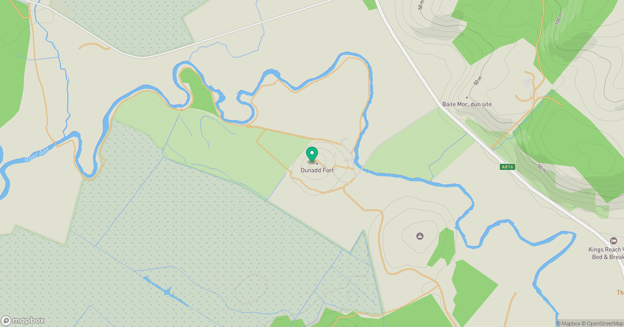
Grid reference: NR836935
View on OpenStreetMapOpens a map in a new tab, centred on the hill.
No comments yet. Be the first.