

Corbar Hill
Good walks are even better shared.
SK0574 : Gate in Corbar Woods
Brian Deegan Photo source
Overview
Corbar Hill: A Hidden Gem in the Peak District
Overview
Nestled in the heart of the Peak District, Corbar Hill stands as a wonderful spot for both novice hikers and seasoned veterans alike. With its modest height of 210 meters, it may not rival the giants such as Kinder Scout, but it offers a charming escape with stunning views and a rich tapestry of folklore.
Geology
The limestone composition of Corbar Hill is a geological wonder that sparks curiosity. When you're wandering its paths, take a moment to inspect the rocks for fossils. You might just spot a reminder of the sea creatures that swam here millions of years ago!
Routes
- Lover's Walk Trail:
This easy loop gives a leisurely stroll ideal for families and walkers who fancy a gentle hike while taking in the stunning views without breaking a sweat. - Direct Ascent from Buxton:
For those craving a bit of a workout, this moderate route provides a more direct path to the summit, rewarding you with the satisfaction of pushing your limits.
Summit Features
At the top, a modest stone cairn greets climbers along with a lovely viewfinder, perfect for spotting landmarks. Snap a photo, grab a few giggles, and enjoy the moment before descending!
Terrain
The terrain varies from grassy stretches at the base to rocky outcrops near the summit. It’s like a nice mix of a walk in the park and a mini rock scramble!
Views
Prepare to be dazzled! The vistas from Corbar Hill showcase the jewels of the Peak District, including rugged hills and verdant valleys. Late spring and early autumn are particularly stunning, with vibrant colours and clearer skies. Bring your camera, or risk being scolded by your friends who weren't there to see it!
Hazards
While not treacherous, be cautious of loose rocks and inclement weather. If it's raining cats and dogs, you might want to stay indoors and catch up on that Netflix series instead.
Access
Getting there is a breeze! Buxton's Pavilion Gardens offers ample parking, and it’s only a short walk to the hill. The Buxton Railway Station offers connections from Manchester, making it easily accessible for a day visit.
Facilities
Once off the mountain, treat yourself to a break at the Pavilion Gardens café, or picnic in the green splendour. Restrooms are on-site, so no need to rush down after a long trek!
History
The name Corbar has charming roots in Old English, hinting at the gathering of crows. Historically, this hill was significant during the Industrial Revolution, providing locals with a vantage point over the expanding industries below.
Next time you're in the Peak District, make sure Corbar Hill is on your list. It’s an ideal spot for a mini-adventure without the fuss of the bigger peaks. Happy hiking!
Explore routes near Corbar Hill
Walks starting near this hill. Open a route to check its map, distance and full itinerary.
Miller’s Dale to Bakewell guided walk
View route
Miller’s Dale to Bakewell guided walk
View route
Miller’s Dale to Bakewell guided walk
View route
Miller’s Dale to Bakewell guided walk
View route
Route planning notes
These notes describe possible approaches. Check a route's map and access information when planning your walk.
Lover's Walk Trail
A picturesque path that takes you around the foot of Corbar Hill, providing a gentle ascent with stunning views of the surrounding countryside.
Direct Ascent from Buxton
This route starts from Buxton and takes you directly to the summit, offering a more challenging ascent through wooded areas and rocky paths.
Make a day of it, together
Find someone to share the walk with, or organise a day out along a route you like.
Photo Gallery
View all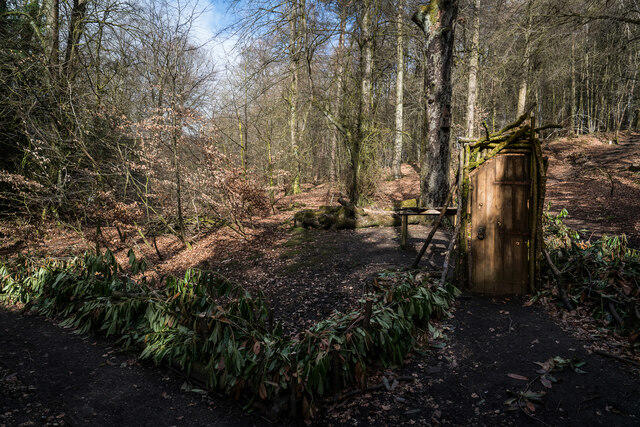 Photo could not load
SK0574 : Gate in Corbar Woods
Brian Deegan
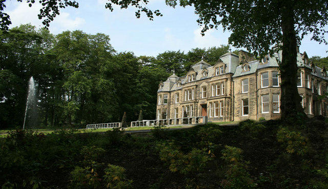 Photo could not load
SK0574 : The Chateau - View from the Grounds
pigott law
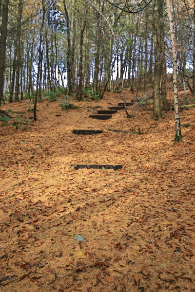 Photo could not load
SK0574 : Autumn Carpet in Corbar Wood
Bob Jenkins
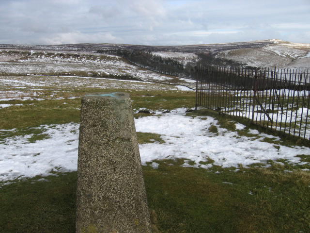 Photo could not load
SK0574 : From Corbar Hill Trig Point S2767
Chris Wimbush
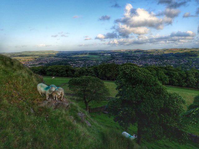 Photo could not load
SK0574 : Corbar Hill
Mick Garratt
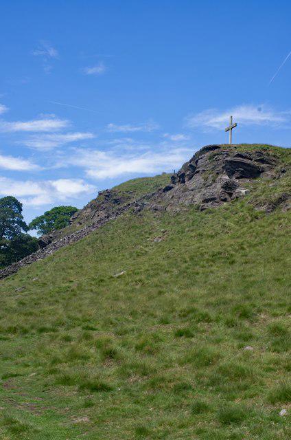 Photo could not load
SK0574 : Buxton : Corbar Cross
Jim Osley
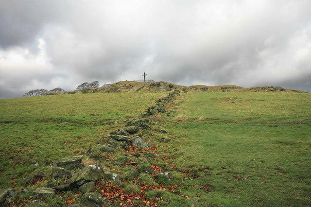 Photo could not load
SK0574 : Corbar Cross
Bob Jenkins
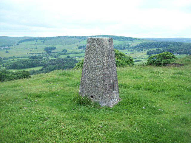 Photo could not load
SK0574 : Triangulation Pillar on Corbar Hill
Jonathan Clitheroe
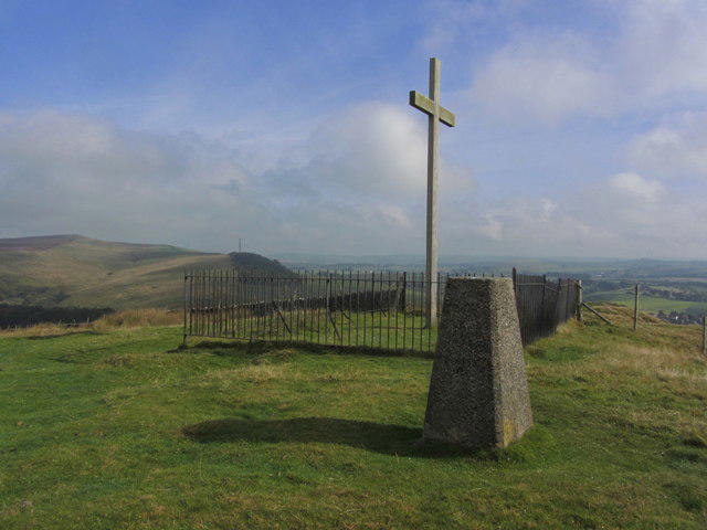 Photo could not load
SK0574 : Buxton - Corbar Hill - Cross & trig point
Colin Park
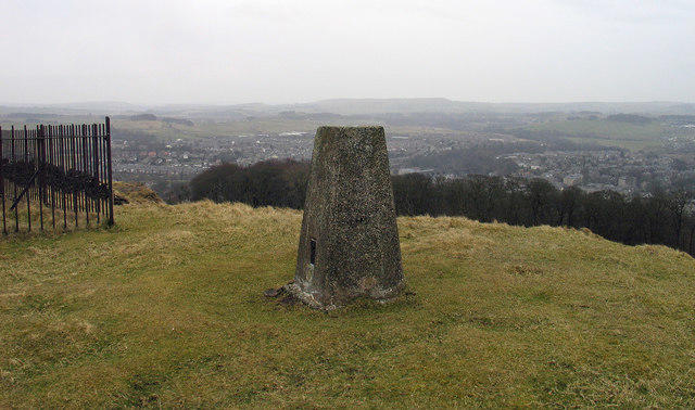
SK0574 : Trig point on Corbar Hill
Trevor Littlewood
Hill facts and local notes
Classifications
Elevation
437m
1,433 ft
Prominence
17m
Coordinates
53.2657, -1.9244
SK051742
OS Map
119
Explorer: OL24W
At the Summit
The summit boasts a small stone cairn and a stunning viewfinder that helps direct your gaze to the various hills and valleys beyond. Don’t forget to wave at the locals in Buxton, they might wave back!
Terrain & Geology
Corbar Hill is primarily composed of limestone, a result of the ancient seas that once covered this area. The exposed rock formations reveal fascinating fossils and marine sediments, perfect for budding geologists or simply curious hikers.
Views & Scenery
From the summit, hikers can enjoy expansive views of the Peak District, including famous landmarks such as the Dark Peak and the limestone caverns of Castleton.
History & Heritage
Name Origin
The name 'Corbar' is derived from the Old English terms meaning 'the hill where the crows gather', a fitting description given the resident wildlife.
Historical Significance
Corbar Hill has historical significance as a viewing point during the Industrial Revolution, allowing locals to keep an eye on the development of the nearby quarrying industries.
Getting There & Facilities
Parking
The closest parking is available at the Buxton Pavilion Gardens, which is about a 15-minute walk from the trailhead.
Public Transport
Buxton Railway Station provides services from Manchester and is approximately 2 km from the foot of Corbar Hill.
Nearby Facilities
The Pavilion Gardens nearby offers a café, restrooms, and plenty of benches for a well-deserved break after your hike.
Safety Information
Known Hazards
- Loose rocks on the summit path can be treacherous, particularly when wet. It's wise to keep an eye on the weather and stay off the hill during heavy rain.
General Safety Tips
- Check weather conditions before setting out
- Carry appropriate clothing and equipment
- Let someone know your planned route
- Take a map, compass, and GPS device
- Carry emergency supplies: food, water, first aid kit, torch
Hills
Some common questions about the hills answered
Are there group walks up Corbar Hill?
Many walkers use Walkmates to join or organise walks with others. You can check for group walks around Corbar Hill through the maps
Are there other walkers around Corbar Hill?
Activity varies by location and time, but Walkmates lets you see whether others have shared walks or shown interest in this area. Find other people through the walking friends search walking friends for Corbar Hill search or of course create your own walk for Corbar Hill
Can I organise a walk to Corbar Hill?
Yes. If there aren’t any walks listed already, you can create a walk and make it available for others to join.
If you're signed up to Walkmates, you can create a walk to Corbar Hill.
How do I find a walk up this hill?
There are often multiple ways to walk this hill, depending on experience and route preference. Walkmates helps you explore walks and routes that others have shared.
Can I suggest a new route up Corbar Hill?
Yes. You can suggest or create routes to share with others. Walkmates focuses on the social side of walking, so routes are used to help people organise walks and explore areas together, rather than as detailed navigation tools or route libraries.
Other uses really appreciate knowledgeable walkers sharing their routes. Share your favourite route to Corbar Hill here
The is an error or something incorrect about this hill. How do I let you know?
We always strive to keep the information on Walkmates as accurate as possible. If you find an error, please let us know through the contact form and we'll aim to correct it as quickly as possible
Community Discussion
Comments
Location
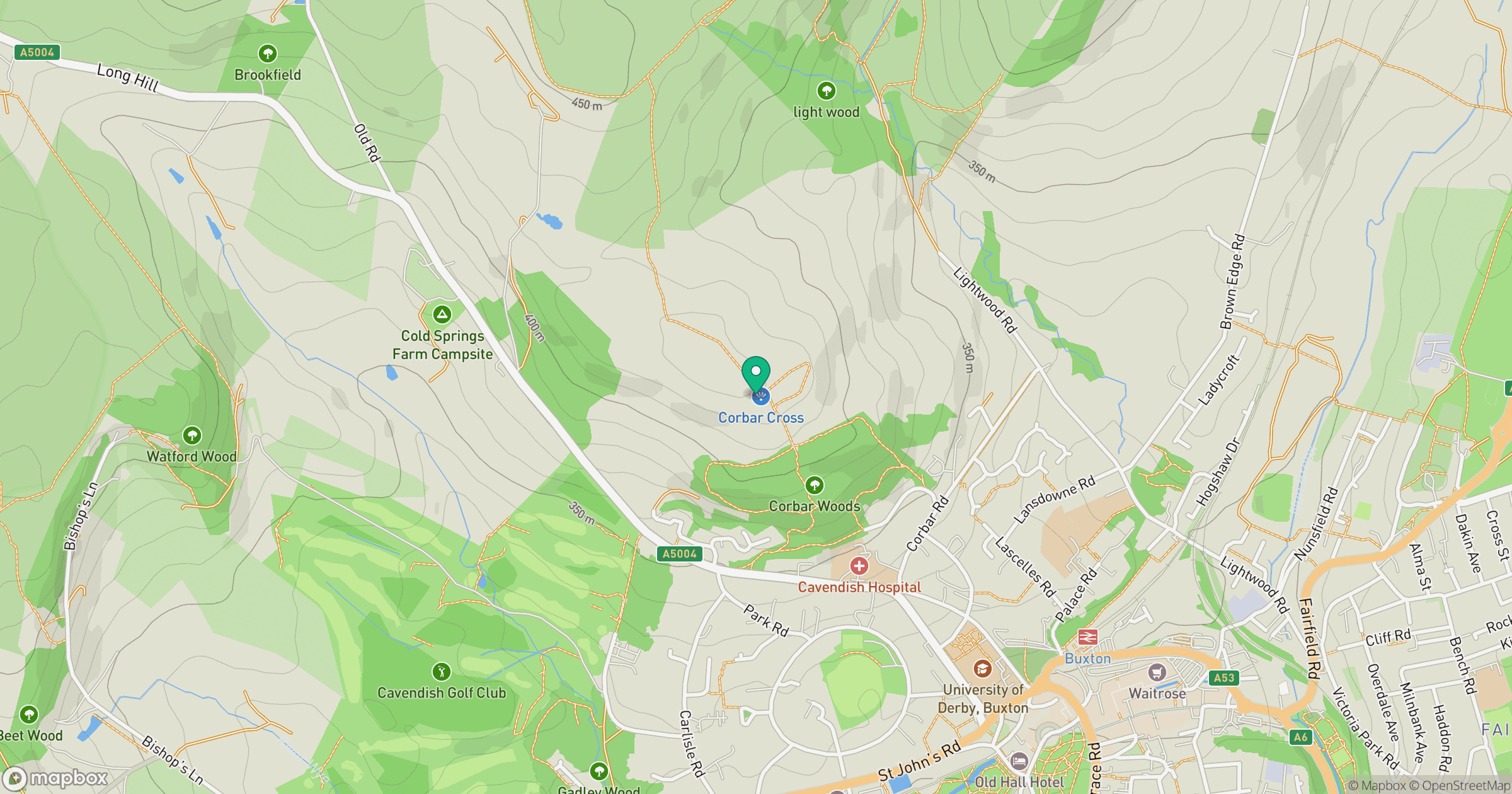
Grid reference: SK051742
View on OpenStreetMapOpens a map in a new tab, centred on the hill.
Nearby Hills
The Roaches
505m

Kinder Scout
636m
Rombalds Moor [Ilkley Moor]
402m
Winter Hill
456m

Pendle Hill
557m
No comments yet. Be the first.