

Causey Pike
Good walks are even better shared.
NY2220 : Ascent of Causey Plke from the East
Derek Voller Photo source
Overview
Causey Pike
Causey Pike’s distinctive rocky summit reaches 637 m, not the former narrative figure of 659 m. DoBIH records a small cairn on rock at the highest point. Its summit is linked westwards to the undulating ridge towards Scar Crags.
Uzzicar circuit
The complete WalkLakes route starts and finishes at the informal parking area above Uzzicar Farm on the Newlands Pass road, NY232217. The source gives 8.3 km and 609 m ascent. It begins along the road, crosses Stoneycroft Gill and takes the path on the right up Rowling End, then continues over Sleet Hawse to Causey Pike.
Rocky steps and the final short scramble require confidence on rock. Hands may be needed and there are steep drops, especially to the right on ascent. Wet or icy conditions make the scrambling harder. The source’s minimum walking time is not a general safe time allowance.
For the return, follow the ridge west over Scar Crags and descend to Sail Pass. Turn sharply right at the crossroads, without continuing up Sail. The path traverses above Long Comb, then becomes the track beside Stoneycroft Gill that returns to the same parking area. Do not attempt an improvised direct northward descent from the summit to the beck: Keswick Mountain Rescue documented a walker following a nonexistent app path there on 2 January 2023.
Rock and access
BGS describes Ordovician sedimentary rocks of the Skiddaw Group, including hornfelsed Kirk Stile Formation rocks at the summit. The former Palaeogene andesite explanation was incorrect.
A bus approach from Braithwaite is outside the 8.3 km circuit. The timetable checked on 18 October 2026 lists Braithwaite Croft Terrace for 77/77A services and is valid 5 October–1 November. Also check the current closure of footpath 201023 along Newlands Beck south of Little Braithwaite, stated to run until 30 June 2027. Follow the National Park’s latest alternative-route advice, current signs and the latest bus timetable.
Sources checked: 18 October 2026.
Explore routes near Causey Pike
Walks starting near this hill. Open a route to check its map, distance and full itinerary.
Whinlatter dark skies walk
View route
Whinlatter dark skies walk
View route
Scafell Pike from Seathwaite via the Corridor Route
View route
Steeple, Scoat Fell and Haycock from Ennerdale
View route
Route planning notes
These notes describe possible approaches. Check a route's map and access information when planning your walk.
Causey Pike and Scar Crags from Uzzicar
Start and finish at the informal parking area above Uzzicar Farm on the Newlands Pass road, NY232217. Walk down the road and cross Stoneycroft Gill, then take the signed path on the right to Rowling End. Continue over Sleet Hawse and scramble up the rocky summit of Causey Pike. Follow the ridge west over Scar Crags to Sail Pass. Turn sharply right at the crossroads, without climbing Sail, and descend the terrace above Long Comb and the old mine. Keep right on the widening path and track beside Stoneycroft Gill to return to the same parking area. WalkLakes gives 8.3 km and 609 m ascent for the complete circuit. The short final scramble needs confident movement on rock and care near steep drops.
Make a day of it, together
Find someone to share the walk with, or organise a day out along a route you like.
Photo Gallery
View all Photo could not load
NY2220 : Ascent of Causey Plke from the East
Derek Voller
 Photo could not load
NY2120 : The Derwent Fells - as seen from the bottom of Skiddaw
Harry Gardner
 Photo could not load
NY2120 : Ridge connecting Causey Pike and Scar Crags
Trevor Littlewood
 Photo could not load
NY2120 : Causey Pike
Chris Holifield
 Photo could not load
NY2120 : Ascending Causey Pike
Michael Graham
 Photo could not load
NY2120 : Causey Pike from the Scar Crags ridge
steven ruffles
 Photo could not load
NY2120 : Causey Pike in the Distance, from the Southeast
Darrin Antrobus
 Photo could not load
NY2120 : On Causey Pike
Michael Graham
 Photo could not load
NY2120 : View from Causey Pike.
Steve Partridge

NY2120 : East side summit crags on Causey Pike
Nigel Davies
Hill facts and local notes
Classifications
Elevation
637m
2,090 ft
Prominence
40m
Coordinates
54.5768, -3.2101
NY218208
OS Map
89 90
Explorer: OL4S
At the Summit
The summit features a prominent rocky outcrop and a small, stone-built cairn celebrating the achievement of reaching the peak. On a clear day, you might find other hikers sharing tales of their exploits.
Terrain & Geology
Causey Pike is formed from Ordovician Skiddaw Group rocks. BGS describes hornfelsed Kirk Stile Formation rocks at the summit thrust over sandstone of the Robinson Member of the Buttermere Formation. These are sedimentary rocks affected by deformation and heating, not early Palaeogene andesitic lava flows.
Views & Scenery
Views from the summit include stunning panoramas of the surrounding fells, including Skiddaw, the Derwentwater, and a glimpse of the Solway Firth on a clear day.
History & Heritage
Name Origin
Causey is a dialect word for a causeway, as recorded in Ordnance Survey’s place-name glossary. The precise historical route associated with this hill name has not been established here; the former derivation from an Old Norse word meaning “cold” is not supported.
Historical Significance
Causey Pike, along with its neighbouring fells, has been a favourite amongst climbers and hikers for generations, and it holds a special place in the hearts of Wainwright enthusiasts.
Getting There & Facilities
Parking
The WalkLakes circuit uses informal parking beside the Newlands Pass road just above Uzzicar Farm, NY232217, at the end of the mine track. This is a different start from Braithwaite. No National Trust ownership or guaranteed space is established; park only where permitted and leave farm and road access clear.
Public Transport
Stagecoach’s 77/77A timetable checked on 18 October 2026, valid 5 October–1 November 2026, lists Braithwaite Croft Terrace and Keswick. A walk from a bus stop to the Uzzicar start is additional to the 8.3 km circuit and requires separate planning. Check current services and return times. The Newlands Beck footpath south of Little Braithwaite is subject to the National Park’s closure notice until 30 June 2027; use the latest advised alternative.
Nearby Facilities
Nearby facilities include the Co-operative store for snacks and beverages, along with a couple of pubs in Braithwaite serving hearty meals and local ales.
Safety Information
Known Hazards
- The ascent over Rowling End has rocky steps, and the final ascent of Causey Pike involves a short ungraded scramble. Hands may be needed; steep drops, especially to the right on ascent, require care. Wet or icy rock can make it substantially harder.
- Do not improvise a direct northward shortcut from the summit to Stonycroft Beck. Keswick Mountain Rescue’s 2 January 2023 report describes a walker misled onto steep ground by a nonexistent path on an app. Follow the planned ridge and return route.
- For approaches from Braithwaite, check the current closure of footpath 201023 along Newlands Beck south of Little Braithwaite. The National Park notice checked 18 October 2026 extends it to 30 June 2027; follow the current signed alternatives and do not assume the riverside path is passable.
- Weather and visibility can change quickly. Carry navigation equipment, suitable clothing and sufficient daylight for the complete route; do not use a source’s minimum walking time as a safe universal allowance.
General Safety Tips
- Check weather conditions before setting out
- Carry appropriate clothing and equipment
- Let someone know your planned route
- Take a map, compass, and GPS device
- Carry emergency supplies: food, water, first aid kit, torch
Hills
Some common questions about the hills answered
Are there group walks up Causey Pike?
Many walkers use Walkmates to join or organise walks with others. You can check for group walks around Causey Pike through the maps
Are there other walkers around Causey Pike?
Activity varies by location and time, but Walkmates lets you see whether others have shared walks or shown interest in this area. Find other people through the walking friends search walking friends for Causey Pike search or of course create your own walk for Causey Pike
Can I organise a walk to Causey Pike?
Yes. If there aren’t any walks listed already, you can create a walk and make it available for others to join.
If you're signed up to Walkmates, you can create a walk to Causey Pike.
How do I find a walk up this hill?
There are often multiple ways to walk this hill, depending on experience and route preference. Walkmates helps you explore walks and routes that others have shared.
Can I suggest a new route up Causey Pike?
Yes. You can suggest or create routes to share with others. Walkmates focuses on the social side of walking, so routes are used to help people organise walks and explore areas together, rather than as detailed navigation tools or route libraries.
Other uses really appreciate knowledgeable walkers sharing their routes. Share your favourite route to Causey Pike here
The is an error or something incorrect about this hill. How do I let you know?
We always strive to keep the information on Walkmates as accurate as possible. If you find an error, please let us know through the contact form and we'll aim to correct it as quickly as possible
Community Discussion
Comments
Location
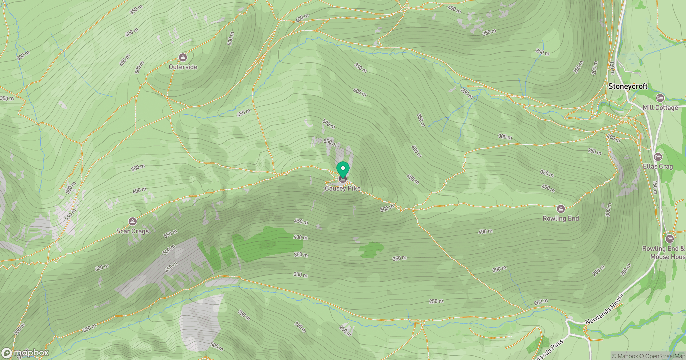
Grid reference: NY218208
View on OpenStreetMapOpens a map in a new tab, centred on the hill.
Nearby Hills
Grisedale Pike
790m
Crag Hill [Eel Crag]
839m
Fleetwith Pike
649m
Grasmoor
852m
High Stile [Grey Crag - High Stile]
806m
No comments yet. Be the first.