

Brim Fell
Good walks are even better shared.
SD2698 : Frozen Spring
Michael Graham Photo source
Overview
Brim Fell: A Hidden Gem in the Lake District
Nestled in the heart of the Lake District, Brim Fell is a delight for hikers who yearn for both a challenge and breathtaking views. With an elevation of 802 meters (2,634 feet), it's a Marilyn that doesn't demand the same effort as some of its taller cousins, yet rewards those who make the ascent with sweeping vistas.
Geology
Brim Fell is primarily composed of ancient volcanic rock, remnants from when the earth was still taking shape. Its rugged terrain presents a mixture of rocky outcrops and lush grassy slopes, a true testament to the raw beauty of the region. As you trek up, be sure to admire the fascinating geological features that tell the story of the earth's tumultuous past.
Routes
The most popular route is The Coniston Circular, starting from Coniston village. This moderate hike is about 11.5 kilometers long and takes approximately 4.5 hours to complete. The path meanders through picturesque landscapes, with intermittent views of Coniston Water and the enchanting hills that surround it. Don’t forget to take a snack and enjoy a breather at the summit – you’ve earned it!
Summit Features
At the summit, you'll find a charming little cairn that stands proud against the backdrop of the magnificent hills. The views here are panoramic, stretching across the Lake District, including stunning sights of Scafell Pike and Great Gable poking their heads above the horizon.
Terrain Type
Expect a mix of rocky and grassy terrain, with some squelchy bogs that might try to steal your boots if you're not careful. Proper footwear is a must unless you fancy a surprise foot spa!
Views
The views from Brim Fell are nothing short of spectacular. On a clear day, the surrounding peaks and Coniston Water glistening below will leave you breathless – and not just from the climb! The best seasons for these marvellous sights would be late spring through early autumn, when nature is in full bloom and visibility is at its prime.
Hazards
Stay vigilant as you navigate the rocky ascent. Loose stones can be a sneaky hazard, especially when you're distracted by the views. Additionally, some paths are prone to becoming boggy after a good rain, so you might want to avoid going for a paddle unless that's part of your plan!
Nearby Summits
Brim Fell is surrounded by other illustrious peaks such as Dow Crag (778 meters) and the mighty Scafell Pike (978 meters), ideal for those looking to extend their adventure.
Access
Accessing Brim Fell is straightforward. The nearest parking can be found at the end of Lake Road in Coniston, where you can also find ample facilities in the village that can cater to your needs. If you prefer to let the bus take the strain, worry not! Regular buses connect Coniston to Ambleside and Ulverston.
Facilities
Coniston is well-equipped with charming cafes, lively pubs, and clean toilets to refresh you before or after your journey up Brim Fell. It’s a good spot to plan your meals, perhaps indulging in a hearty cake after your hike!
History
The name 'Brim Fell' adds a poetic touch to your hiking experience, rooted in Old Norse meaning 'edge of the mountain'. Historically, this area thrived on slate mining during the 19th century, marking its importance on the industrial map.
So, pack your boots, grab your camera, and set off to conquer Brim Fell – it's a delightful memento of nature's artistry waiting to be explored!
Explore routes near Brim Fell
Walks starting near this hill. Open a route to check its map, distance and full itinerary.
Great Carrs Halifax Wreckage from Wrynose Pass
View route
Coniston to Tarn Hows: Monk Coniston Gardens and Woodland Circuit
View route
Tarn Hows Fast Route
View route
Bow Fell from Langdale
View route
Route planning notes
These notes describe possible approaches. Check a route's map and access information when planning your walk.
The Coniston Circular
A popular route starting from Coniston village, offering spectacular views as you ascend up to Brim Fell and beyond.
Make a day of it, together
Find someone to share the walk with, or organise a day out along a route you like.
Photo Gallery
View all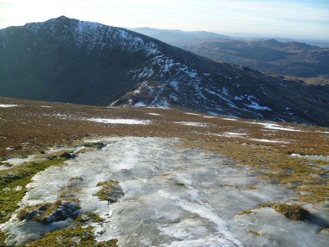 Photo could not load
SD2698 : Frozen Spring
Michael Graham
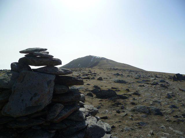 Photo could not load
SD2798 : On Brim Fell
Michael Graham
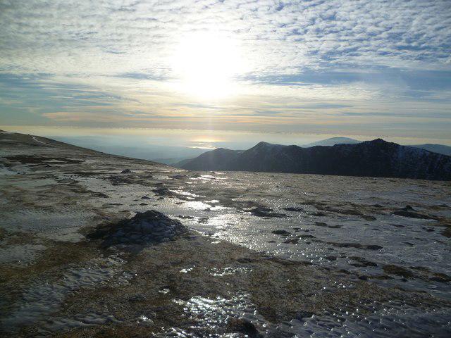 Photo could not load
SD2798 : Ice Field
Michael Graham
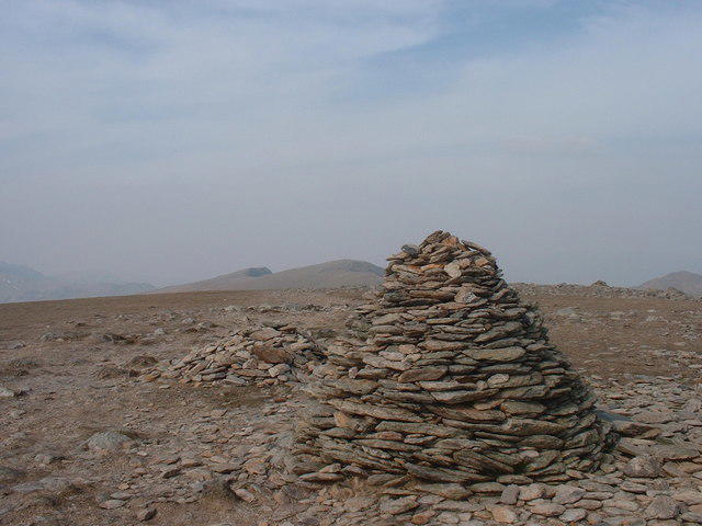 Photo could not load
SD2798 : Summit Cairn, Brim Fell
Michael Graham
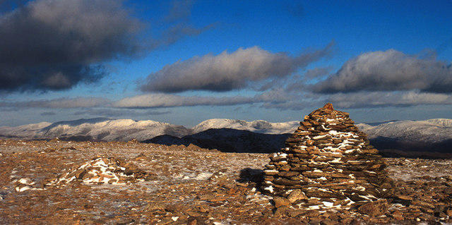 Photo could not load
SD2798 : Cairn Brim Fell
Tom Richardson
 Photo could not load
SD2798 : Just under the cloud base (so far)
Ian Greig
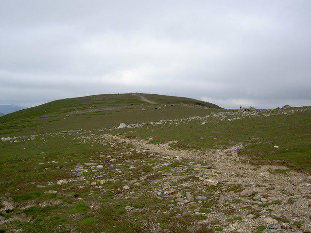 Photo could not load
SD2798 : The ridge path towards Swirl How
Ian Greig
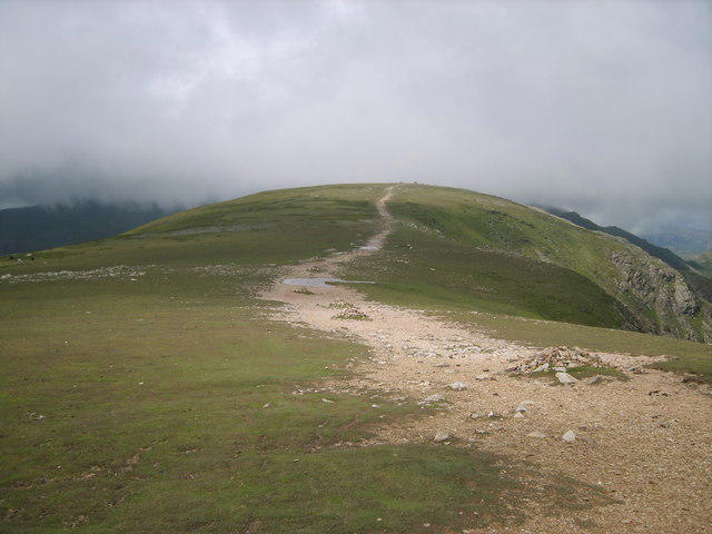 Photo could not load
SD2798 : Brim Fell Ridge
Michael Graham
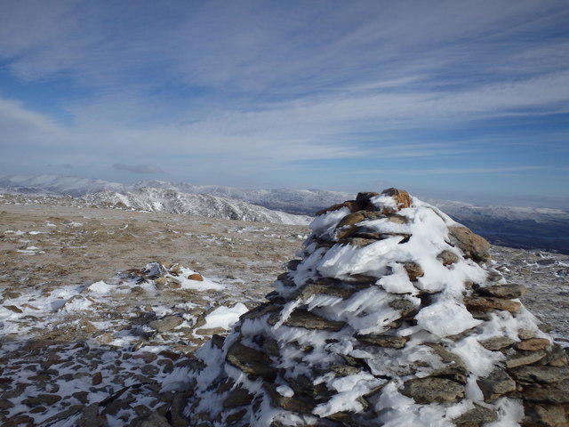 Photo could not load
SD2798 : On Brim Fell
Michael Graham
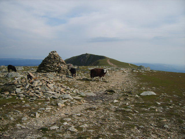
SD2798 : Herdwicks, Brim Fell
Michael Graham
Hill facts and local notes
Classifications
Elevation
796m
2,611 ft
Prominence
20m
Coordinates
54.3773, -3.1242
SD270985
OS Map
96 97
Explorer: OL6N
At the Summit
The summit features a small cairn and a splendid view over the surrounding peaks, including the iconic Scafell Pike.
Terrain & Geology
Brim Fell is primarily made up of volcanic rock, a remnant of ancient volcanic activity in the area. The summit features rugged crags and a distinctive ridge.
Views & Scenery
From the summit, you can see the majestic peaks of the Lake District, including Scafell Pike and Great Gable, as well as Coniston Water glistening below.
History & Heritage
Name Origin
The name 'Brim Fell' derives from Old Norse, where 'brim' means 'edge' and 'fell' refers to a mountain or hill.
Historical Significance
Brim Fell has historical significance as part of the larger slate mining area, which thrived in the 19th century.
Getting There & Facilities
Parking
There is a car park at the end of the Lake Road in Coniston, which provides a starting point for many routes up Brim Fell.
Public Transport
Buses regularly run from Ambleside and Ulverston to Coniston village, making it accessible for those using public transport.
Nearby Facilities
In Coniston, you'll find plenty of cafés, pubs, and toilets, so you can refuel before or after tackling this splendid peak.
Safety Information
Known Hazards
- Watch out for loose stones on the ascent and potential bogginess in certain areas, especially after rainfall.
General Safety Tips
- Check weather conditions before setting out
- Carry appropriate clothing and equipment
- Let someone know your planned route
- Take a map, compass, and GPS device
- Carry emergency supplies: food, water, first aid kit, torch
Hills
Some common questions about the hills answered
Are there group walks up Brim Fell?
Many walkers use Walkmates to join or organise walks with others. You can check for group walks around Brim Fell through the maps
Are there other walkers around Brim Fell?
Activity varies by location and time, but Walkmates lets you see whether others have shared walks or shown interest in this area. Find other people through the walking friends search walking friends for Brim Fell search or of course create your own walk for Brim Fell
Can I organise a walk to Brim Fell?
Yes. If there aren’t any walks listed already, you can create a walk and make it available for others to join.
If you're signed up to Walkmates, you can create a walk to Brim Fell.
How do I find a walk up this hill?
There are often multiple ways to walk this hill, depending on experience and route preference. Walkmates helps you explore walks and routes that others have shared.
Can I suggest a new route up Brim Fell?
Yes. You can suggest or create routes to share with others. Walkmates focuses on the social side of walking, so routes are used to help people organise walks and explore areas together, rather than as detailed navigation tools or route libraries.
Other uses really appreciate knowledgeable walkers sharing their routes. Share your favourite route to Brim Fell here
The is an error or something incorrect about this hill. How do I let you know?
We always strive to keep the information on Walkmates as accurate as possible. If you find an error, please let us know through the contact form and we'll aim to correct it as quickly as possible
Community Discussion
Comments
Location
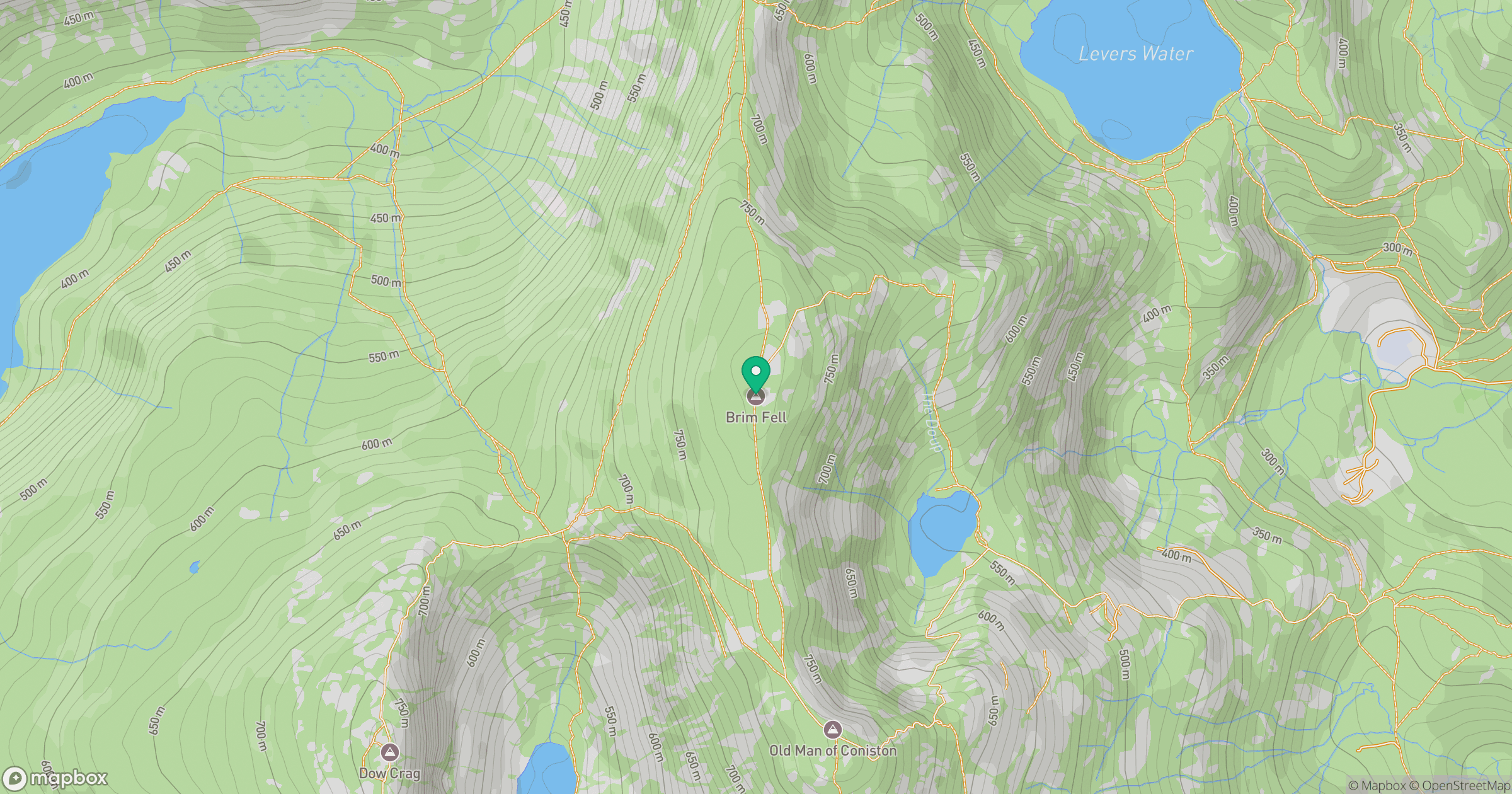
Grid reference: SD270985
View on OpenStreetMapOpens a map in a new tab, centred on the hill.
![The Old Man of Coniston [Coniston Old Man]](https://cdn.walkmates.com/gallery-images/0c140e91269b49abbee339fc41828d25.jpg)
No comments yet. Be the first.