

Blackford Hill
Good walks are even better shared.
NT2570 : Trig Point, Blackford Hill, Edinburgh
Leslie Barrie Photo source
Overview
Blackford Hill is a 164 m summit in south Edinburgh, within the Hermitage of Braid and Blackford Hill Local Nature Reserve. It overlooks the city and Firth of Forth, with woodland walks below.
Blackford Hill
Overview and summit
Blackford Hill rises to 164 m in south Edinburgh, within the Hermitage of Braid and Blackford Hill Local Nature Reserve. The natural summit is a rock 6 m south-east of the trig point. A nearby view indicator helps identify the city panorama, including Arthur's Seat and the Firth of Forth.
Walking route
The Walkhighlands Hermitage of Braid and Blackford Hill circuit starts and finishes on Braid Road. Follow the burn path to Hermitage House, then climb via the left fork, stile and wall gap. The narrow path above the allotments has a steep, unprotected drop. Continue to the trig; the natural summit rock is 6 m south-east. Return towards the Observatory, turn right past Corbie's Craig and descend to the glen bridge. Turn right upstream via Hermitage House to Braid Road.
Walkhighlands gives 4.25 km, about 1.5 hours and 137 m ascent for its described trig-point circuit, including the return. Woodland and grass paths can be muddy. Consult the route map before setting out and follow local signs or diversions.
Access and facilities
There is limited parking near the Royal Observatory at the top of Observatory Road and limited on-road parking on Braid Road. Check local restrictions. For public transport, use Lothian's current journey planner: Comiston Road serves the Braid Road approach, while Blackford Avenue and West Mains Road serve eastern approaches.
The council lists public toilets in the Stables beside Hermitage House, normally open 09:00–16:00 daily, except 25–26 December and 1–2 January. Check visitor-centre opening before relying on it. The Royal Observatory is a working scientific site with advertised public events; access to its buildings is separate from a hill walk.
Geology and heritage
Blackford Hill's andesite lava formed around 410 million years ago. Glacial erosion shaped the hill, while meltwater cut the Hermitage gorge. Agassiz Rock is associated with Louis Agassiz's recognition of glacial erosion here in 1840. Leave rock exposures undamaged.
The summit fort and settlement are protected as scheduled monument SM5818. Respect the earthworks and exposed archaeological remains. Blackford Hill was purchased for the city in 1884.
Safety
Keep clear of crag edges and take care beside Blackford Pond and the Braid Burn. Wet rock, mud, snow or ice can make footing less secure; exposed upper paths need extra care in wind. Supervise children near drops and water. Check the council reserve information and local notices before walking.
Explore routes near Blackford Hill
Walks starting near this hill. Open a route to check its map, distance and full itinerary.
Artists’ walk in Craigmillar Castle Park (group meeting)
View route
To Absent Friends: Holyrood Park walk
View route
Dalkeith Country Park: Estate and North Woods Green Trail
View route
East Calder: Almondell, Mandela Bridge and River Almond Circuit
View route
Route planning notes
These notes describe possible approaches. Check a route's map and access information when planning your walk.
Hermitage of Braid and Blackford Hill circuit
From Braid Road, follow the burn path to Hermitage House, then climb via the left fork, stile and wall gap. The narrow path above the allotments has a steep, unprotected drop. Continue to the trig; the natural summit rock is 6 m south-east. Return towards the Observatory, turn right past Corbie's Craig and descend to the glen bridge. Turn right upstream via Hermitage House to Braid Road. Walkhighlands gives 4.25 km, about 1.5 hours and 137 m ascent for its described trig-point circuit. Paths can be muddy.
Make a day of it, together
Find someone to share the walk with, or organise a day out along a route you like.
Photo Gallery
View all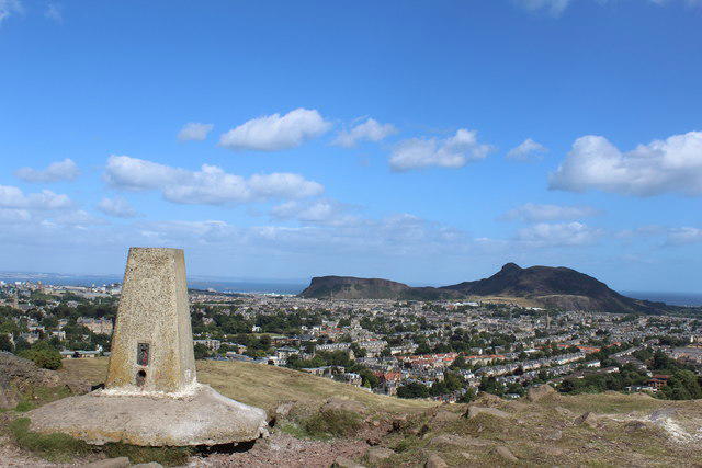 Photo could not load
NT2570 : Trig Point, Blackford Hill, Edinburgh
Leslie Barrie
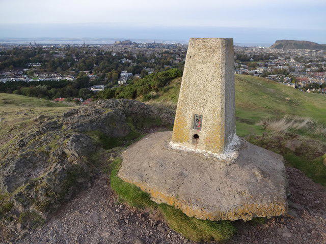 Photo could not load
NT2570 : Blackford hill
Brian Robertson
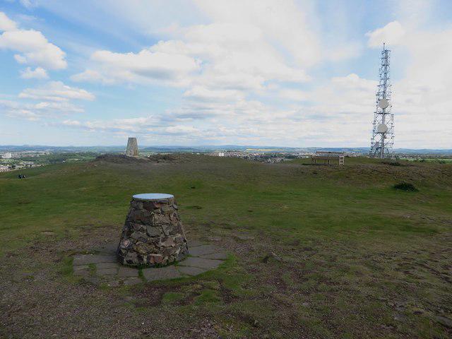 Photo could not load
NT2570 : The summit of Blackford Hill
Graham Robson
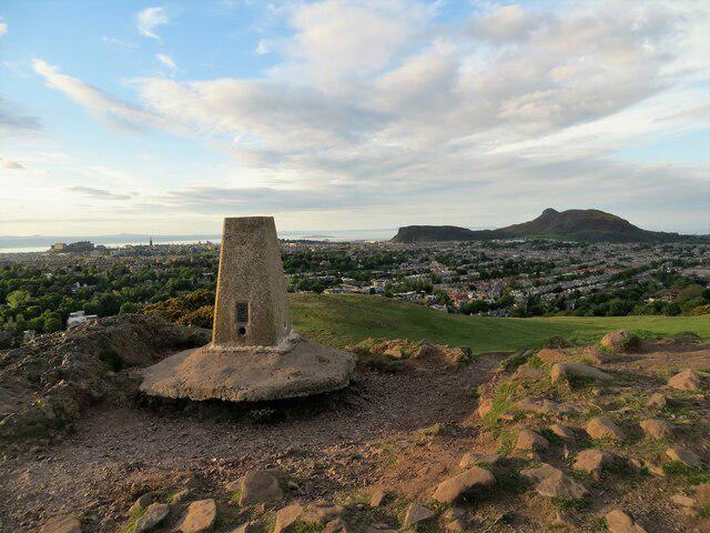 Photo could not load
NT2570 : Trig pillar on Blackford Hill
John Ferguson
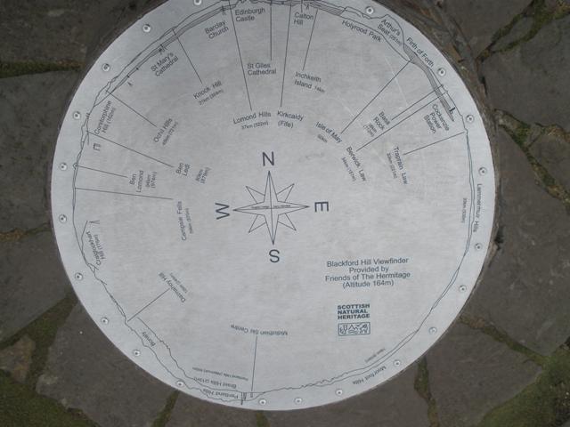 Photo could not load
NT2570 : Viewfinder, Blackford Hill
Derek Tootill
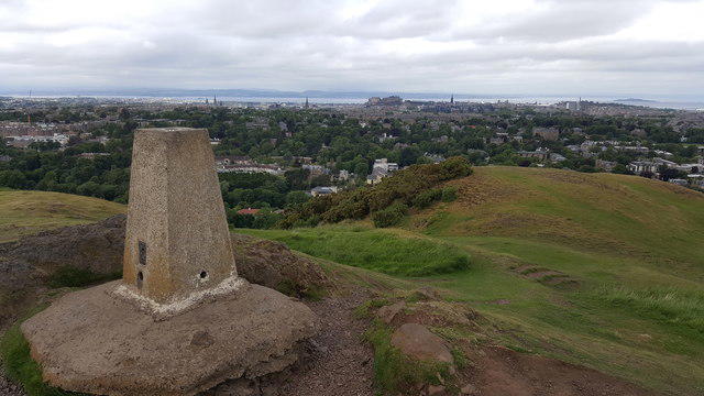 Photo could not load
NT2570 : Blackford Hill triangulation pillar
Clive Nicholson
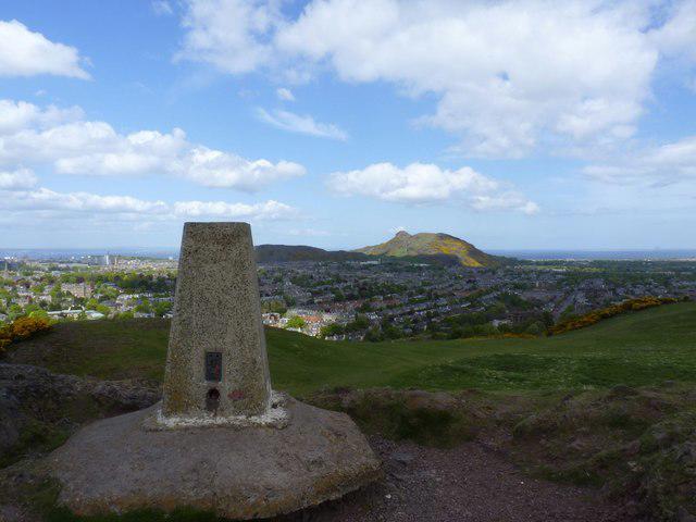 Photo could not load
NT2570 : Trigpoint, Blackford Hill, Edinburgh
Becky Williamson
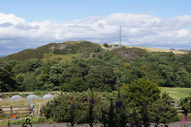 Photo could not load
NT2570 : Blackford Hill from the Braid Hills path
Mike Pennington
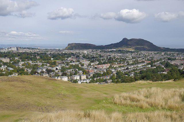 Photo could not load
NT2570 : On Blackford Hill
Richard Webb
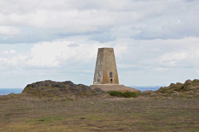
NT2570 : The Trig point
Anthony O'Neil
Hill facts and local notes
Classifications
Elevation
164m
538 ft
Prominence
63m
Coordinates
55.9230, -3.1946
NT254706
OS Map
66
Explorer: 350
At the Summit
The natural high point is a rock 6 m south-east of the trig point, with a view indicator nearby. Remains of a prehistoric fort and settlement occupy the summit area.
Terrain & Geology
Blackford Hill is formed from andesite lava erupted around 410 million years ago during Devonian volcanism. Later glaciation shaped the hill, while meltwater cut the Hermitage of Braid gorge.
Views & Scenery
From the summit, one can enjoy sweeping views of Edinburgh, the Firth of Forth, and the iconic Arthur's Seat.
History & Heritage
Historical Significance
The later prehistoric fort and settlement on Blackford Hill are protected as scheduled monument SM5818. Blackford Hill was purchased for the city in 1884. At Agassiz Rock, Louis Agassiz recognised evidence of glacial erosion in 1840.
Getting There & Facilities
Parking
Limited parking is available near the Royal Observatory at the top of Observatory Road. The Braid Road approach has limited on-road parking. Check signs and restrictions; public transport is a useful alternative.
Public Transport
Use Lothian Buses' current journey planner for Comiston Road near Braidburn Terrace (Braid Road entrance), or Blackford Avenue/West Mains Road (eastern approaches). Allow for the uphill walk from the road. Check current stops and diversions before travelling.
Nearby Facilities
The council lists toilets at the Stables beside Hermitage House, normally open 09:00–16:00 daily except 25–26 December and 1–2 January. Check visitor-centre opening before relying on it. The Royal Observatory admits the public for advertised events; its buildings are not general hill-walking facilities.
Safety Information
Known Hazards
- The Walkhighlands circuit includes a narrow path above the allotments with a steep, unprotected drop.
- Keep clear of crag edges; Blackford Pond and the Braid Burn are water hazards.
- Muddy paths and steep, rough sections require care. Supervise children near drops and water.
Seasonal Hazards
Rain can make grass, rock and mud slippery. Snow or ice increases the risk of slipping, and exposed upper paths need extra care in strong wind. Allow enough daylight for the return.
General Safety Tips
- Check weather conditions before setting out
- Carry appropriate clothing and equipment
- Let someone know your planned route
- Take a map, compass, and GPS device
- Carry emergency supplies: food, water, first aid kit, torch
Hills
Some common questions about the hills answered
Are there group walks up Blackford Hill?
Many walkers use Walkmates to join or organise walks with others. You can check for group walks around Blackford Hill through the maps
Are there other walkers around Blackford Hill?
Activity varies by location and time, but Walkmates lets you see whether others have shared walks or shown interest in this area. Find other people through the walking friends search walking friends for Blackford Hill search or of course create your own walk for Blackford Hill
Can I organise a walk to Blackford Hill?
Yes. If there aren’t any walks listed already, you can create a walk and make it available for others to join.
If you're signed up to Walkmates, you can create a walk to Blackford Hill.
How do I find a walk up this hill?
There are often multiple ways to walk this hill, depending on experience and route preference. Walkmates helps you explore walks and routes that others have shared.
Can I suggest a new route up Blackford Hill?
Yes. You can suggest or create routes to share with others. Walkmates focuses on the social side of walking, so routes are used to help people organise walks and explore areas together, rather than as detailed navigation tools or route libraries.
Other uses really appreciate knowledgeable walkers sharing their routes. Share your favourite route to Blackford Hill here
The is an error or something incorrect about this hill. How do I let you know?
We always strive to keep the information on Walkmates as accurate as possible. If you find an error, please let us know through the contact form and we'll aim to correct it as quickly as possible
Community Discussion
Comments
Location
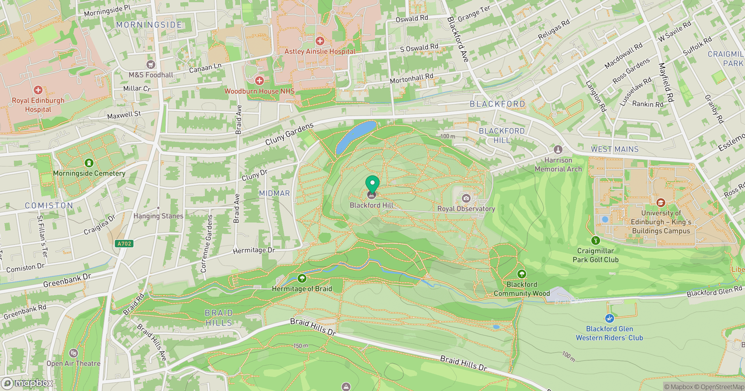
Grid reference: NT254706
View on OpenStreetMapOpens a map in a new tab, centred on the hill.


No comments yet. Be the first.