

Black Combe South Top
Good walks are even better shared.
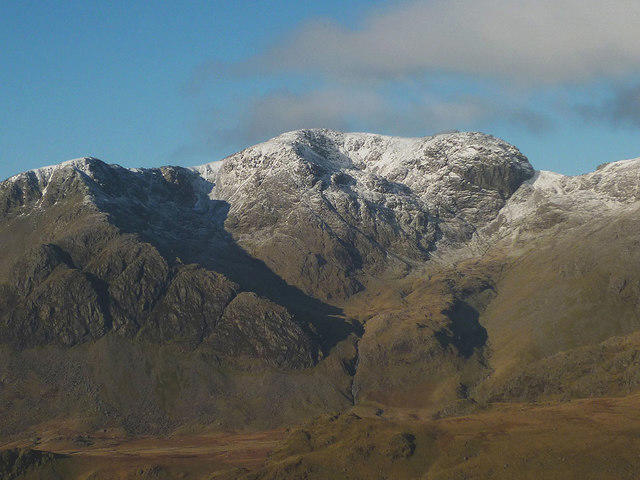
SD1385 : Black Combe, South Top
Michael Graham Photo source
Overview
Black Combe South Top: A Hiker's Haven
Black Combe South Top is a delightful destination for both the novice hiker and the seasoned mountain-goer. Standing tall at 703 meters, it proudly holds the title of a Marilyn, beckoning adventurers from far and wide to bask in its beauty.
Geology
Nestled within the breathtaking Lake District, Black Combe South Top is primarily composed of layers of sedimentary rock—shale and sandstone—formed through a series of geological processes that have taken eons. These geological features give the mountain its distinct character, and it's a fantastic location for geology enthusiasts to explore the ancient history of our planet.
Routes
Whether you're looking for a brisk stroll or an extended hike, there’s a route for everyone:
- Black Combe Main Path: This well-signposted trail begins in Kirksanton and is the most popular path to the summit. The 6.5 km trek to the top usually takes about 2.5 hours, making it a moderate effort with rewarding views.
- Old Road Route: For those seeking a bit more solitude, this 8.0 km trail is your ticket. Expect to take about 3.5 hours to reach the summit, but beware—this route is more demanding!
Summit Features
Upon reaching the summit, hikers are greeted by a stone cairn and a trig point. You’ll want to capture the moment with a photo, as the sense of achievement you feel is nothing short of exhilarating!
Terrain
The terrain is predominantly grassy interspersed with rocky outcrops. The approach to the summit can become boggy, especially after rainfall, so sturdy footwear is a must. After all, nobody wants to lose a boot to a sneaky bog!
Views
The views from Black Combe South Top are nothing short of spectacular. On a clear day, you’ll see the Isle of Man to the west, along with the Duddon Estuary, Southern, and Northern Fells. Spring and autumn are particularly glorious times to climb, offering vibrant colours and dramatic atmospheres.
Hazards
Be cautious of sudden weather changes that can sweep in like a ninja! Also, footing can be slippery in wet conditions, so tread carefully. Low visibility can occur due to fog, turning your hike into an unexpected adventure—just remember to keep it on the safe side.
Access
Getting to Black Combe South Top is straightforward:
- Nearest Parking: Roadside parking can be found in Kirksanton, right near the foothills.
- Public Transport: A regular bus service connects Millom and nearby towns to Kirksanton, ensuring you don’t need to hoof it all the way from home!
- Nearest Town: Millom is the closest town with amenities and is a great place to grab a post-hike bite.
Facilities
While there are no facilities on the mountain, Millom has several charming cafés and pubs to savor a well-deserved meal.
History
Etymologically, 'Combe' comes from the Old Norse word for 'valley', tying this peak back to its historical roots. Black Combe was once of significant strategic importance as a lookout point for coastal movements, adding a touch of historical intrigue to your hike.
To conclude, Black Combe South Top is not just a hike; it’s an experience. Whether you're there for the views, the geology, or just a bit of fresh air, you're in for a treat.
Get your boots on and start your adventure today!
Explore routes near Black Combe South Top
Walks starting near this hill. Open a route to check its map, distance and full itinerary.
Coniston to Tarn Hows: Monk Coniston Gardens and Woodland Circuit
View route
Great Carrs Halifax Wreckage from Wrynose Pass
View route
Scafell Pike via Brown Tongue and Hollow Stones
View route
Tarn Hows Fast Route
View route
Route planning notes
These notes describe possible approaches. Check a route's map and access information when planning your walk.
Black Combe Main Path
A well-defined path from the village of Kirksanton that offers stunning views throughout the ascent, this route is popular among walkers looking for a moderate trek.
Old Road Route
A slightly longer and less trodden route that offers a more tranquil hiking experience, starting from the southern end of the mountain. Perfect for those who enjoy a bit of solitude.
Make a day of it, together
Find someone to share the walk with, or organise a day out along a route you like.
Photo Gallery
View all Photo could not load
SD1385 : Black Combe, South Top
Michael Graham
 Photo could not load
SD1385 : Cairn, Black Combe
Michael Graham
 Photo could not load
SD1385 : Tarn, Black Combe
Michael Graham
 Photo could not load
SD1385 : Black Combe Summit
Mick Garratt
Hill facts and local notes
Classifications
Elevation
588m
1,929 ft
Prominence
8m
Coordinates
54.2549, -3.3283
SD135851
OS Map
96
Explorer: OL6S
At the Summit
The summit boasts a prominent stone cairn and offers a trig point, perfect for those wanting to make their friends envious with a summit selfie. The feeling of achievement here is almost palpable.
Terrain & Geology
Black Combe South Top is part of the Black Combe massif, which is predominantly composed of sedimentary rock including shale and sandstone. The area showcases layers formed over millions of years, offering fascinating insights into geological processes.
Views & Scenery
On a clear day, you can see the Isle of Man to the west, the Duddon Estuary, and the majestic peaks of the Southern and Northern Fells in the distance.
History & Heritage
Name Origin
The name 'Combe' is derived from the Old Norse word for 'valley', indicating the mountainous landscape of the area.
Historical Significance
Black Combe has historical significance as it was once a lookout point for coastal merchants and pirates. In legend, it is said that the mountain was named after a giant who roamed the hills.
Getting There & Facilities
Parking
The nearest parking is located at Kirksanton village, where you can find roadside parking and a small layby.
Public Transport
Regular bus services run from Millom and other nearby towns that will drop you off close to Kirksanton.
Nearby Facilities
There are no facilities directly on the mountain, but you can find several cafés and pubs in the nearby town of Millom and Kirksanton.
Safety Information
Known Hazards
- Potential for sudden weather changes, slippery footing in wet conditions, and low visibility due to fog.
General Safety Tips
- Check weather conditions before setting out
- Carry appropriate clothing and equipment
- Let someone know your planned route
- Take a map, compass, and GPS device
- Carry emergency supplies: food, water, first aid kit, torch
Hills
Some common questions about the hills answered
Are there group walks up Black Combe South Top?
Many walkers use Walkmates to join or organise walks with others. You can check for group walks around Black Combe South Top through the maps
Are there other walkers around Black Combe South Top?
Activity varies by location and time, but Walkmates lets you see whether others have shared walks or shown interest in this area. Find other people through the walking friends search walking friends for Black Combe South Top search or of course create your own walk for Black Combe South Top
Can I organise a walk to Black Combe South Top?
Yes. If there aren’t any walks listed already, you can create a walk and make it available for others to join.
If you're signed up to Walkmates, you can create a walk to Black Combe South Top.
How do I find a walk up this hill?
There are often multiple ways to walk this hill, depending on experience and route preference. Walkmates helps you explore walks and routes that others have shared.
Can I suggest a new route up Black Combe South Top?
Yes. You can suggest or create routes to share with others. Walkmates focuses on the social side of walking, so routes are used to help people organise walks and explore areas together, rather than as detailed navigation tools or route libraries.
Other uses really appreciate knowledgeable walkers sharing their routes. Share your favourite route to Black Combe South Top here
The is an error or something incorrect about this hill. How do I let you know?
We always strive to keep the information on Walkmates as accurate as possible. If you find an error, please let us know through the contact form and we'll aim to correct it as quickly as possible
Community Discussion
Comments
Location
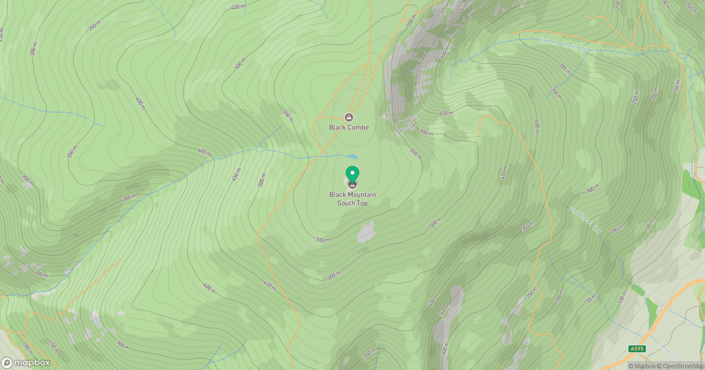
Grid reference: SD135851
View on OpenStreetMapOpens a map in a new tab, centred on the hill.
No comments yet. Be the first.