

Beeston Castle
Good walks are even better shared.
Overview
Beeston Castle: A Hiker's Delight
Introduction
Nestled in the picturesque Cheshire countryside, Beeston Castle stands proudly atop a sandstone crag, offering visitors both a glimpse into the past and stunning views of the surrounding landscape.
Geology
The crag upon which Beeston Castle is built is a marvel of geological history, primarily composed of Triassic sandstone. The unique sedimentary formations are not only fascinating to geologists but also provide a sturdy foundation for the castle's impressive ruins.
Access
Beeston Castle is easily accessible for all, with a well-maintained car park located just a stone's throw from the castle gates. If you prefer public transport, hop on a train to Tarporley or Crewe, and then catch a local bus to complete your journey. The nearest town, Tarporley, is worth a visit for its charming streets and cafés.
Routes
The easiest route to the summit is the Castle Park Trail—a delightful 2.5 km walk that takes about an hour to complete. It's an easy trek for families and those looking to enjoy a leisurely stroll with a bit of history thrown in. So, lace up your walking shoes and let’s explore!
Summit Features
Once at the summit, be prepared to be transported back in time as you explore the well-preserved ruins of Beeston Castle. The panoramic views from the castle walls will make the short hike entirely worth it. Don’t forget to capture the moment with a photo or two—just remember to keep your feet steady on the uneven stone!
Views
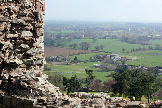
On a clear day, expect breathtaking sights of the Cheshire Plain and the distant Welsh hills. Spring and autumn are particularly stunning, with vibrant colours adding to the natural beauty.
Hazards
While the trails are generally safe, it's wise to keep your wits about you on the uneven stones and watch out for any slippery patches. Please don’t try to take a selfie while doing an acrobatic pose—it might not end well!
Nearby Summits
If you’re feeling adventurous, nearby Delamere Forest is just a short drive away and offers additional trails for exploration.
Conclusion
Beeston Castle is more than just a hill with ruins; it’s a step back in time combined with an opportunity to enjoy the great outdoors. So pack a picnic, bring your loved ones, and enjoy everything this remarkable location has to offer!
Last Updated
2023-10-11
Explore routes near Beeston Castle
Walks starting near this hill. Open a route to check its map, distance and full itinerary.
Waverton to Chester Shot Tower: Shropshire Union Canal Return
View route
Delamere Forest: Blakemere Moss woodland circuit
View route
Nantwich Walk with Men Walking & Talking
View route
Chester Walk with Men Walking & Talking
View route
Route planning notes
These notes describe possible approaches. Check a route's map and access information when planning your walk.
Beeston Castle Circular Walk
This popular circular route begins at Beeston Castle's main car park and follows a well-defined path around the hill before ascending to the castle ruins. Along the way, enjoy views of the Cheshire Plain and surrounding countryside. The route includes woodland paths and open fields, making it a varied and enjoyable walk.
Beeston Castle and Peckforton Hills Loop
Starting from Beeston Castle, this route extends to explore the nearby Peckforton Hills. The path takes you through ancient woodlands, past sandstone ridges, and offers panoramic views from higher ground. It combines history and natural beauty for a rewarding half-day hike.
Beeston Castle to Bunbury Walk
This linear route connects Beeston Castle with the picturesque village of Bunbury. The trail follows quiet country lanes, farmland paths, and the Shropshire Union Canal. It’s an ideal choice for walkers seeking a mix of history and rural charm, with opportunities to enjoy a pub meal in Bunbury.
Beeston Castle and Sandstone Trail Segment
This route incorporates a section of the famous Sandstone Trail, starting from Beeston Castle and heading south along the trail. Walkers will traverse sandstone ridges, pass through beautiful woodlands, and enjoy sweeping views of the surrounding countryside. The return route loops back to Beeston.
Beeston Castle Short Woodland Walk
Perfect for families or those with limited time, this short walk begins at Beeston Castle and winds through the surrounding woodland. The trail is easy to follow and offers opportunities to spot wildlife, making it a great option for a leisurely stroll.
Make a day of it, together
Find someone to share the walk with, or organise a day out along a route you like.
Photo Gallery
View all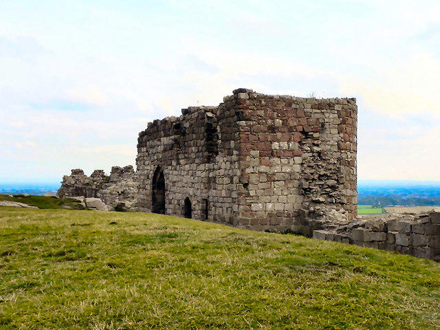 Photo could not load
SJ5359 : Beeston Castle Inner Gatehouse
David Dixon
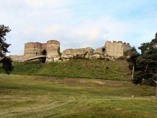 Photo could not load
SJ5359 : Beeston Castle
David Dixon
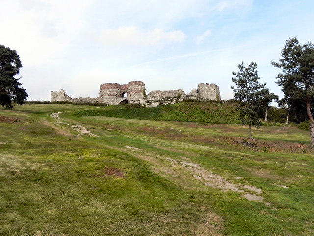 Photo could not load
SJ5359 : Beeston Castle
David Dixon
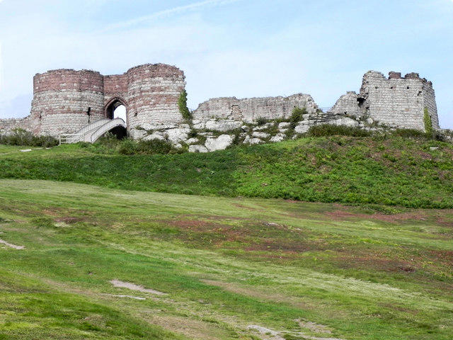 Photo could not load
SJ5359 : Beeston Castle, Inner Gatehouse and Modern Bridge
David Dixon
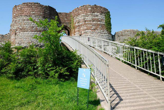 Photo could not load
SJ5359 : One-Way System at Beeston Castle
Jeff Buck
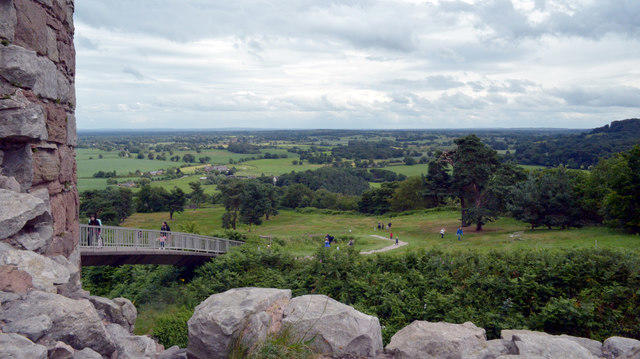 Photo could not load
SJ5359 : Beeston Castle
habiloid
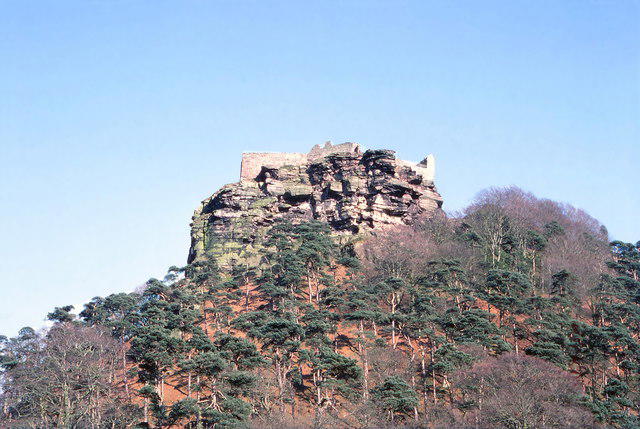 Photo could not load
SJ5359 : Beeston Crag
Jeff Buck
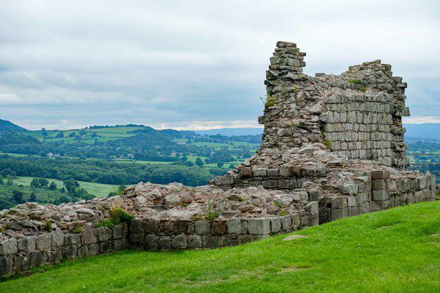 Photo could not load
SJ5359 : The remains of Beeston Castle
Jeff Buck
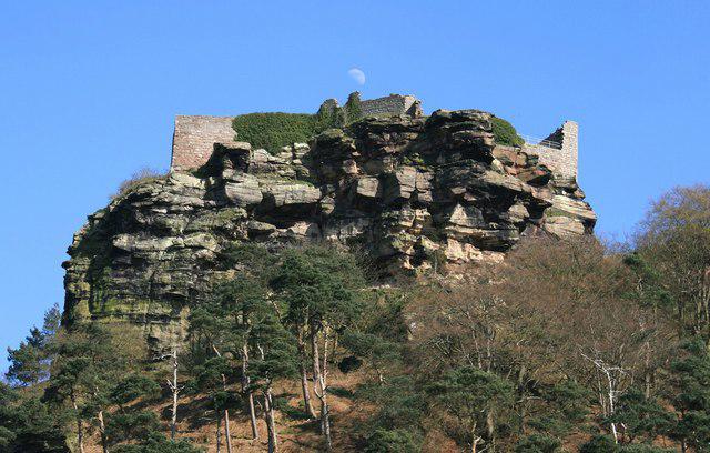 Photo could not load
SJ5359 : Beeston Castle
Jeff Buck
SJ5359 : View from Beeston Castle
Jeff Buck
Hill facts and local notes
Classifications
Elevation
162m
531 ft
Prominence
90m
Coordinates
53.1286, -2.6939
SJ536592
OS Map
117
Explorer: 257W
At the Summit
The summit features well-preserved ruins of Beeston Castle, providing a picturesque spot for a picnic and some impressive photo ops. There's also a small viewing platform for enhanced vistas.
Terrain & Geology
Beeston Castle sits atop a sandstone crag, formed during the Triassic period. The rock displays interesting sedimentary structures and is a great example of the area's geological history.
Views & Scenery
Spectacular views of the Cheshire Plain and the Welsh hills on a clear day.
History & Heritage
Name Origin
The name Beeston is thought to derive from the Old English 'bēos' (bent grass or rush) and 'tun' (enclosure or farm).
Historical Significance
Beeston Castle has a rich history dating back to the 1220s and has been a significant military site throughout the centuries.
Getting There & Facilities
Parking
Beeston Castle car park is a short walk from the castle entrance and accommodates several vehicles. A small fee may apply.
Public Transport
The nearest train stations are in Tarporley or Crewe. Bus services also run from these areas to near the castle.
Nearby Facilities
There is a visitor centre with information about the castle's history, a café offering light refreshments, and toilet facilities adjacent to the car park.
Safety Information
Known Hazards
- Uneven terrain near the castle; watch your step! The weather can change quickly, so dress appropriately.
General Safety Tips
- Check weather conditions before setting out
- Carry appropriate clothing and equipment
- Let someone know your planned route
- Take a map, compass, and GPS device
- Carry emergency supplies: food, water, first aid kit, torch
Hills
Some common questions about the hills answered
Are there group walks up Beeston Castle?
Many walkers use Walkmates to join or organise walks with others. You can check for group walks around Beeston Castle through the maps
Are there other walkers around Beeston Castle?
Activity varies by location and time, but Walkmates lets you see whether others have shared walks or shown interest in this area. Find other people through the walking friends search walking friends for Beeston Castle search or of course create your own walk for Beeston Castle
Can I organise a walk to Beeston Castle?
Yes. If there aren’t any walks listed already, you can create a walk and make it available for others to join.
If you're signed up to Walkmates, you can create a walk to Beeston Castle.
How do I find a walk up this hill?
There are often multiple ways to walk this hill, depending on experience and route preference. Walkmates helps you explore walks and routes that others have shared.
Can I suggest a new route up Beeston Castle?
Yes. You can suggest or create routes to share with others. Walkmates focuses on the social side of walking, so routes are used to help people organise walks and explore areas together, rather than as detailed navigation tools or route libraries.
Other uses really appreciate knowledgeable walkers sharing their routes. Share your favourite route to Beeston Castle here
The is an error or something incorrect about this hill. How do I let you know?
We always strive to keep the information on Walkmates as accurate as possible. If you find an error, please let us know through the contact form and we'll aim to correct it as quickly as possible
Community Discussion
Comments
Location
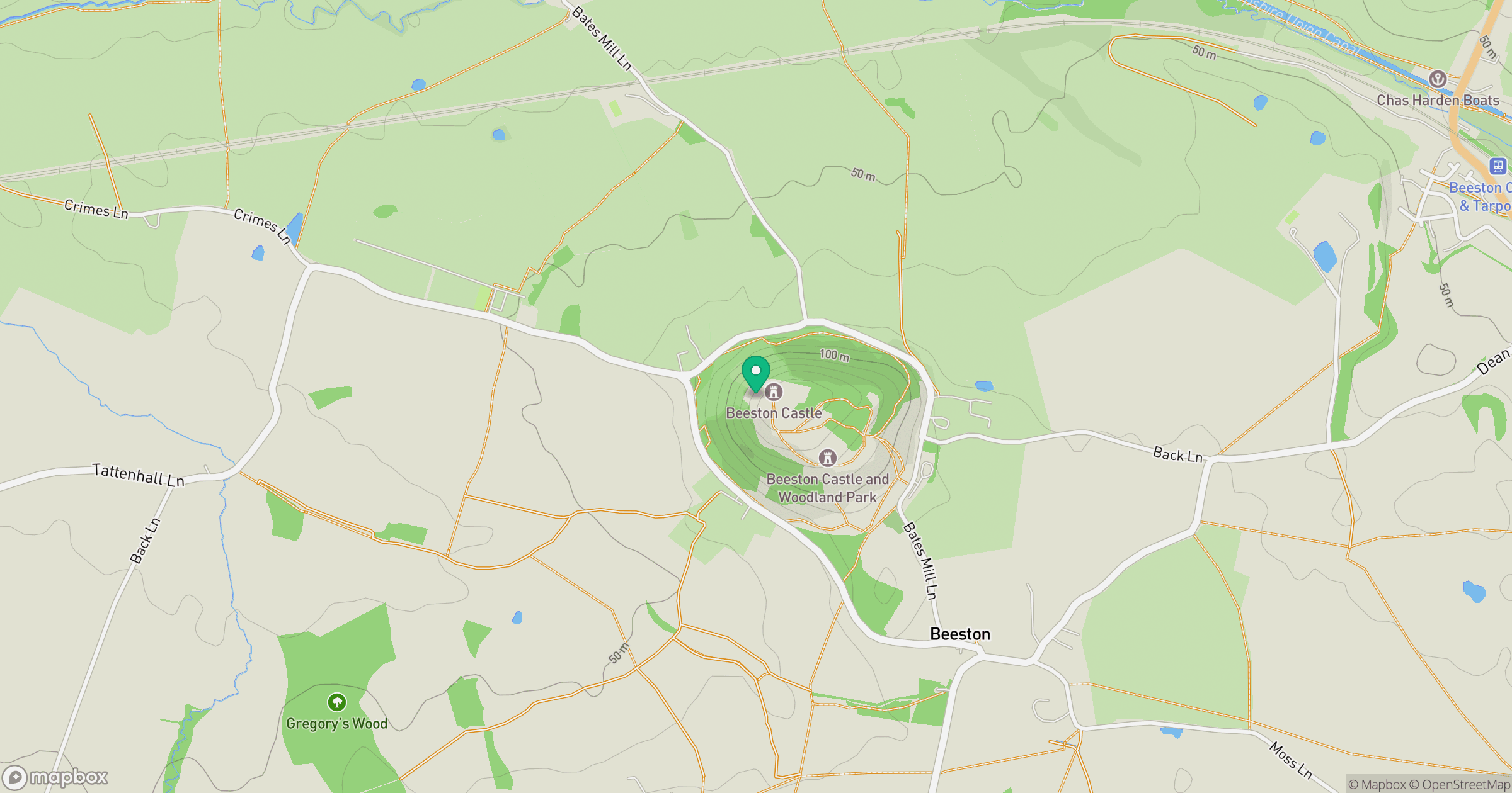
Grid reference: SJ536592
View on OpenStreetMapOpens a map in a new tab, centred on the hill.

No comments yet. Be the first.