
![NY3904 : A walk over Wansfell Pike [25]](/media/gallery/480/a681cac1471a4b1b9e3cd6b2352971f0.jpg)
Wansfell Pike
Good walks are even better shared.
NY3904 : A walk over Wansfell Pike [25]
Michael Dibb Photo source
Overview
Wansfell Pike is the rocky 484.3 m top above Ambleside, with views over Windermere and the surrounding Lakeland fells. Its steep pitched approach can be combined with a return through Troutbeck and Skelghyll Wood. The higher Wansfell summit, Baystones, is a separate 486.9 m top to the northeast.
Wansfell Pike: A Hiker's Gem in the Lake District
Wansfell Pike rises above Ambleside to 484.3 m. Its summit is the rock outcrop 6 m south of the fence at NY 39416 04169, identified by the Database of British and Irish Hills. The outcrop farther from the fence is not the highest point. There is no summit trig pillar.
The Pike is a Birkett and Synge. Baystones, northeast along the ridge, is the separate 486.9 m Wainwright summit of Wansfell. The nearby Wansfell North Top is another distinct hill, at 486.1 m. The Pike is therefore not the highest point of the whole fell.
Walking routes
Ambleside, Pike, Troutbeck and Skelghyll Wood
Cumbria Tourism's circuit starts and finishes in Ambleside (NY376045): 10.2 km, 600 m height gain and 4–5 hours. Climb Stockghyll Lane and the pitched path to the Pike, descend by Nanny Lane to Troutbeck, then return through Robin Lane, High Skelghyll and Skelghyll Wood to Old Lake Road and Ambleside. Retracing the ascent is another option, but these circuit figures do not describe it.
Troutbeck, Pike and Baystones
The National Trust's church-start loop is 10.08 km and 3–5 hours, graded challenging. From Jesus Church (NY412027), it goes by Townend and Hundreds Road to the Pike, follows the ridge to Baystones, then descends south to Troutbeck and returns to the church.
Ambleside circuit including Baystones
Walking Britain's longer itinerary is 12.2 km with 545 m ascent and a stated 5 hours 10 minutes. It adds Baystones after the Pike and returns to Ambleside through Nanny Lane, Troutbeck, Robin Lane and Skelghyll Wood. These figures belong to that whole itinerary. Older summit heights in the route guide differ from the surveyed catalogue values above.
Terrain and views
Expect a sustained steep climb on pitched stone steps, summit rocks, open fell paths, muddy patches and rough bridleways. WalkLakes describes clear-weather views towards the Coniston fells, Langdale Pikes, Fairfield Horseshoe and Red Screes. Windermere lies to the south. Its own waterfall-and-woodland circuit has different figures: 10.7 km, 576 m ascent and a minimum time of 3 hours 6 minutes. That minimum is not a promise of an ordinary walking duration.
Parking, transport and facilities
Rydal Road car park provides paid parking in Ambleside. The council lists 24-hour access, with charging from 08:00 to 20:00. Troutbeck parking is limited; keep gateways and roads clear.
Stagecoach lists 555 and 599 links from Windermere to Ambleside. The published 508 timetable includes Troutbeck Church; check running dates and the last return before relying on it. The 555 and 599 stop at Troutbeck Bridge, about 2.2 km from the church start, so that approach is extra walking.
The National Park's toilet list includes Rydal Road and Stock Ghyll Lane/Clock Tower in Ambleside. Check opening times. Troutbeck has a tearoom and pubs; their opening hours vary.
Safety and access
The short climb is still steep and rough. Wet stone can be slippery, especially on descent; mist makes navigation harder. Carry a map, compass, waterproofs and warm clothing. Keep dogs on leads on the National Trust circuit, where sheep and cattle graze.
No Wansfell-specific closure was found in the National Park's current orders or known path issues checked on 16 October 2026. This is not a guarantee of access: recheck notices and follow signs on the ground.
Geology and local history
The BGS Ambleside memoir, first published in 2000, records rhyodacitic intrusions close to the Pike at NY393040. These intruded the Seathwaite Fell Formation and deformed overlying Lincomb Tarns rocks. This describes the local geology, rather than assigning a single rock type to the exact summit outcrop.
Stock Ghyll, on the Ambleside approach, once supplied power to bobbin mills serving the Lancashire cotton trade. The hill also has an established fell race organised by Ambleside AC, climbing from Stock Ghyll Lane to the rocky summit. Race statistics and race descent lines are not walking-route guidance.
Explore routes near Wansfell Pike
Walks starting near this hill. Open a route to check its map, distance and full itinerary.
Tarn Hows Fast Route
View route
Coniston to Tarn Hows: Monk Coniston Gardens and Woodland Circuit
View route
Bow Fell from Langdale
View route
Great Carrs Halifax Wreckage from Wrynose Pass
View route
Route planning notes
These notes describe possible approaches. Check a route's map and access information when planning your walk.
Wansfell Pike, Troutbeck and Skelghyll circuit
Start in Ambleside (NY376045). Climb Stockghyll Lane and the steep pitched path to Wansfell Pike. Descend east to Nanny Lane and Troutbeck, then return by Robin Lane, High Skelghyll, Skelghyll Wood and Old Lake Road to Ambleside. Cumbria Tourism gives 10.2 km, 600 m height gain and 4–5 hours for this complete circuit; these are not summit-only return figures.
Troutbeck circuit over Wansfell Pike and Baystones
From Jesus Church, Troutbeck (NY412027), walk via Green Gate, Townend, Fell Lane and Hundreds Road to Wansfell Pike. Continue northeast by the ridge wall to Baystones, descend south to Troutbeck and return through lanes and footpaths to the church. The National Trust gives 10.08 km and 3–5 hours for this complete challenging loop. Dogs must be on leads around the grazing livestock.
Ambleside circuit over Wansfell Pike and Baystones
From central Ambleside (NY375045), use Stockghyll Lane or the waterfall path, then the pitched ascent to Wansfell Pike. Follow the ridge wall northeast to Baystones. Descend southeast to Nanny Lane, walk through Troutbeck, and return via Robin Lane, High Skelghyll and the main track through Skelghyll Wood to Ambleside. Walking Britain gives 12.2 km, 545 m ascent and 5 hours 10 minutes for this full circuit.
Make a day of it, together
Find someone to share the walk with, or organise a day out along a route you like.
Photo Gallery
View all![NY3904 : A walk over Wansfell Pike [25]](https://cdn.walkmates.com/gallery-images/a681cac1471a4b1b9e3cd6b2352971f0.jpg) Photo could not load
Photo could not load
NY3904 : A walk over Wansfell Pike [25]
Michael Dibb
![NY3904 : A walk over Wansfell Pike [27]](https://cdn.walkmates.com/gallery-images/406440e242234873abd352b74c5990b9.jpg) Photo could not load
Photo could not load
NY3904 : A walk over Wansfell Pike [27]
Michael Dibb
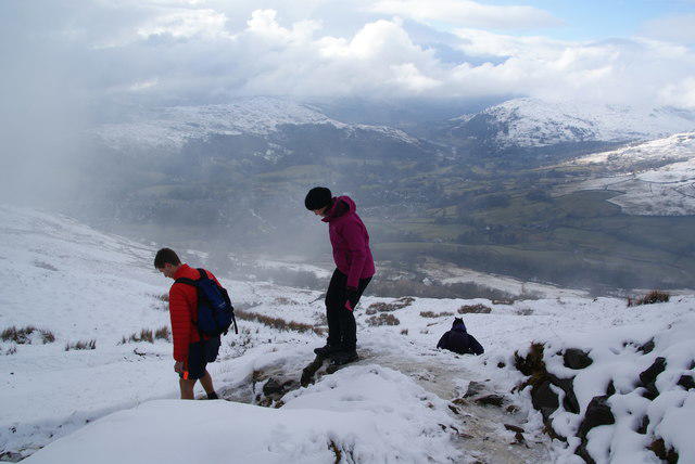 Photo could not load
NY3904 : Beginning the descent of Wansfell Pike
Bill Boaden
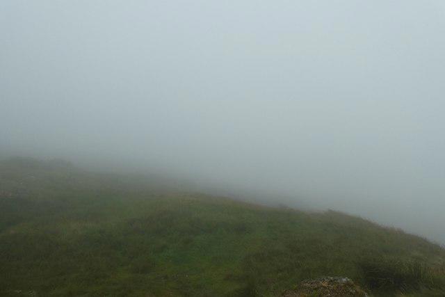 Photo could not load
NY3904 : Low cloud on Wansfell
DS Pugh
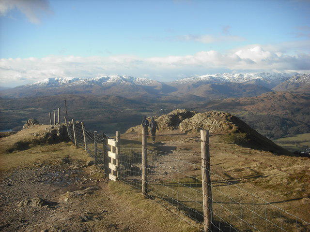 Photo could not load
NY3904 : On Wansfell Pike
Michael Graham
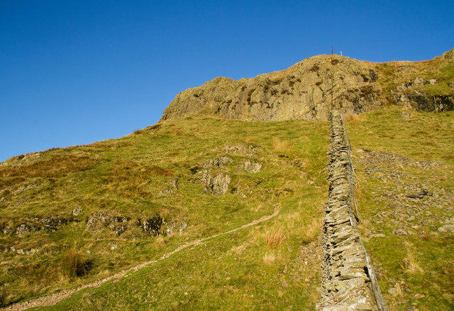 Photo could not load
NY3904 : Summit of Wansfell Pike
Chris Denny
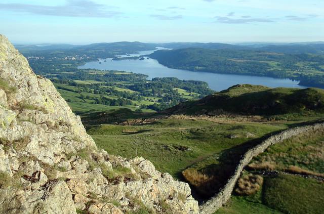 Photo could not load
NY3904 : Looking south from Wansfell Pike
David Pickersgill
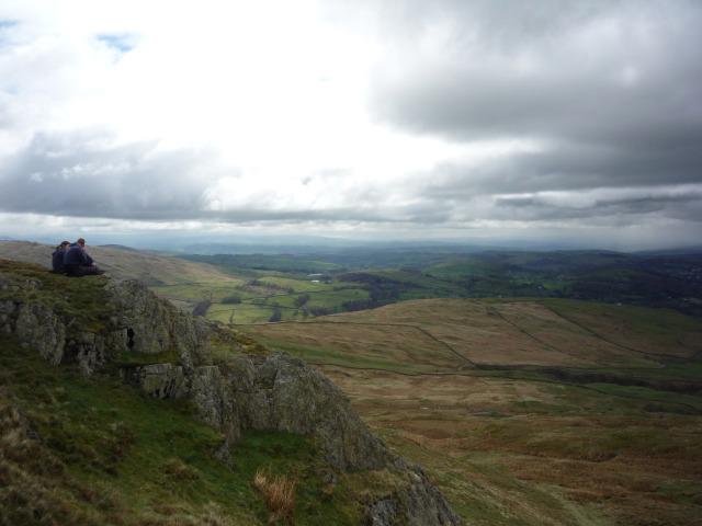 Photo could not load
NY3904 : Admiring the view
DS Pugh
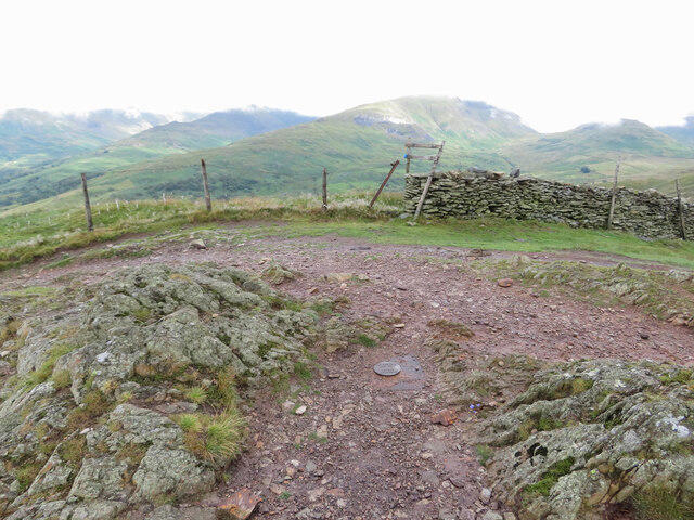 Photo could not load
NY3904 : Buried-block trig point on Wansfell Pike
Gareth James
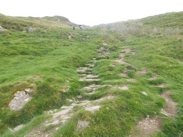
NY3904 : Steep path up Wansfell Pike
Peter S
Hill facts and local notes
Classifications
Elevation
484m
1,589 ft
Prominence
31m
Coordinates
54.4293, -2.9354
NY394041
OS Map
90
Explorer: OL7N
At the Summit
Rock outcrop 6 m south of the fence at NY 39416 04169, not the outcrop farther from the fence. DoBIH gives 484.3 m. There is no summit trig pillar; Baystones is a separate higher summit.
Terrain & Geology
BGS records rhyodacitic intrusions close to Wansfell Pike at NY393040, within the Seathwaite Fell Formation. Their emplacement deformed the overlying Lincomb Tarns Formation. This is local geological context, not an exact summit-outcrop identification.
Views & Scenery
In clear weather, Windermere and Ambleside, the Coniston fells, Langdale Pikes, Fairfield Horseshoe and Red Screes.
History & Heritage
Historical Significance
Stock Ghyll on the Ambleside approach once powered bobbin mills serving the Lancashire cotton trade. Wansfell also has an established fell race organised by Ambleside AC, climbing from Stock Ghyll Lane to the rocky summit.
Getting There & Facilities
Parking
Rydal Road car park in Ambleside is a paid town-centre option. The council lists it as open all day, with charges from 08:00 to 20:00. The Troutbeck church-start circuit has limited layby and off-road parking; a space is not guaranteed. Keep lanes and farm entrances clear.
Public Transport
Stagecoach 555 and 599 connect Windermere with Ambleside. Its published 508 timetable includes Troutbeck Church; verify operating dates and the last return. The 555/599 stop at Troutbeck Bridge, about 2.2 km from the church-start circuit, so allow extra walking. Check current operator information before travel.
Nearby Facilities
Public toilets are listed at Rydal Road and Stock Ghyll Lane/Clock Tower in Ambleside; check opening times. Troutbeck has the Old Post Office Tearoom and village pubs. Bring water and food for the fell rather than relying on refreshments being open.
Safety Information
Known Hazards
- The Ambleside ascent is steep and rough; wet stone steps and summit rocks can be slippery, particularly on descent.
- The open fell is exposed to changing weather and mist; carry suitable clothing and navigation equipment.
- The National Trust asks for dogs on leads on its Troutbeck circuit because sheep and cattle graze the land.
- Lanes carry vehicles and woodland bridleways may have cyclists. Check current National Park path notices and follow on-site restrictions.
General Safety Tips
- Check weather conditions before setting out
- Carry appropriate clothing and equipment
- Let someone know your planned route
- Take a map, compass, and GPS device
- Carry emergency supplies: food, water, first aid kit, torch
Hills
Some common questions about the hills answered
Are there group walks up Wansfell Pike?
Many walkers use Walkmates to join or organise walks with others. You can check for group walks around Wansfell Pike through the maps
Are there other walkers around Wansfell Pike?
Activity varies by location and time, but Walkmates lets you see whether others have shared walks or shown interest in this area. Find other people through the walking friends search walking friends for Wansfell Pike search or of course create your own walk for Wansfell Pike
Can I organise a walk to Wansfell Pike?
Yes. If there aren’t any walks listed already, you can create a walk and make it available for others to join.
If you're signed up to Walkmates, you can create a walk to Wansfell Pike.
How do I find a walk up this hill?
There are often multiple ways to walk this hill, depending on experience and route preference. Walkmates helps you explore walks and routes that others have shared.
Can I suggest a new route up Wansfell Pike?
Yes. You can suggest or create routes to share with others. Walkmates focuses on the social side of walking, so routes are used to help people organise walks and explore areas together, rather than as detailed navigation tools or route libraries.
Other uses really appreciate knowledgeable walkers sharing their routes. Share your favourite route to Wansfell Pike here
The is an error or something incorrect about this hill. How do I let you know?
We always strive to keep the information on Walkmates as accurate as possible. If you find an error, please let us know through the contact form and we'll aim to correct it as quickly as possible
Community Discussion
Comments
Location
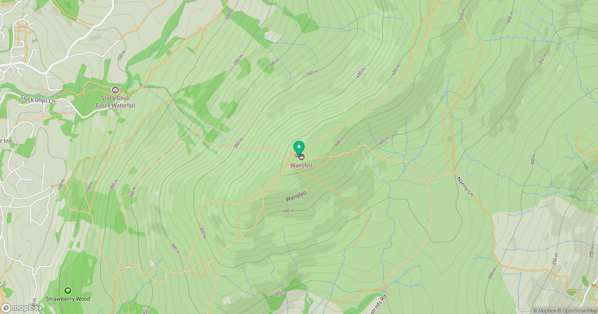
Grid reference: NY394041
View on OpenStreetMapOpens a map in a new tab, centred on the hill.

No comments yet. Be the first.