

Sallows
Good walks are even better shared.
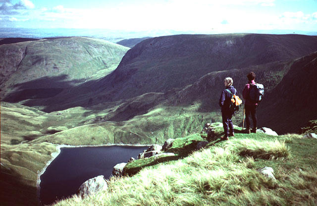
NY4303 : Sallows Summit
Shaun Ferguson Photo source
Overview
Sallows: A Hidden Gem in the Lake District
Nestled in the heart of the stunning Lake District, Sallows might not be as widely known as its towering neighbours, but it offers an exquisite trek with delightful scenery and a feel-good factor!
Geology
Sallows showcases the beauty of sedimentary rocks, primarily sandstone and siltstone, dating back to the Carboniferous period. As you wander through the landscape, you can't help but marvel at how these ancient formations have shaped this picturesque area over millennia.
Routes
There are several routes to explore Sallows:
- Sallows from the Outgate: This route is perfect for most walkers. You’ll start from the quaint village of Outgate, meandering through cozy woods before tackling the ascent to the summit. Pack a picnic, as the views at the top are simply breath-taking.
- Sallows via Tarn Hows: A slightly more challenging route, this circular path leads you around the scenic Tarn Hows. It's a bit of a climb, but the sight of the lake amidst the hills will make your heart sing!
Summit Features
As you reach the summit, be sure to take a moment to appreciate the small stone cairn. It’s a great marker that tells you, yes, you’ve done it, and reminds you to take that triumphant summit selfie!
Terrain Type
Expect grassy slopes peppered with rocky outcrops and colorful heather. It’s a true representation of the rugged beauty of the Lake District.
Views
From the summit, you’ll be treated to stunning vistas. Coniston Water glistens below, and on clear days, you might even spot the Isle of Man. If the views don’t take your breath away, the climb probably will!
Hazards
As with any hike, be wary of loose rocks and steep edges. It's advised to keep your feet—and your wits—about you, especially when it’s wet.
Nearby Summits
If you’re up for it, why not tackle some of the nearby giants? Coniston Old Man and Black Combe are just a stone’s throw away and make for excellent companions to Sallows on your hiking adventures.
Access
You can park your car in Outgate’s modest car park (get there early!). Public transport is also available, with buses running regularly from Ambleside and Coniston.
Facilities
Coniston, located a short drive away, offers amenities such as cafes, pubs, and shops. Perfect for grabbing that well-earned slice of cake and cup of tea!
History
‘Sallows’ translates to ‘willows’, a nod to the trees that once lined the banks of the area. Historically, this region has attracted a multitude of artists and writers, including the beloved Beatrix Potter, who found inspiration amidst these lush landscapes.
So lace up your hiking boots, grab your walking stick, and set off to explore Sallows. It might not be the highest peak, but it sure knows how to charm with its stunning views and rich history. Happy hiking!
Explore routes near Sallows
Walks starting near this hill. Open a route to check its map, distance and full itinerary.
Tarn Hows Fast Route
View route
Coniston to Tarn Hows: Monk Coniston Gardens and Woodland Circuit
View route
Striding Edge, Helvellyn and Catstye Cam
View route
Helvellyn via Striding Edge
View route
Route planning notes
These notes describe possible approaches. Check a route's map and access information when planning your walk.
Sallows from the Outgate
A pleasant circular walk starting from the village of Outgate, meandering through picturesque woodland before ascending to the peak of Sallows, rewarding hikers with stunning panoramic views.
Sallows via Tarn Hows
This route takes you through the scenic Tarn Hows, offering a delightful ascent alongside the water before heading up to the summit of Sallows through more rugged terrain.
Make a day of it, together
Find someone to share the walk with, or organise a day out along a route you like.
Photo Gallery
View all Photo could not load
NY4303 : Sallows Summit
Shaun Ferguson
 Photo could not load
NY4304 : Sallows summit
Graham Robson
 Photo could not load
NY4304 : Sallows summit
David Brown
 Photo could not load
NY4303 : Cairn Sallows
Michael Graham
 Photo could not load
NY4303 : Approaching Sallows summit
Anthony Foster
 Photo could not load
NY4303 : Sallows summit
Anthony Foster
 Photo could not load
NY4303 : Sallows
Michael Graham
 Photo could not load
NY4303 : Sallows
Trevor Littlewood
Hill facts and local notes
Classifications
Elevation
516m
1,693 ft
Prominence
69m
Coordinates
54.4281, -2.8700
NY436039
OS Map
90
Explorer: OL7N
At the Summit
The summit is adorned with a small cairn, making it an excellent spot for a photo op—and perhaps pretend you’ve conquered Everest for a day.
Terrain & Geology
Sallows is predominantly composed of sedimentary rock with sandstone and siltstone making up its structure, creating a landscape that is both resilient and aesthetically pleasing. Its formation dates back to the Carboniferous period, a time when these rock layers were first laid down under ancient seas.
Views & Scenery
On a clear day, you can marvel at views stretching across Coniston Water, the distant peaks of the Langdale Pikes, and even the Isle of Man if you're lucky!
History & Heritage
Name Origin
The name 'Sallows' is thought to originate from the Old English 'Sale', possibly reflecting the old willows that once dotted the area.
Historical Significance
This area has been a popular retreat for writers and artists throughout history, with Beatrix Potter being a notable visitor to the Lake District.
Getting There & Facilities
Parking
There is ample parking at the village of Outgate, with a small car park available. Limited spaces, so arrive early to avoid disappointment!
Public Transport
Buses regularly run from Ambleside and Coniston to Outgate, making it an accessible start point for non-drivers.
Nearby Facilities
The nearest facilities include cafes and small shops in Coniston, where you can grab a well-deserved slice of cake post-hike.
Safety Information
Known Hazards
- Loose rocks and steep drops in certain areas require caution, particularly in wet conditions when trails may become slippery.
General Safety Tips
- Check weather conditions before setting out
- Carry appropriate clothing and equipment
- Let someone know your planned route
- Take a map, compass, and GPS device
- Carry emergency supplies: food, water, first aid kit, torch
Hills
Some common questions about the hills answered
Are there group walks up Sallows?
Many walkers use Walkmates to join or organise walks with others. You can check for group walks around Sallows through the maps
Are there other walkers around Sallows?
Activity varies by location and time, but Walkmates lets you see whether others have shared walks or shown interest in this area. Find other people through the walking friends search walking friends for Sallows search or of course create your own walk for Sallows
Can I organise a walk to Sallows?
Yes. If there aren’t any walks listed already, you can create a walk and make it available for others to join.
If you're signed up to Walkmates, you can create a walk to Sallows.
How do I find a walk up this hill?
There are often multiple ways to walk this hill, depending on experience and route preference. Walkmates helps you explore walks and routes that others have shared.
Can I suggest a new route up Sallows?
Yes. You can suggest or create routes to share with others. Walkmates focuses on the social side of walking, so routes are used to help people organise walks and explore areas together, rather than as detailed navigation tools or route libraries.
Other uses really appreciate knowledgeable walkers sharing their routes. Share your favourite route to Sallows here
The is an error or something incorrect about this hill. How do I let you know?
We always strive to keep the information on Walkmates as accurate as possible. If you find an error, please let us know through the contact form and we'll aim to correct it as quickly as possible
Community Discussion
Comments
Location
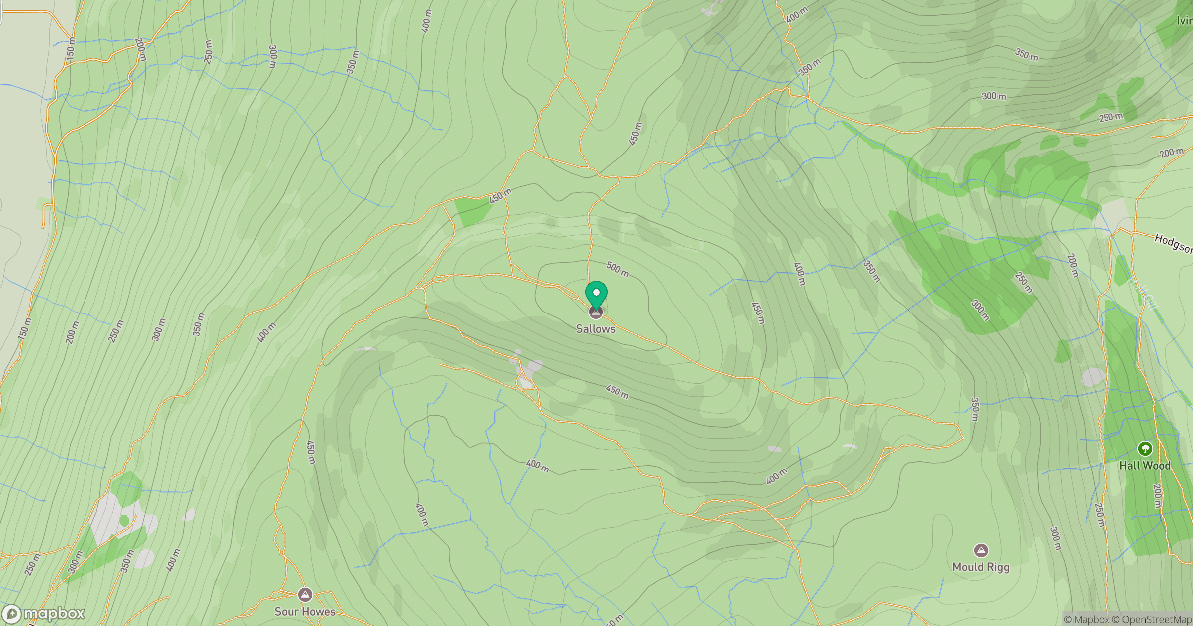
Grid reference: NY436039
View on OpenStreetMapOpens a map in a new tab, centred on the hill.
No comments yet. Be the first.