

Ruadh Stac Mor
Good walks are even better shared.
NH0175 : Ruadh Stac Mor
Hill Walker Photo source
Overview
Ruadh Stac Mor: The Majestic Giant of the Scottish Highlands
Nestled in the heart of the Scottish Highlands, Ruadh Stac Mor offers exhilarating hiking opportunities along with stunning landscapes that will make even the most seasoned hikers stop and take a breath... or perhaps a selfie.
Geology
The mountain’s rugged profile is primarily made of metamorphic rocks like schists and gneisses, showcasing the rich geological history of the region. As you ascend, you might even feel like you are walking on ancient history!
Routes
Two primary routes lead to the summit:
- Coire Mhuillidh Route - This picturesque path covers about 10 km, taking approximately 4.5 hours. It’s moderately challenging and offers scenic views all along.
- North Ridge Route - A challenging 12 km trek that will take around 5.5 hours. Expect some scrambling and technical sections, with views that will make every effort worthwhile.
Summit Features
As you reach the summit, you'll be greeted by a stone cairn that marks the top. The views are like a cherry on top of a well-made sundae. Take your time to soak in the breathtaking scenery, including the striking Loch Srònaich.
Terrain Type
Expect a mix of rocky paths and grassy slopes. Watch your step, especially in the boggy areas that can turn into a mini swamp.
Views
From the summit, enjoy remarkable views of Loch Awe and the surrounding peaks. For the best experience, spring and early summer are prime times, with clearer skies that allow for stunning panoramas.
Hazards
Be prepared for the unpredictable Scottish weather – it can change faster than you can say 'haggis!' The terrain can be slippery, so pack your sturdy boots and perhaps an extra pair of socks, just in case.
Nearby Summits
Nearby peaks like An Teallach and Sgurr Fiona offer additional challenges for those looking for more adventure.
Access
Parking is available at the end of the A832, making it relatively easy to start your adventure. Public transport options are limited, so having a vehicle is the easiest way to reach the trailhead. Garve, the nearest town, is about 20 km away and offers basic amenities.
Facilities
While facilities are limited near the mountain, you can find essential services in Garve, such as a café (for that post-hike treat) and public toilets.
History
Ruadh Stac Mor, which translates to 'big red stack' in Gaelic, reflects the mountain’s distinctive colour. It holds a significant place in local tales and climbing culture, making it a must-visit for those enchanted by the Scottish wilderness.
So pack your essentials, lace up those hiking boots, and set off to explore the magnificent Ruadh Stac Mor. It’s a journey that promises both challenge and beauty.
Explore routes near Ruadh Stac Mor
Walks starting near this hill. Open a route to check its map, distance and full itinerary.
Beinn Eighe Lancaster Wreckage at Coire Mhic Fhearchair
View route
Fairy Lochs Liberator Wreckage Circuit
View route
Glen Affric: Coire Loch Woodland Trail
View route
Loch Migdale from Torroy: Spinningdale pinewood and loch shore walk
View route
Route planning notes
These notes describe possible approaches. Check a route's map and access information when planning your walk.
Coire Mhuillidh Route
A scenic route through lush glens leading up to the summit, with stunning views along the way.
North Ridge Route
A more challenging option that involves some scrambling, but rewards hikers with breathtaking panoramas.
Make a day of it, together
Find someone to share the walk with, or organise a day out along a route you like.
Photo Gallery
View all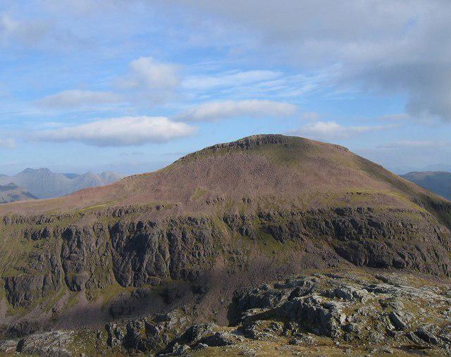 Photo could not load
NH0175 : Ruadh Stac Mor
Hill Walker
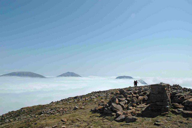 Photo could not load
NH0175 : Summit of Ruadh Stac Mor
charlie kennedy
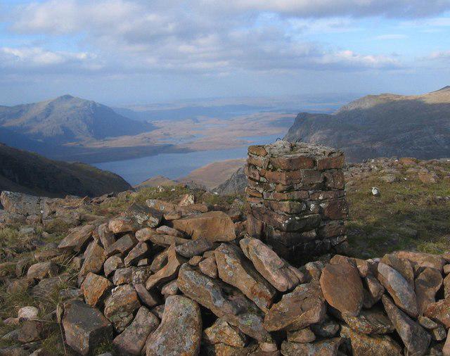 Photo could not load
NH0175 : Summit Cairn, Ruadh Stac Mor
Hill Walker
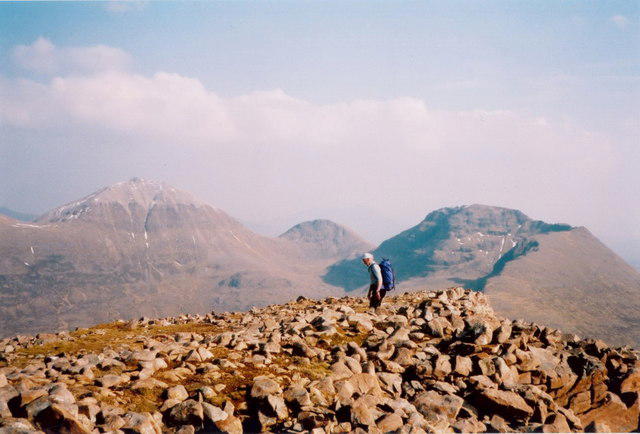 Photo could not load
NH0175 : Boulderfield near the summit of Ruadh Stac Mòr
Richard Law
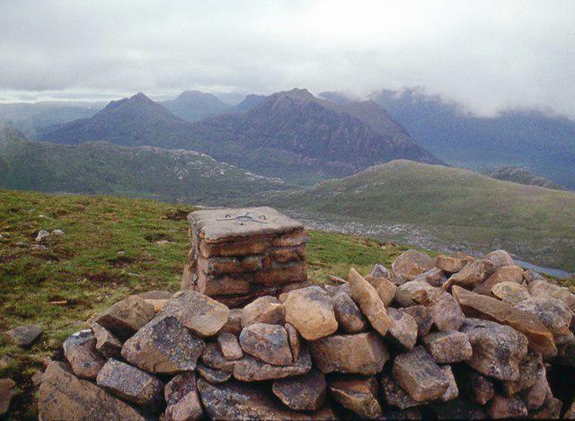 Photo could not load
NH0175 : Summit of Ruadh Stac Mòr looking to the Beinn Deargs
Alan Reid
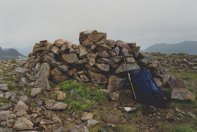 Photo could not load
NH0175 : The summit of Ruadh Stac Mòr
Nigel Brown
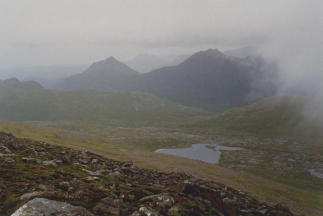 Photo could not load
NH0175 : View north from Ruadh Stac Mòr
Nigel Brown
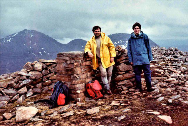 Photo could not load
NH0175 : Ruadh Stac Mor
Raibeart MacAoidh
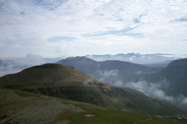 Photo could not load
NH0175 : Ruadh Stac Mor from A' Mhaighdean
Jim Barton
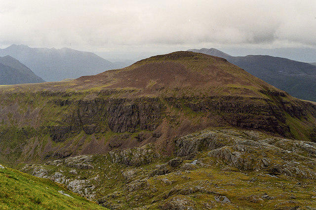 Photo could not load
NH0175 : Ruadh Stac Mòr, from A' Mhaighdean
Nigel Brown
Hill facts and local notes
Classifications
Elevation
919m
3,014 ft
Prominence
170m
Coordinates
57.7268, -5.3293
NH018756
OS Map
19
Explorer: 433 435S
At the Summit
The summit features a stone cairn marking the peak and offers panoramic views of the surrounding landscape, including the impressive Loch Srònaich.
Terrain & Geology
Ruadh Stac Mor is primarily composed of metamorphic rocks, mainly schists and gneisses, that date back to the Lewisian complex. The rugged terrain and exposed rock faces offer a glimpse into the geological history of the Scottish Highlands.
Views & Scenery
From the summit, hikers can enjoy views of the deep blue waters of Loch Awe, the rugged peaks of the surrounding Munros, and the expansive stretches of wild Scottish countryside.
History & Heritage
Name Origin
The name 'Ruadh Stac Mor' translates to 'big red stack' in Gaelic, referencing both its colour and prominent summit feature.
Historical Significance
Ruadh Stac Mor has been a favourite of climbers and hikers for many years and is steeped in local folktales attributed to the wild, untamed Scottish Highlands.
Getting There & Facilities
Parking
Parking is available at the end of the A832 at the designated car park near Strathconon.
Public Transport
There are limited bus services to nearby villages; the closest is in Garve, but it’s recommended to travel by car for more flexibility.
Nearby Facilities
Facilities are sparse; however, you can find public toilets and a café in Garve. A picnic is encouraged, but don’t forget the all-important flask of tea!
Safety Information
Known Hazards
- Be wary of sudden weather changes typical of the Scottish Highlands. The rocky terrain can be slippery, especially when wet. Watch out for steep drops near the summit.
General Safety Tips
- Check weather conditions before setting out
- Carry appropriate clothing and equipment
- Let someone know your planned route
- Take a map, compass, and GPS device
- Carry emergency supplies: food, water, first aid kit, torch
Hills
Some common questions about the hills answered
Are there group walks up Ruadh Stac Mor?
Many walkers use Walkmates to join or organise walks with others. You can check for group walks around Ruadh Stac Mor through the maps
Are there other walkers around Ruadh Stac Mor?
Activity varies by location and time, but Walkmates lets you see whether others have shared walks or shown interest in this area. Find other people through the walking friends search walking friends for Ruadh Stac Mor search or of course create your own walk for Ruadh Stac Mor
Can I organise a walk to Ruadh Stac Mor?
Yes. If there aren’t any walks listed already, you can create a walk and make it available for others to join.
If you're signed up to Walkmates, you can create a walk to Ruadh Stac Mor.
How do I find a walk up this hill?
There are often multiple ways to walk this hill, depending on experience and route preference. Walkmates helps you explore walks and routes that others have shared.
Can I suggest a new route up Ruadh Stac Mor?
Yes. You can suggest or create routes to share with others. Walkmates focuses on the social side of walking, so routes are used to help people organise walks and explore areas together, rather than as detailed navigation tools or route libraries.
Other uses really appreciate knowledgeable walkers sharing their routes. Share your favourite route to Ruadh Stac Mor here
The is an error or something incorrect about this hill. How do I let you know?
We always strive to keep the information on Walkmates as accurate as possible. If you find an error, please let us know through the contact form and we'll aim to correct it as quickly as possible
Community Discussion
Comments
Location
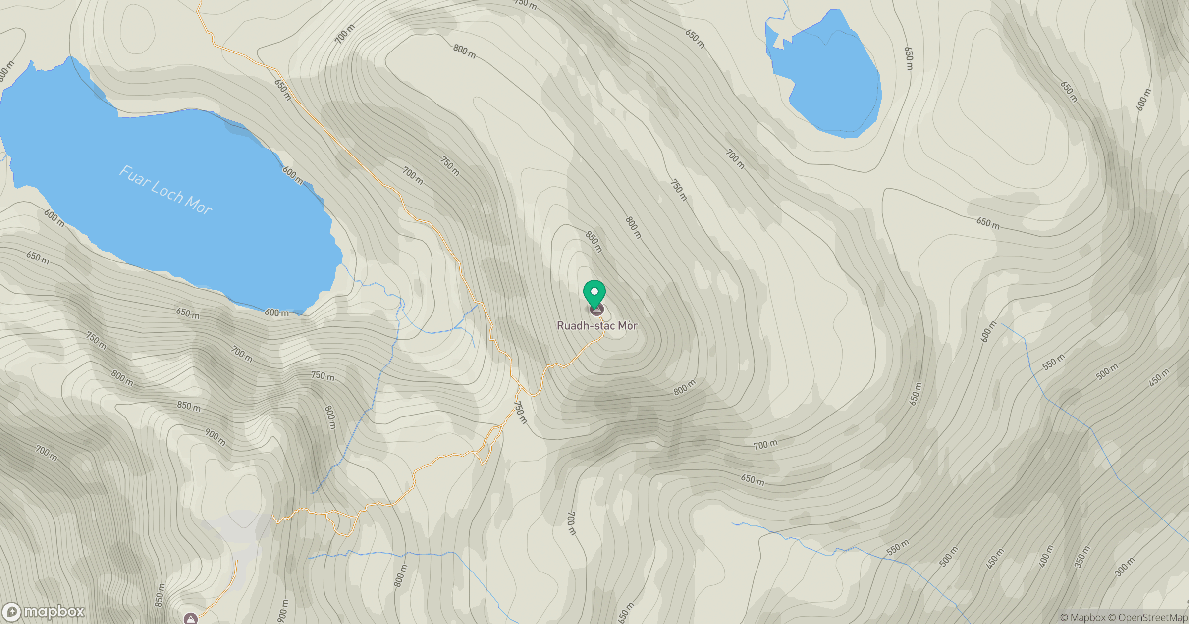
Grid reference: NH018756
View on OpenStreetMapOpens a map in a new tab, centred on the hill.
No comments yet. Be the first.