

Muckle Flugga
Good walks are even better shared.
HP6019 : Muckle Flugga lighthouse
David Purchase Photo source
Overview
Muckle Flugga: The Great Cape of the North
Muckle Flugga is not your typical mountain, but it certainly lays claim to extraordinary coastal beauty and a significant piece of nautical history. Although it rises to a petite 41 meters, it's nestled among some of the UK’s most stunning landscapes in the Shetland Islands.
Geology
Muckle Flugga is primarily composed of sedimentary rocks like sandstone and mudstone. Its dramatic appearance is a product of glaciers that carved the landscape, providing a rocky safety net for cliff-dwellers (the seabirds, of course!).
Routes
The Muckle Flugga Trail is an easy 0.8 km journey, ideal for families or those looking to enjoy the scenery without too much puffing and panting. The trail meanders pleasantly towards the summit, offering numerous vantage points for photo-ops.
Summit Features
At the summit, you’ll be greeted by the iconic lighthouse. Erected in 1858, it’s a testament to human ingenuity and maritime necessity, standing proudly against the frothy North Sea—a perfect spot for a photo unless you're afraid of heights!
Terrain
The terrain here is rugged and rocky with some grassy stretches. Be prepared for the wind, as this is a coastal route, and you wouldn't want your hat flying off to Norway!
Views
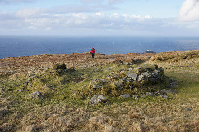
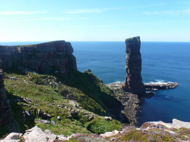
From the top, the views can be nothing short of breathtaking: see the Out Stack and the vast expanse of the North Sea. The best time to soak in the sights is during late spring and summer when clarity is prime and sea life is abound. Spotting a playful whale is always a bonus!
Hazards
While strolling along the cliffs, take heed of the strong currents and whims of the tide. The rocky terrain can be treacherous, especially when wet, so stick to the path to avoid an impromptu swimming lesson.
Access
Getting to Muckle Flugga is half the adventure! Park at Haroldswick and hike approximately four miles, savouring the stunning landscapes along the way. Public transport options are limited; odd buses from Lerwick occasionally grace the area.
Facilities
Nearby, you'll find a café and toilets in Haroldswick, along with a community shop in Baltasound for your snack needs. Remember, no frolicking without sustenance!
History
Muckle Flugga's name reflects its impressive stature—'big cape'—and its historical significance as a navigational landmark has kept it relevant through the ages. The lighthouse not only assists sailors but now stands as a beloved tourist attraction.
In conclusion, while Muckle Flugga may not make you sweat in the traditional mountain sense, it embodies the rugged charm and historical significance that draws adventurers from all walks of life. So, grab your boots, pack your sandwiches, and prepare for stunning views, a bit of history, and the joy of a good outdoors jaunt!
Enjoy your adventure—just keep your hat on tight!
Explore routes near Muckle Flugga
Walks starting near this hill. Open a route to check its map, distance and full itinerary.
Route planning notes
These notes describe possible approaches. Check a route's map and access information when planning your walk.
Muckle Flugga Lighthouse Route
Start from the Hermaness Nature Reserve car park and follow the well-trodden path north through the reserve. Pass by cliffs teeming with seabirds and enjoy stunning views of the Atlantic. Continue to the northernmost tip of Unst and take in the iconic sight of the Muckle Flugga Lighthouse perched dramatically on its rocky islet. Return via the same path.
Hermaness Circular Walk
Begin at the Hermaness Nature Reserve car park and follow the boardwalk through the moorland, keeping an eye out for puffins and skuas. Climb the gentle slopes to the coastal cliffs, then continue along the cliff edge for panoramic views of the North Sea and Muckle Flugga. Loop back inland through the reserve to complete the circuit.
Muckle Flugga Coastal Adventure
Start from Burrafirth and take the coastal path leading to the Hermaness cliffs. Ascend gradually toward the viewpoint overlooking Muckle Flugga Lighthouse. This route offers dramatic seascapes and abundant wildlife sightings. Retrace your steps back to Burrafirth.
Unst Northern Tip Exploration
Set off from the Hermaness Visitor Centre and explore the northernmost reaches of Unst. Traverse the peat bogs and climb to the rugged cliffs. Take in the views of Muckle Flugga and Out Stack, the UK's northernmost point. Return to the visitor centre via the marked paths.
Muckle Flugga Wildlife Walk
Starting at the Hermaness Nature Reserve car park, this route focuses on the rich birdlife and natural beauty of the area. Follow the boardwalk to the cliffs, where you can spot puffins, gannets, and fulmars. Continue to the viewpoint overlooking Muckle Flugga, then head back along the same path.
Make a day of it, together
Find someone to share the walk with, or organise a day out along a route you like.
Photo Gallery
View all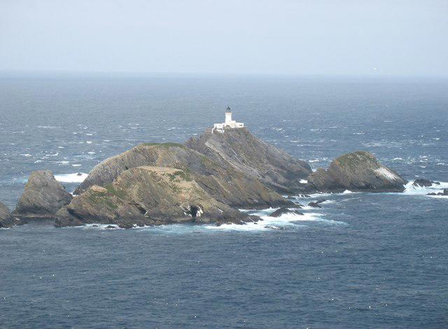 Photo could not load
HP6019 : Muckle Flugga lighthouse
David Purchase
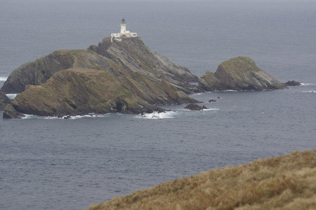 Photo could not load
HP6019 : Muckle Flugga
Stephen McKay
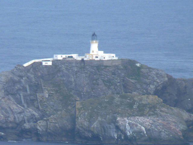 Photo could not load
HP6019 : Muckle Flugga lighthouse
James Allan
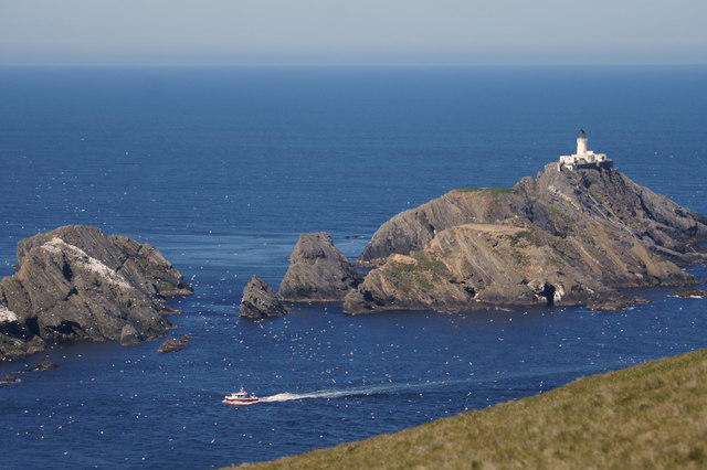 Photo could not load
HP6019 : Muckle Flugga from Hermaness Hill
Mike Pennington
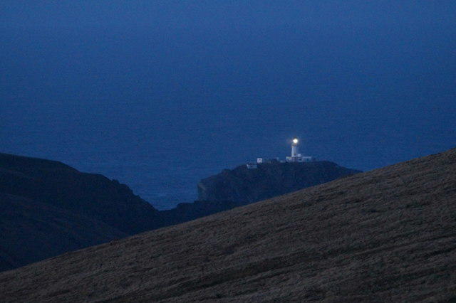 Photo could not load
HP6019 : Muckle Flugga Lighthouse from Sothers Field
Mike Pennington
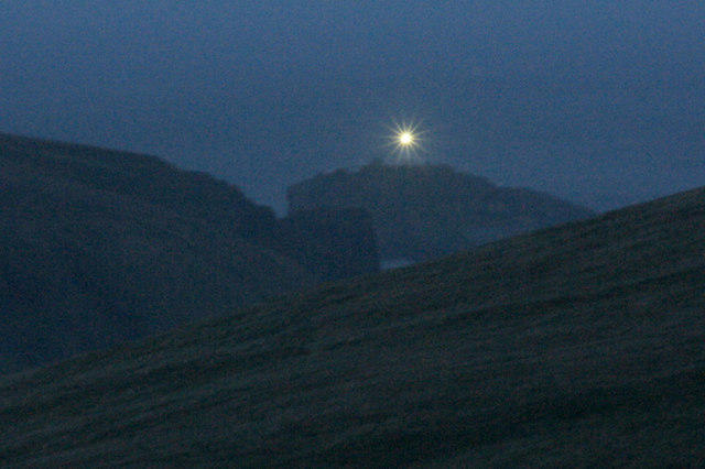 Photo could not load
HP6019 : Muckle Flugga lighthouse at dusk, from Saxa Vord
Mike Pennington
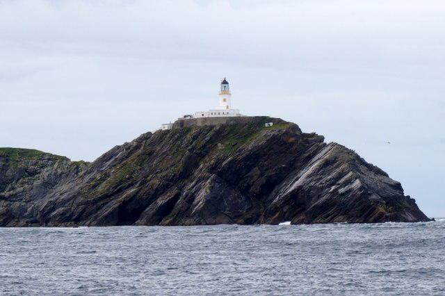 Photo could not load
HP6019 : Muckle Flugga from the sea
Mike Pennington
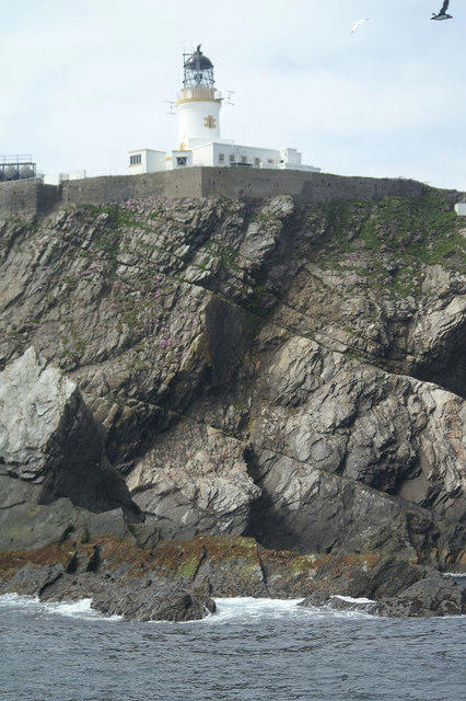 Photo could not load
HP6019 : Muckle Flugga lighthouse from the north
Mike Pennington
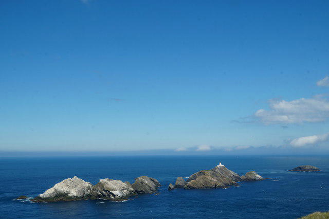 Photo could not load
HP6019 : The Muckle Flugga skerries from above Looswick on Hermaness
Mike Pennington
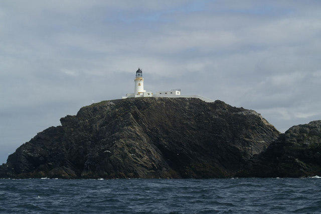
HP6019 : Muckle Flugga from the seaward side
Mike Pennington
Hill facts and local notes
Classifications
Elevation
45m
148 ft
Prominence
45m
Coordinates
60.8556, -0.8853
HP606197
OS Map
1
Explorer: 470N
At the Summit
The summit boasts a historic lighthouse, which stands as a sentinel over the North Sea, providing a striking contrast against the dramatic cliffs and sea spray.
Terrain & Geology
Muckle Flugga features mainly sedimentary rocks, specifically sandstone and mudstone, contributing to its rugged coastal charm. Its geological formation has been shaped by glacial activity, giving it a distinct appearance against the backdrop of the North Sea.
Views & Scenery
The views include the nearby Out Stack, the northernmost point of the UK, and expansive vistas of the North Sea, where you might even spot passing whales if you're lucky!
History & Heritage
Name Origin
The name 'Muckle Flugga' derives from the Norse 'Muckle', meaning big or great, and 'Flugga', meaning cape, which aptly describes its stature.
Historical Significance
Muckle Flugga holds significant historical importance due to its lighthouse, constructed in 1858, and has long been a vital navigational beacon for sailors navigating the treacherous waters of Shetland.
Getting There & Facilities
Parking
There is a designated parking area at Haroldswick, which is around 4 miles from the starting point of the trail.
Public Transport
Public transport options are limited, but there are occasional bus services from Lerwick to various locations on Unst.
Nearby Facilities
Visitors can find toilets and a small café in Haroldswick. The local community shop in Baltasound offers refreshments and some hiking essentials.
Safety Information
Known Hazards
- Strong currents and changing tides around the coast; walkers should be cautious of cliff edges and slippery rocks, especially in wet conditions.
General Safety Tips
- Check weather conditions before setting out
- Carry appropriate clothing and equipment
- Let someone know your planned route
- Take a map, compass, and GPS device
- Carry emergency supplies: food, water, first aid kit, torch
Hills
Some common questions about the hills answered
Are there group walks up Muckle Flugga?
Many walkers use Walkmates to join or organise walks with others. You can check for group walks around Muckle Flugga through the maps
Are there other walkers around Muckle Flugga?
Activity varies by location and time, but Walkmates lets you see whether others have shared walks or shown interest in this area. Find other people through the walking friends search walking friends for Muckle Flugga search or of course create your own walk for Muckle Flugga
Can I organise a walk to Muckle Flugga?
Yes. If there aren’t any walks listed already, you can create a walk and make it available for others to join.
If you're signed up to Walkmates, you can create a walk to Muckle Flugga.
How do I find a walk up this hill?
There are often multiple ways to walk this hill, depending on experience and route preference. Walkmates helps you explore walks and routes that others have shared.
Can I suggest a new route up Muckle Flugga?
Yes. You can suggest or create routes to share with others. Walkmates focuses on the social side of walking, so routes are used to help people organise walks and explore areas together, rather than as detailed navigation tools or route libraries.
Other uses really appreciate knowledgeable walkers sharing their routes. Share your favourite route to Muckle Flugga here
The is an error or something incorrect about this hill. How do I let you know?
We always strive to keep the information on Walkmates as accurate as possible. If you find an error, please let us know through the contact form and we'll aim to correct it as quickly as possible
Community Discussion
Comments
Location
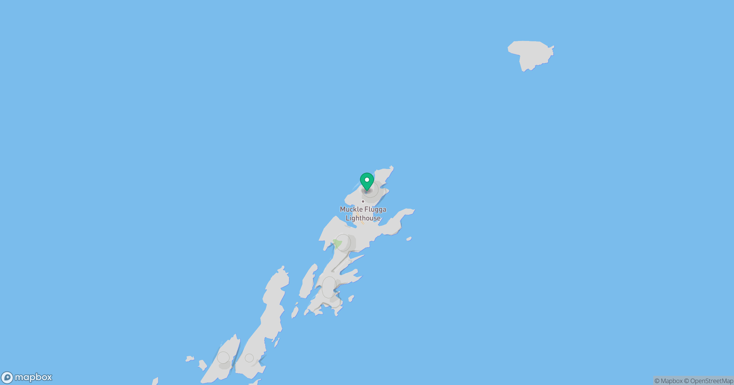
Grid reference: HP606197
View on OpenStreetMapOpens a map in a new tab, centred on the hill.
No comments yet. Be the first.