

Meall a' Phubuill
Good walks are even better shared.
NN0285 : Ben Nevis and the hills of Lochaber from Meall a' Phubuill
Richard Law Photo source
Overview
Meall a' Phubuill: A Hiker's Delight
Overview
Meall a' Phubuill, standing at 803 meters, is a proud Munro located in the breathtaking Scottish Highlands. This peak not only beckons keen walkers but also rewards hikers with panoramic vistas that are simply breathtaking.
Geology
The bedrock of Meall a' Phubuill is primarily composed of ancient gneiss, formed from metamorphosed granite. This geological wonder not only shapes the rugged terrain but tells a tale of the Earth's history, spanning billions of years.
Routes
Several routes lead to the summit, each offering different experiences:
- From the Glencoe to Kinlochleven: A leisurely 12 km trek, perfect for those looking to soak in nature without overly taxing themselves.
- Brough's route - Beinn a' Chrùlaiste: For the thrill-seekers, this 8 km path provides a more challenging ascent, with a steep incline that tests endurance and resolve.
Summit Features
The summit is marked by a charming stone cairn—perfect for a photo opportunity or for you to take a little rest as you bask in the splendour around you.
Terrain and Views
Expect a delightful mix of rocky ridges and grassy slopes, with a sprinkling of boggy patches to keep you on your toes. The views from the top are the real icing on the cake! Picture this: you'll have grand views of Ben Nevis, the Mamores and the tranquility of Loch Leven.
Hazards
While the mountain invites you with open arms, remember that the weather here can be as fickle as a cat on a hot tin roof. Always be prepared for sudden changes and watch your footing, especially on rocky sections.
Access and Facilities
Kinlochleven serves as the best starting point for your adventure. With secure parking and a range of charming cafes, you can fuel up before your climb. Public transport options are also available, so feel free to leave your car at home and enjoy the journey!
History and Folklore
The name might evoke thoughts of a local drinking establishment, but Meall a' Phubuill's name truly reflects the rich language and culture of the Highlands. Moreover, tales of this mountain have woven into the fabric of local lore, adding a sprinkle of mystery and charm to your hike.
In summary, Meall a' Phubuill is more than just a mountain; it's a character in a story, waiting for you to explore its heights and valleys. So lace up those hiking boots—adventure awaits!
Last Updated
2023-10-01
Source
Ordnance Survey
Explore routes near Meall a' Phubuill
Walks starting near this hill. Open a route to check its map, distance and full itinerary.
Banavie to Glen Loy Aqueduct: Neptune’s Staircase Canal Towpath
View route
Ben Nevis via Mountain Path
View route
Fort Augustus to Kytra Lock: Caledonian Canal Towpath
View route
Glen Affric: Coire Loch Woodland Trail
View route
Route planning notes
These notes describe possible approaches. Check a route's map and access information when planning your walk.
From the Glencoe to Kinlochleven
A scenic route starting from Kinlochleven which takes you through a mix of forest and open moorland before ascending the slopes of Meall a' Phubuill.
Brough's route - Beinn a' Chrùlaiste
A shorter route but steeper, starting at the Broughs, following sheep tracks and with spectacular views.
Make a day of it, together
Find someone to share the walk with, or organise a day out along a route you like.
Photo Gallery
View all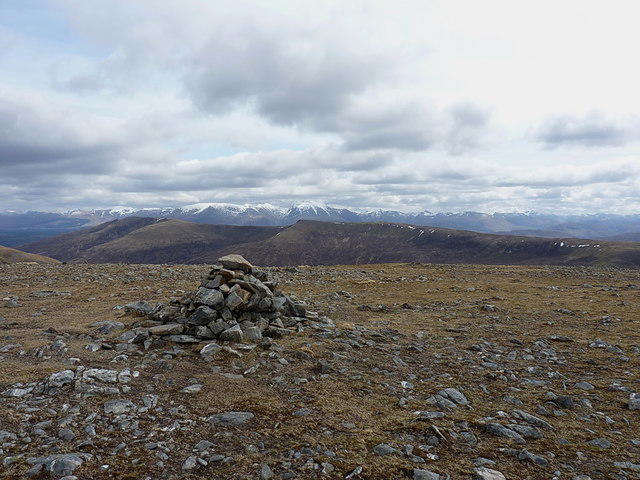 Photo could not load
NN0285 : Ben Nevis and the hills of Lochaber from Meall a' Phubuill
Richard Law
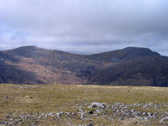 Photo could not load
NN0285 : Flat summit area of Meall a' Phubuill
Trevor Littlewood
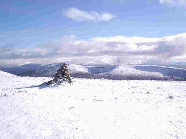 Photo could not load
NN0285 : Meall a Phubuill
andrew daws
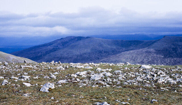 Photo could not load
NN0285 : Rocks at summit area of Meall a' Phubuill
Trevor Littlewood
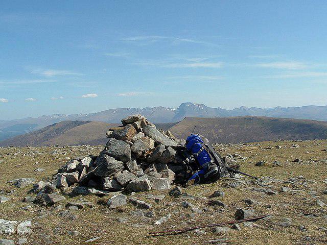 Photo could not load
NN0285 : Meall a' Phubuill (summit cairn)
Raibeart MacAoidh
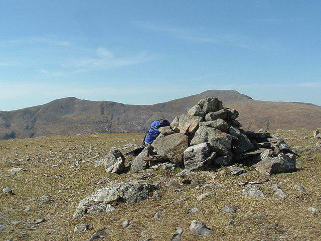 Photo could not load
NN0285 : Meall a' Phubuill (summit cairn)
Raibeart MacAoidh
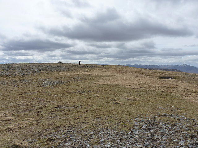 Photo could not load
NN0285 : Last bit to the top
Richard Law
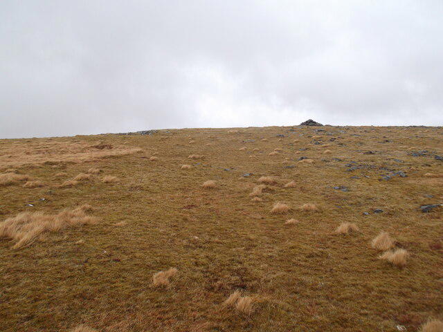 Photo could not load
NN0285 : Unremarkable summit plateau of Meall a'Phubuill
David Brown
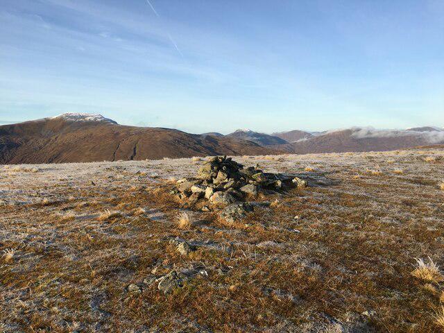 Photo could not load
NN0285 : Summit of Meall a’ Phubuill
Steven Brown
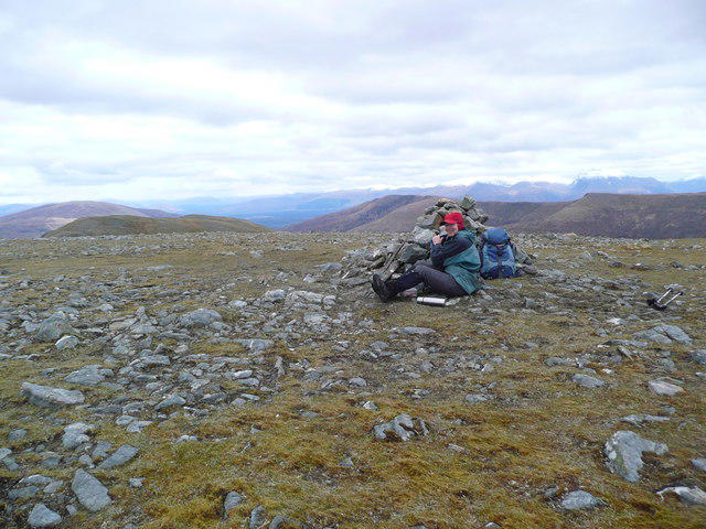 Photo could not load
NN0285 : Summit cairn on Meall a' Phubuill
Gordon Brown
Hill facts and local notes
Classifications
Elevation
773m
2,535 ft
Prominence
467m
Coordinates
56.9180, -5.2390
NN029854
OS Map
41
Explorer: 399
At the Summit
The summit features a stone cairn that offers an opportunity for climbers to leave their mark, as well as stunning panoramic views of the surrounding landscape.
Terrain & Geology
Meall a' Phubuill is primarily composed of gneiss, which provides a rugged and scenic terrain. The mountain's geology is typical of the North West Highlands, showcasing ancient formations that are over a billion years old.
Views & Scenery
From the summit, you can see Ben Nevis, the Mamores, and the shimmering Loch Leven. On a clear day, the views are nothing short of spectacular.
History & Heritage
Name Origin
The name 'Meall a' Phubuill' translates to 'Hill of the Little Pub' in Scottish Gaelic, perhaps hinting at a past where the local mountain goat population enjoyed the odd pint!
Historical Significance
Rich in historical lore, this mountain has long been a site for local folklore and adventure tales among the Highland communities.
Getting There & Facilities
Parking
There is parking available at the Kinlochleven village car park, which also offers access to various trails.
Public Transport
Buses run to Kinlochleven from Glasgow and Fort William, making it accessible for those relying on public transport.
Nearby Facilities
Kinlochleven offers cafes, a bakery, and public toilets, ensuring hikers can refuel before or after their trek.
Safety Information
Known Hazards
- Be mindful of sudden weather changes, as conditions can change rapidly in the Highlands. There are also rocky sections that require careful footing.
General Safety Tips
- Check weather conditions before setting out
- Carry appropriate clothing and equipment
- Let someone know your planned route
- Take a map, compass, and GPS device
- Carry emergency supplies: food, water, first aid kit, torch
Hills
Some common questions about the hills answered
Are there group walks up Meall a' Phubuill?
Many walkers use Walkmates to join or organise walks with others. You can check for group walks around Meall a' Phubuill through the maps
Are there other walkers around Meall a' Phubuill?
Activity varies by location and time, but Walkmates lets you see whether others have shared walks or shown interest in this area. Find other people through the walking friends search walking friends for Meall a' Phubuill search or of course create your own walk for Meall a' Phubuill
Can I organise a walk to Meall a' Phubuill?
Yes. If there aren’t any walks listed already, you can create a walk and make it available for others to join.
If you're signed up to Walkmates, you can create a walk to Meall a' Phubuill.
How do I find a walk up this hill?
There are often multiple ways to walk this hill, depending on experience and route preference. Walkmates helps you explore walks and routes that others have shared.
Can I suggest a new route up Meall a' Phubuill?
Yes. You can suggest or create routes to share with others. Walkmates focuses on the social side of walking, so routes are used to help people organise walks and explore areas together, rather than as detailed navigation tools or route libraries.
Other uses really appreciate knowledgeable walkers sharing their routes. Share your favourite route to Meall a' Phubuill here
The is an error or something incorrect about this hill. How do I let you know?
We always strive to keep the information on Walkmates as accurate as possible. If you find an error, please let us know through the contact form and we'll aim to correct it as quickly as possible
Community Discussion
Comments
Location
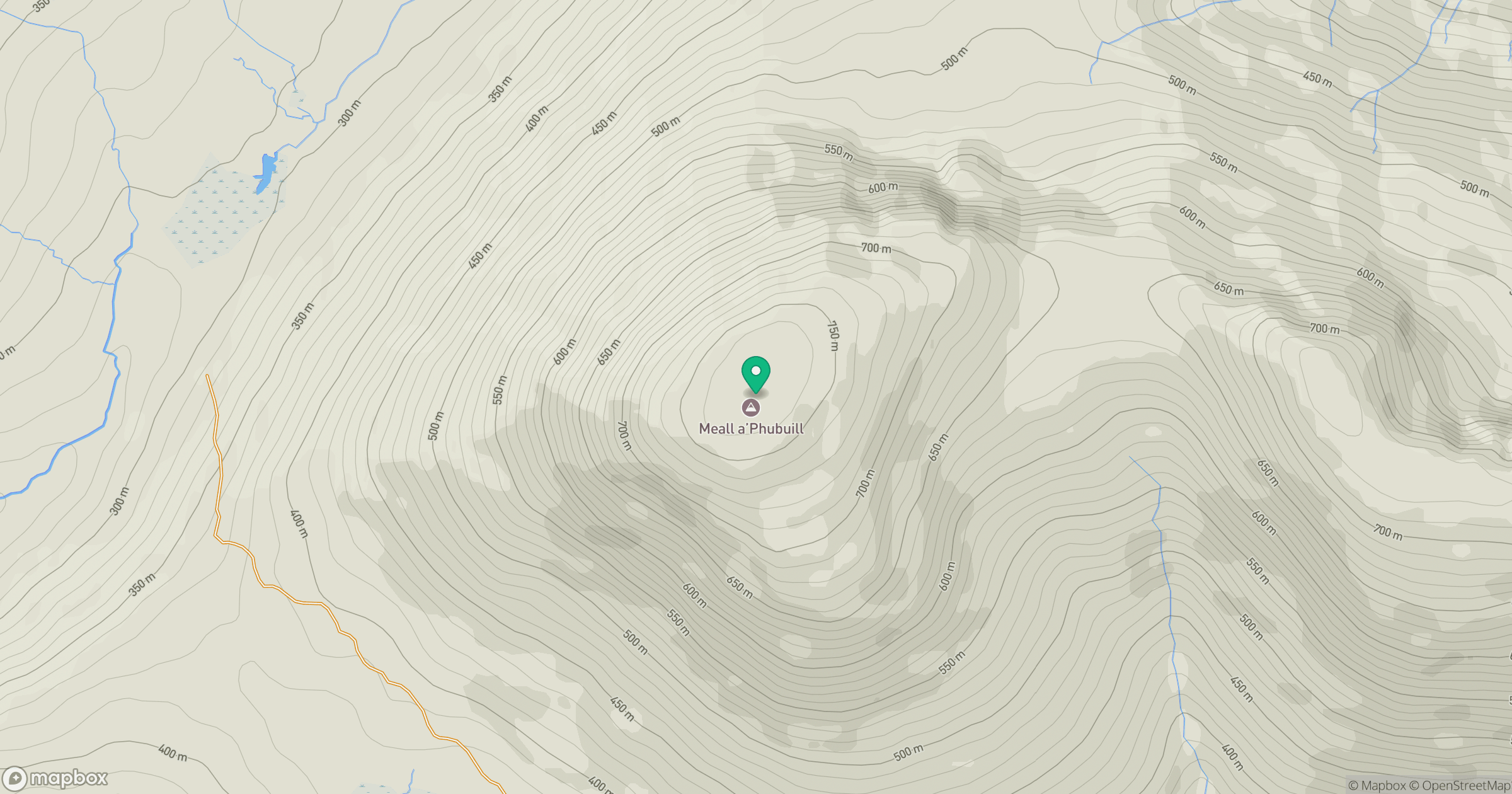
Grid reference: NN029854
View on OpenStreetMapOpens a map in a new tab, centred on the hill.
![Ben Nevis [Beinn Nibheis]](https://cdn.walkmates.com/gallery-images/44e34d25abc849e78f7b99a97863fffb.jpg)
No comments yet. Be the first.