

Meall a' Bhuachaille
Good walks are even better shared.
NH9911 : Summit cairn on Meall a Bhuachaille
Gordon Brown Photo source
Overview
Meall a' Bhuachaille is an 810 m Corbett rising above Glenmore and Loch Morlich in the Cairngorms. Woodland paths lead to an open summit with a large shelter cairn and views towards Cairn Gorm and the Northern Corries. The classic Glenmore circuit visits An Lochan Uaine and Ryvoan Bothy; check current access notices before walking.
Meall a' Bhuachaille
Above Glenmore
Meall a' Bhuachaille is an 810 m Corbett above Glenmore and Loch Morlich, on the northern side of the Cairngorms. It is the highest point of the Kincardine Hills. Its separate position gives a close view across Glenmore to Cairn Gorm and the Northern Corries, with forest and Strathspey below.
The summit has a large stone cairn and wind shelter. Beyond the forest the hill is open and exposed: a clear path does not remove the need for navigation, weather protection and sound judgement.
Glenmore and Ryvoan circuit
The usual circular walk starts at Glenmore Visitor Centre, NH977098. The higher woodland path leads towards An Lochan Uaine, then the route continues through Ryvoan Pass to Ryvoan Bothy. A sustained climb on the east-side path reaches the summit. Descend west towards the col below Creagan Gorm, then turn south through Coire Chondlaich to return to Glenmore.
Walkhighlands publishes 8.5 km, 540 m ascent and 3.5–4.5 hours for that itinerary. These figures do not describe a one-way east-ridge ascent or the longer ridge walk from Badaguish. Rough steps and short boardwalk sections on the woodland approach can be slippery when wet or icy. The direct western ascent from Glenmore, returning by the same path, is another option, with no distance or time asserted here.
Access update: 16 October 2026
FLS's 5 October reopening notice and current local alerts confirm access to An Lochan Uaine and Ryvoan Bothy, and the full summit circuit. Older wildfire notices describing a west-only summit ascent have been superseded for this circuit. Allt Mor and the Lodge Trail remain affected by closures. Stay on open routes in the burned forest because unstable trees and branches remain a hazard.
The longer Badaguish ridge itinerary has a separate forestry closure. Check FLS local alerts and follow signs before setting out.
Rock and local history
FLS identifies quartzite on the open hill, rather than the granite that dominates the main Cairngorm massif. The Gaelic name means Hill of the Herdsman. Nearby Ryvoan Bothy stands on the Thieves' Road and survives from a farm abandoned in 1877.
Starting the walk
Glenmore has paid parking, a visitor centre and a café. Buses from Aviemore towards Cairngorm Mountain pass the visitor centre. Café facilities depend on opening hours; village toilets are nearby. Check the return bus before leaving the valley, and carry what you need for the hill.
Explore routes near Meall a' Bhuachaille
Walks starting near this hill. Open a route to check its map, distance and full itinerary.
Rothiemurchus: Beaver Trail and Lochan Mor
View route
Aviemore: Loch an Eilein and the Croft Track from Rothiemurchus
View route
Cairngorms night walk and stargazing (event meeting)
View route
Cairngorms night walk and stargazing (event meeting)
View route
Route planning notes
These notes describe possible approaches. Check a route's map and access information when planning your walk.
Meall a' Bhuachaille circuit from Glenmore via Ryvoan
Circuit from Glenmore Visitor Centre (NH977098) via the higher woodland path, An Lochan Uaine and Ryvoan Bothy; climb the east-side path to the summit, descend west towards Creagan Gorm col, then south through Coire Chondlaich to Glenmore. Walkhighlands: 8.5 km, 540 m ascent, 3.5–4.5 hours. FLS confirms the full circuit open (checked 16 October 2026); follow local signs and check current alerts.
Make a day of it, together
Find someone to share the walk with, or organise a day out along a route you like.
Photo Gallery
View all Photo could not load
NH9911 : Summit cairn on Meall a Bhuachaille
Gordon Brown
 Photo could not load
NH9911 : At the summit of Meall a' Bhuachaille
Alan O'Dowd
 Photo could not load
NH9911 : Bog pool, Meall a' Bhuachaille
Dorothy Carse
 Photo could not load
NH9811 : Shelter on Meall a' Bhuachaille
Andy Waddington
 Photo could not load
NH9911 : Meall a' Bhuachaille from Allt Mor
Jim Barton
 Photo could not load
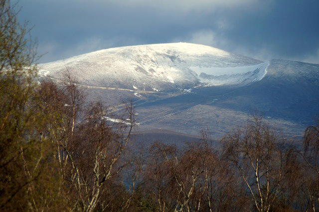
NH9911 : Meall a' Bhuachaille
L Cowieson
 Photo could not load
NH9911 : Summit shelter Meall a' Bhuachaille
L Cowieson
 Photo could not load
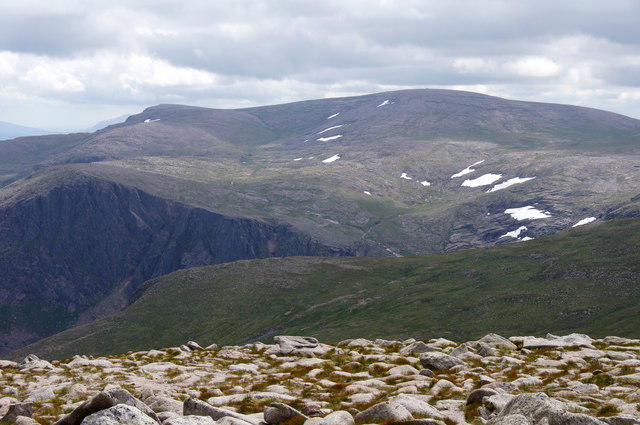
NH9911 : Meall a’ Bhuachaille
Walter Baxter
 Photo could not load
NH9911 : The summit cairn of Meall a' Bhuachaille
Walter Baxter

NH9911 : The summit of Meall a’ Bhuachaille
Walter Baxter
Hill facts and local notes
Classifications
Elevation
810m
2,657 ft
Prominence
436m
Coordinates
57.1835, -3.6711
NH990115
OS Map
36
Explorer: OL57N 403N
At the Summit
A large stone cairn with a wind shelter marks the summit.
Terrain & Geology
FLS's Strathspey land-management plan identifies quartzite on the open ground of Meall a' Bhuachaille and towards the Slugan Pass. This quartz-rich rock is metamorphosed sandstone. The surrounding forest also overlies psammite; the main Cairngorm granite massif lies across Glenmore.
Views & Scenery
Views across Glenmore to Cairn Gorm and the Northern Corries, down to Loch Morlich, and over the forests towards Strathspey. Creagan Gorm and the continuation of the Kincardine ridge lie to the west and north-west.
History & Heritage
Name Origin
Gaelic: Hill of the Herdsman, also rendered Hill of the Shepherd.
Historical Significance
Ryvoan Bothy, on the usual circuit, stands on the Thieves' Road between Nethy Bridge and Glenmore. It is the surviving part of a farm abandoned in 1877 and is maintained by the Mountain Bothies Association.
Getting There & Facilities
Parking
Paid parking at Glenmore Visitor Centre, the usual circuit start at NH977098. The visitor centre car park is managed by Aviemore and Glenmore Community Trust; FLS parking passes are not valid there. Check local access signs and parking information before travelling. Allt Mor car park remains closed as of 16 October 2026.
Public Transport
Buses between Aviemore and Cairngorm Mountain pass Glenmore Visitor Centre. Check Traveline Scotland or the operator for current times and the last return service.
Nearby Facilities
Glenmore Visitor Centre has a café and toilets available during café opening hours. FLS also lists 24-hour village toilets near the bus stop, a short walk away. Check opening times before travelling and carry food, water and hillwalking equipment.
Safety Information
Known Hazards
- Steep hill paths and rough steps need care; woodland boardwalks can be slippery when wet or icy.
- The open upper slopes are exposed to strong wind and low cloud. Carry suitable clothing and a map and compass, and know how to use them.
- Following the 2026 wildfire, unstable trees remain in the burned forest. Use open routes and follow closure signs; Allt Mor and the Lodge Trail remain affected.
- The longer Badaguish ridge route has separate forestry restrictions. Check current FLS notices before planning an extension.
Seasonal Hazards
Snow and ice can make the hill and woodland steps much more demanding than in summer. Winter conditions require appropriate equipment and the skills to use it. Wet or icy boardwalks are slippery; strong winds can affect the exposed summit in any season.
General Safety Tips
- Check weather conditions before setting out
- Carry appropriate clothing and equipment
- Let someone know your planned route
- Take a map, compass, and GPS device
- Carry emergency supplies: food, water, first aid kit, torch
Hills
Some common questions about the hills answered
Are there group walks up Meall a' Bhuachaille?
Many walkers use Walkmates to join or organise walks with others. You can check for group walks around Meall a' Bhuachaille through the maps
Are there other walkers around Meall a' Bhuachaille?
Activity varies by location and time, but Walkmates lets you see whether others have shared walks or shown interest in this area. Find other people through the walking friends search walking friends for Meall a' Bhuachaille search or of course create your own walk for Meall a' Bhuachaille
Can I organise a walk to Meall a' Bhuachaille?
Yes. If there aren’t any walks listed already, you can create a walk and make it available for others to join.
If you're signed up to Walkmates, you can create a walk to Meall a' Bhuachaille.
How do I find a walk up this hill?
There are often multiple ways to walk this hill, depending on experience and route preference. Walkmates helps you explore walks and routes that others have shared.
Can I suggest a new route up Meall a' Bhuachaille?
Yes. You can suggest or create routes to share with others. Walkmates focuses on the social side of walking, so routes are used to help people organise walks and explore areas together, rather than as detailed navigation tools or route libraries.
Other uses really appreciate knowledgeable walkers sharing their routes. Share your favourite route to Meall a' Bhuachaille here
The is an error or something incorrect about this hill. How do I let you know?
We always strive to keep the information on Walkmates as accurate as possible. If you find an error, please let us know through the contact form and we'll aim to correct it as quickly as possible
Community Discussion
Comments
Location
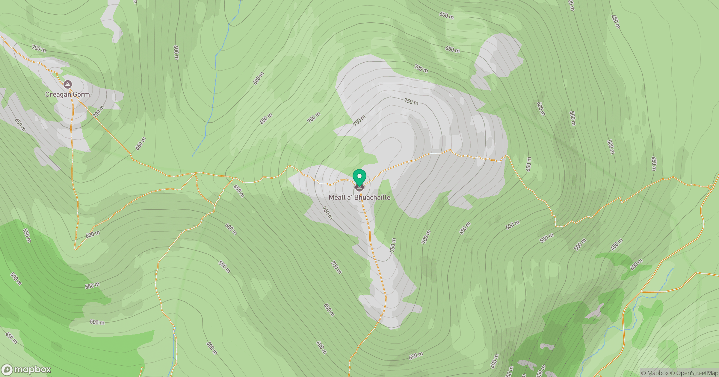
Grid reference: NH990115
View on OpenStreetMapOpens a map in a new tab, centred on the hill.
No comments yet. Be the first.