

Kinnoull Hill
Good walks are even better shared.
NO1322 : Stone table
Lis Burke Photo source
Overview
Kinnoull Hill rises to 222 m above Perth and the River Tay. Its wooded slopes lead to a trig-point summit and a dramatic southern escarpment of volcanic rock. Kinnoull Tower is a separate clifftop folly east-southeast of the summit. With 83 m of prominence, the hill is a Tump. Walks range from the waymarked Tower Trail from Jubilee car park to a longer circuit from Perth city centre.
Kinnoull Hill
Overview
Kinnoull Hill is a 222 m wooded hill east of Perth in Scotland, with 83 m of prominence. It is a Tump. The catalogue summit is ground beside the trig point at NO 13668 22802. Kinnoull Tower, at NO 13906 22727, is a separate clifftop landmark to the east-southeast.
Routes
Tower Trail from Jubilee car park
The red-waymarked loop visits the tower and summit area before returning to Jubilee car park. Forestry and Land Scotland publishes 3.3 km, allows 1 hour and grades it Moderate. Expect steep slopes, uneven gravel and a road crossing. The shorter Jubilee Trail stays below the summit.
Perth and South Inch circuit
Walkhighlands’ 6.5 km circuit starts and finishes at South Inch, NO120230. Cross by the railway footbridge, climb through Barnhill to the summit, follow the escarpment to the tower, then return through the woodland and streets on the Corsiehill side and across Queen’s Bridge. The guide gives 2–3 hours for the whole outing. Moncreiffe Hill is a different hill across the Tay.
Summit and views
The trig-point high ground, nearby stone table and tower are distinct features. Views include Perth, the Tay valley, Moncreiffe Hill and the Lomond Hills, with Highland hills visible in clear weather.
Terrain and safety
Woodland paths include steep and uneven stretches. The southern escarpment has high cliff edges that can be partly hidden by trees. Keep back from the drops and supervise children and dogs closely. The Perth approach includes steps and road crossings. FLS also warns of ticks at Kinnoull; check for them after walking.
Geology and nature
Resistant andesite lava of the Ochil Volcanic Formation, over conglomerates, forms the hill and its stacked southern cliffs. Corsiehill Quarry exposes a separate intrusive dyke. The 72.41 ha Kinnoull Hill SSSI protects woodland, rocky slopes and geology within the larger woodland park.
Access and facilities
Jubilee car park is reached via Muirhall Road from Perth; the nearest postcode is PH2 7LN. FLS lists it as free. Corsiehill Quarry is another access point. The Perth circuit starts from South Inch, where the route guide identifies paid parking. Perth’s rail and bus connections suit the city-centre start. For buses towards Kinnoull Hill, FLS directs visitors to Traveline Scotland.
Picnic areas and viewpoints are in the park. Public toilets and places to eat are in Perth. Kinnoull Shed toilets are bookable facilities, rather than unrestricted public toilets.
Nearby hills
Moncreiffe Hill (223 m) is across the Tay. Deuchny Hill (233 m in the DoBIH catalogue) lies northeast of Kinnoull, and Binn Hill near Kinfauns is 170.7 m. These are separate hills, not stops on the two Kinnoull circuits above.
Name and history
Kinnoull is Gaelic in origin. Peter McNiven’s 2018 study identifies ceann and an uncertain second element, possibly referring to an edge. Kinnoull Tower is a Category B-listed romantic folly inspired by Rhine castles. NatureScot records Lord Dewar’s gift of Kinnoull Hill to the people of Perth in 1924.
Explore routes near Kinnoull Hill
Walks starting near this hill. Open a route to check its map, distance and full itinerary.
Club outing: Crianlarich and West Highland Way (coach departure)
View route
Club outing: Glen Ogle and Killin (coach departure)
View route
Loch Leven: Kinross Pier to RSPB Loch Leven Heritage Trail
View route
Unled club outing: West Drumochter/Beinn Udlamain (coach departure)
View route
Route planning notes
These notes describe possible approaches. Check a route's map and access information when planning your walk.
Tower Trail from Jubilee car park: circular walk
Follow the red-waymarked Tower Trail from Jubilee car park, through the woodland and past Kinnoull Tower and the summit area, then complete the marked loop back to the same car park. Forestry and Land Scotland gives 3.3 km and allows 1 hour for this circuit. The trail has steep and uneven sections and a road crossing; keep away from the escarpment edge. The trig-point high ground and the tower are separate landmarks.
Kinnoull Hill and Tower from Perth: South Inch circuit
Start at South Inch, Perth (NO120230). Cross the Tay beside the railway, climb via Barnhill and the woodland paths to the trig-point summit, then visit the tower along the escarpment. Return on the woodland paths towards Corsiehill, descend through the streets to Dundee Road and cross Queen’s Bridge, then return along the riverside to South Inch. Walkhighlands gives 6.5 km and 2–3 hours for this circuit. It includes steep climbs, steps, road crossings and high cliff edges.
Make a day of it, together
Find someone to share the walk with, or organise a day out along a route you like.
Photo Gallery
View all Photo could not load
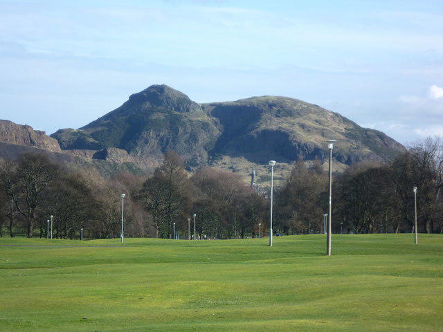
NO1322 : Stone table
Lis Burke
 Photo could not load
NO1322 : Stone table, Kinnoull Hill
Richard Sutcliffe
 Photo could not load
NO1322 : Approaching thunderstorm as seen from the summit of Kinnoull Hill near Perth
Colin Park
 Photo could not load
NO1322 : Kinnoull Hill
Ian Medcalf
 Photo could not load
NO1322 : Kinnoull Hill from the slopes of Deuchny Hill
Mike Pennington
 Photo could not load
NO1322 : Perth from Kinnoull Hill
Lis Burke
 Photo could not load
NO1322 : Kinnoull Hill
Ian Medcalf
 Photo could not load
NO1322 : The view north-west from Kinnoull Hill
David Purchase
 Photo could not load
NO1322 : Kinnoull Hill
Mick Garratt

NO1322 : Kinnoull Tower
Anne Burgess
Hill facts and local notes
Classifications
Elevation
222m
728 ft
Prominence
83m
Coordinates
56.3896, -3.4000
NO136228
OS Map
53 58
Explorer: 369 380W
At the Summit
The 222 m high point is ground beside the trig point at NO 13668 22802. View and history indicators stand in the summit area, with a stone table nearby. Kinnoull Tower is a separate landmark east-southeast of the summit, at NO 13906 22727.
Terrain & Geology
Kinnoull Hill is formed mainly of resistant andesite lavas of the Ochil Volcanic Formation, above conglomerates. Stacked lava flows form the steep southern cliffs. Corsiehill Quarry exposes a separate intrusive igneous dyke.
Views & Scenery
The summit and southern viewpoints overlook Perth, the River Tay and Tay valley. Moncreiffe Hill and the Lomond Hills lie across the river; Highland hills can be seen in clear weather.
History & Heritage
Name Origin
Kinnoull is Gaelic in origin. Peter McNiven’s 2018 place-name study identifies ceann and an uncertain second element, possibly ul, referring to an edge. It may relate to the edge of Gowrie or the hill’s escarpment; a complete translation is not established.
Historical Significance
Kinnoull Tower is a Category B-listed romantic folly inspired by Rhine castles. It was deliberately built as an artificial ruin. NatureScot records that Lord Dewar gave Kinnoull Hill to the people of Perth in 1924. Early records call the hill Craig of Kinnoull.
Getting There & Facilities
Parking
The Tower Trail starts at Jubilee car park, reached from Perth via East Bridge Street and Muirhall Road; PH2 7LN is the closest postcode. Forestry and Land Scotland lists parking there as free. Corsiehill Quarry car park, NO135235, is another access point. The longer Perth circuit starts at South Inch, NO120230, where the guide identifies paid parking.
Public Transport
Perth has rail and bus connections, making the city-centre circuit accessible on foot from town. Forestry and Land Scotland also lists a bus service towards Kinnoull Hill and refers visitors to Traveline Scotland for stops and times. Use the current timetable to plan the onward walk and return.
Nearby Facilities
The woodland park has picnic areas, viewpoints and Blue Badge parking. Public toilets and places to eat are in Perth. Toilets at Kinnoull Shed beside Jubilee car park are available through booking; they should not be treated as freely accessible public toilets.
Safety Information
Known Hazards
- High, steep cliffs line the southern escarpment near the summit and tower. Trees can hide the edge; keep back from drops and supervise children and dogs closely.
- The woodland routes include steep, uneven paths and road crossings. Use the pedestrian crossings on Dundee Road for the Perth circuit.
- Forestry and Land Scotland warns of ticks here. Check for ticks after the walk and remove any promptly.
General Safety Tips
- Check weather conditions before setting out
- Carry appropriate clothing and equipment
- Let someone know your planned route
- Take a map, compass, and GPS device
- Carry emergency supplies: food, water, first aid kit, torch
Hills
Some common questions about the hills answered
Are there group walks up Kinnoull Hill?
Many walkers use Walkmates to join or organise walks with others. You can check for group walks around Kinnoull Hill through the maps
Are there other walkers around Kinnoull Hill?
Activity varies by location and time, but Walkmates lets you see whether others have shared walks or shown interest in this area. Find other people through the walking friends search walking friends for Kinnoull Hill search or of course create your own walk for Kinnoull Hill
Can I organise a walk to Kinnoull Hill?
Yes. If there aren’t any walks listed already, you can create a walk and make it available for others to join.
If you're signed up to Walkmates, you can create a walk to Kinnoull Hill.
How do I find a walk up this hill?
There are often multiple ways to walk this hill, depending on experience and route preference. Walkmates helps you explore walks and routes that others have shared.
Can I suggest a new route up Kinnoull Hill?
Yes. You can suggest or create routes to share with others. Walkmates focuses on the social side of walking, so routes are used to help people organise walks and explore areas together, rather than as detailed navigation tools or route libraries.
Other uses really appreciate knowledgeable walkers sharing their routes. Share your favourite route to Kinnoull Hill here
The is an error or something incorrect about this hill. How do I let you know?
We always strive to keep the information on Walkmates as accurate as possible. If you find an error, please let us know through the contact form and we'll aim to correct it as quickly as possible
Community Discussion
Comments
Location
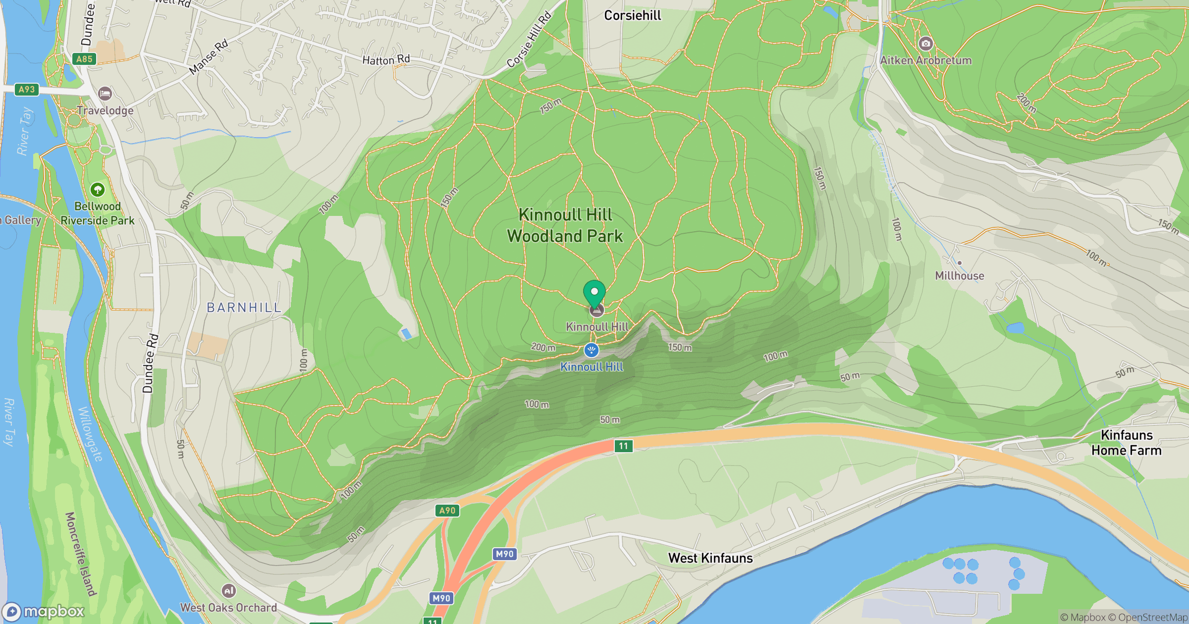
Grid reference: NO136228
View on OpenStreetMapOpens a map in a new tab, centred on the hill.
No comments yet. Be the first.