

Great Borne
Good walks are even better shared.
Overview
Great Borne is a 616-metre fell above Ennerdale, with a rocky summit, steep approaches and a ridge connection to Starling Dodd.
Great Borne above Ennerdale
Great Borne rises to 616 metres above the northern side of Ennerdale's western entrance. Its steep flanks give it a much bigger presence than the height alone suggests. Woodland and the knolls of Bowness Knott and Brown How occupy the lower ground, while Herdus forms the western shoulder of the fell. Beyond the summit, the ridge continues east towards Starling Dodd and the higher mountains around High Stile.
The appeal is the change in scale. A walk begins close to the wooded lakeshore, climbs onto open mountain ground and reaches a broad, rocky top overlooking the western Lake District. Ennerdale Water lies below, with the coast beyond the lower country to the west. The higher fells fill the view up the valley. Clear weather reveals the landscape's shape, but cloud can make the open summit much less easy to read.
The summit and neighbouring fells
The summit area has a trig pillar and a substantial stone wind shelter. The highest point is a rock about 22 metres south of the pillar, at NY 12394 16358. The distinction is small on the ground but useful for walkers following different hill lists: the trig pillar is Wainwright's summit, while the surveyed high point lies just beyond it.
Great Borne is a Wainwright, Birkett, Hewitt and Nuttall, as well as a Simm and HuMP. Starling Dodd, at 633 metres, is the next Wainwright east along the ridge. Red Pike, the 755-metre summit above Buttermere, lies farther on. Continuing towards it adds more climbing and requires a separate plan for the return to Ennerdale.
A circuit from Bowness Knott
A complete circuit from Bowness Knott car park visits Herdus, Great Borne, Gale Fell, Starling Dodd and Little Dodd, then descends to the Ennerdale forest road and follows it west to the start. The normal circuit is about 12.4 kilometres with 726 metres of ascent. These figures include the return, but not temporary diversions.
This is a demanding mountain walk, with rocky steps, boggy ground and a steep, largely pathless descent from Little Dodd to the forest road. Use a full route description and map, allowing time for stops and navigation. The upper route contains indistinct paths, and finding the correct descent matters.
Smithy Beck works in November 2026
The forest-road return is affected by planned bridge works at Smithy Beck from 10 November 2026. The National Park expects the closure to last a week or less, with a signed alternative for walkers using a nearby footbridge. Check the current closure notice and follow the diversion on site. The normal circuit distance will change while that diversion is in use.
Granite, older rocks and the valley
Great Borne stands within the Ennerdale Intrusion, a body of igneous rock formed underground during the Ordovician period. Granite and microgranite are characteristic rocks of this intrusion. The granite formed as magma cooled beneath the surface.
The southern slopes reveal a particularly interesting boundary. Around Bowness Knott and Rake Beck, the intrusion meets older sedimentary rocks of the Skiddaw Group. The contact is exposed on Great Borne's southern slope. Heat from the invading magma altered and hardened the surrounding rocks, and granitic veins cut through them. This closely packed variety is why nearby Bowness Knott is a Geological Conservation Review site. It gives the ascent a geological setting without requiring a detour onto the crags.
Getting there and looking after the fell
Bowness Knott car park, grid reference NY109153 and postcode CA23 3AU, is the practical road start. Parking is charged, and the forest road beyond it is closed to general motor traffic. Follow the signed approach through Ennerdale rather than minor lanes unsuitable for cars.
Ennerdale Bridge is the nearby village base. Forestry England lists The Gather there as a community café, shop and visitor information centre. Take food and water for the hill and check opening times before relying on refreshments afterwards. There is no direct public transport connection to the valley, so arrange the final approach and return before travelling.
Check notices for forestry operations, respect closures and keep dogs under close control around livestock and wildlife. The lower valley's easier paths do not indicate the difficulty of the summit walk.
Weather and preparation
Check a mountain forecast before setting out and again on the day. Wet rock and steep grass become slippery, while rain can make beck crossings difficult. Strong winds and poor visibility can turn the open ridge into a much more serious undertaking. Carry waterproofs, warm layers, food, water, a headtorch and a map and compass that you can use.
Snow or ice calls for winter skills and suitable equipment. Leave your route and expected return time with someone, plan to finish in daylight and be willing to turn back. Choose a lower-level walk when conditions or experience do not suit the mountain route.
Explore routes near Great Borne
Public walks starting within 80 km of this hill. Nearby does not mean a route reaches the summit; check its map and access before setting out.
Scafell Pike via Brown Tongue and Hollow Stones
View route
Scafell Pike from Seathwaite via the Corridor Route
View route
Derwentwater Walk: full lakeside circuit from Keswick
View route
Great Carrs Halifax Wreckage from Wrynose Pass
View route
Route planning notes
These notes describe possible approaches, not verified navigable routes or permission to cross land. Check current paths, local access rules and conditions before setting out.
Great Borne and Starling Dodd circuit from Bowness Knott
Start and finish at Bowness Knott car park. Visit Herdus, Great Borne, Gale Fell, Starling Dodd and Little Dodd, returning by the Ennerdale forest road. Normal circuit: 12.4 km and 726 m ascent. Follow the Smithy Beck pedestrian diversion during bridge works from 10 November 2026; this changes the distance.
Make a day of it, together
Find someone to share the walk with, or organise a day out along a route you like.
Photo Gallery
View all Photo could not load
NY1216 : Fence, Great Borne
Michael Graham
 Photo could not load
NY1216 : Great Borne summit
Karl and Ali
 Photo could not load
NY1216 : Summit of Great Borne
Shaun Ferguson
 Photo could not load
NY1216 : Great Borne
Steve Partridge
 Photo could not load
NY1216 : Great Borne summit
Andrew Smith
 Photo could not load
NY1216 : Great Borne
Jim Ager
 Photo could not load
NY1216 : Windshelter, Great Borne
Michael Graham
 Photo could not load
NY1216 : Rocks at summit of Great Borne
Trevor Littlewood
 Photo could not load
NY1216 : Great Borne Summit
Michael Graham

NY1216 : On Great Borne
Michael Graham
Hill facts and local notes
Classifications
Elevation
616m
2,021 ft
Prominence
113m
Coordinates
54.5349, -3.3554
NY123163
OS Map
89
Explorer: OL4S 303
At the Summit
A rock about 22 m south of the trig pillar is the surveyed high point. A stone wind shelter stands nearby; the trig pillar marks Wainwright's summit.
Terrain & Geology
The Ennerdale Intrusion contains granite and microgranite. On the southern slopes it meets older Skiddaw Group sedimentary rocks, altered by heat from the intrusion.
Views & Scenery
Ennerdale Water and the higher fells up the valley, with the western coastal plain and sea in clear weather.
Getting There & Facilities
Check current local access restrictions, parking rules and transport timetables before travelling. These notes do not confirm public access to the summit.
Parking
Bowness Knott car park, NY109153, CA23 3AU. Charges apply. No general vehicle access beyond the car park.
Public Transport
No direct public transport connection to Ennerdale. Arrange onward travel and the return journey before setting out.
Nearby Facilities
The Gather in Ennerdale Bridge offers a café, shop and visitor information. Check opening times and carry food and water for the fell.
Safety Information
Known Hazards
- Steep slopes, rocky steps and indistinct paths require careful route-finding.
- Wet rock, grass and swollen becks can be hazardous.
- Obey forestry closures and temporary diversions.
Seasonal Hazards
Snow, ice, strong winds and low cloud increase the demands of this exposed fell. Smithy Beck bridge works affect the forest-road return from 10 November 2026; follow the signed pedestrian diversion and check the current notice.
General Safety Tips
- Check weather conditions before setting out
- Carry appropriate clothing and equipment
- Let someone know your planned route
- Take a map, compass, and GPS device
- Carry emergency supplies: food, water, first aid kit, torch
Hills
Some common questions about the hills answered
Are there group walks up Great Borne?
Many walkers use Walkmates to join or organise walks with others. You can check for group walks around Great Borne through the maps
Are there other walkers around Great Borne?
Activity varies by location and time, but Walkmates lets you see whether others have shared walks or shown interest in this area. Find other people through the walking friends search walking friends for Great Borne search or of course create your own walk for Great Borne
Can I organise a walk to Great Borne?
Yes. If there aren’t any walks listed already, you can create a walk and make it available for others to join.
If you're signed up to Walkmates, you can create a walk to Great Borne.
How do I find a walk up this hill?
There are often multiple ways to walk this hill, depending on experience and route preference. Walkmates helps you explore walks and routes that others have shared.
Can I suggest a new route up Great Borne?
Yes. You can suggest or create routes to share with others. Walkmates focuses on the social side of walking, so routes are used to help people organise walks and explore areas together, rather than as detailed navigation tools or route libraries.
Other uses really appreciate knowledgeable walkers sharing their routes. Share your favourite route to Great Borne here
The is an error or something incorrect about this hill. How do I let you know?
We always strive to keep the information on Walkmates as accurate as possible. If you find an error, please let us know through the contact form and we'll aim to correct it as quickly as possible
Community Discussion
Comments
Location
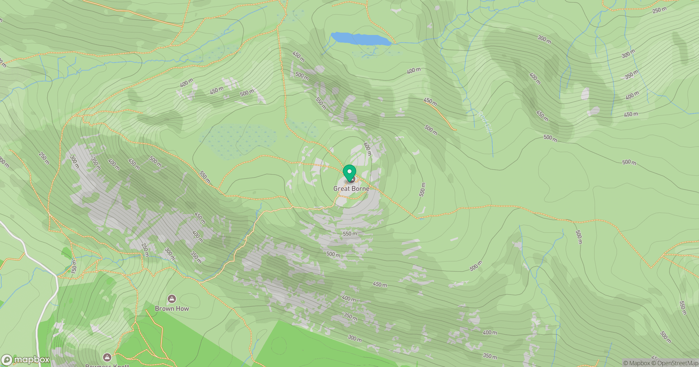
Grid reference: NY123163
View on OpenStreetMapOpens a map in a new tab, centred on the hill.
Hills within 30 km
Straight-line distance, not a walking route or confirmation of access.
High Stile [Grey Crag - High Stile]
806m

Pillar
892m
Grasmoor
852m

Crag Hill [Eel Crag]
839m

Grisedale Pike
790m
No comments yet. Be the first.