

Creag Bheag
Good walks are even better shared.
NH7401 : Summit of Creag Bheag looking east over Spey valley
Jerry Evans Photo source
Overview
Creag Bheag
Nestled in the heart of the Scottish Highlands, Creag Bheag stands proudly as a Marilyn with an elevation of 603 meters.
Geology
Creag Bheag is primarily composed of schist and granite. The dramatic landscapes and varied ecosystems that surround this peak are a product of the complex geological processes that have shaped the Highlands over millions of years. Don’t worry, though; the ancient rocks are quite supportive and won't judge your choice of footwear.
Routes
There are two popular routes for reaching the summit:
1. Circuit via Loch Gynack
This moderate loop is approximately 9 km long and takes around 3.5 hours to complete. It offers stunning views and allows you to enjoy the scenic beauty of Loch Gynack before your ascent.
2. Direct Ascent from the A86
For those in a hurry to tick this Marilyn off their list, this easy 4.5 km route from the A86 will get you to the top in about 2 hours. Perfect for a quick weekend bagging!
Summit Features
The summit is marked by a quaint cairn, providing the perfect backdrop for a victory selfie. Don’t forget to take a moment to admire the stunning panoramic views before you head back down.
Terrain Type
The terrain is a delightful mix of rocky outcrops and grassy slopes, with the occasional boggy patch that may leave your socks feeling less than fresh. Remember: a hike is not complete without a bit of mud!
Views
From the summit, you’ll be treated to breathtaking sights of the surrounding peaks, including the distinguished Cairngorms in the east. The best times to visit for views that will make your friends envious are in the spring and autumn when the skies are usually clearer and the scenery is at its most vibrant.
Hazards
Keep an eye out for the notoriously swift changes in weather that the Scottish Highlands are known for. Those clouds can roll in quicker than you can say "pint of lager." And do watch your step—those muddy patches are expert ambush artists!
Nearby Summits
If you're feeling adventurous, a couple of nearby summits include:
- Creag Ruadh (647 m): Offering a slightly higher challenge.
- Carn nan Gobhar (826 m): A bit further afield but worth the trek.
Access
You can park at the convenient layby along the A86 just south of Laggan. There's also public transport from Newtonmore, but be sure to check the schedules—they can be a bit like elusive hill sheep sometimes.
Facilities
Although there aren't any facilities on the mountain itself, Laggan offers a warm welcome with cafes and shops, ensuring you can indulge in a post-hike treat or two.
History
The name 'Creag Bheag' translates to 'small crag' in Scottish Gaelic. A fitting title indeed!
Historically, this peak has provided a serene escape for locals and hikers alike, playing a role in the rich tapestry that is Highland culture.
So there you have it—a mountain with personality, and one that promises a refreshing day on the trails.
Happy hiking!
Explore routes near Creag Bheag
Walks starting near this hill. Open a route to check its map, distance and full itinerary.
Rothiemurchus: Beaver Trail and Lochan Mor
View route
Aviemore: Loch an Eilein and the Croft Track from Rothiemurchus
View route
Fort Augustus to Kytra Lock: Caledonian Canal Towpath
View route
Glen Affric: Coire Loch Woodland Trail
View route
Route planning notes
These notes describe possible approaches. Check a route's map and access information when planning your walk.
Circuit via Loch Gynack
This circular route offers stunning views while providing a moderate challenge as it navigates around Loch Gynack before ascending Creag Bheag.
Direct Ascent from the A86
A straightforward ascent from the main road, making it a popular choice for those looking to bag the summit quickly.
Make a day of it, together
Find someone to share the walk with, or organise a day out along a route you like.
Photo Gallery
View all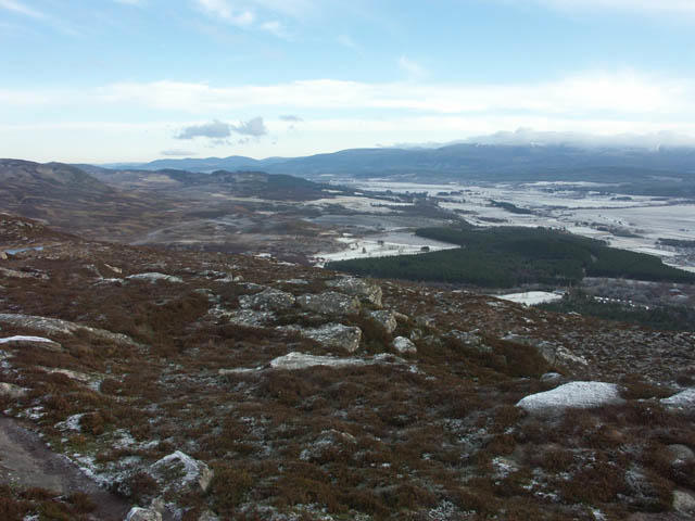 Photo could not load
NH7401 : Summit of Creag Bheag looking east over Spey valley
Jerry Evans
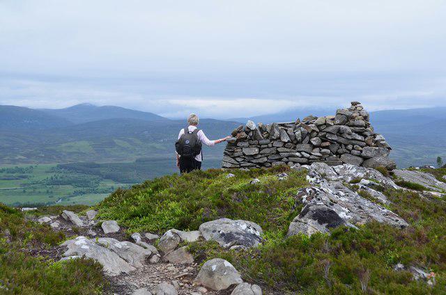 Photo could not load
NH7401 : Summit shelter, Creag Bheag
Jim Barton
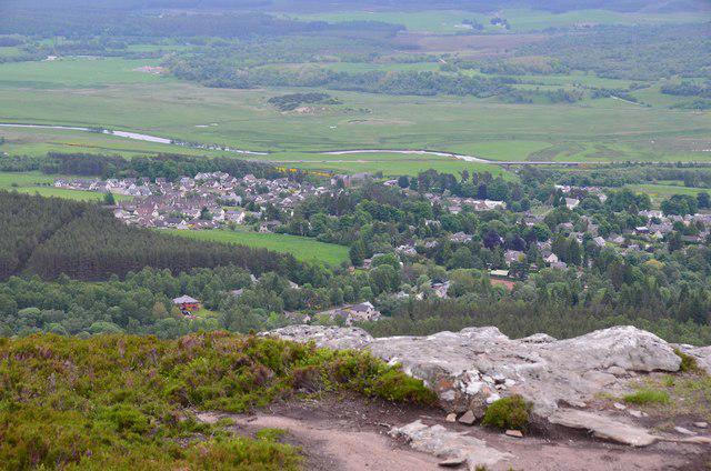 Photo could not load
NH7401 : Kingussie from Creag Bheag summit
Jim Barton
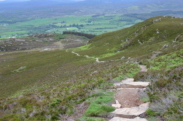 Photo could not load
NH7401 : Path down Creag Bheag
Jim Barton
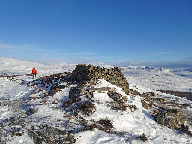 Photo could not load
NH7401 : Creag Bheag Shelter
Adam Ward
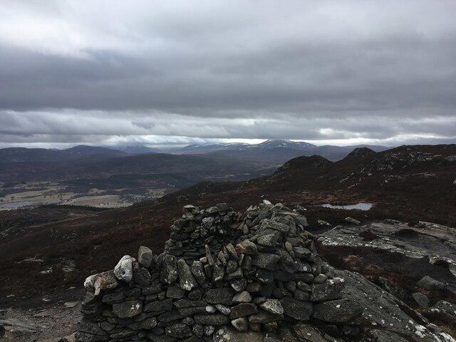 Photo could not load
NH7401 : Wind shelter on Creag Bheag
Steven Brown
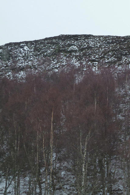 Photo could not load
NH7401 : Creag Bheag from the Loch Gynack path
Peter Bond
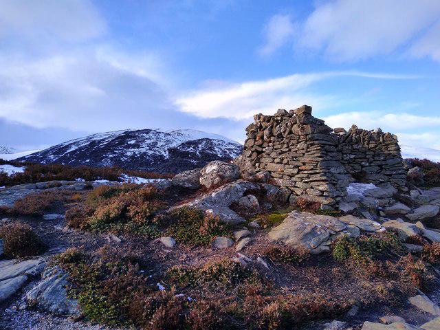 Photo could not load
NH7401 : On the top of Creag Bheag
Aleks Scholz
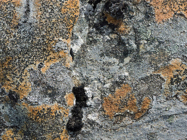 Photo could not load
NH7401 : Lichens by the top of Creag Bheag, Kingussie
Julian Paren
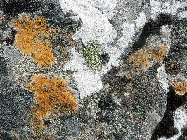
NH7401 : Lichens by the top of Creag Bheag, Kingussie
Julian Paren
Hill facts and local notes
Classifications
Elevation
487m
1,598 ft
Prominence
159m
Coordinates
57.0887, -4.0720
NH745016
OS Map
35
Explorer: OL56 402
At the Summit
The summit is marked by a small cairn and offers a panoramic viewpoint over the surrounding landscape, making it a perfect spot for a photo op.
Terrain & Geology
Creag Bheag is primarily composed of schist and granite, typical of the geological formations found in the Highlands. The area's complex geology contributes to its dramatic landscapes and varied ecosystems.
Views & Scenery
From the summit, enjoy views of the surrounding peaks, including the mighty Cairngorms to the east and the Monadhliath Mountains to the south.
History & Heritage
Name Origin
The name 'Creag Bheag' translates to 'small crag' in Scottish Gaelic, a fitting title for this modest but beautiful peak.
Historical Significance
Like many Scottish hills, it's been a favorite among local hikers and provides a glimpse into the rich cultural tapestry of Highland life.
Getting There & Facilities
Parking
You can park at the layby along the A86 just south of Laggan.
Public Transport
The nearest bus services run from Newtonmore and Laggan, but check seasonal schedules for availability.
Nearby Facilities
There are no facilities directly on the mountain, but Laggan offers a few cafes and a shop for essentials. Take a wee break before your adventure!
Safety Information
Known Hazards
- Be mindful of sudden weather changes. The Scottish mountains have a reputation for being moody. Also, watch out for muddy patches, particularly after rain.
General Safety Tips
- Check weather conditions before setting out
- Carry appropriate clothing and equipment
- Let someone know your planned route
- Take a map, compass, and GPS device
- Carry emergency supplies: food, water, first aid kit, torch
Hills
Some common questions about the hills answered
Are there group walks up Creag Bheag?
Many walkers use Walkmates to join or organise walks with others. You can check for group walks around Creag Bheag through the maps
Are there other walkers around Creag Bheag?
Activity varies by location and time, but Walkmates lets you see whether others have shared walks or shown interest in this area. Find other people through the walking friends search walking friends for Creag Bheag search or of course create your own walk for Creag Bheag
Can I organise a walk to Creag Bheag?
Yes. If there aren’t any walks listed already, you can create a walk and make it available for others to join.
If you're signed up to Walkmates, you can create a walk to Creag Bheag.
How do I find a walk up this hill?
There are often multiple ways to walk this hill, depending on experience and route preference. Walkmates helps you explore walks and routes that others have shared.
Can I suggest a new route up Creag Bheag?
Yes. You can suggest or create routes to share with others. Walkmates focuses on the social side of walking, so routes are used to help people organise walks and explore areas together, rather than as detailed navigation tools or route libraries.
Other uses really appreciate knowledgeable walkers sharing their routes. Share your favourite route to Creag Bheag here
The is an error or something incorrect about this hill. How do I let you know?
We always strive to keep the information on Walkmates as accurate as possible. If you find an error, please let us know through the contact form and we'll aim to correct it as quickly as possible
Community Discussion
Comments
Location
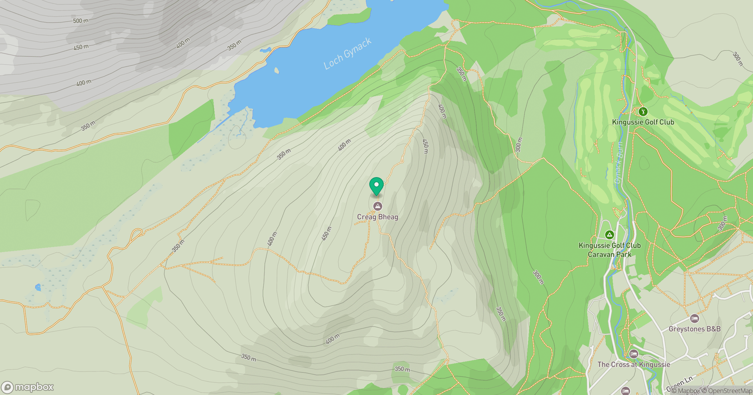
Grid reference: NH745016
View on OpenStreetMapOpens a map in a new tab, centred on the hill.
![Ben Macdui [Beinn Macduibh]](https://cdn.walkmates.com/gallery-images/e60cf32aeb394c3282fcdd14a63368f0.jpg)
No comments yet. Be the first.