

Cairn Bannoch
Good walks are even better shared.
NO2282 : Summit of Cairn Bannoch with view towards Broad Cairn
Colin Park Photo source
Overview
Cairn Bannoch: An Enthralling Experience
Nestled in the heart of the Grampian Mountains, Cairn Bannoch stands proud at 1042 meters, drawing outdoor enthusiasts eager to conquer its heights. With a gentle yet rewarding route from Glen Esk, this Munro offers a taste of Scotland’s wild beauty and an opportunity for adventure.
Geology
As you trek up Cairn Bannoch, you can't help but admire the geological wonders surrounding you. The granite and schist formations tell the tale of the Earth's rugged history, shaped by glacial processes. Here, ancient rocks have withstood the test of time, creating the majestic features you see today. It’s a real treat for geology buffs and nature lovers alike!
Routes
The predominant route to the summit is via Glen Esk, which is well-marked and accessible for most hikers. The trek involves approximately 12 km of walking time, leading you through stunning landscapes dotted with heather and peat bogs.
Summit Features
Reaching the summit, you’ll be greeted by a proud stone cairn that not only marks the pinnacle of your journey but also serves as a reminder of the many adventurers who have come before you. This iconic feature offers the perfect backdrop for a group photo or a moment of personal reflection.
Terrain Type
Expect a rocky and varied terrain, with some sections that may require careful navigation due to boulders and uneven ground. That said, the occasional grassy area provides a pleasant interlude, easing the strain on your legs.
Views
On a clear day, the views from Cairn Bannoch are simply breathtaking. With landmarks like Mount Keen dominating the horizon, it's a photographer's dream. The best chances for clear vistas are during spring and early summer, so plan your hike accordingly!
Hazards
Keep your wits about you, as the Scottish weather can be as fickle as a cat at bath time. Sudden changes can occur, and the terrain can become soggy in places, particularly after rain. Proper footwear and rain gear are highly advisable!
Access
Getting to Cairn Bannoch is straightforward. The nearest parking area is at the Glen Esk car park, which can fill up quickly, particularly on weekends. Edzell is the closest town if you need supplies, and while public transport can be a bit of a faff, it’s nothing a good taxi can't fix.
Facilities
Once you've conquered the mountain, you might crave a warm drink. Edzell has a couple of cafes where you can rest your weary legs and reflect on your adventure, but facilities on the mountain are just you and nature – so be sure to plan ahead.
History
The name ‘Cairn Bannoch’ carries a sense of heritage, rooted in the local dialect. A journey to this summit isn’t just a hike; it's a walk through time and lore that adds to the rich narratives woven throughout Scotland's wilderness.
Cairn Bannoch promises an unforgettable experience as you conquer one of Scotland’s esteemed Munros. So lace up those boots and set forth on your adventure!
Explore routes near Cairn Bannoch
Walks starting near this hill. Open a route to check its map, distance and full itinerary.
Loch Muick full circuit from Spittal of Glen Muick
View route
Cairngorms night walk and stargazing (event meeting)
View route
Cairngorms night walk and stargazing (event meeting)
View route
Cairngorms night walk and stargazing (event meeting)
View route
Route planning notes
These notes describe possible approaches. Check a route's map and access information when planning your walk.
Cairn Bannoch via Glen Esk
A popular and scenic walk starting from Glen Esk, offering a gradual ascent through beautiful landscapes.
Make a day of it, together
Find someone to share the walk with, or organise a day out along a route you like.
Photo Gallery
View all Photo could not load
NO2282 : Summit of Cairn Bannoch with view towards Broad Cairn
Colin Park
 Photo could not load
NO2282 : Cairn Bannoch summit
Alan Reid
 Photo could not load
NO2282 : Boundary old & new
Liz Gray
 Photo could not load
NO2282 : Cairn Bannoch
Ralph Greig
 Photo could not load
NO2282 : Old boundary post near Cairn Bannoch
Colin Park
 Photo could not load
NO2282 : Lochnagar, the White Mounth and Eagles Rock from the summit of Cairn Bannoch
Andrew McCallum
 Photo could not load
NO2282 : Angular rocks on Cairn Bannoch
Trevor Littlewood
 Photo could not load
NO2282 : Looking north west from the summit of Cairn Bannoch towards Carn an t-Sagairt Mòr with the Cairngorms beyond
Andrew McCallum
 Photo could not load
NO2282 : Cairn Bannoch
David Brown

NO2282 : Cairn Bannoch
Stephen Sweeney
Hill facts and local notes
Classifications
Elevation
1,011m
3,317 ft
Prominence
76m
Coordinates
56.9277, -3.2784
NO222825
OS Map
44
Explorer: OL53N 388N
At the Summit
The summit features a prominent stone cairn that offers a sense of achievement to many hikers who reach its peak. On clear days, this spot boasts stunning panoramas of the surrounding mountain landscape.
Terrain & Geology
Cairn Bannoch is primarily composed of granite and schist, typical for this region, which gives it a rugged and ancient character. The geological formations here are shaped by glacial activity, resulting in distinctive U-shaped valleys and high peaks.
Views & Scenery
From the summit, you can see the majestic peaks of the surrounding Grampian Mountains, including Mount Keen and the vast expanse of Glen Esk.
History & Heritage
Name Origin
The name 'Cairn' comes from the Scottish Gaelic word 'cairn' meaning a pile of stones, often used as trail markers or memorials. 'Bannoch' possibly relates to an old term meaning 'hill' or 'summit'.
Historical Significance
Cairn Bannoch is not just a physical landmark; it bears cultural significance within local folklore and is part of the rich tapestry of Scotland's hiking heritage.
Getting There & Facilities
Parking
Parking is available at the Glen Esk car park (NO284804). This area can get busy, particularly during peak hiking seasons, so arrive early to snag a spot.
Public Transport
Public transport options are limited, though you can reach nearby towns such as Edzell via bus services. From there, it’s advisable to use a taxi or arrange a lift to the starting point.
Nearby Facilities
Basic facilities are available in Edzell, including cafes and toilets. Once you're on the mountain, it's just you and nature, so plan ahead!
Safety Information
Known Hazards
- Be aware of rapidly changing weather conditions. Waterproof gear is essential, and boggy ground may be present, particularly after rain.
General Safety Tips
- Check weather conditions before setting out
- Carry appropriate clothing and equipment
- Let someone know your planned route
- Take a map, compass, and GPS device
- Carry emergency supplies: food, water, first aid kit, torch
Hills
Some common questions about the hills answered
Are there group walks up Cairn Bannoch?
Many walkers use Walkmates to join or organise walks with others. You can check for group walks around Cairn Bannoch through the maps
Are there other walkers around Cairn Bannoch?
Activity varies by location and time, but Walkmates lets you see whether others have shared walks or shown interest in this area. Find other people through the walking friends search walking friends for Cairn Bannoch search or of course create your own walk for Cairn Bannoch
Can I organise a walk to Cairn Bannoch?
Yes. If there aren’t any walks listed already, you can create a walk and make it available for others to join.
If you're signed up to Walkmates, you can create a walk to Cairn Bannoch.
How do I find a walk up this hill?
There are often multiple ways to walk this hill, depending on experience and route preference. Walkmates helps you explore walks and routes that others have shared.
Can I suggest a new route up Cairn Bannoch?
Yes. You can suggest or create routes to share with others. Walkmates focuses on the social side of walking, so routes are used to help people organise walks and explore areas together, rather than as detailed navigation tools or route libraries.
Other uses really appreciate knowledgeable walkers sharing their routes. Share your favourite route to Cairn Bannoch here
The is an error or something incorrect about this hill. How do I let you know?
We always strive to keep the information on Walkmates as accurate as possible. If you find an error, please let us know through the contact form and we'll aim to correct it as quickly as possible
Community Discussion
Comments
Location
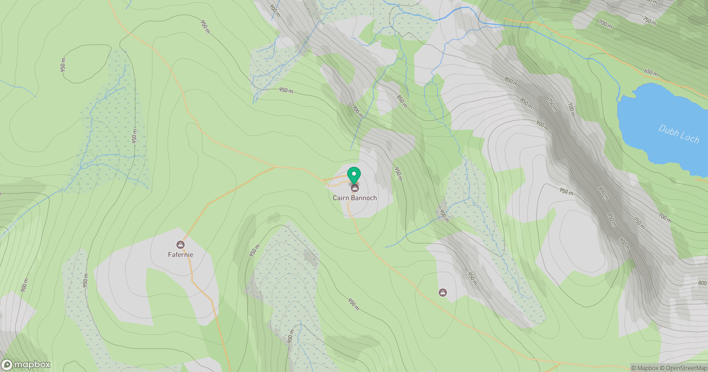
Grid reference: NO222825
View on OpenStreetMapOpens a map in a new tab, centred on the hill.
No comments yet. Be the first.