

Beinn Dearg Mor
Good walks are even better shared.
NH0379 : Beinn Dearg Mòr and Loch na Sealga
Richard Webb Photo source
Overview
Beinn Dearg Mor
Beinn Dearg Mor is a towering giant in the Scottish Highlands, standing at an impressive 1085 meters. As the Munro classification suggests, it’s a peak well worth conquering for both novices and seasoned hikers alike.
Geology
The mountain's composition of granite gives it a distinctive look, with fascinating geological features shaped by millions of years of weathering and glaciation. If you peer closely, you might even spot the odd bit of quartz - the mountain is nearly blushing with its pinkish hues!
Routes
There are a couple of popular routes to the summit, with the Glen Golly Route being the more frequented path. Stretching approximately 11.5 km and taking around 5.5 hours, it is classified as moderate, thus suiting a wide range of abilities. Alternatively, if you’re seeking a challenge, consider the An Teallach Approach. It’s steeper and about 10 km long but rewards hikers with exhaustive views and the thrill of tackling more rugged terrain.
Summit Features
Upon reaching the summit, be greeted by a sturdy trig point and a large stone cairn—perfect for a group selfie, if you're inclined to document your feat!
Terrain Type
Expect a mixed bag of rocky outcrops and grassy slopes. Just be sure to keep an eye open for the occasional bog; while they can add character to your hike, they might also try to swallow your boots!
Views
The vistas are nothing short of spectacular, with the likes of An Teallach and the serene waters of Loch Broom gracing the horizon from the summit. Ideal times for enjoying these sights are late spring and autumn, when the visibility is often at its best and the landscape is painted in rich colours.
Hazards
As with any mountain expedition, caution is key. Keep an ear tuned to the weather, as it can turn from sunny to stormy in a heartbeat. Also, be wary of loose stones and those sly boggy patches that can try and trip you up!
Access
For parking, you’ll find limited roadside options at Glen Golly, so arrive early if you want to snag a spot. The closest town is Ullapool, which provides a variety of amenities including cafes for a well-deserved coffee after your trek!
Facilities
Ullapool, just a stone's throw from the mountain, has all the necessary facilities to refresh you post-hike, including delightful eateries and toilet amenities.
History
The name 'Beinn Dearg Mor' reflects its notable characteristics, translating to 'Big Red Mountain'. This mountain has been a part of the local narrative and landscape for generations, attracting adventurers from near and far.
In summary, Beinn Dearg Mor is not just a mountain to climb; it’s a token of the majestic Scottish landscape, waiting to challenge you while simultaneously offering a taste of nature’s beauty. Be prepared, stay safe, and enjoy every moment of your trek!
Happy hiking!
Explore routes near Beinn Dearg Mor
Walks starting near this hill. Open a route to check its map, distance and full itinerary.
Fairy Lochs Liberator Wreckage Circuit
View route
Beinn Eighe Lancaster Wreckage at Coire Mhic Fhearchair
View route
Glen Affric: Coire Loch Woodland Trail
View route
Loch Migdale from Torroy: Spinningdale pinewood and loch shore walk
View route
Route planning notes
These notes describe possible approaches. Check a route's map and access information when planning your walk.
Glen Golly Route
A popular route starting from Glen Golly that provides a captivating approach to the summit, offering stunning views of the surrounding hills.
An Teallach Approach
This route winds up through beautiful heather-clad slopes before taking you to the summit, perfect for those who enjoy a scenic wander.
Make a day of it, together
Find someone to share the walk with, or organise a day out along a route you like.
Photo Gallery
View all Photo could not load
NH0379 : Beinn Dearg Mòr and Loch na Sealga
Richard Webb
 Photo could not load
NH0379 : Summit Crags - Beinn Dearg Mhor
K A
 Photo could not load
NH0379 : Beinn Dearg Mor
Paul McNair
 Photo could not load
NH0379 : Beinn Dearg Mor & Loch na Sealga from Sgurr Fiona, An Teallach
Colin Park
 Photo could not load
NH0379 : Looking towards the summit of Beinn Dearg Mor
Carole Engel
 Photo could not load
NH0379 : Summit cliffs of Beinn Dearg Mor
Jonathan Venn
 Photo could not load
NH0379 : Summit of Beinn Dearg Mor looking NE
Jonathan Venn
 Photo could not load
NH0379 : Summit cairn of Beinn Dearg Mor
Jonathan Venn
 Photo could not load
NH0379 : Beinn Dearg Mor
Jim Barton

NH0379 : Looking down the north face of Beinn Dearg Mor
Jonathan Venn
Hill facts and local notes
Classifications
Elevation
906m
2,973 ft
Prominence
564m
Coordinates
57.7658, -5.3099
NH032799
OS Map
19
Explorer: 435N 435S
At the Summit
The summit of Beinn Dearg Mor features a prominent trig point and a large cairn, making it a popular spot for hikers to rest and take photos.
Terrain & Geology
Beinn Dearg Mor is predominantly composed of granite, offering striations and granite tors that hint at its ancient origins. The rugged terrain is further shaped by glaciation, giving it the dramatic contours it boasts today.
Views & Scenery
From the summit, hikers can enjoy breathtaking views of the surrounding mountain ranges, including An Teallach, the Fisherfield Forest, and Loch Broom in the distance.
History & Heritage
Name Origin
The name 'Beinn Dearg Mor' translates to 'Big Red Mountain' in Scottish Gaelic, likely referring to the reddish hues of the granite when sunlight hits it just right.
Historical Significance
The mountain holds cultural significance as part of the local Highland landscape and has long been a popular destination for both casual walkers and seasoned climbers.
Getting There & Facilities
Parking
There is limited roadside parking available on the A832, at Glen Golly, with space for a few cars.
Public Transport
Regular bus services run to nearby Ullapool, with a taxi required to reach Glen Golly.
Nearby Facilities
Ullapool offers various facilities, including cafes, restaurants, and toilets.
Safety Information
Known Hazards
- Potential for rapidly changing weather conditions, loose rocks, and boggy patches in lower sections.
General Safety Tips
- Check weather conditions before setting out
- Carry appropriate clothing and equipment
- Let someone know your planned route
- Take a map, compass, and GPS device
- Carry emergency supplies: food, water, first aid kit, torch
Hills
Some common questions about the hills answered
Are there group walks up Beinn Dearg Mor?
Many walkers use Walkmates to join or organise walks with others. You can check for group walks around Beinn Dearg Mor through the maps
Are there other walkers around Beinn Dearg Mor?
Activity varies by location and time, but Walkmates lets you see whether others have shared walks or shown interest in this area. Find other people through the walking friends search walking friends for Beinn Dearg Mor search or of course create your own walk for Beinn Dearg Mor
Can I organise a walk to Beinn Dearg Mor?
Yes. If there aren’t any walks listed already, you can create a walk and make it available for others to join.
If you're signed up to Walkmates, you can create a walk to Beinn Dearg Mor.
How do I find a walk up this hill?
There are often multiple ways to walk this hill, depending on experience and route preference. Walkmates helps you explore walks and routes that others have shared.
Can I suggest a new route up Beinn Dearg Mor?
Yes. You can suggest or create routes to share with others. Walkmates focuses on the social side of walking, so routes are used to help people organise walks and explore areas together, rather than as detailed navigation tools or route libraries.
Other uses really appreciate knowledgeable walkers sharing their routes. Share your favourite route to Beinn Dearg Mor here
The is an error or something incorrect about this hill. How do I let you know?
We always strive to keep the information on Walkmates as accurate as possible. If you find an error, please let us know through the contact form and we'll aim to correct it as quickly as possible
Community Discussion
Comments
Location
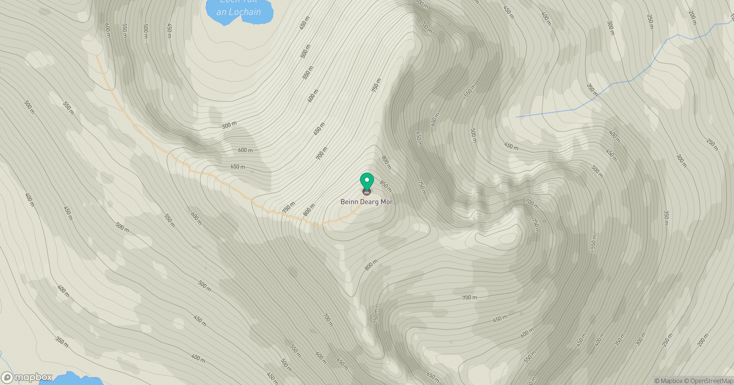
Grid reference: NH032799
View on OpenStreetMapOpens a map in a new tab, centred on the hill.
No comments yet. Be the first.