

Low Pike
Good walks are even better shared.
NY3707 : Ridge towards High Pike
Graham Horn Photo source
Overview
Low Pike: A Hiker's Delight
Low Pike is a charming peak nestled within the enchanting Lake District. Standing at an elevation of 609 meters, it may not be the tallest, but its allure lies in the beauty of the journey as much as the destination.
Geology
The rock that forms Low Pike is primarily volcanic in nature, belonging to the Skiddaw group. The combination of volcanic rock, slate, and schist around the area creates a varied terrain that adds character to your hike. Watch your step though; some rocks can be as slippery as a fish out of water!
Access and Parking
Accessing Low Pike is a breeze, especially when using Ambleside as your base. There are several car parks available, particularly around Waterhead, but be prepared to pay a few quid for the privilege. If public transport is more your cup of tea, robust bus services connect Ambleside to Windermere and surrounding towns.
Routes
Whether you prefer a gentle ascent or a more challenging trek, Low Pike has a route for everyone:
- Ambleside to Low Pike: A well-trodden path that offers spectacular views and is perfect for families and casual walkers. Distance: 6.5 km, Time: approx. 2.5 hours.
- Low Pike from Red Screes: For those seeking a bit more adventure, this route connects the mighty Low Pike and the towering Red Screes. Distance: 8.0 km, Time: approx. 3.5 hours. Prepare for a workout and some stunning vistas!
Summit Features
At the summit, expect a modest cairn that pays homage to the many hikers who have graced its peak. From here, sweeping vistas await you with sights of Windermere and possibly even the Scafell range on a clear day.
Hazards
The hike is moderately safe, but do keep an eye out for slippery rocks and boggy patches. No one wants to return home covered in mud unless it's part of the fun!
Nearby Summits
After conquering Low Pike, consider taking on its nearby siblings:
- High Pike: 657 meters
- Red Screes: 802 meters
Both provide their own unique challenges and rewarding views.
Facilities
After your adventure, indulge in one of Ambleside's hundreds of cafes and pubs. A hot drink and a slice of cake is the perfect way to unwind!
Conclusion
Low Pike may not have the highest peak, but it certainly packs a punch in terms of adventure and views. Don't miss out on this hidden gem of the Lake District!
Happy hiking!
Explore routes near Low Pike
Walks starting near this hill. Open a route to check its map, distance and full itinerary.
Bow Fell from Langdale
View route
Striding Edge, Helvellyn and Catstye Cam
View route
Helvellyn via Striding Edge
View route
Tarn Hows Fast Route
View route
Route planning notes
These notes describe possible approaches. Check a route's map and access information when planning your walk.
Ambleside to Low Pike
A popular and straightforward ascent starting from Ambleside which offers splendid views as you climb.
Low Pike from Red Screes
A slightly challenging route that connects Low Pike to Red Screes, recommended for those wanting a bit of a challenge with rewarding views.
Make a day of it, together
Find someone to share the walk with, or organise a day out along a route you like.
Photo Gallery
View all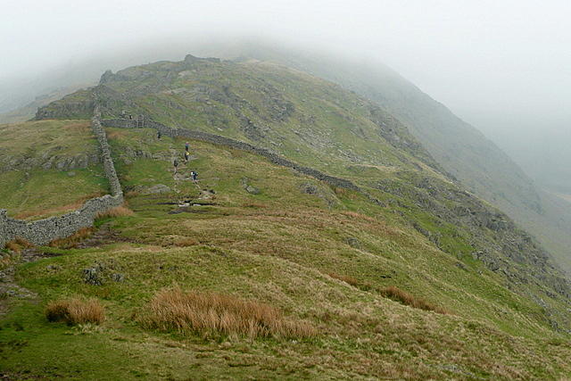 Photo could not load
NY3707 : Ridge towards High Pike
Graham Horn
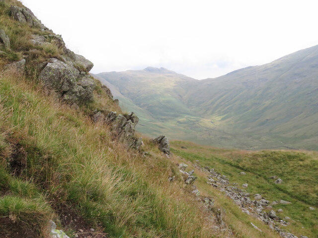 Photo could not load
NY3707 : View from Low Pike over Scandale Fell
Gareth James
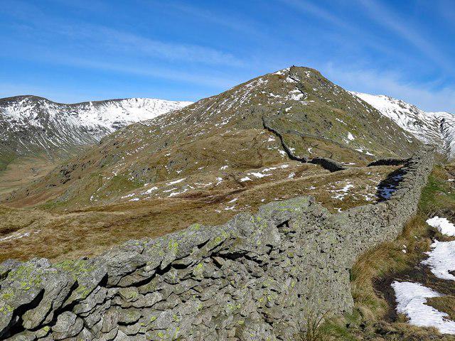 Photo could not load
NY3707 : Wall below High Pike
Andrew Curtis
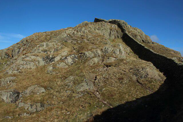 Photo could not load
NY3707 : Outcrop at Low Pike
Graham Robson
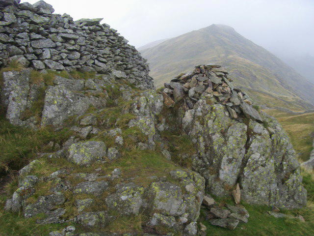 Photo could not load
NY3707 : Low Pike Summit
Shaun Ferguson
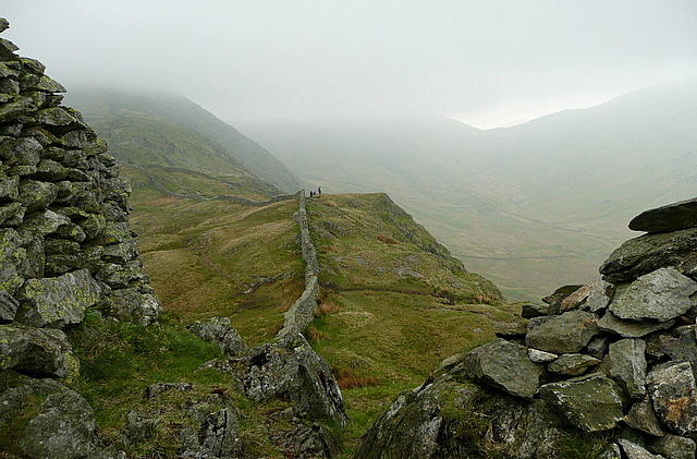 Photo could not load
NY3707 : Stick or twist?
Graham Horn
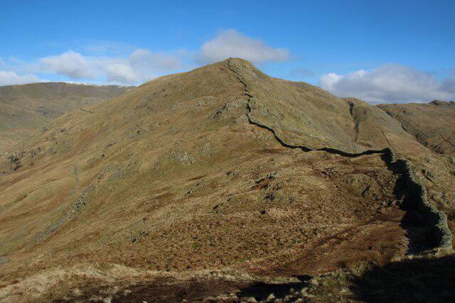 Photo could not load
NY3707 : View North From Low Pike
Graham Robson
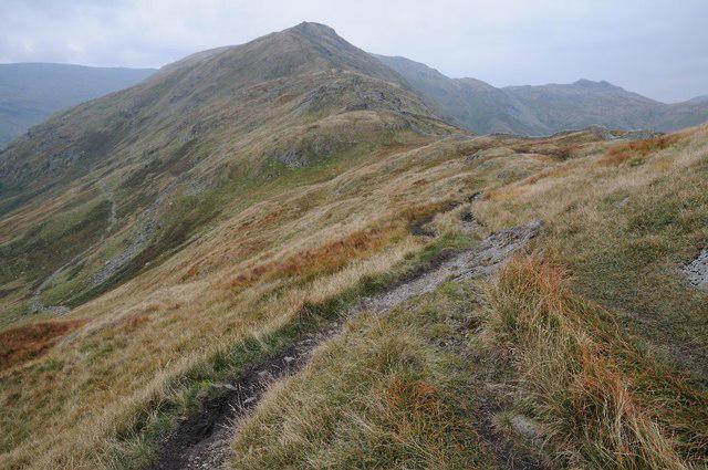 Photo could not load
NY3707 : View to High Pike
Philip Halling
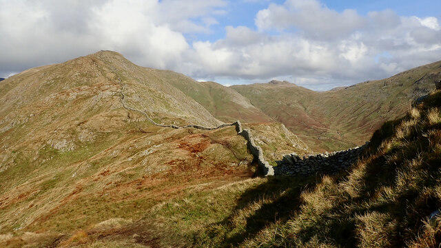 Photo could not load
NY3707 : High Pike from Low Pike
Mick Garratt
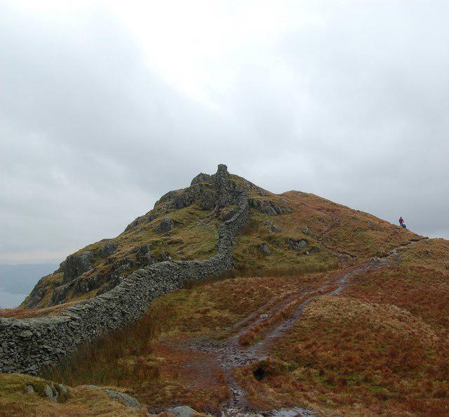
NY3707 : Low Pike
Anthony Parkes
Hill facts and local notes
Classifications
Elevation
508m
1,667 ft
Prominence
18m
Coordinates
54.4621, -2.9680
NY373078
OS Map
90
Explorer: OL7N
At the Summit
The summit boasts a simple but prominent cairn, serving as a humble marker amongst the dramatic scenery.
Terrain & Geology
Low Pike is primarily composed of volcanic rock from the Skiddaw group, providing a rugged but stunningly picturesque landscape. The surrounding area features layers of slate and schist, adding to the geological diversity.
Views & Scenery
From the summit, you can enjoy sweeping views of Windermere, the rolling fells, and, on a clear day, the imposing peaks of the Scafell range.
History & Heritage
Name Origin
The name 'Pike' refers to a pointed hill or peak, while 'Low' denotes its stature compared to nearby higher fells.
Historical Significance
Low Pike has been a popular destination for hikers and outdoor enthusiasts for generations, cherished for its accessible paths and stunning views.
Getting There & Facilities
Parking
There are several car parks in Ambleside, especially around Waterhead, with charges applicable. Arrive early to avoid the scramble for a spot during peak season.
Public Transport
Regular bus services operate from Windermere and other nearby towns to Ambleside, making it accessible for hikers relying on public transport.
Nearby Facilities
Ambleside offers a plethora of facilities including cafes, pubs, and toilets. Grab a slice of cake at one of the lovely tea rooms to fuel up before your hike!
Safety Information
Known Hazards
- Watch for slippery rocks, especially after rain. Crossing some boggy sections can also be tricky if not properly navigated.
General Safety Tips
- Check weather conditions before setting out
- Carry appropriate clothing and equipment
- Let someone know your planned route
- Take a map, compass, and GPS device
- Carry emergency supplies: food, water, first aid kit, torch
Hills
Some common questions about the hills answered
Are there group walks up Low Pike?
Many walkers use Walkmates to join or organise walks with others. You can check for group walks around Low Pike through the maps
Are there other walkers around Low Pike?
Activity varies by location and time, but Walkmates lets you see whether others have shared walks or shown interest in this area. Find other people through the walking friends search walking friends for Low Pike search or of course create your own walk for Low Pike
Can I organise a walk to Low Pike?
Yes. If there aren’t any walks listed already, you can create a walk and make it available for others to join.
If you're signed up to Walkmates, you can create a walk to Low Pike.
How do I find a walk up this hill?
There are often multiple ways to walk this hill, depending on experience and route preference. Walkmates helps you explore walks and routes that others have shared.
Can I suggest a new route up Low Pike?
Yes. You can suggest or create routes to share with others. Walkmates focuses on the social side of walking, so routes are used to help people organise walks and explore areas together, rather than as detailed navigation tools or route libraries.
Other uses really appreciate knowledgeable walkers sharing their routes. Share your favourite route to Low Pike here
The is an error or something incorrect about this hill. How do I let you know?
We always strive to keep the information on Walkmates as accurate as possible. If you find an error, please let us know through the contact form and we'll aim to correct it as quickly as possible
Community Discussion
Comments
Location
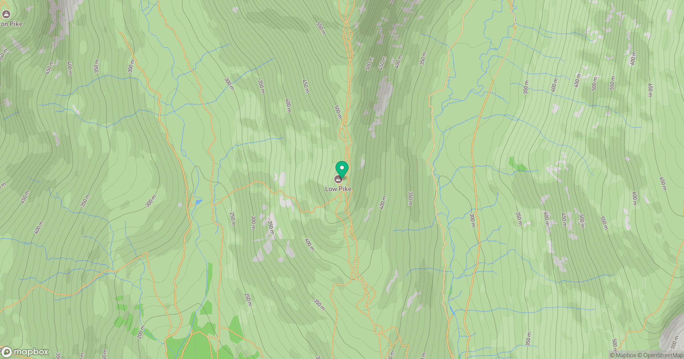
Grid reference: NY373078
View on OpenStreetMapOpens a map in a new tab, centred on the hill.

No comments yet. Be the first.