

Bynack Beg
Good walks are even better shared.
NJ0306 : Bynack Beg from Bynack More
Colin Park Photo source
Overview
Bynack Beg
Overview
Bynack Beg, standing tall at an elevation of 1,090 meters, is not just another Munro; it's a hike that captures the heart of the Scottish Highlands. Located near NJ036068, it welcomes adventurous souls with both arms—albeit chilly ones!
Geology
This mountain boasts granite that aged on a geological timescale. Formed during the Caledonian orogeny, the geological complexities add character to the landscape, with sharp ridges and boulders that dare the less nimble to face them. Just remember, if the rocks start talking back, you may want to reconsider if you've had enough of the highland breeze!
Routes
Two prominent routes lead climbers up to this beloved summit:
Bynack More Route: A delightful trek starting from the Cairn Gorm ski area with approximately 13.5 km to cover, taking around 5 hours. This path weaves through enchanting forests and plush heather hills.
From Glenmore: Slightly shorter at 12.0 km, this route can be tackled comfortably in 4.5 hours, winding through serene woodland before opening up to the stunning summit views.
Summit Features
Once you've puffed your way to the top, don't forget to catch your breath at the prominent stone cairn marking Bynack Beg's summit. It’s a fantastic spot for selfies—or simply just to soak in the views.
Terrain Type
Be prepared for rocky paths and stretches of heather-covered hills. While the scenery is picturesque, you may encounter boggy sections that remind you who’s really in charge here!
Views
From the summit, don’t miss the sweeping vistas of the Cairngorms, where Ben Macdui stands proud as the headliner. The finest views are often seen during spring and early autumn when Mother Nature dons her best attire.
Hazards
Keep an eye on the weather, as it can turn from serene to severe in the blink of an eye—classic Highland unpredictability! Also, be cautious of muddy trails that might attempt to swallow your boots whole.
Access
The nearest parking lot can be found at the Cairn Gorm Mountain ski area, your go-to launchpad for this hike. If public transport is more your style, bus services from Aviemore will get you there with minimal fuss. The charming town of Aviemore is your closest hub for all things supplies and relaxation.
Facilities
After your hike, you can refuel your energy with coffee, cakes, and even a good natter with fellow hikers at the nearby cafes.
History
The name 'Bynack' hails from the Scottish Gaelic meaning ‘mountain of the slope’, and it is culturally significant in the hiking community, especially for those pursuing the Munro challenge.
So lace up your boots and set off for Bynack Beg—it promises to be a trek of a lifetime, or at least until your next mountain conquest!
Last Updated
2023-10-01
Explore routes near Bynack Beg
Walks starting near this hill. Open a route to check its map, distance and full itinerary.
Rothiemurchus: Beaver Trail and Lochan Mor
View route
Aviemore: Loch an Eilein and the Croft Track from Rothiemurchus
View route
Cairngorms night walk and stargazing (event meeting)
View route
Cairngorms night walk and stargazing (event meeting)
View route
Route planning notes
These notes describe possible approaches. Check a route's map and access information when planning your walk.
Bynack More Route
A popular route starting from the Cairn Gorm Mountain ski area, leading through beautiful forests and heather-covered hills to the summit.
From Glenmore
This route approaches from the Glenmore area, featuring serene woodland paths and scenic views.
Make a day of it, together
Find someone to share the walk with, or organise a day out along a route you like.
Photo Gallery
View all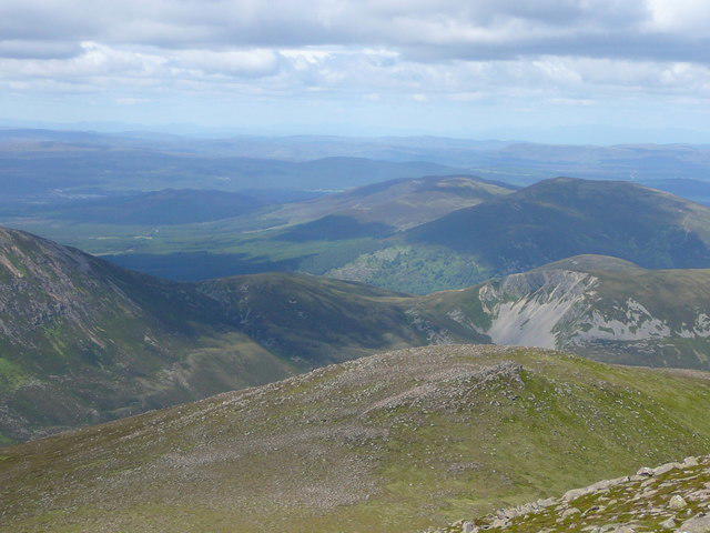 Photo could not load
NJ0306 : Bynack Beg from Bynack More
Colin Park
Hill facts and local notes
Classifications
Elevation
970m
3,182 ft
Prominence
23m
Coordinates
57.1423, -3.5941
NJ036068
OS Map
36
Explorer: OL57N OL57S OL58N OL58S 403N 403S 404N 404S
At the Summit
The summit of Bynack Beg is marked by a prominent cairn made of stone. It offers spectacular views and is a popular spot for photographs.
Terrain & Geology
Bynack Beg is primarily composed of granite, formed during the Caledonian orogeny. The rocky summit features distinctively sharp ridges and exposed boulders, typical of the highland granite landscape.
Views & Scenery
From the summit, hikers can enjoy panoramic views of the surrounding Cairngorms, including the majestic Ben Macdui, the second highest mountain in the UK.
History & Heritage
Name Origin
The name 'Bynack' is thought to derive from the Scottish Gaelic 'Beinn a' Chlair', meaning 'mountain of the slope'.
Historical Significance
Bynack Beg is popular among hikers as part of the Munro challenge and holds cultural significance for local walkers.
Getting There & Facilities
Parking
There are parking facilities available at the Cairn Gorm Mountain ski area, which can accommodate a large number of vehicles.
Public Transport
Regular bus services are available from Aviemore to the Cairn Gorm ski area.
Nearby Facilities
Cafes and visitor centres are available at the ski area, providing a warm drink and snacks after your adventurous day.
Safety Information
Known Hazards
- Beware of the changeable weather conditions, which can shift quickly in the Highlands. Note also the potential for muddy paths and uneven terrain.
General Safety Tips
- Check weather conditions before setting out
- Carry appropriate clothing and equipment
- Let someone know your planned route
- Take a map, compass, and GPS device
- Carry emergency supplies: food, water, first aid kit, torch
Hills
Some common questions about the hills answered
Are there group walks up Bynack Beg?
Many walkers use Walkmates to join or organise walks with others. You can check for group walks around Bynack Beg through the maps
Are there other walkers around Bynack Beg?
Activity varies by location and time, but Walkmates lets you see whether others have shared walks or shown interest in this area. Find other people through the walking friends search walking friends for Bynack Beg search or of course create your own walk for Bynack Beg
Can I organise a walk to Bynack Beg?
Yes. If there aren’t any walks listed already, you can create a walk and make it available for others to join.
If you're signed up to Walkmates, you can create a walk to Bynack Beg.
How do I find a walk up this hill?
There are often multiple ways to walk this hill, depending on experience and route preference. Walkmates helps you explore walks and routes that others have shared.
Can I suggest a new route up Bynack Beg?
Yes. You can suggest or create routes to share with others. Walkmates focuses on the social side of walking, so routes are used to help people organise walks and explore areas together, rather than as detailed navigation tools or route libraries.
Other uses really appreciate knowledgeable walkers sharing their routes. Share your favourite route to Bynack Beg here
The is an error or something incorrect about this hill. How do I let you know?
We always strive to keep the information on Walkmates as accurate as possible. If you find an error, please let us know through the contact form and we'll aim to correct it as quickly as possible
Community Discussion
Comments
Location
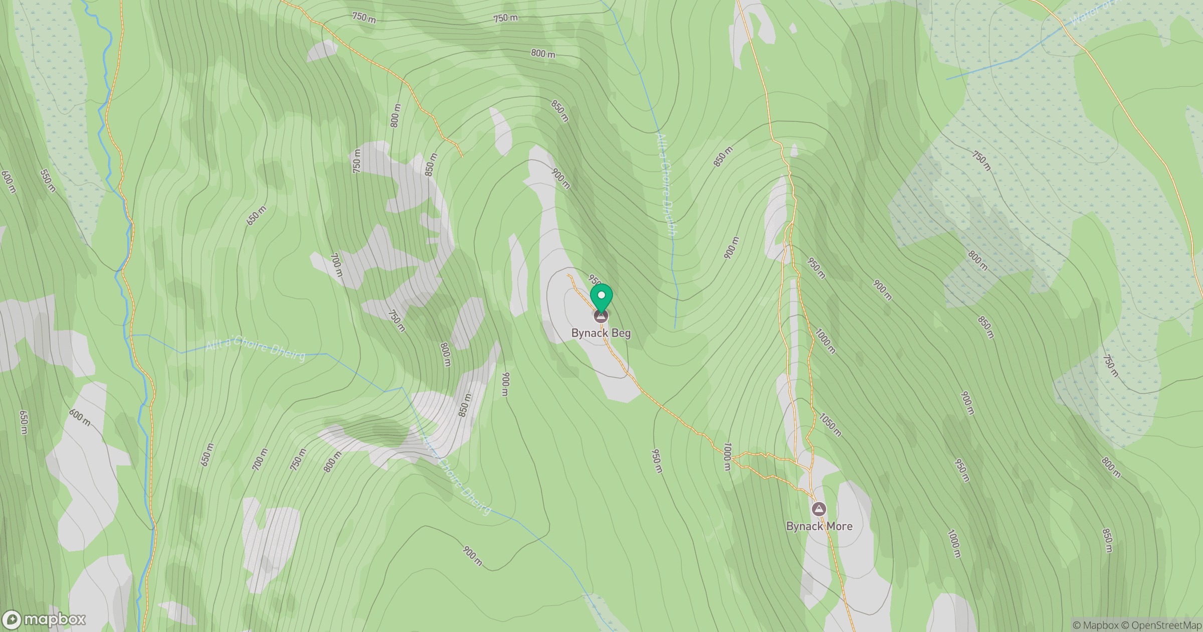
Grid reference: NJ036068
View on OpenStreetMapOpens a map in a new tab, centred on the hill.
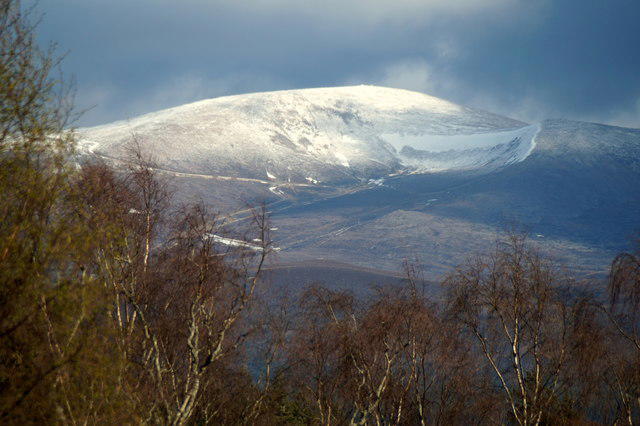
![Ben Macdui [Beinn Macduibh]](https://cdn.walkmates.com/gallery-images/e60cf32aeb394c3282fcdd14a63368f0.jpg)
No comments yet. Be the first.