

Birks
Good walks are even better shared.
NY3714 : Path on Birks
Bill Boaden Photo source
Overview
Birks: A Gem of the Lake District
Nestled in the heart of the Lake District, Birks offers an accessible adventure for walkers looking to experience the stunning scenery this iconic region is known for. With an elevation of 592 meters, it may not be the highest peak, but its commanding views and inviting trails make it a worthy addition to any hiking itinerary.
Geology
Birks stands proudly as a testament to the geological history of the Lake District, formed primarily from Borrowdale Volcanic Group rocks. This complex geological composition tells tales of ancient volcanic activity and glacial carving that have left behind a rugged, yet inviting landscape.
Routes
A popular route to the summit is via the Patterdale Path, a well-trodden trail that meanders through lush greenery and rocky patches, making it a delightful option for those of moderate fitness. The circular route offers a pleasant mix of tranquil nature and breathtaking views.
With a distance of approximately 6.5 km, most hikers can expect to conquer Birks in around 3.5 hours.
Summit Features
When you finally reach the summit, you’re greeted by a small, unassuming cairn atop a rocky outcrop. It’s a perfect spot to pause, take a selfie, and soak in the surrounding vistas that’ll make your Instagram followers green with envy.
Terrain
The terrain can be described as a mix of rocky and grassy sections, with some steep inclines that might just leave you puffing like a seasoned marathon runner. But fret not; every step is worth the effort!
Views
The views from the top are nothing short of spectacular. Look out over Helvellyn, Ullswater, and the expansive fells that define this landscape. Remember, spring and autumn are the best seasons for stellar views, when the scenery is adorned in glorious colours.
Hazards
Keep an eye out for potential hazards, such as slippery stones, muddy patches, and the unpredictable weather that can sweep in. Always remember to pack your sense of adventure (and a decent waterproof jacket for good measure).
Access and Facilities
Getting there is a breeze; the Patterdale car park is conveniently located for hikers. If you prefer to leave the car behind, the bus service from Penrith makes for a stress-free ride. Don’t forget to pop into one of Patterdale’s cafes for a slice of cake!
History
The name ‘Birks’ holds historical weight, with roots tracing back to the Old Norse, meaning ‘birch tree’. It speaks of the ancient woodlands that once flourished in the area. This beloved peak remains a beacon for outdoor enthusiasts, rich with local lore and stunning scenery.
So lace up those boots and head out to Birks – the mountain that offers the best of the Lake District without the need for scaling Everest. Happy hiking!
Explore routes near Birks
Walks starting near this hill. Open a route to check its map, distance and full itinerary.
Striding Edge, Helvellyn and Catstye Cam
View route
Helvellyn via Striding Edge
View route
Bow Fell from Langdale
View route
Scafell Pike from Seathwaite via the Corridor Route
View route
Route planning notes
These notes describe possible approaches. Check a route's map and access information when planning your walk.
Birks via the Patterdale Path
A popular route starting from Patterdale; this well-maintained path follows the contours up to Birks, with stunning views along the way.
Make a day of it, together
Find someone to share the walk with, or organise a day out along a route you like.
Photo Gallery
View all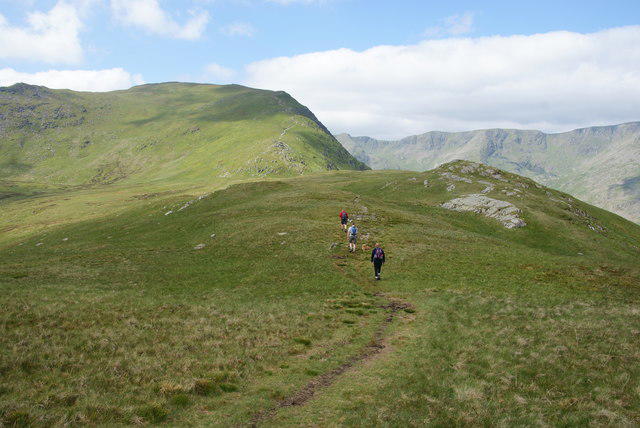 Photo could not load
NY3714 : Path on Birks
Bill Boaden
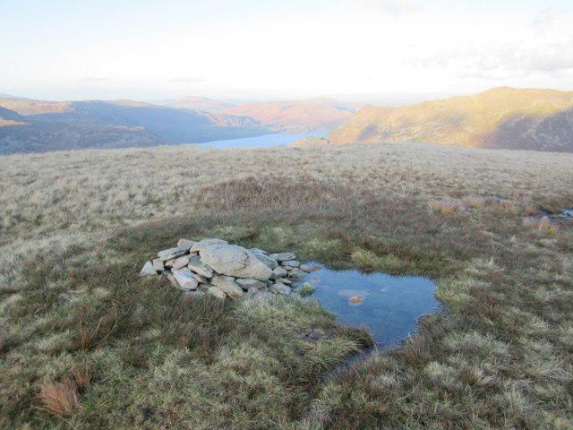 Photo could not load
NY3814 : Summit Cairn on Birks
Graham Robson
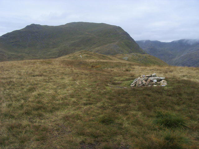 Photo could not load
NY3814 : Birks Summit
Shaun Ferguson
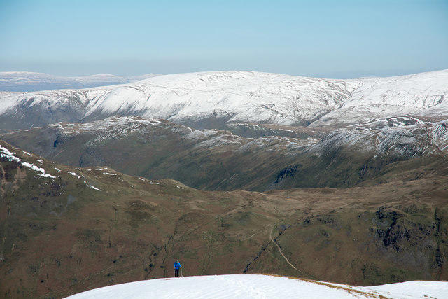 Photo could not load
NY3814 : Lone walker approaching summit of Birks
Trevor Littlewood
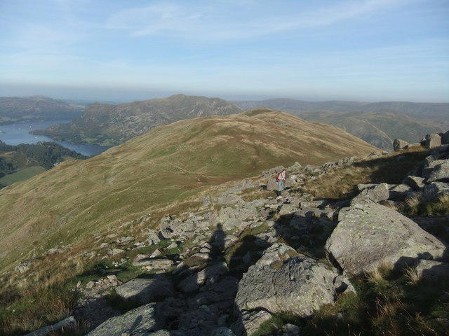 Photo could not load
NY3714 : Birks
David Brown
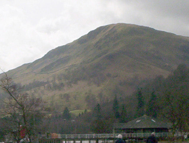 Photo could not load
NY3814 : Birks from Glenridding
Ann Clare
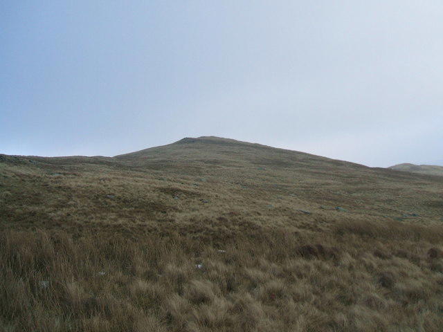 Photo could not load
NY3814 : Birks from Gavel Moss
David Brown
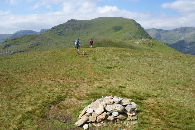 Photo could not load
NY3814 : The summit ridge of Birks
Bill Boaden
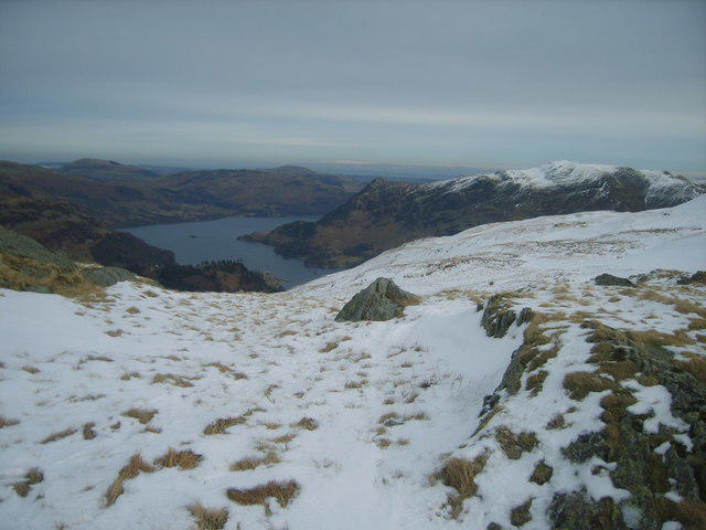 Photo could not load
NY3714 : On Birks
Michael Graham
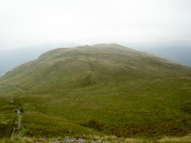
NY3714 : Birks
Ian Greig
Hill facts and local notes
Classifications
Elevation
624m
2,047 ft
Prominence
20m
Coordinates
54.5207, -2.9591
NY380143
OS Map
90
Explorer: OL5S
At the Summit
The summit of Birks features a small rocky outcrop with a modest cairn, which may not win any beauty contests, but serves as a nice spot to take a breather and enjoy the panoramic views.
Terrain & Geology
Birks is primarily composed of volcanic rocks from the Borrowdale Volcanic Group, offering a fascinating glimpse into the geological history of the Lake District. The rugged terrain is a product of both volcanic activity and the ensuing glacial erosion, showcasing the dynamic processes that shaped this iconic landscape.
Views & Scenery
From the summit, you'll be treated to impressive views of the Helvellyn range, Ullswater, and the surrounding fells. On a clear day, the vistas stretch far and wide!
History & Heritage
Name Origin
The name 'Birks' is derived from the Old Norse word 'birki', meaning 'birch tree', reflecting the past and present woodland cover in the area.
Historical Significance
Birks has been a favourite among local walkers and climbers for decades, embodying the rugged charm of the Lake District and serving as a launch point for various expeditions.
Getting There & Facilities
Parking
Parking is available at the Patterdale car park, which is well-suited for hikers and provides easy access to various trails.
Public Transport
Buses operate from Penrith to Patterdale, making it convenient for those relying on public transport.
Nearby Facilities
Patterdale offers several facilities, including cafes for a much-needed cup of tea and toilets for the more practical needs of hikers.
Safety Information
Known Hazards
- Beware of slippery stones and muddy patches, especially after rainfall. Also, keep an eye out for sudden weather changes typical of the Lake District!
General Safety Tips
- Check weather conditions before setting out
- Carry appropriate clothing and equipment
- Let someone know your planned route
- Take a map, compass, and GPS device
- Carry emergency supplies: food, water, first aid kit, torch
Hills
Some common questions about the hills answered
Are there group walks up Birks?
Many walkers use Walkmates to join or organise walks with others. You can check for group walks around Birks through the maps
Are there other walkers around Birks?
Activity varies by location and time, but Walkmates lets you see whether others have shared walks or shown interest in this area. Find other people through the walking friends search walking friends for Birks search or of course create your own walk for Birks
Can I organise a walk to Birks?
Yes. If there aren’t any walks listed already, you can create a walk and make it available for others to join.
If you're signed up to Walkmates, you can create a walk to Birks.
How do I find a walk up this hill?
There are often multiple ways to walk this hill, depending on experience and route preference. Walkmates helps you explore walks and routes that others have shared.
Can I suggest a new route up Birks?
Yes. You can suggest or create routes to share with others. Walkmates focuses on the social side of walking, so routes are used to help people organise walks and explore areas together, rather than as detailed navigation tools or route libraries.
Other uses really appreciate knowledgeable walkers sharing their routes. Share your favourite route to Birks here
The is an error or something incorrect about this hill. How do I let you know?
We always strive to keep the information on Walkmates as accurate as possible. If you find an error, please let us know through the contact form and we'll aim to correct it as quickly as possible
Community Discussion
Comments
Location
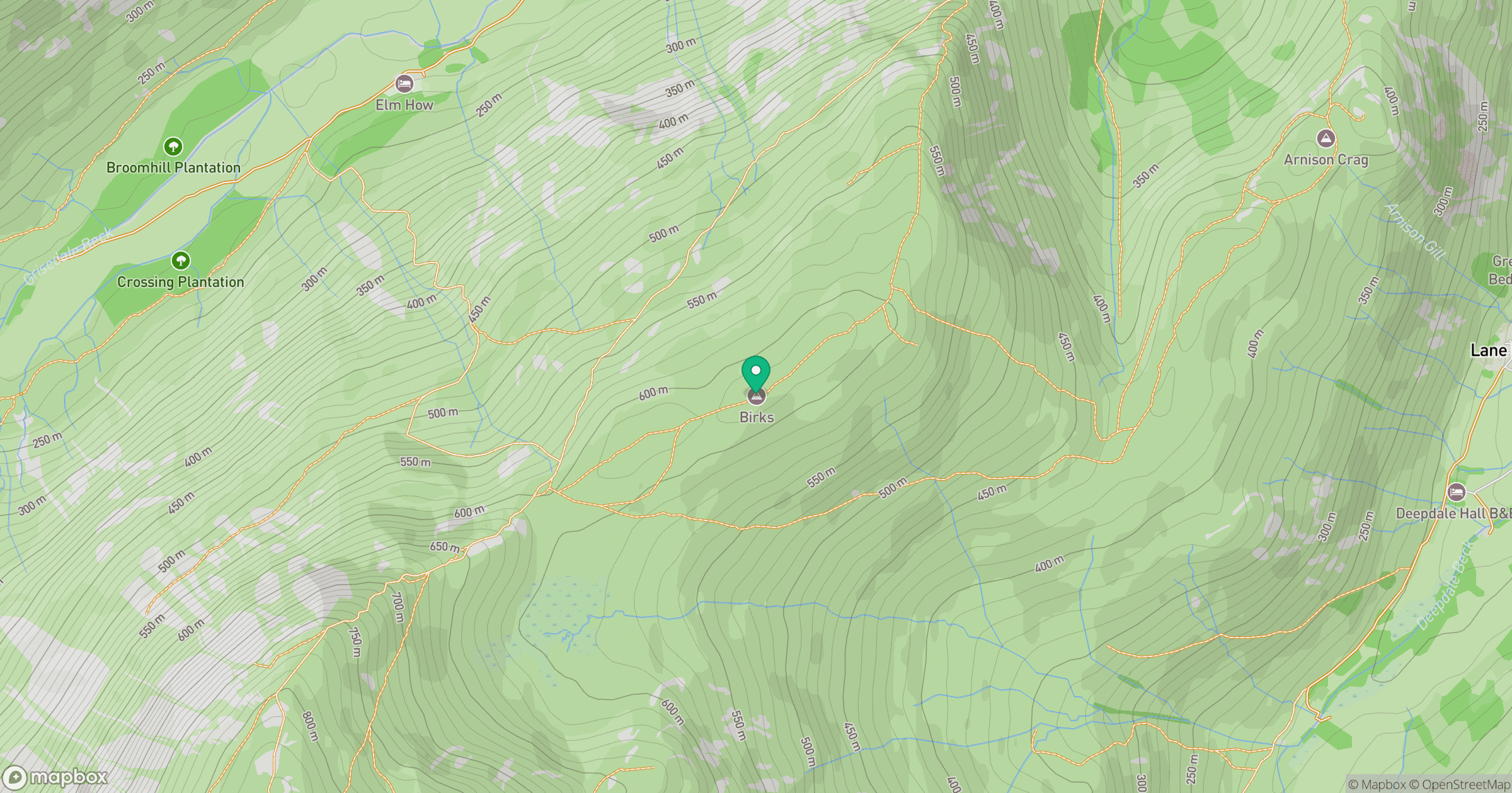
Grid reference: NY380143
View on OpenStreetMapOpens a map in a new tab, centred on the hill.

No comments yet. Be the first.