
Inishmurray
Good walks are even better shared.
Overview
Inishmurray: The Hidden Gem of the Atlantic
Nestled off the coast of County Sligo, Inishmurray is not just a mere island; it’s a treasure trove of history, wildlife, and breathtaking landscapes. It's the perfect spot for those seeking a quieter alternative to the hustle and bustle of mainland hiking.
Geology
The island’s terrain is shaped by sedimentary rocks, primarily limestones and shales. The relentless forces of the Atlantic have sculpted its dramatic coastline, leaving behind striking cliffs that will make you feel positively small. Perfect for a geology enthusiast eager to see how nature's artist works!
Routes
The Inishmurray Walking Trail is your ticket to experiencing everything this island has to offer. Clocking in at about 5 kilometres, this easy route offers a leisurely stroll with views that will make you feel like you've stepped into a postcard. Expect to spend around two hours leisurely wandering and taking it all in.
Terrain
Be prepared for a delightful mix of rocky paths and grassy stretches, interspersed with sandy areas. It’s ideal for a casual hike, but do watch your step near the cliffs—nobody enjoys an unexpected swim!
Views
The views from Inishmurray are nothing short of spectacular. The majestic Benbulben mountain looms to the northeast, while the vast Atlantic Ocean stretches out endlessly to the west. For the best views, aim for spring or summer when the skies are clearer and the flowers are in full bloom—nature’s confetti!
Hazards
This isn’t a trek for the faint-hearted; there are a few hazards you should keep in mind. The slippery rocks along the coast can be quite the deterrent, and the weather can change faster than you can say ‘coastal breeze’. Always check the forecast before heading out!
Nearby Summits
If you’re looking to extend your hiking adventures, Benbulben offers a more challenging climb nearby, reaching an elevation of 496 meters. A perfect post-Inishmurray challenge!
Access
Gaining access to Inishmurray is a breeze. Park your car at Mullaghmore Harbour, where you can catch a boat to the island. If you prefer public transport, regular buses run from Sligo to Mullaghmore, ensuring your journey to adventure is hassle-free.
Facilities
Inishmurray is as rustic as it gets, with no facilities on the island itself. Fear not! Mullaghmore is just a stone's throw away, and you can enjoy a pint or grab a bite to eat after your hike.
History
The name, Inishmurray, translates to 'Island of St. Murray', reflecting its rich monastic history. It’s a site of significant historical importance, showcasing ancient ruins that give a window into the life of early Christians in Ireland. A place where the past and present coexist beautifully.
Inishmurray offers a unique escape for hikers, history buffs, and nature lovers alike. Don’t miss out on this unspoiled gem!
Explore routes near Inishmurray
Walks starting near this hill. Open a route to check its map, distance and full itinerary.
Route planning notes
These notes describe possible approaches. Check a route's map and access information when planning your walk.
Inishmurray Walking Trail
A circular route encompassing the island, providing delightful coastal views and access to historical sites.
Make a day of it, together
Find someone to share the walk with, or organise a day out along a route you like.
Hill facts and local notes
Classifications
Elevation
24m
79 ft
Prominence
24m
Coordinates
54.4309, -8.6710
G565538
OS Map
16
At the Summit
The island features several ancient ruins, including monastic remains, and a stunning coastal backdrop rather than a traditional summit.
Terrain & Geology
Inishmurray is primarily composed of sedimentary rocks, with visible limestones and some shales that have been shaped by coastal erosion, giving rise to its dramatic cliffs and unique landforms.
Views & Scenery
Breathtaking views of the Atlantic Ocean, Sligo coastline, and the nearby Benbulben Mountain.
History & Heritage
Name Origin
Inishmurray translates to 'Island of St. Murray', highlighting its historic monastic roots.
Historical Significance
It houses ancient monasteries that illustrate early Christian settlement and is an important archaeological site.
Getting There & Facilities
Parking
Parking is available at the Mullaghmore Harbour, followed by a short boat ride to the island.
Public Transport
Regular bus services operate from Sligo to Mullaghmore.
Nearby Facilities
There are no facilities on Inishmurray, but Mullaghmore offers pubs, eateries, and restrooms.
Safety Information
Known Hazards
- Watch out for slippery rocks along the coast and sudden weather changes common in maritime environments.
General Safety Tips
- Check weather conditions before setting out
- Carry appropriate clothing and equipment
- Let someone know your planned route
- Take a map, compass, and GPS device
- Carry emergency supplies: food, water, first aid kit, torch
Hills
Some common questions about the hills answered
Are there group walks up Inishmurray?
Many walkers use Walkmates to join or organise walks with others. You can check for group walks around Inishmurray through the maps
Are there other walkers around Inishmurray?
Activity varies by location and time, but Walkmates lets you see whether others have shared walks or shown interest in this area. Find other people through the walking friends search walking friends for Inishmurray search or of course create your own walk for Inishmurray
Can I organise a walk to Inishmurray?
Yes. If there aren’t any walks listed already, you can create a walk and make it available for others to join.
If you're signed up to Walkmates, you can create a walk to Inishmurray.
How do I find a walk up this hill?
There are often multiple ways to walk this hill, depending on experience and route preference. Walkmates helps you explore walks and routes that others have shared.
Can I suggest a new route up Inishmurray?
Yes. You can suggest or create routes to share with others. Walkmates focuses on the social side of walking, so routes are used to help people organise walks and explore areas together, rather than as detailed navigation tools or route libraries.
Other uses really appreciate knowledgeable walkers sharing their routes. Share your favourite route to Inishmurray here
The is an error or something incorrect about this hill. How do I let you know?
We always strive to keep the information on Walkmates as accurate as possible. If you find an error, please let us know through the contact form and we'll aim to correct it as quickly as possible
Community Discussion
Comments
Location
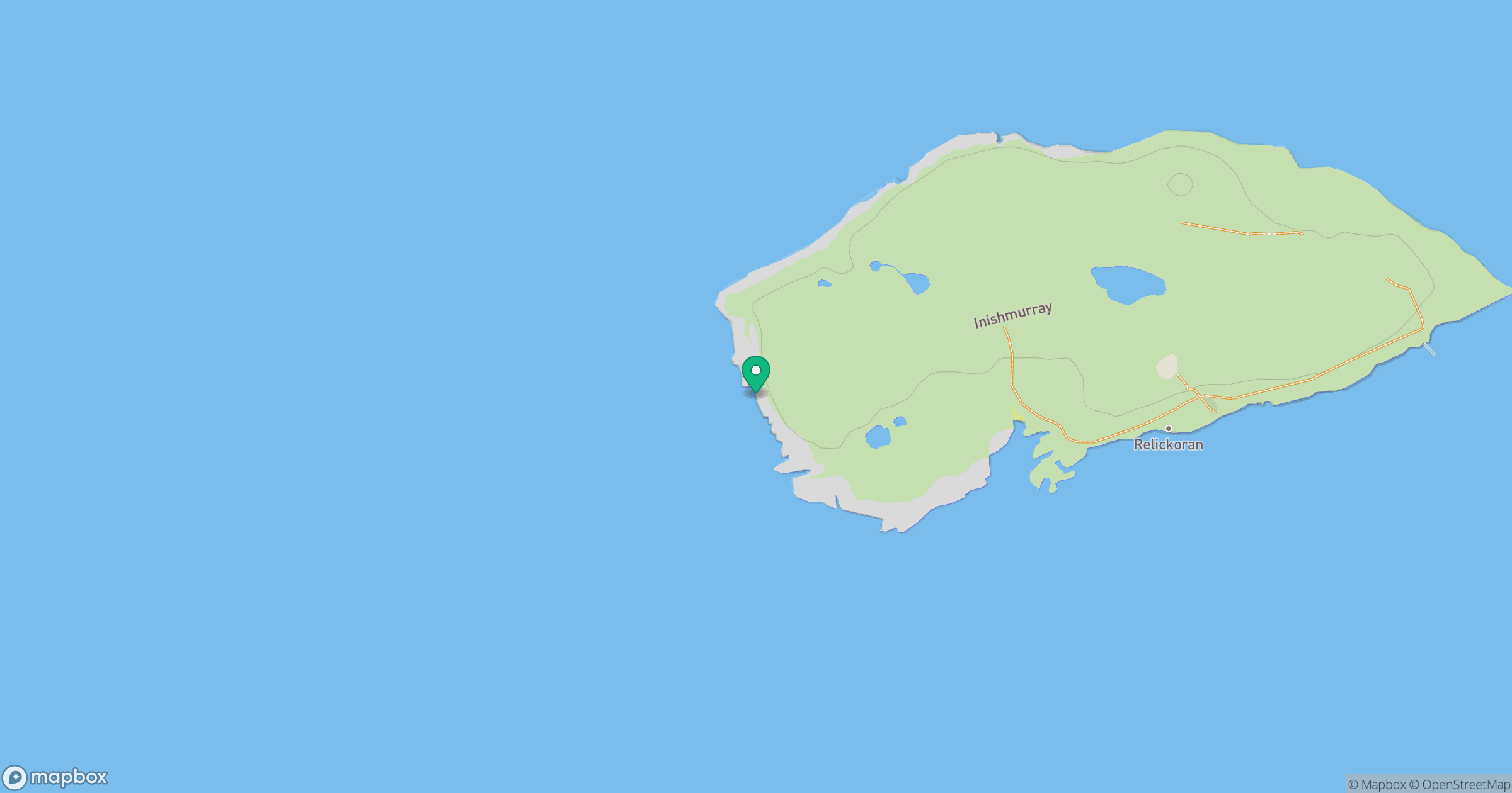
Grid reference: G565538
View on OpenStreetMapOpens a map in a new tab, centred on the hill.
No comments yet. Be the first.